
My most current blog entry:
Entries by Dr. Jeff Harper (334)
Ratchaburi Ramble
One of the benefits of having a wife who is a serious golfer is that I get to tag along when she goes on an out-of-Bangkok golf junket with her pals. We were on vacation in the seaside town of Hua Hin and made the short drive north to the Ratchaburi Royal Golf Club early one morning after a spactacular sunrise over the Gulf of Thailand . . . . and while she played a competitive round, I explored the nearby countryside, the old town market in Ratchaburi town, and the 10th century Wat Mahathat Worawihan.
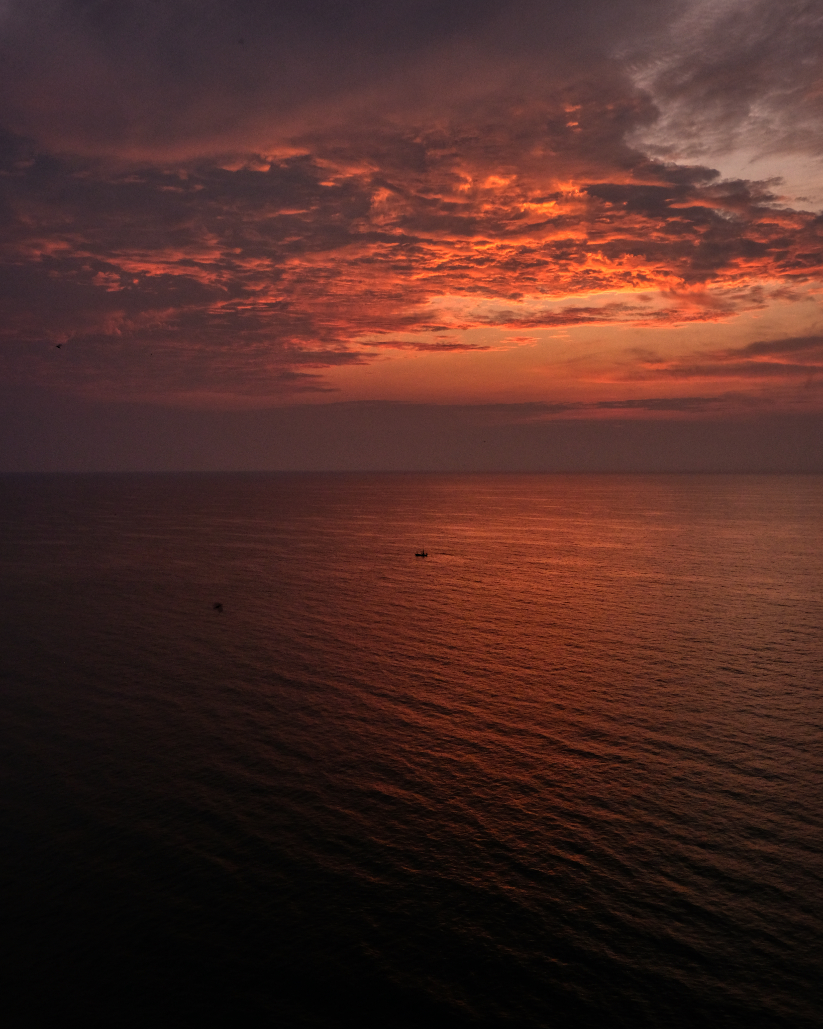 It's nice to sit on the balcony drinking the the first morning cup of coffee while the sun is rising over the Gulf of Thailand. The squid fishermen were returning with their catch after having been out to sea all night.
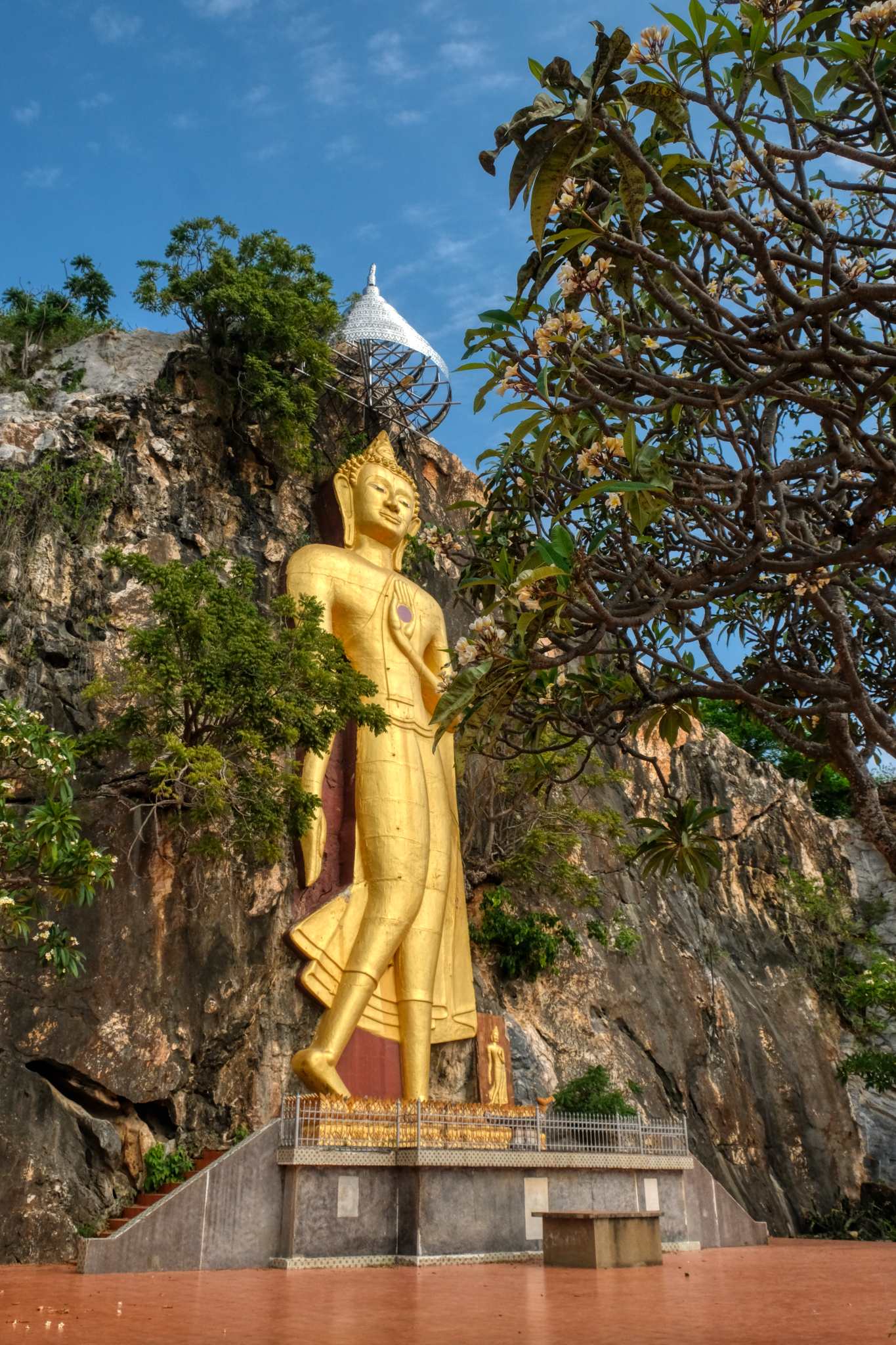
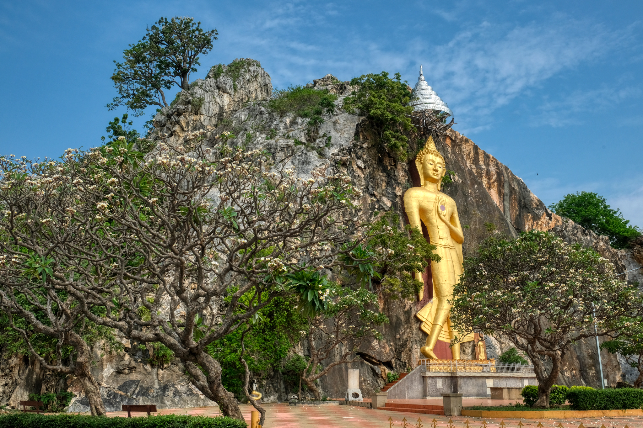 Along the Ratchaburi highway . . . a giant Buddha statue . . . without a place name.
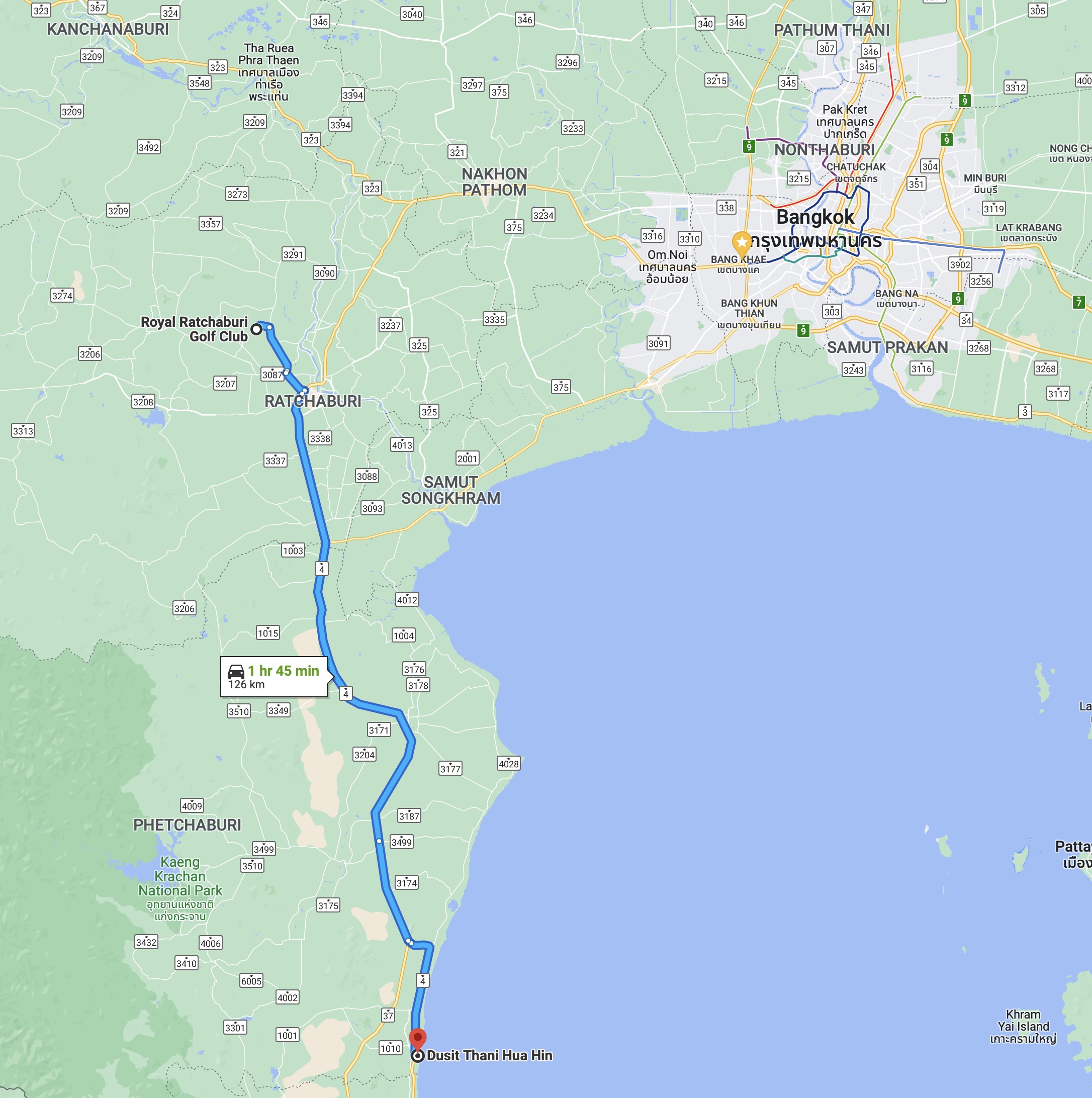 Only an hour and 45 minutes away . . . up and into the hilly Ratchaburi Province.
 Small provincial roads in Thailand always serve up some amazing sights.
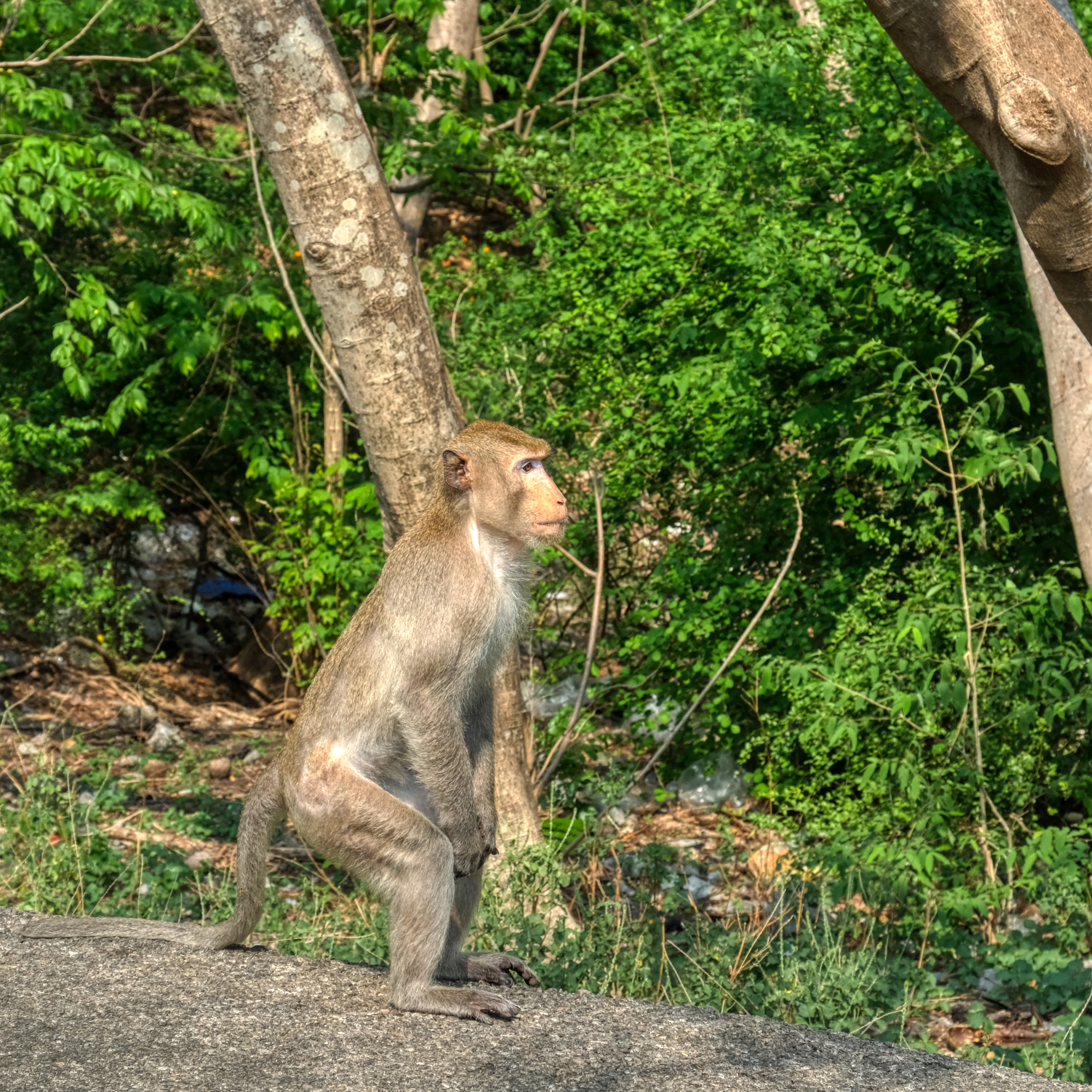 Yes, they have monkeys in Thailand. This one, and about 20 of his buddies kept me from leaving my car to walk up a trail to a large cave Buddha temple.
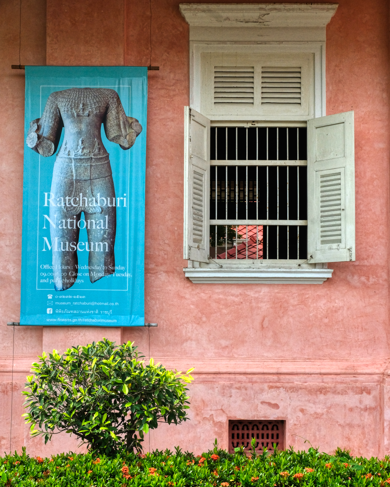
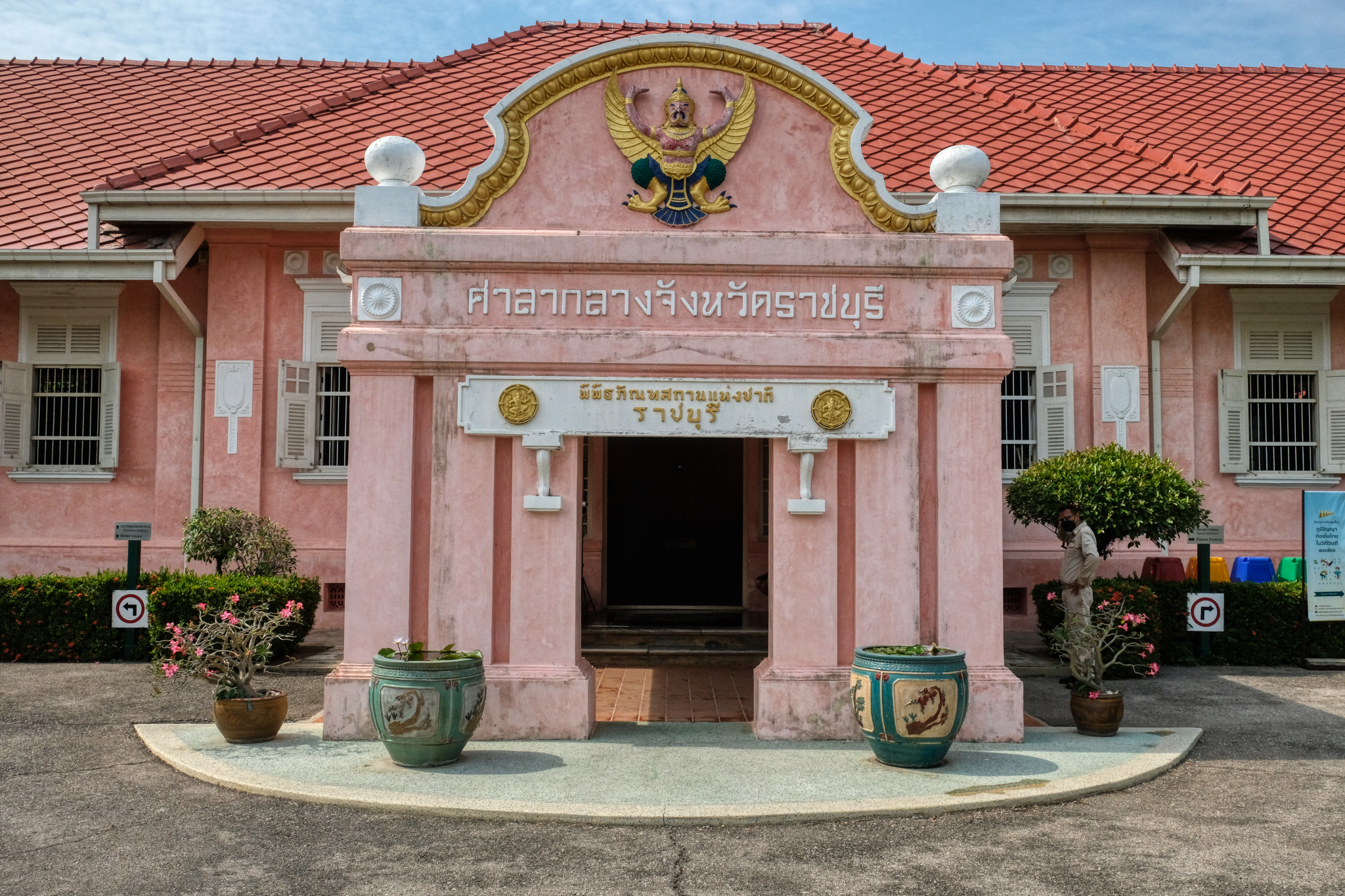 As I was on a 'ramble', I had no particular place to go. I made my way to Ratchaburi, a town I had never visited. I arrived in Ratchaburi on small roads and on the outskirts of town I discovered this wonderful place: The Ratchaburi National Museum.
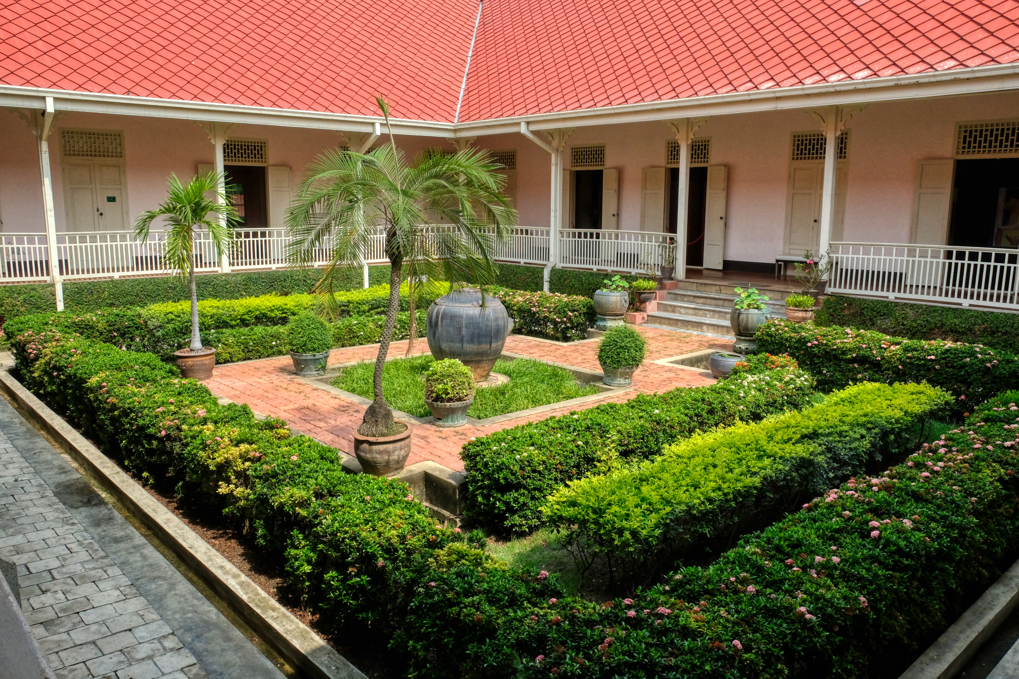
 It was a gorgeous building . . . old Thai monumental style.
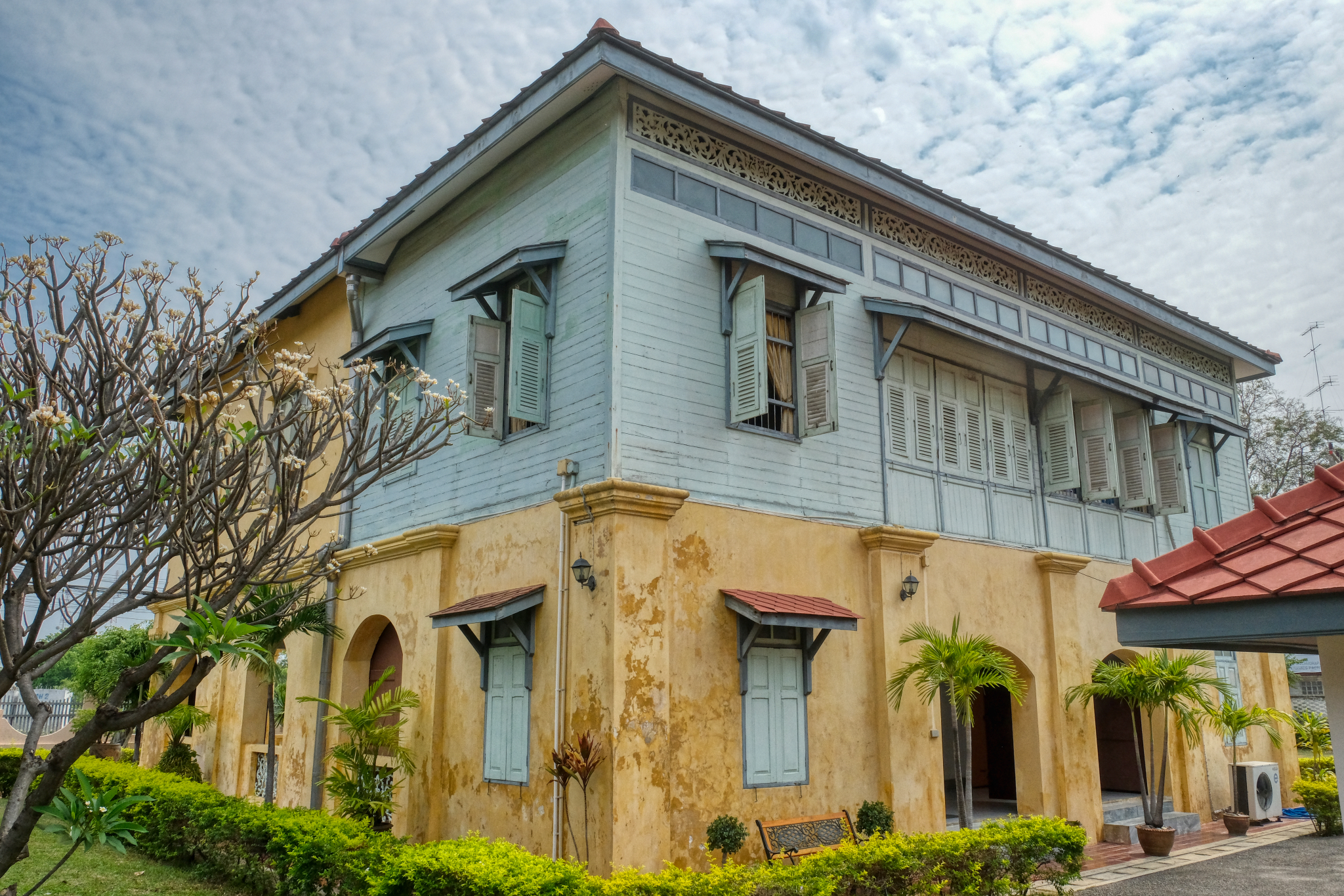 There were two buildings on the museum property. I adored the patina, color, and style of this old gem.
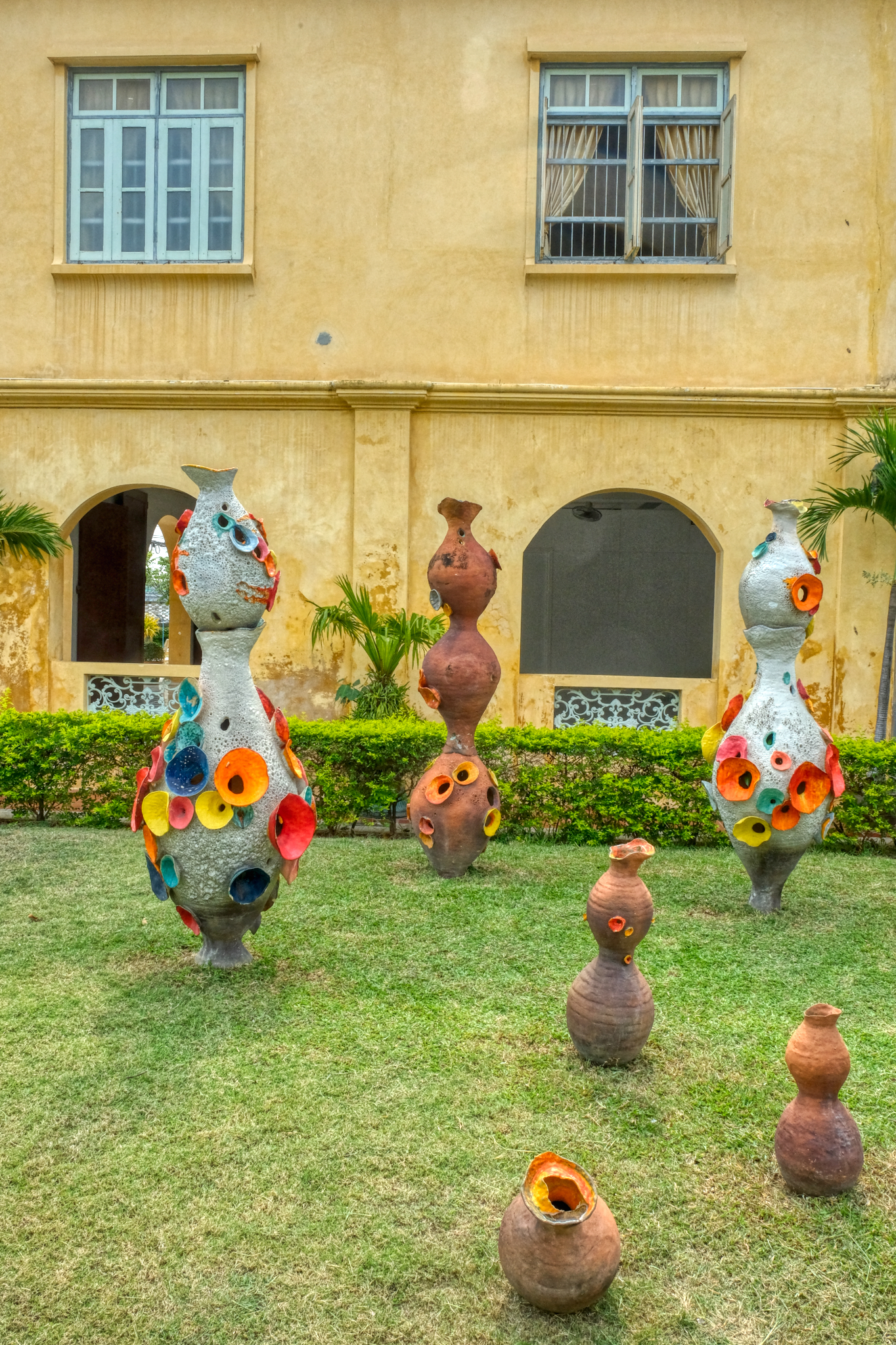 Being a museum, they had yard art too.
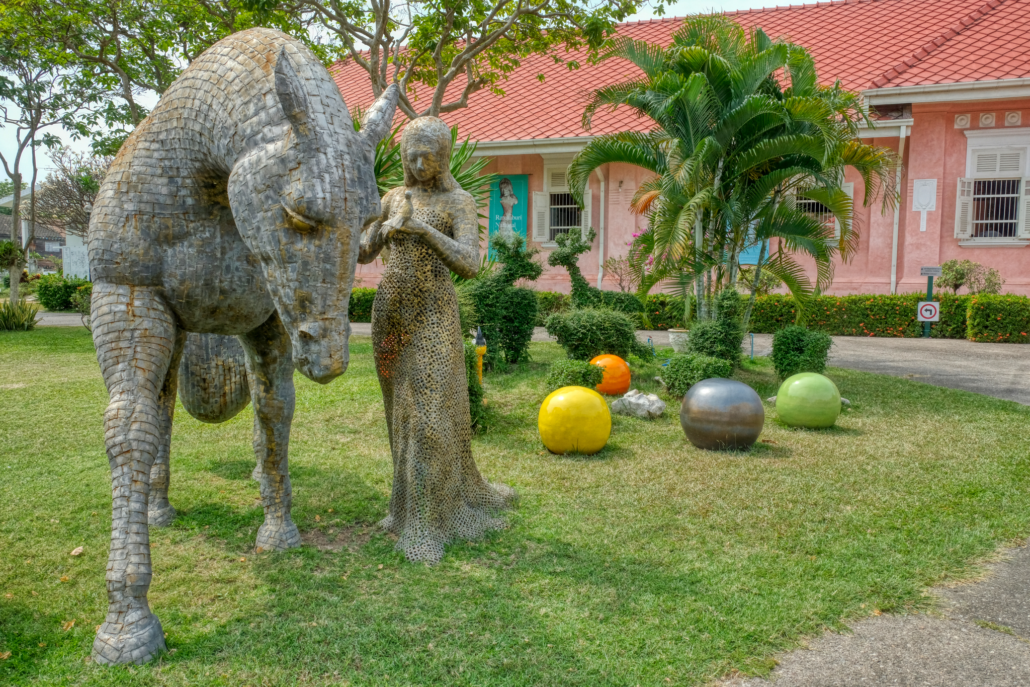 This large metal sculpture was fantastic.
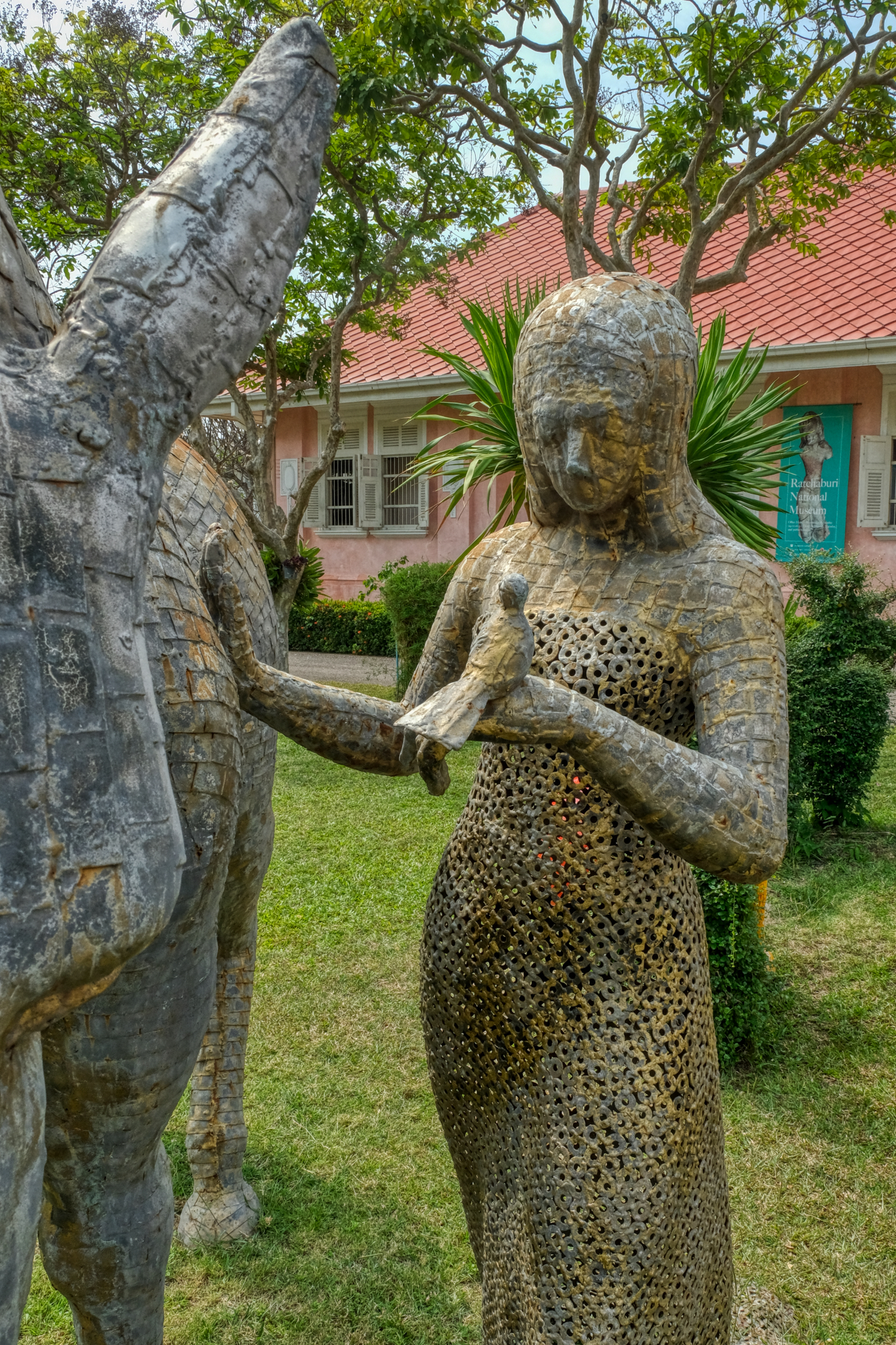 Made entirely of ordinary steel washers and small squares of steel. Amazing.
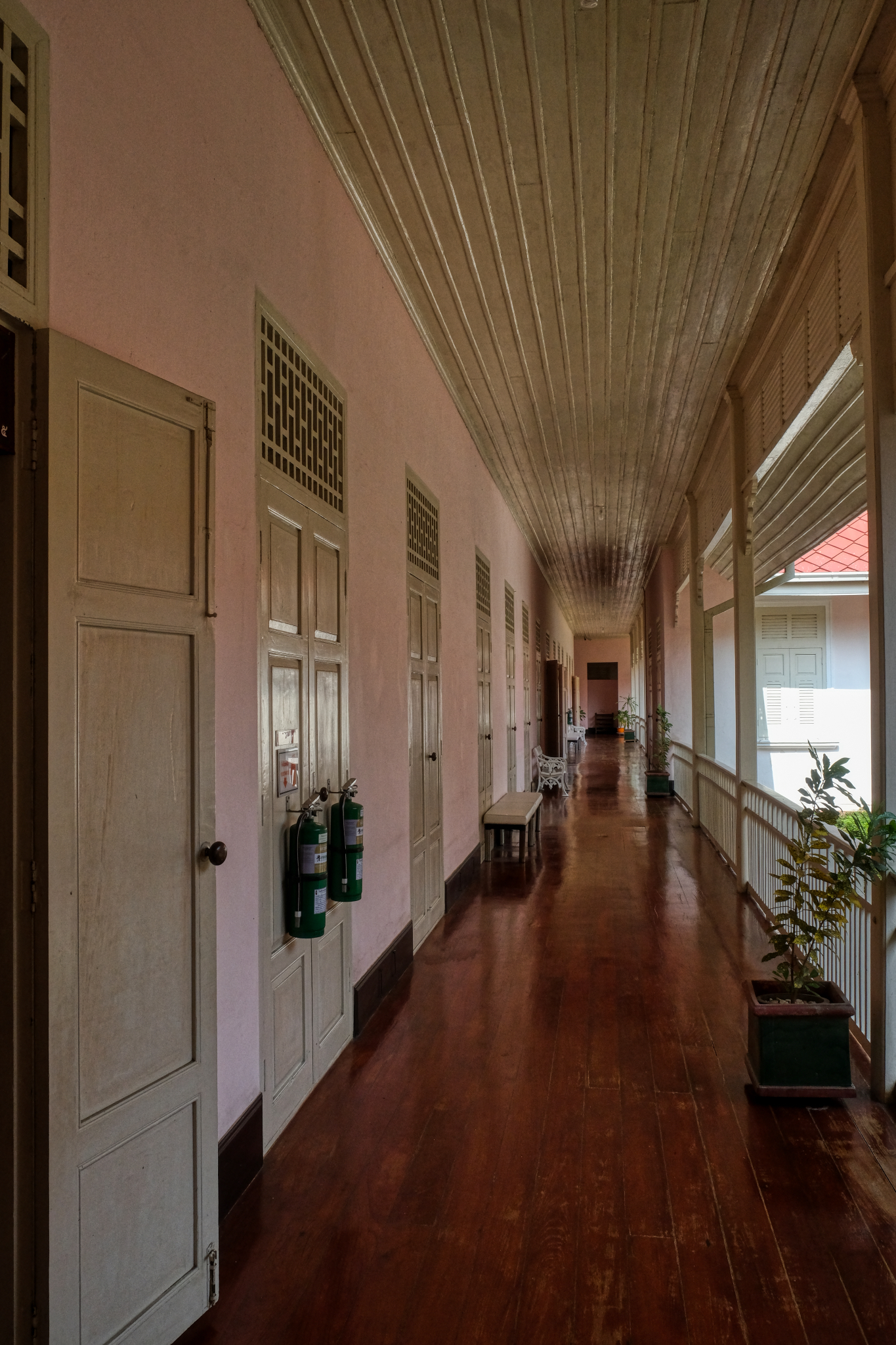 The museum rules strictly prohibited photography of the exhibits . . . and they enforced this rule by having one of the museum staff follow me from room to room. They did, however, allow me to photograph the halls and courtyard when I asked.
 The museum collection was excellent and very well organized. The exhibits began in prehistory and ancient geology of the area and proceeded chronologically as you walked from room to room around the courtyard. It was one of the best, most informative provincial museums I have been to anywhere in the world.
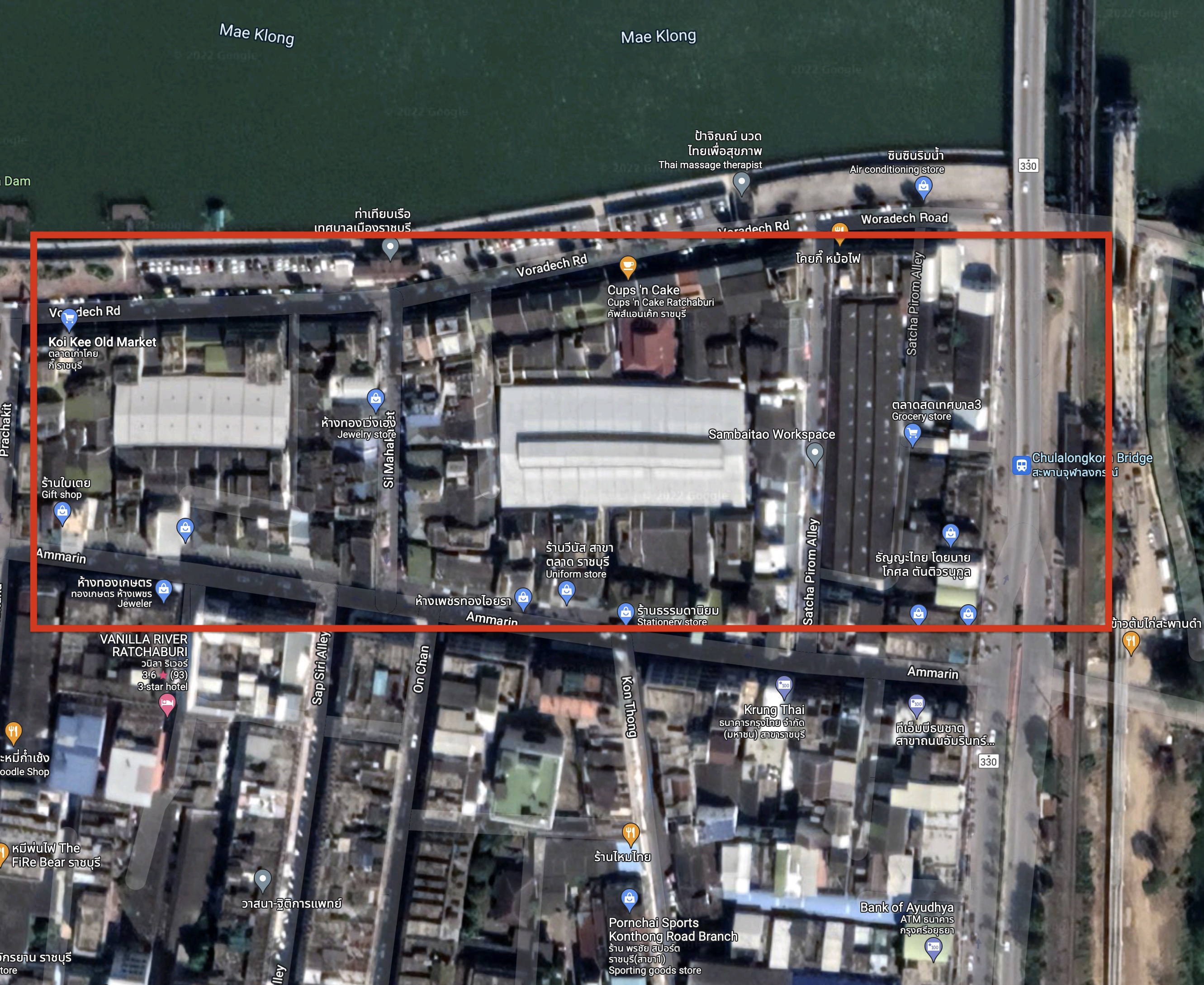 I next drove into the town center and the old city center market. The market occupies the inside center alleyways of several blocks along the Mae Klong River.
 As I left the museum I looked on my GoogleMaps and spotted a river and "Old Town Market" . . . so I drove straight there. I love these old town, city center markets in Thailand's small cities. This market would have been in it's prime during the 1950s and 1960s.
 The old markets are the remnants of the oldest parts of Thai cities and maintain an older way of doing business.
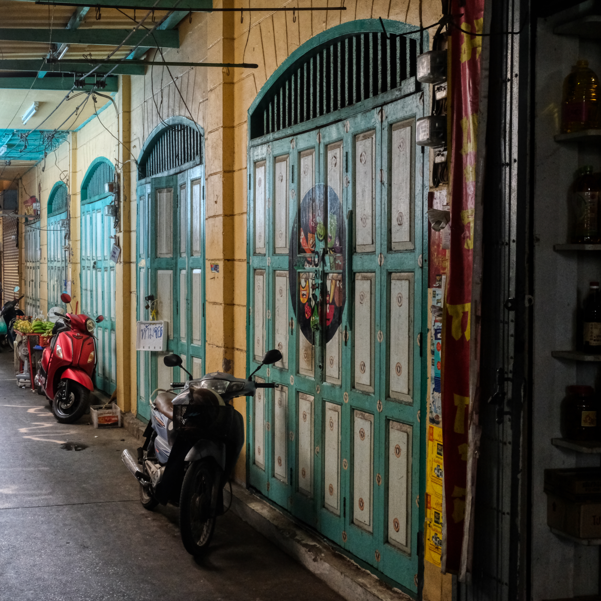 The city or local area government seems to have taken an interest in this old market. Many of the walls and old panel doors seem to have been painted recently. It looked very good.
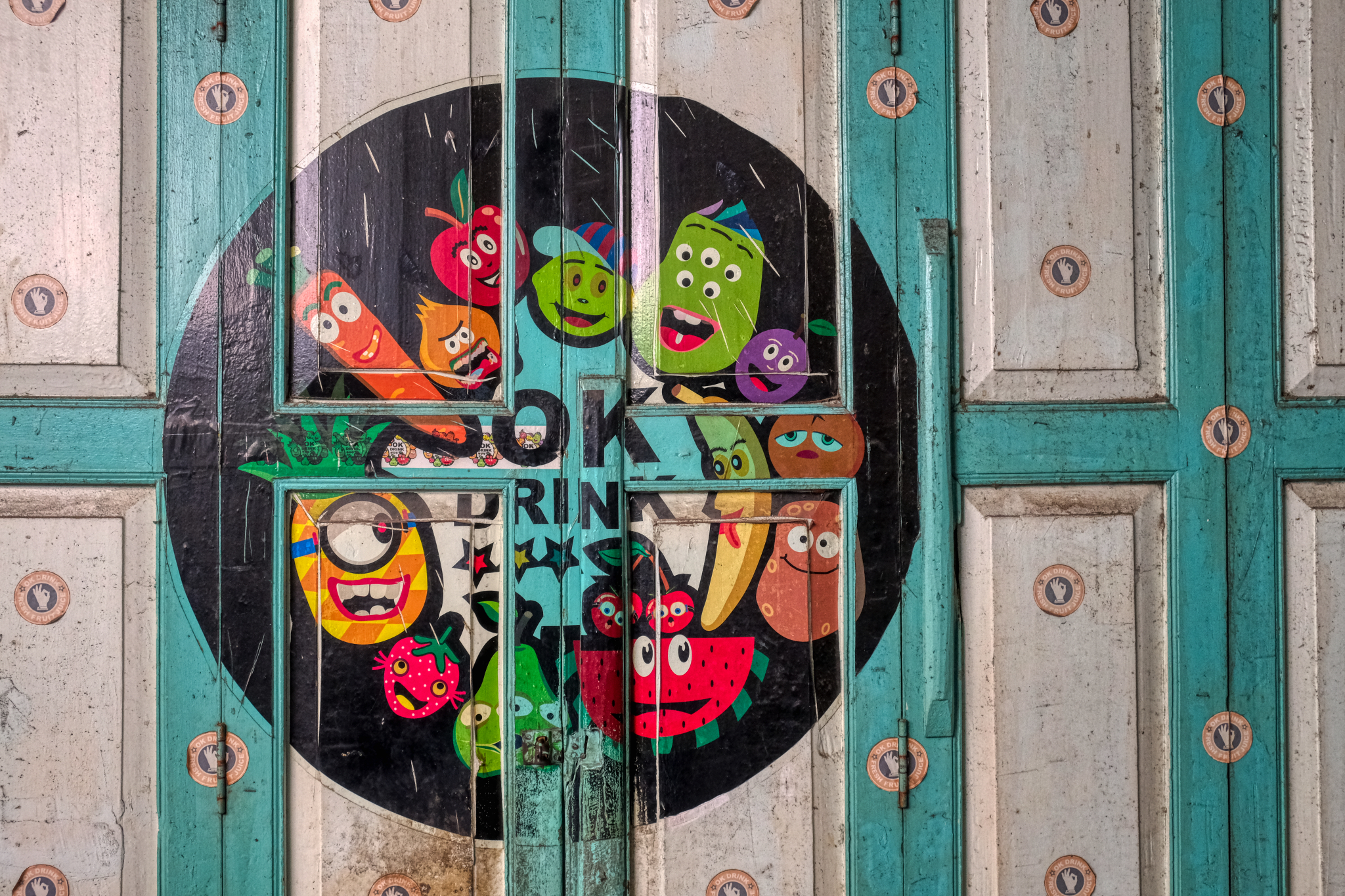 A colorful advertisement on the panel doors.
 History in paint.
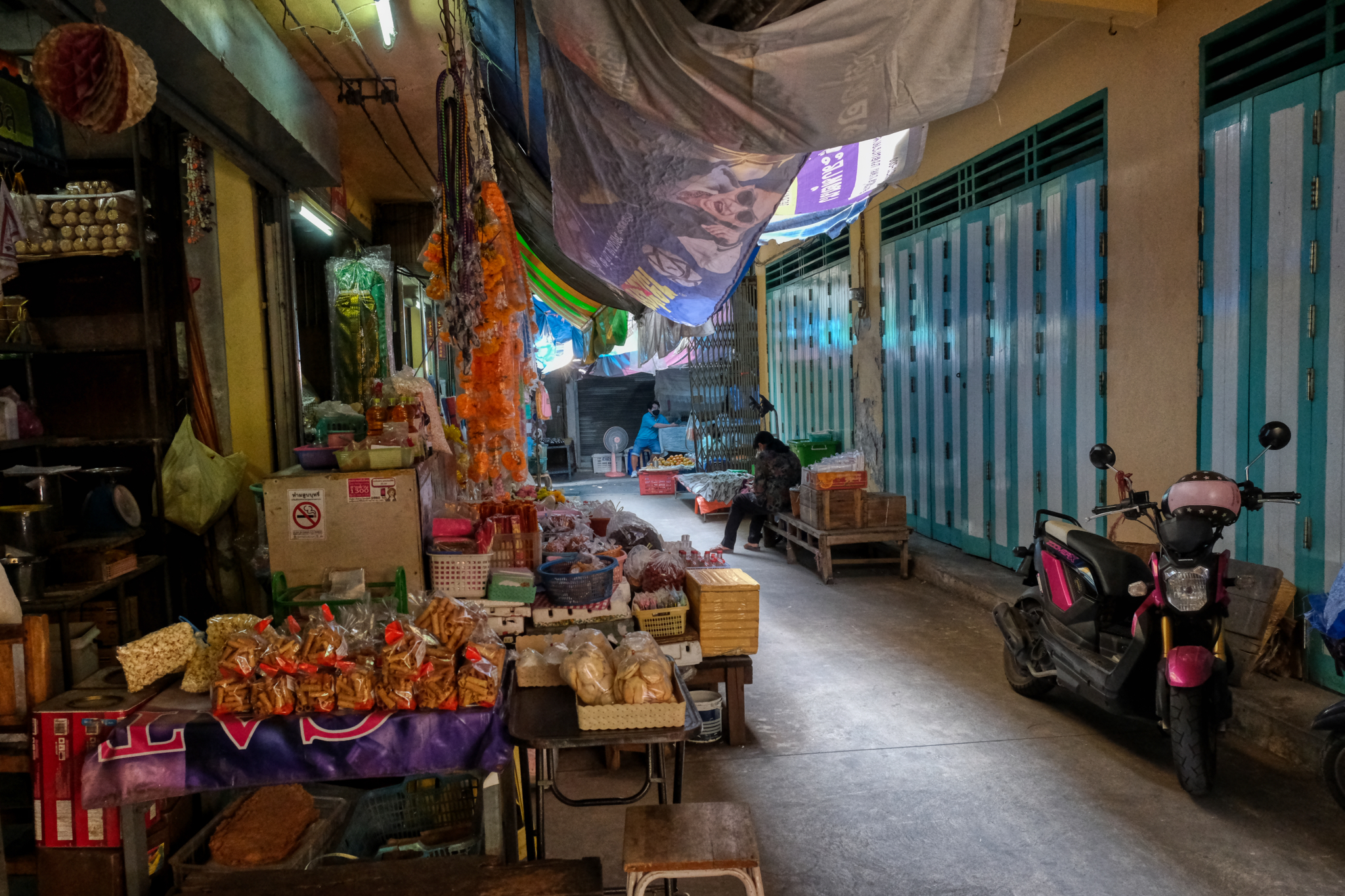
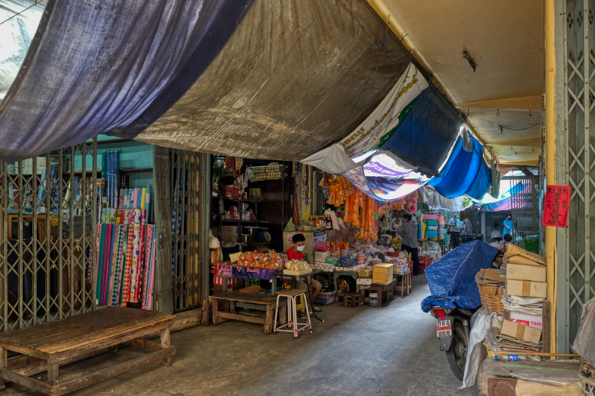
 Small business in the alleys, which are themselves lined with very old small shops.
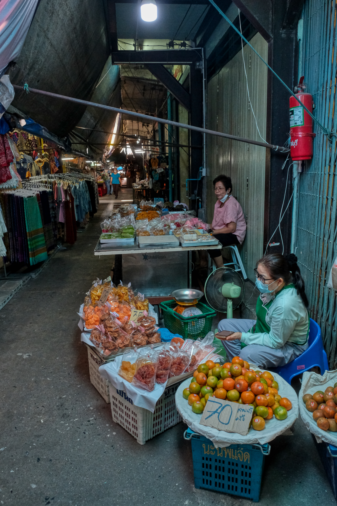
 My first thought when seeing this shop was, 'supply and demand.' What kind of world is outside of this market can be deduced by what one sees for sale in it. There is an old pattern of consumption, imbedded in the cultural practices, the anthropology of food, that still demands these items.
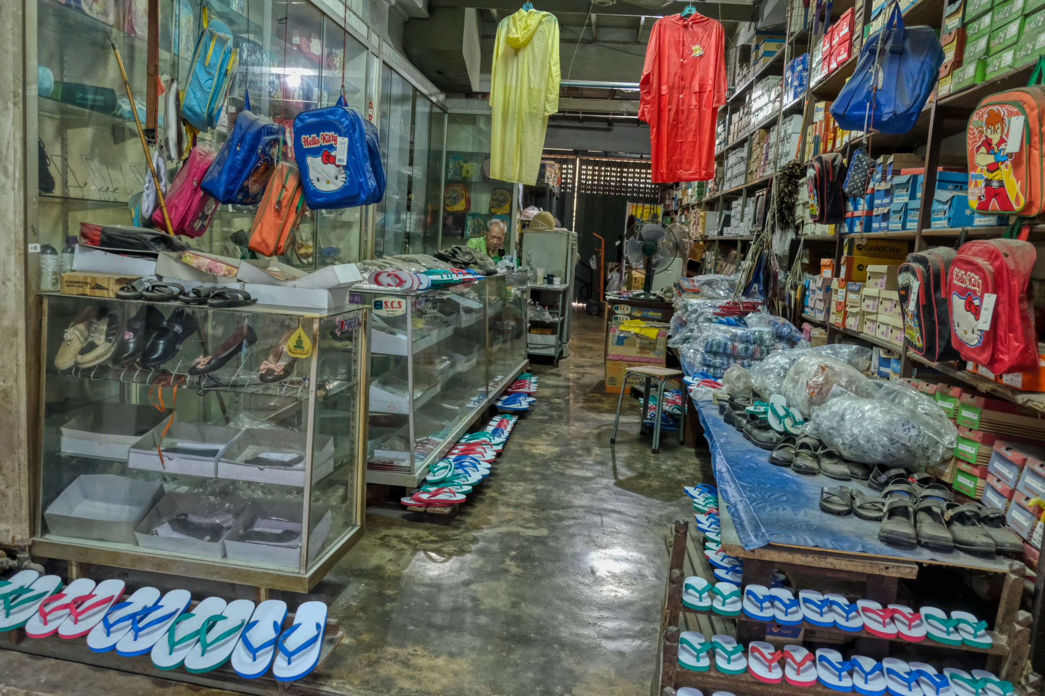 Times change. There was a time, maybe 50 years ago, when this shop was at the center of the Ratchaburi commercial center. You came here, and here only, if you wanted to buy a pair of new shoes. But the city grew in a different direction: what was the busy hub of activity has now became the backwater of the old town 'wet market.' This old man seems to have been here as long as the furniture. He doesn't even bother to dust off the shoes any more.
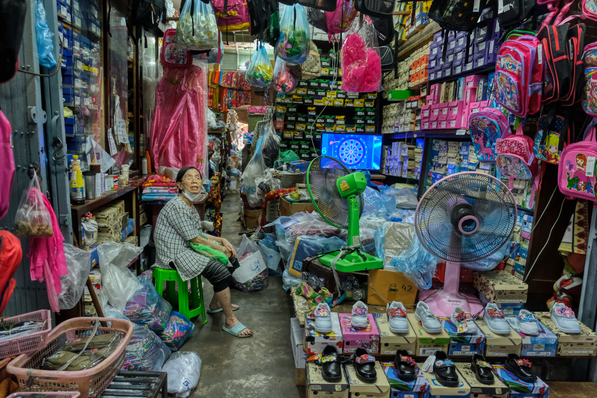 She is still hopeful and making an effort. These shops have suffered terribly during the pandemic: people do not like to congregate in the tight quarters of these narrow alleyways. I am sure she lives in the back of this shop.
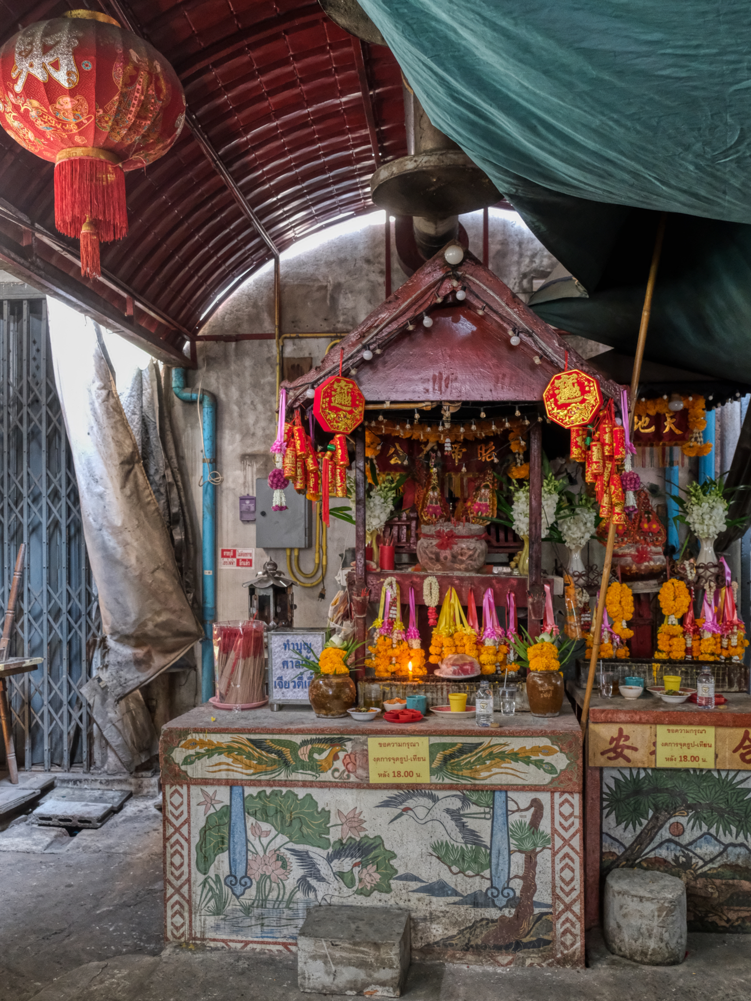 Tucked away deep in the old market is the spirit house/spirit altar for the shopkeepers to leave their offerings in hopes of better luck. The flowers and other offerings were all fresh from this very morning.
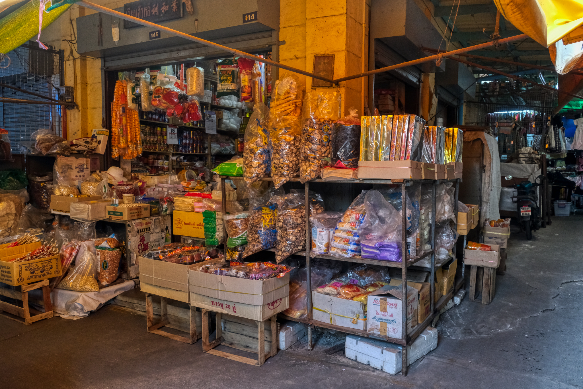
 This dry goods shop in the old market seemed to be doing pretty good. You have to remember that less than a mile from this spot there are several multinational big box giant supermarkets. It is hard to understand how these small shops survive. I assume it survives by servicing those who work in the old market itself.
 There were many sections of the old town market, and of course, one of them was for fresh fruits and vegetables. So delicious in Thailand.
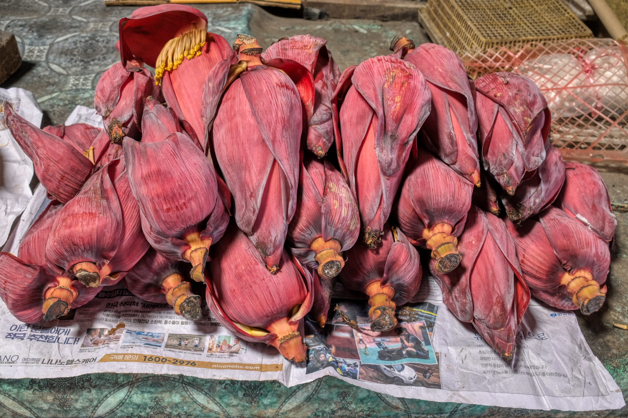 Banana flower hearts . . . used in some Thai dishes.
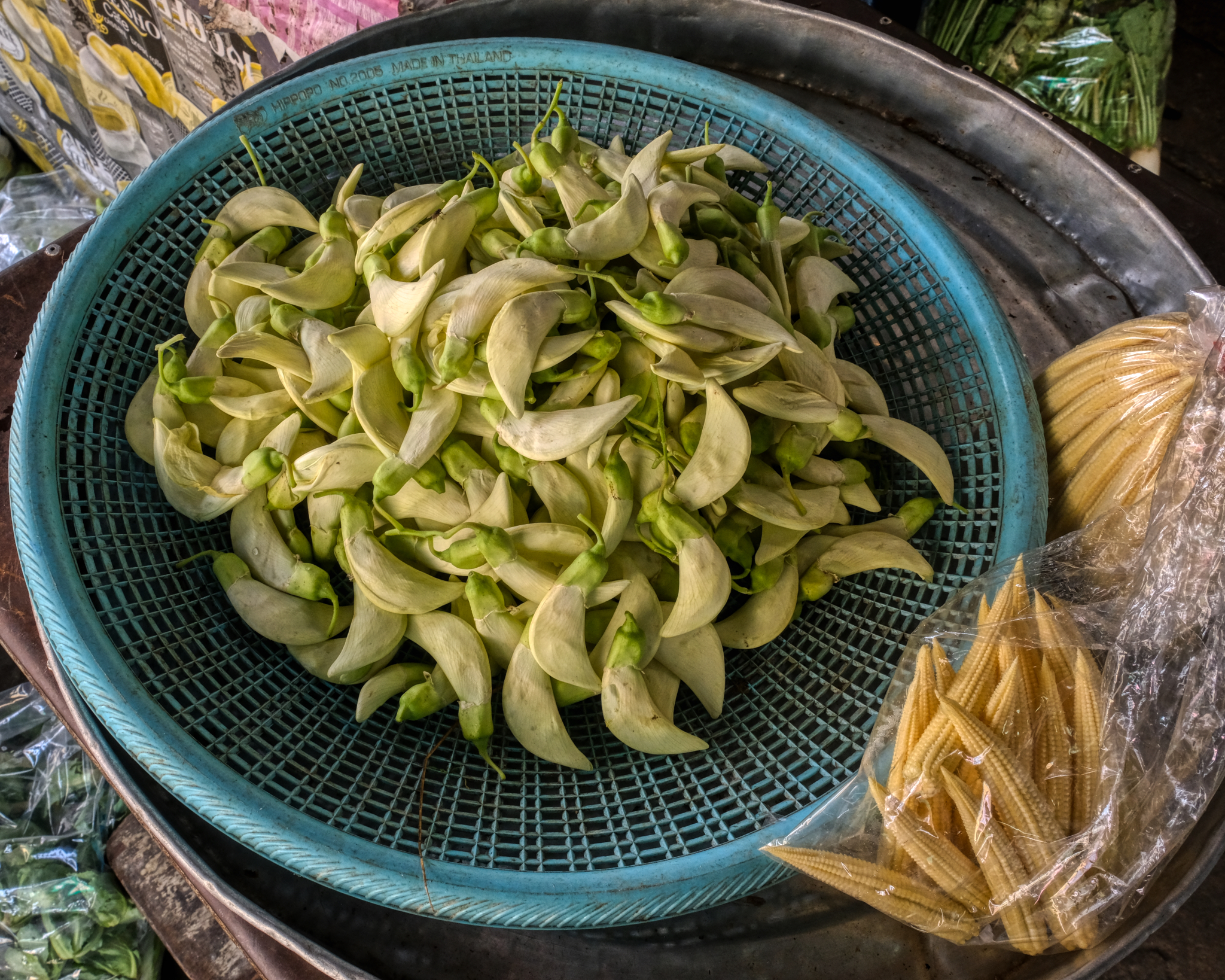 I had never seen this before . . . some kind of flower bud for use in one of the many thousands of Thai dishes.
 Although most of the market I saw so far was clean, neat, and recently refurbished, I eventually found the oldest part of the market. It was partially abandoned and the commerce there seemed to be left to the poorest people.
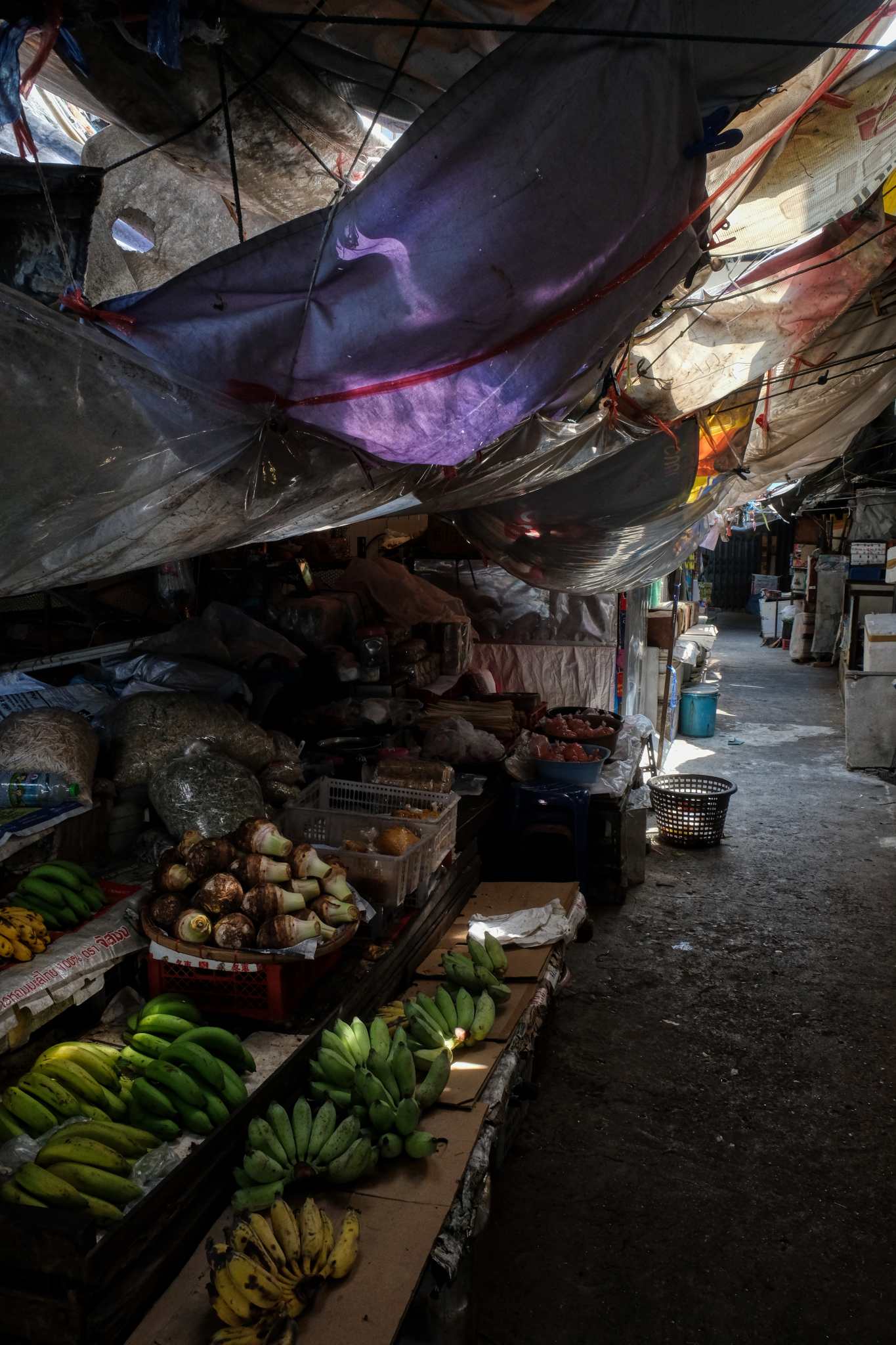
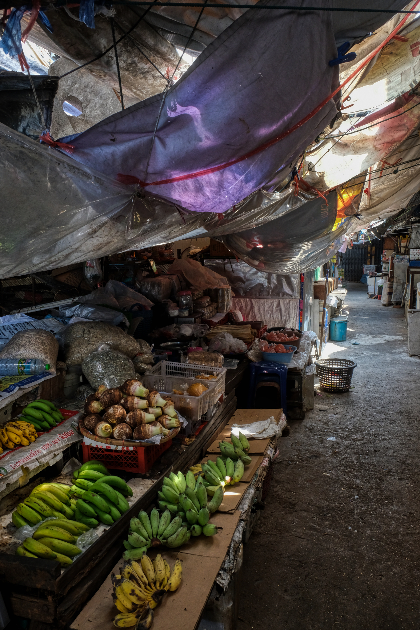 Old plastic rain flies over meagre offerings in the old, dead market. It is here we see the dilapidation caused by the corporate big box stores a couple of blocks away. I LOVE this photo.
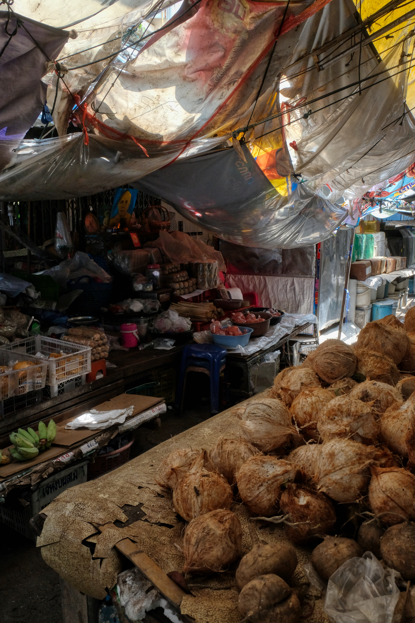 Old coconuts for sale.
 I was the ONLY person in this part of the market. Nobody was here, not even the merchants . . . at 10:00 in the morning.
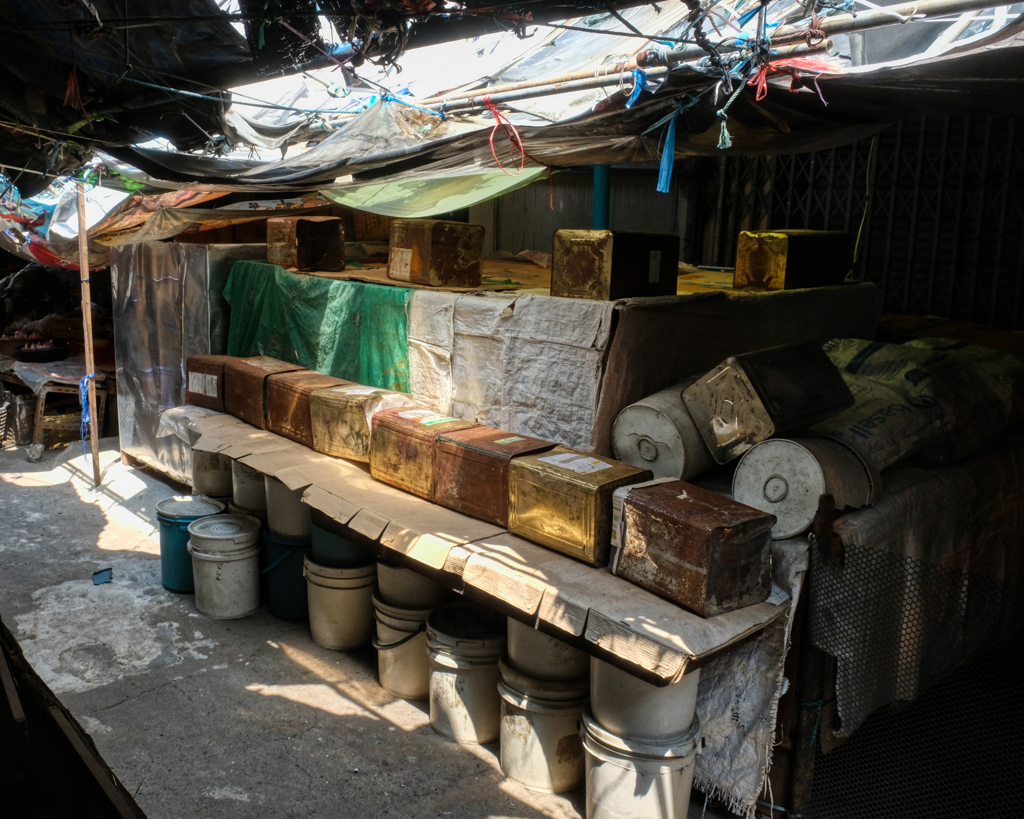 I tried to imagine what this 'business' was . . . but came up short.
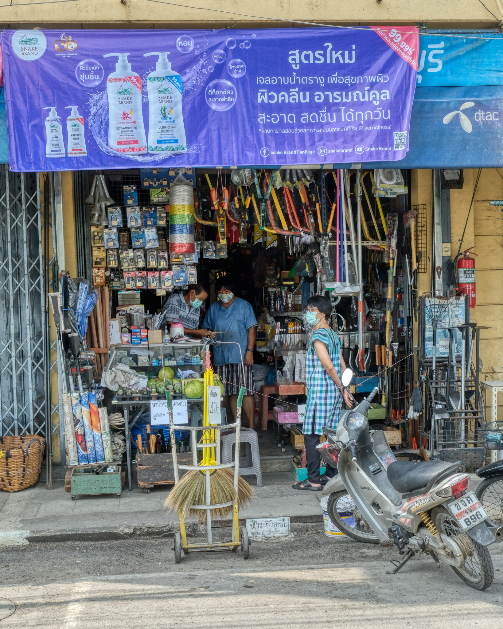
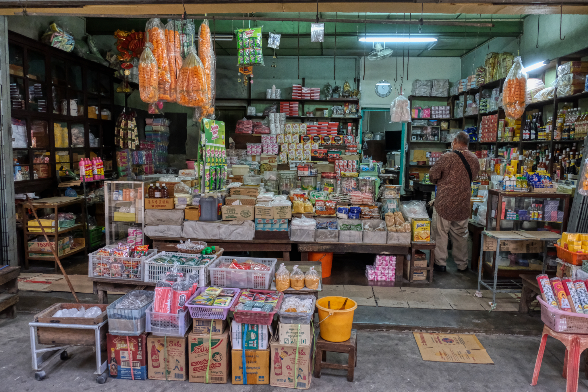
Outside of the inner alleyways of the old market, along the city streets, are more businesses. Here ,a hardware store.
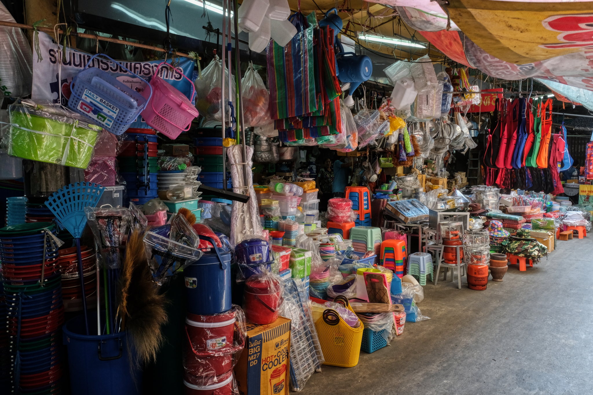
 Shops that have everything a local resident would want and need.
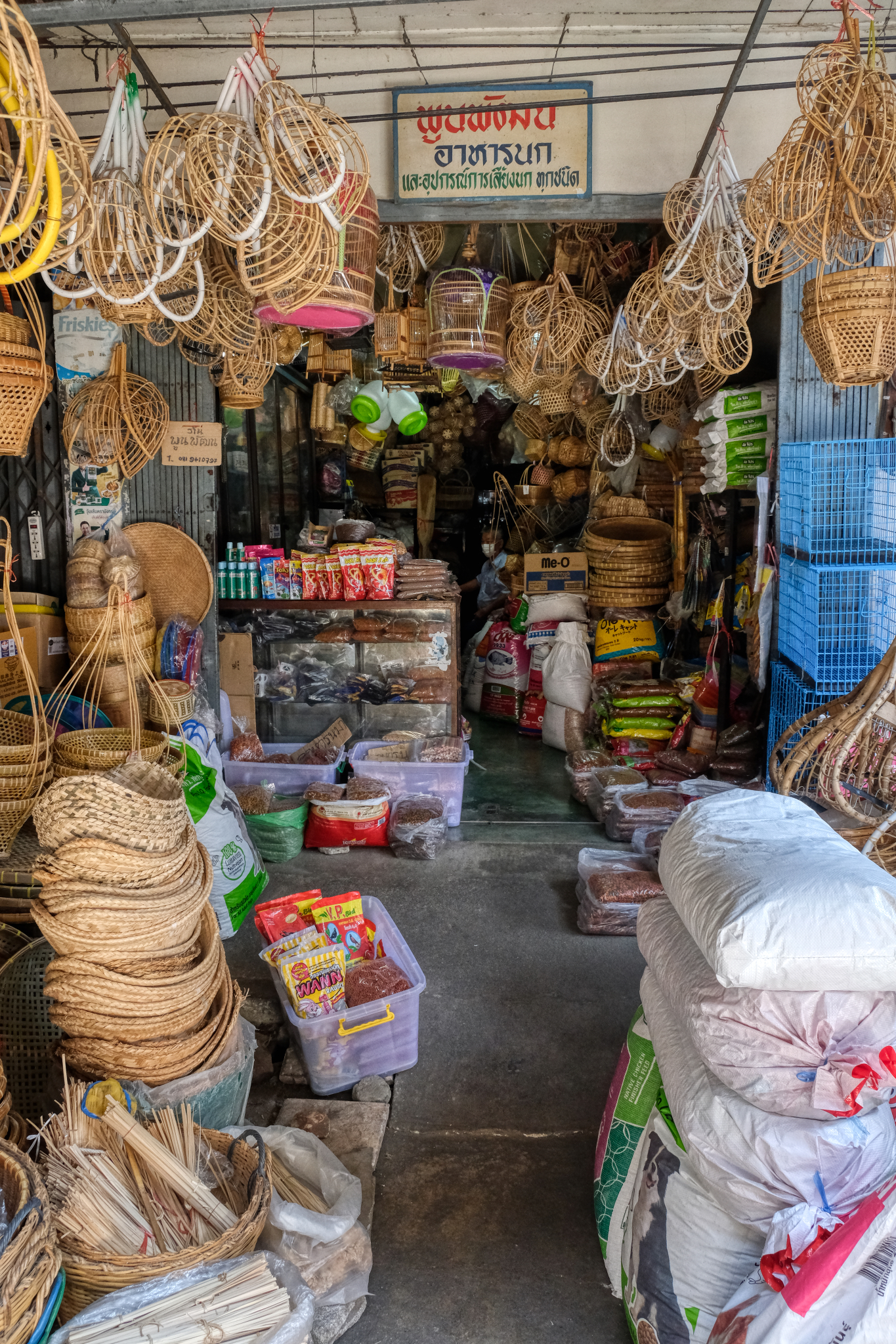
 If it can be made out of straw, bamboo, or wicker . . . . they have it here.
 Of course, if it can be made out of straw, bamboo, or wicker . . . it can also be made out of plastic.
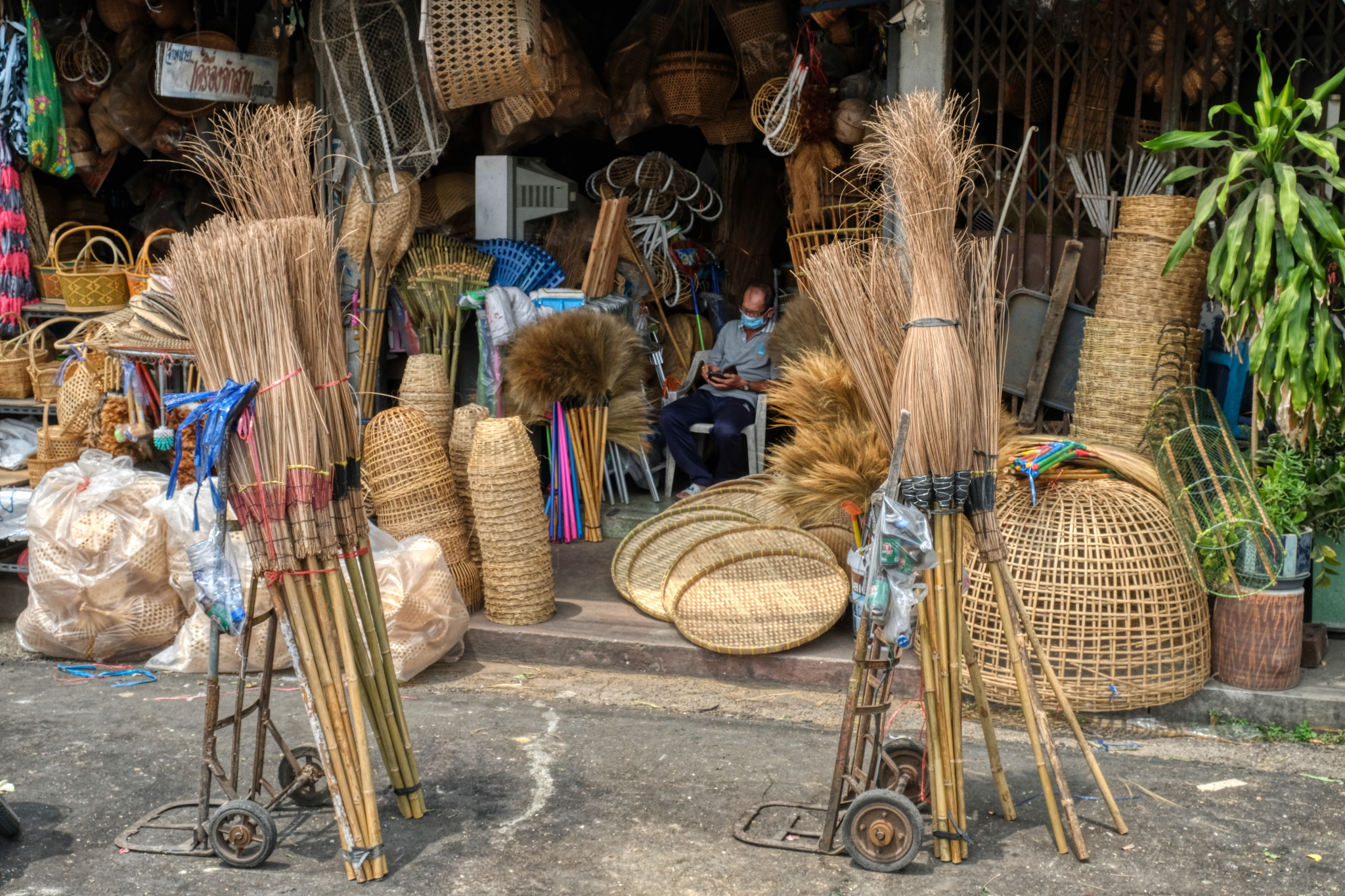
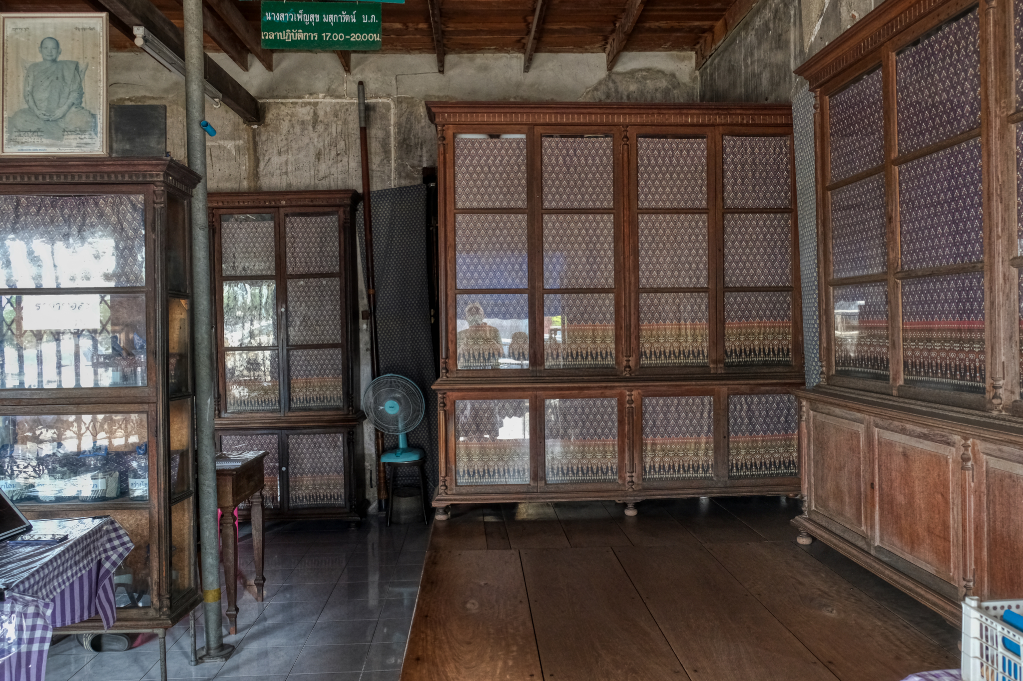 The owner of this shop told me it was restored to how it was when her family started it 100 years ago. A beautiful look into the past times in Thailand.
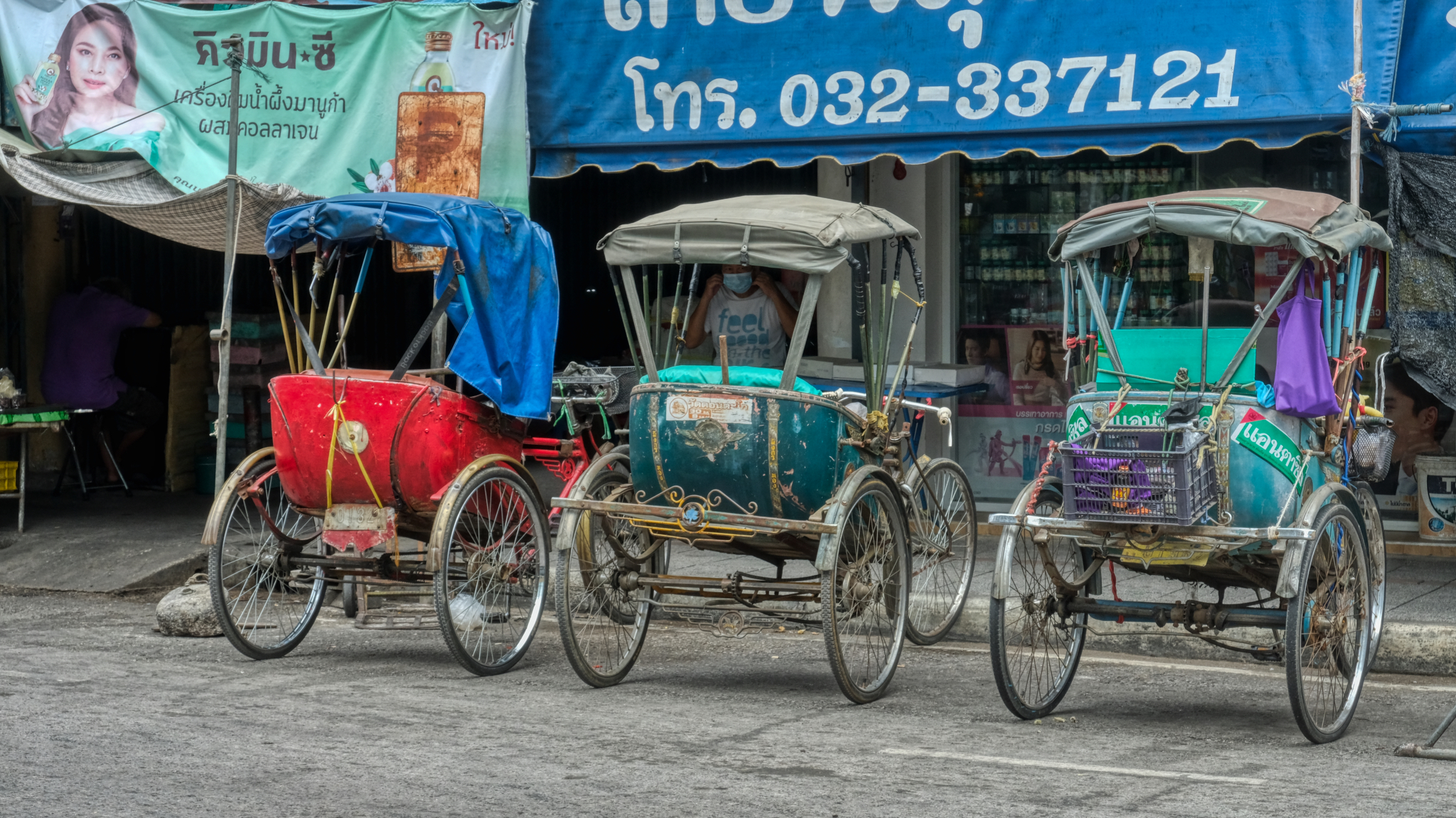 When I came to live in Thailand 26 years ago these samlors were ubiquitous. There would always be 20-30 of these 'pedal cabs' lied up next to the wet markets ready to take the customers home. Now it is rare to see them anywhere any more.
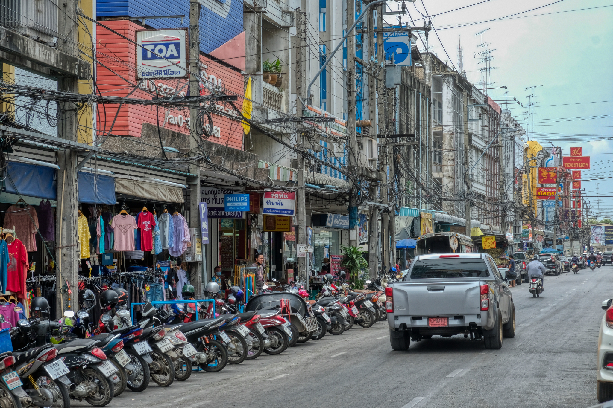 The "modern" Ratchiburi commercial center, dating from the 1970s and 1980s. Of course the true 'modern' Ratchiburi commercial zone is now located in the multinational Big Box stores and shopping malls that dot the major roads leading in and out of the town . . . and the Thais drive there in their pick-up trucks.
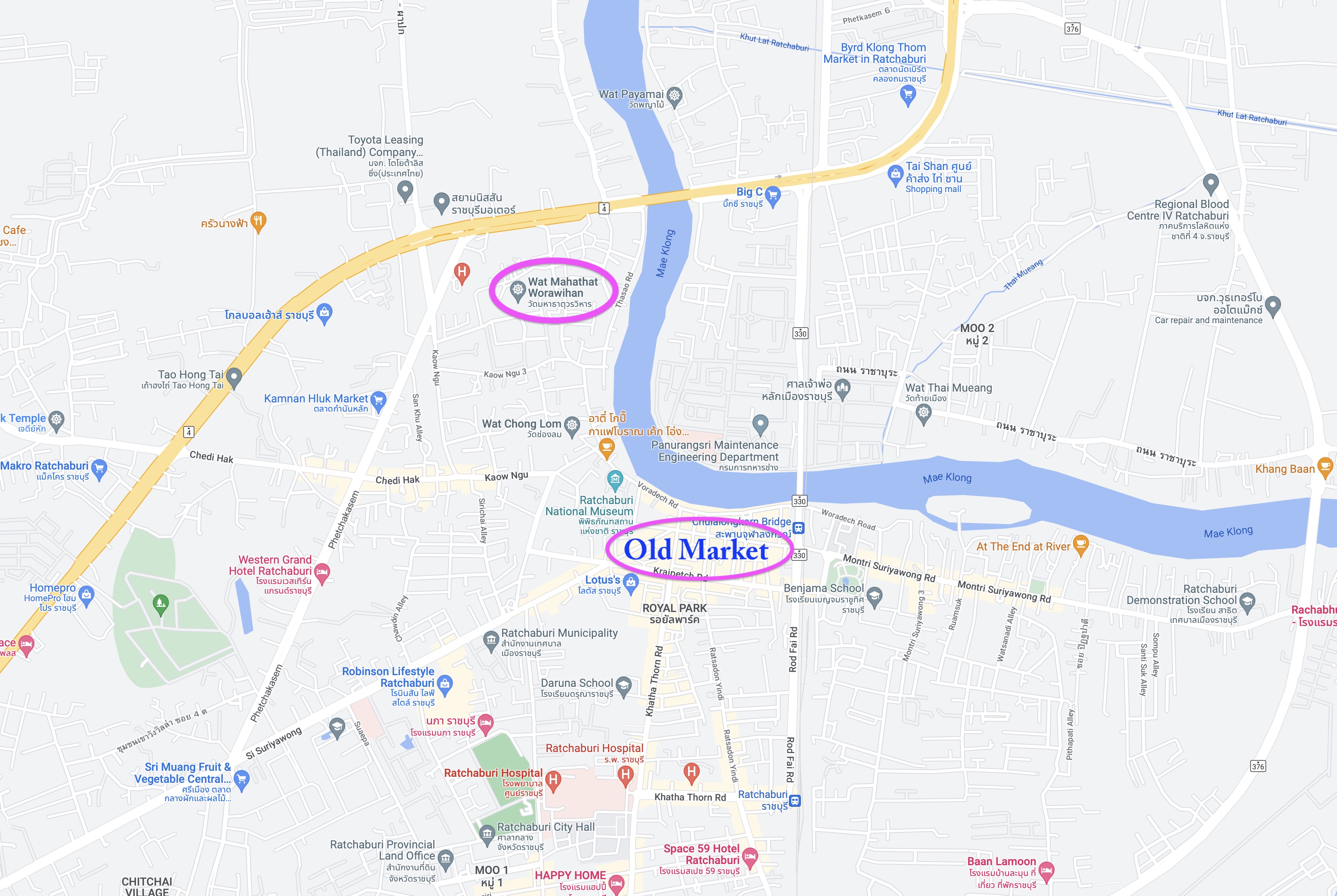 My last stop was at the amazing 10th century Wat Mahathat Worawihan.
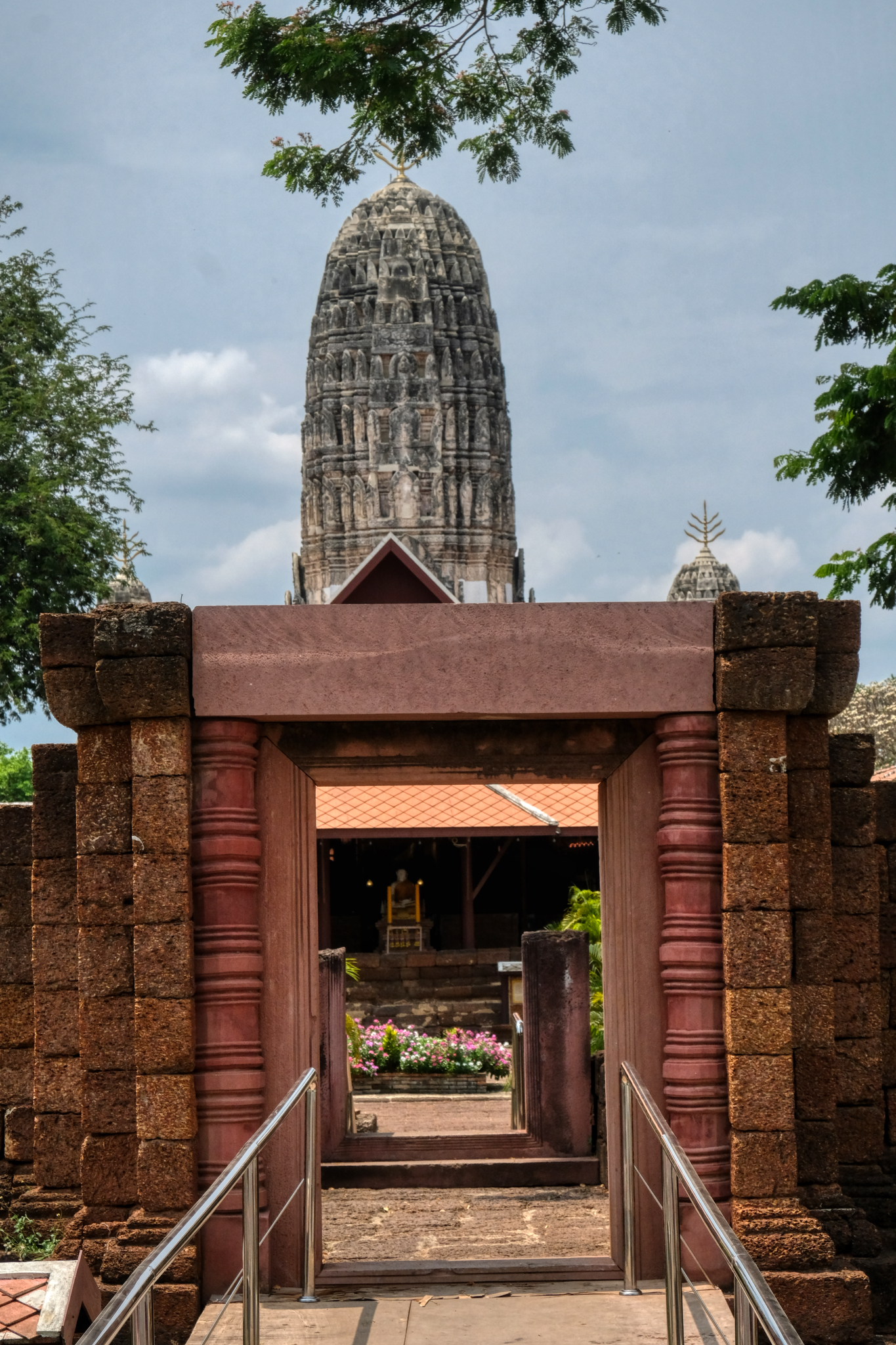 The front gate of Wat Mahathat Worawihan did not impress. But what was within astonished me.
 My first inkling about the beauty within this was was when I looked through a small building's window and saw this.
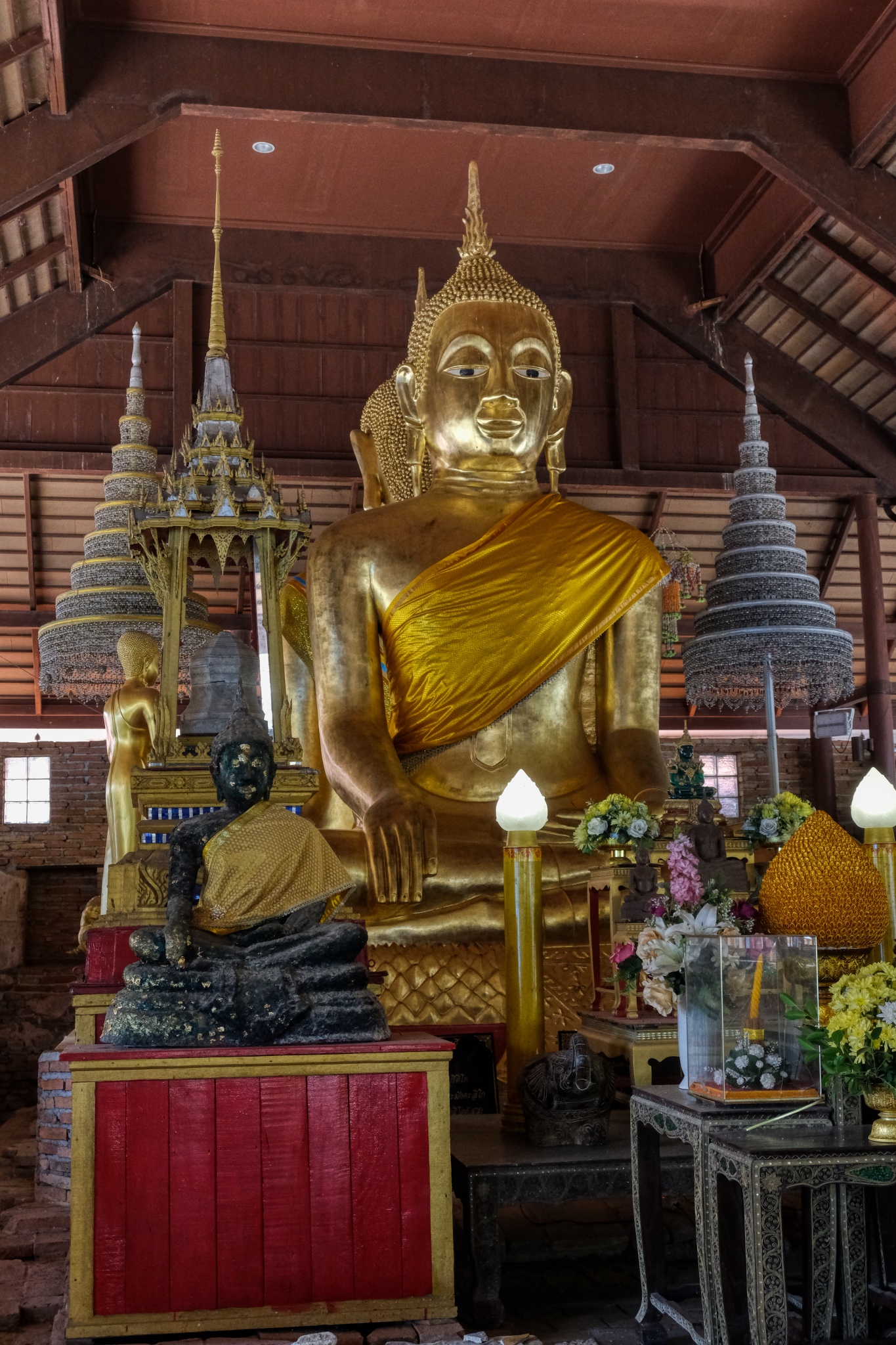
 The sala/temple straight ahead looked inviting. I could see a large Buddha image within.
 I took my shoes off and went in and discovered this remarkable spiritual space. If you look closely you can see the bases of the pillars that held up an earlier temple in the same location. "It is believed that this temple was built in the Dvaravati Period, around the 10th-11th Century, nearly the same time as when the old city of Ratchaburi was built. Later, a Khmer or Lop Buri sanctuary was built over the temple around the 13th Century to be the centre of the town according to the Khmer belief regarding the universe."
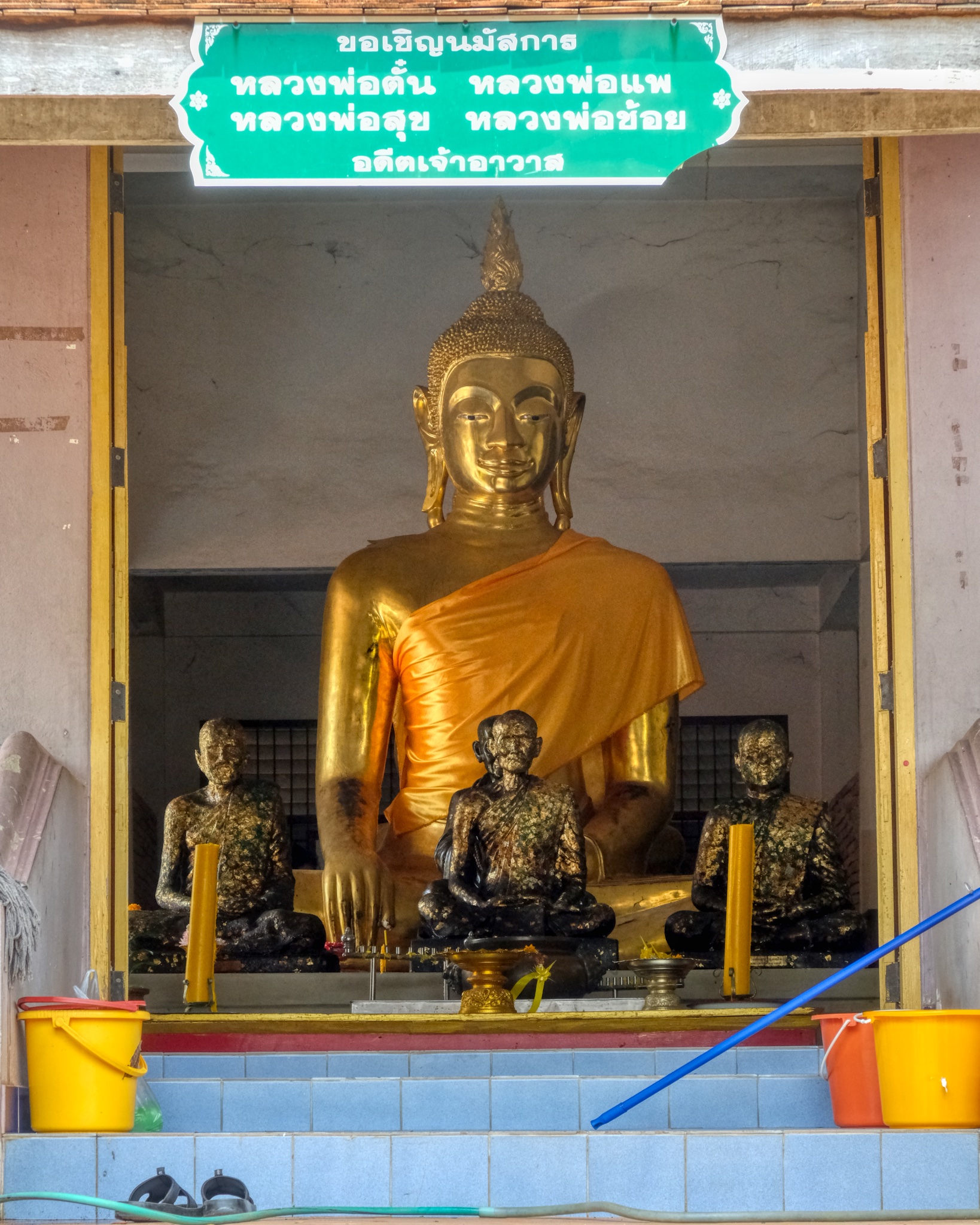
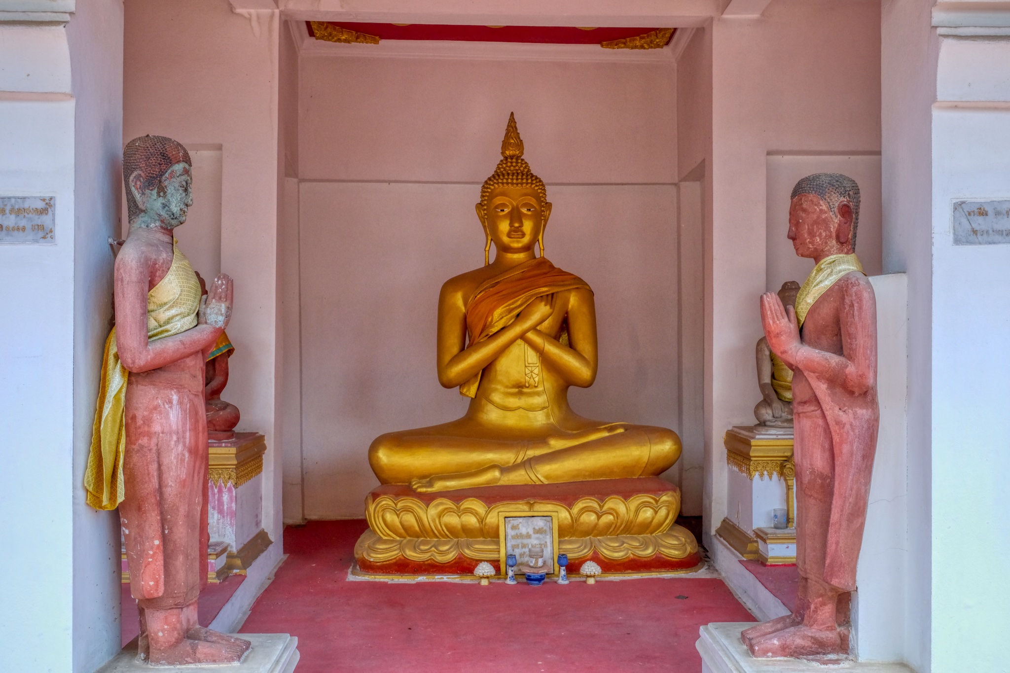
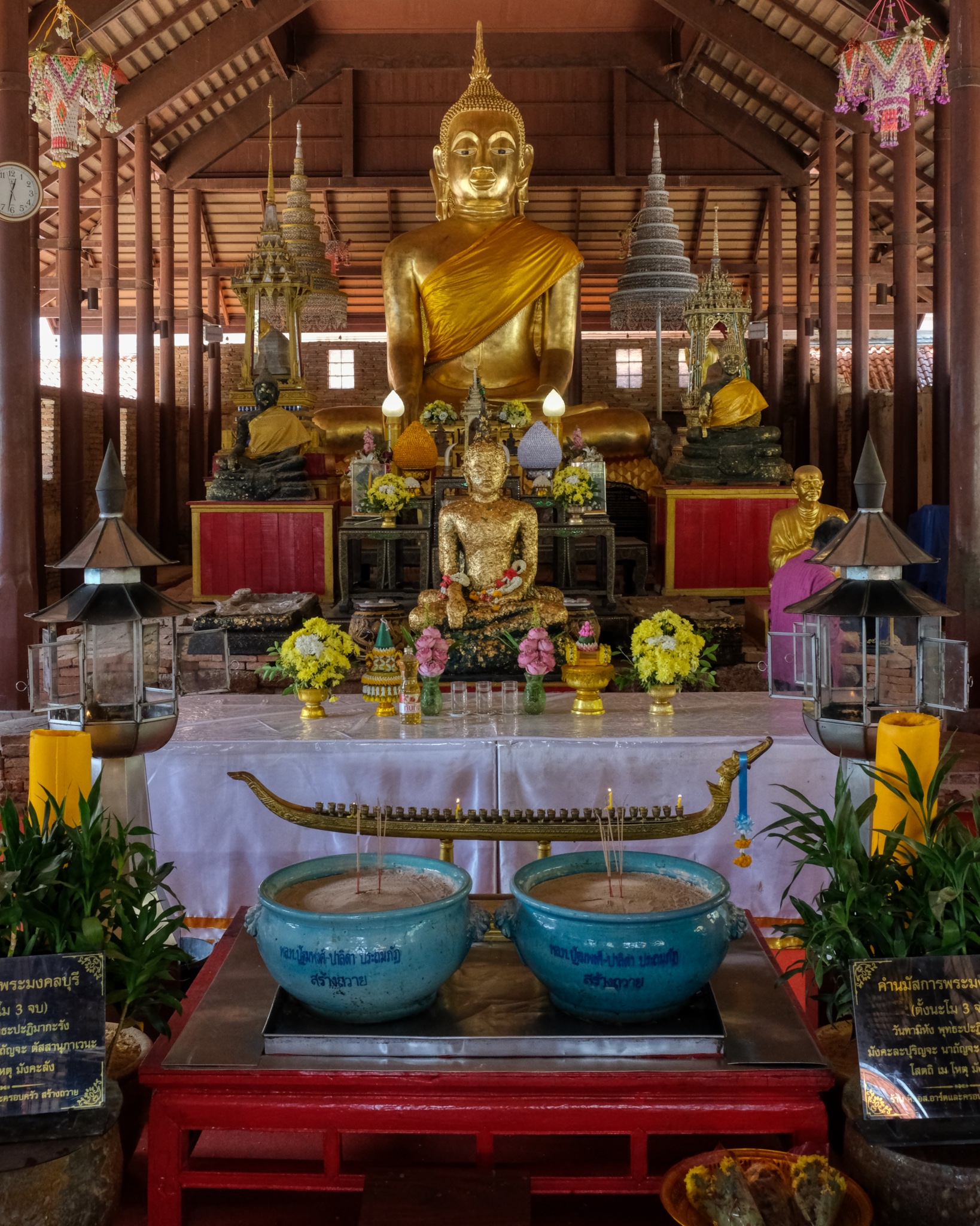 Exquisite Buddha images and a fine altar.
 Buddha.
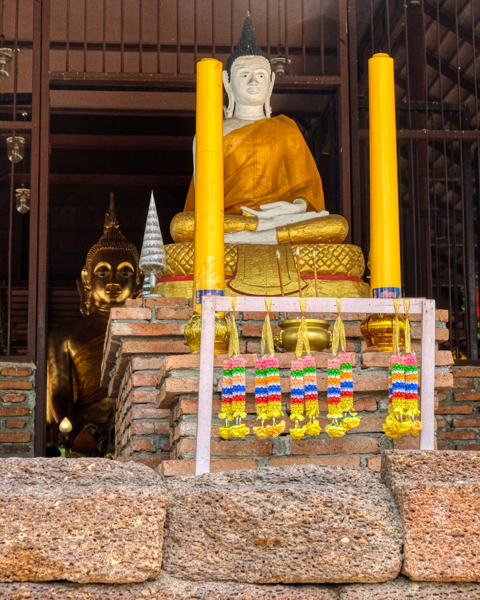
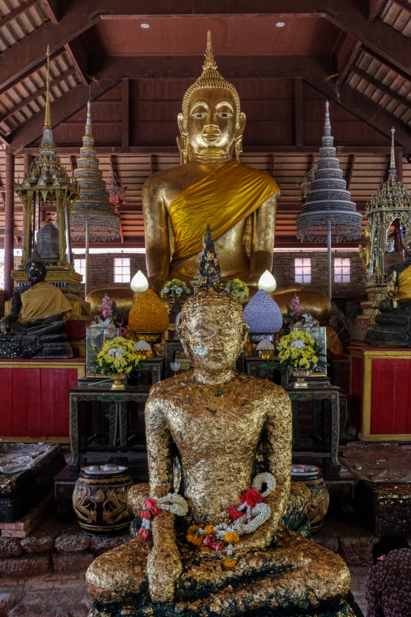
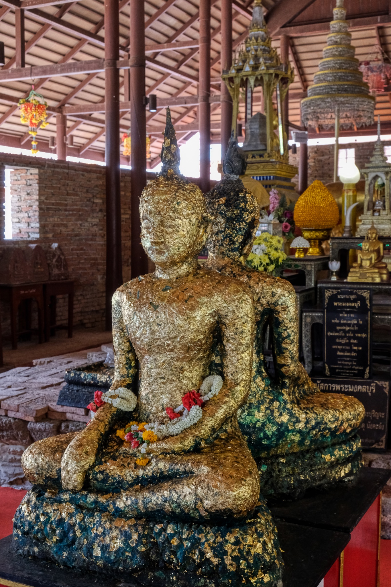 Devotees adorn Buddha images with gold leaf as a part of respectful practices. I was intrigued by these two Buddhas sitting back-to-back.
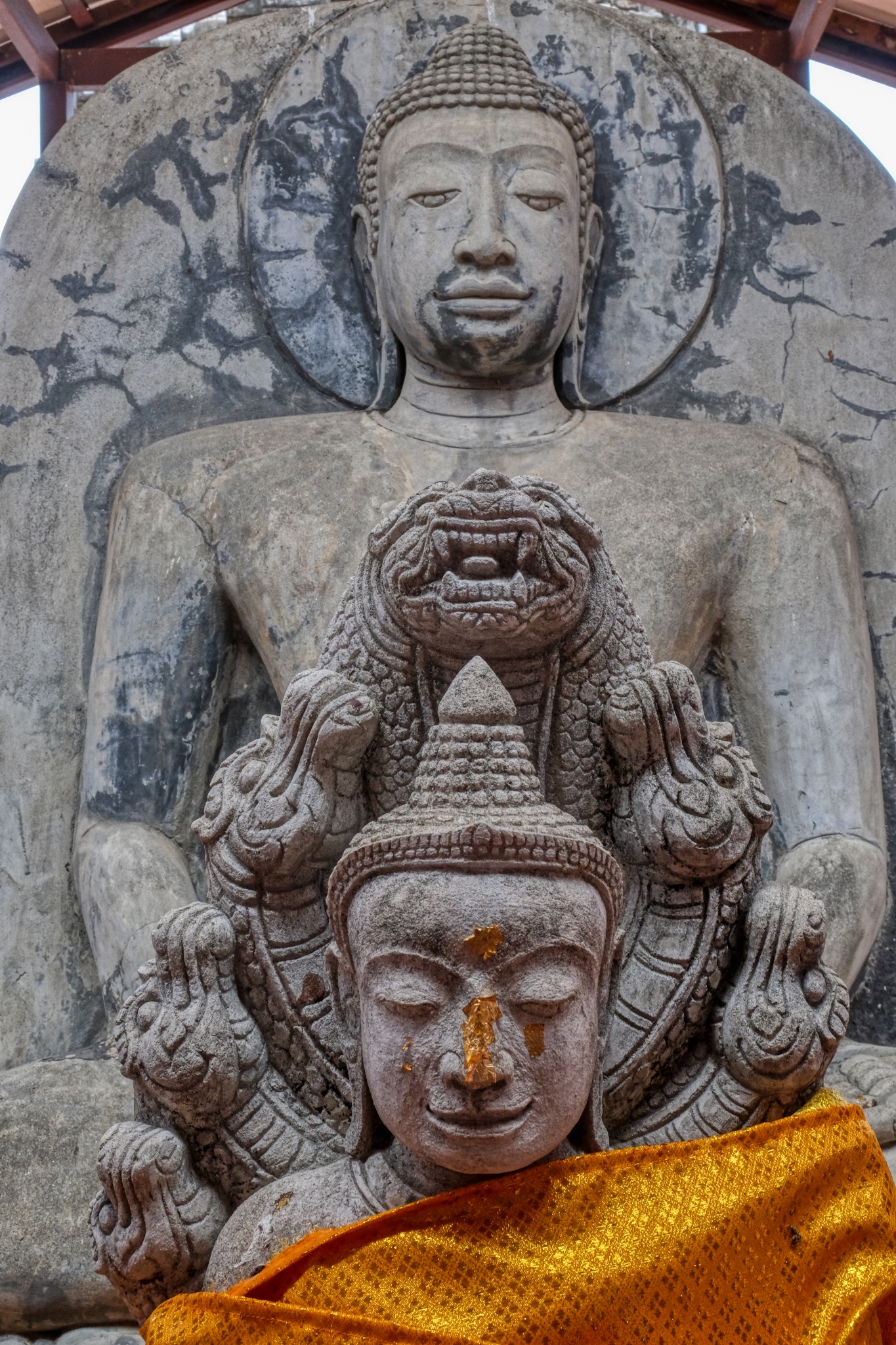
 When I looked up at the main, large Buddha image I noticed that it was also a double Buddha. It is very unusual to see two Buddhas sitting back-to-back.
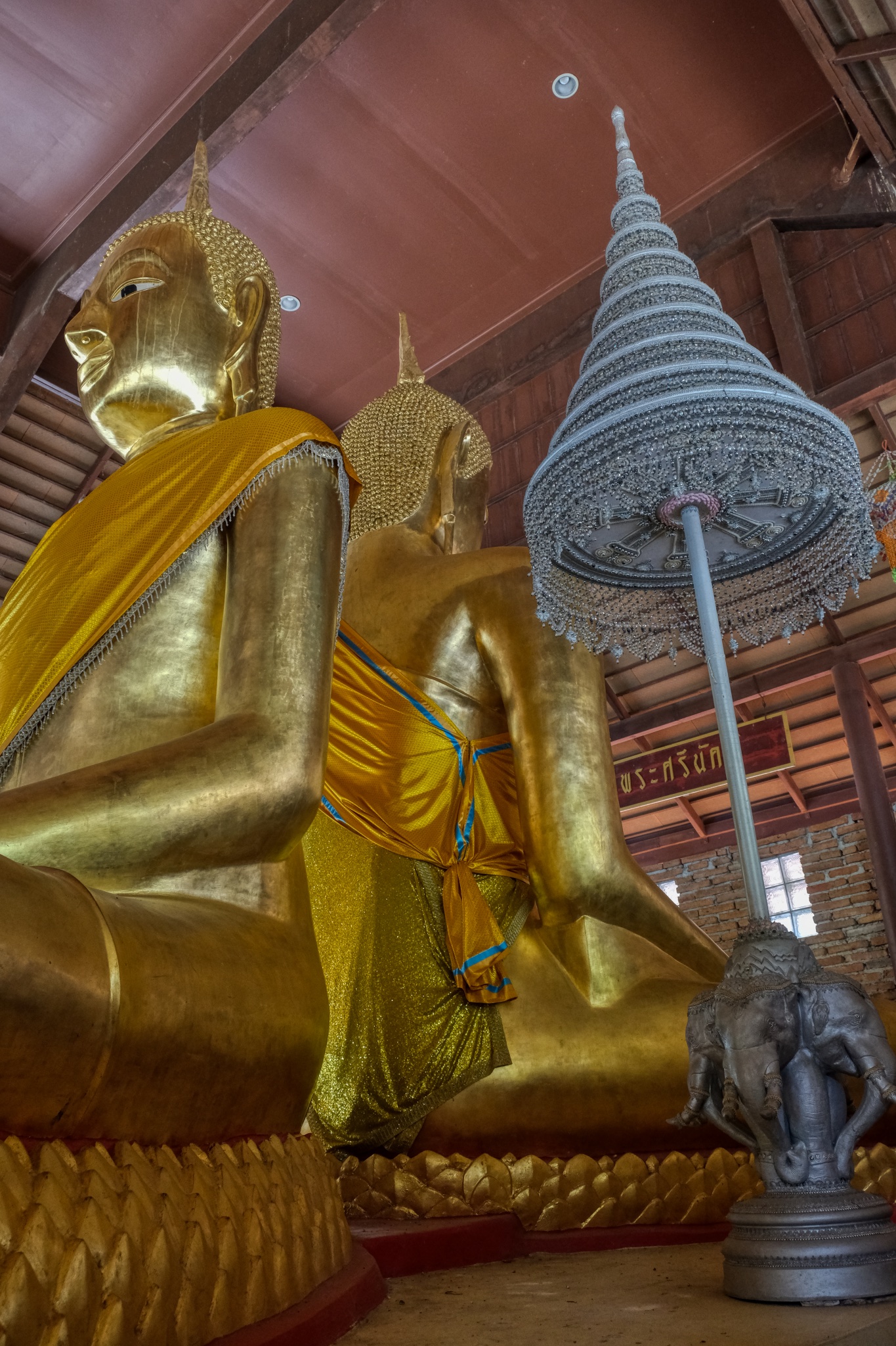 Normally only one Buddha sits in a Wat, and normally facing East.
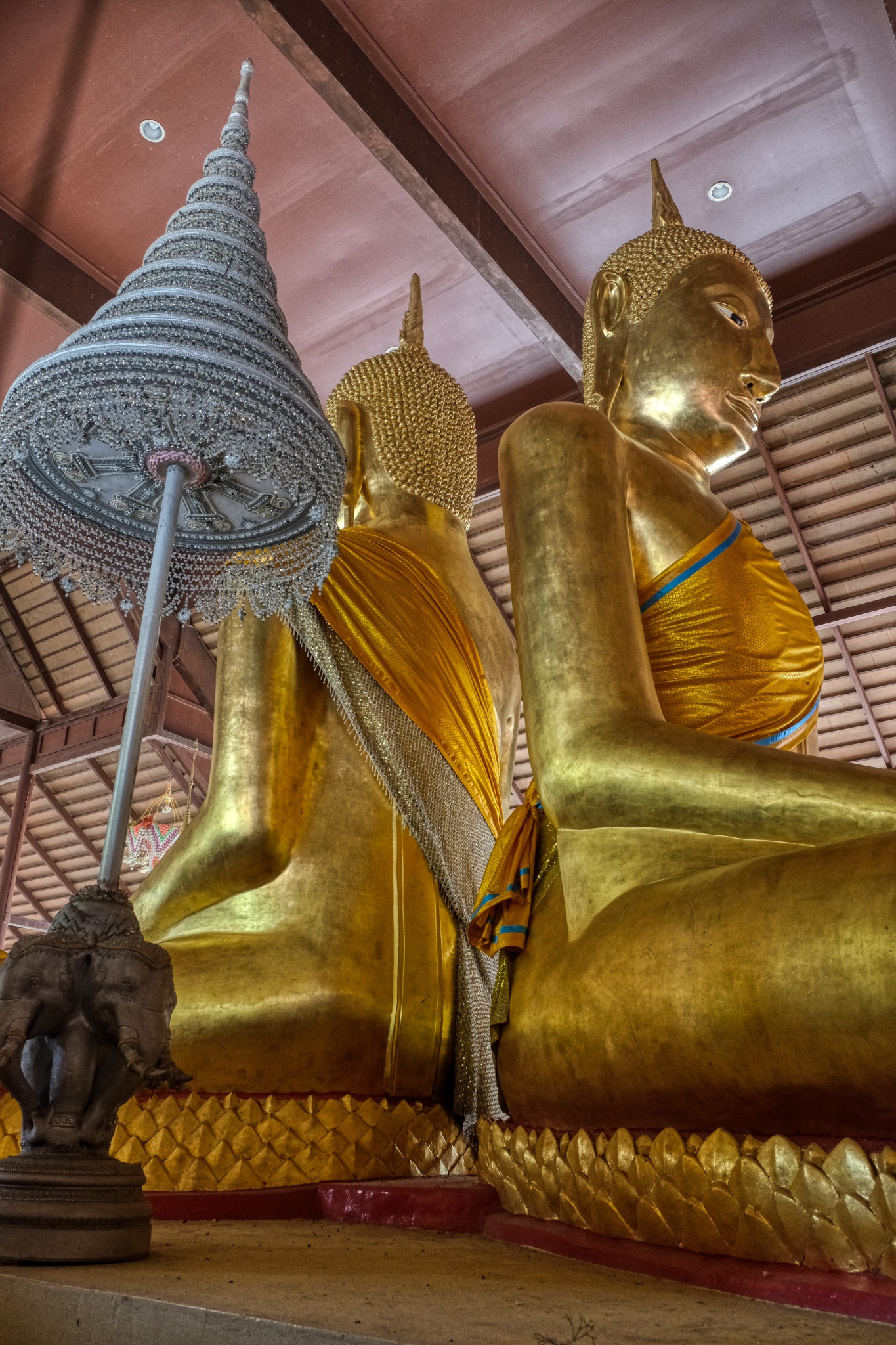 They were extraordinarily beautiful Buddhas. My research turned this up:"It is a stucco Buddha image in the gesture of subduing Mara, which has a lap width of 8 Sok 1 Khuep. Its characteristic is of the Pre-Ayutthaya art, with a Sukhothai style face. It has a long body but short knees. He turns his face to the east, and there is another Buddha image behind his back, turning its face to the opposite side or the west. This means we ask the Buddha’s blessing to prevent danger from the front as well as the back." (citation)
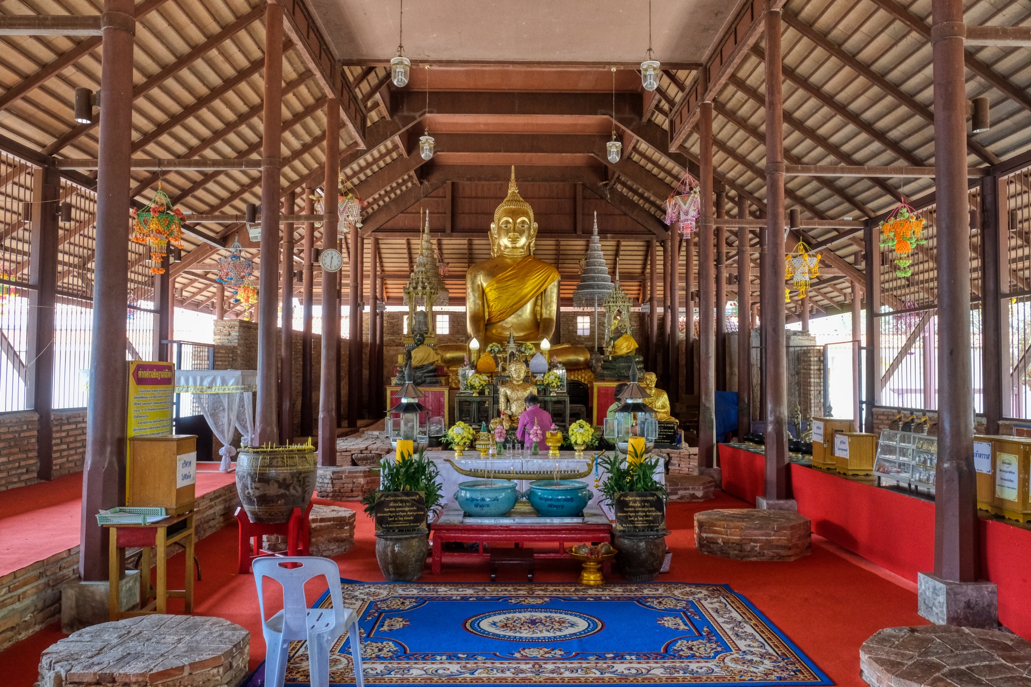
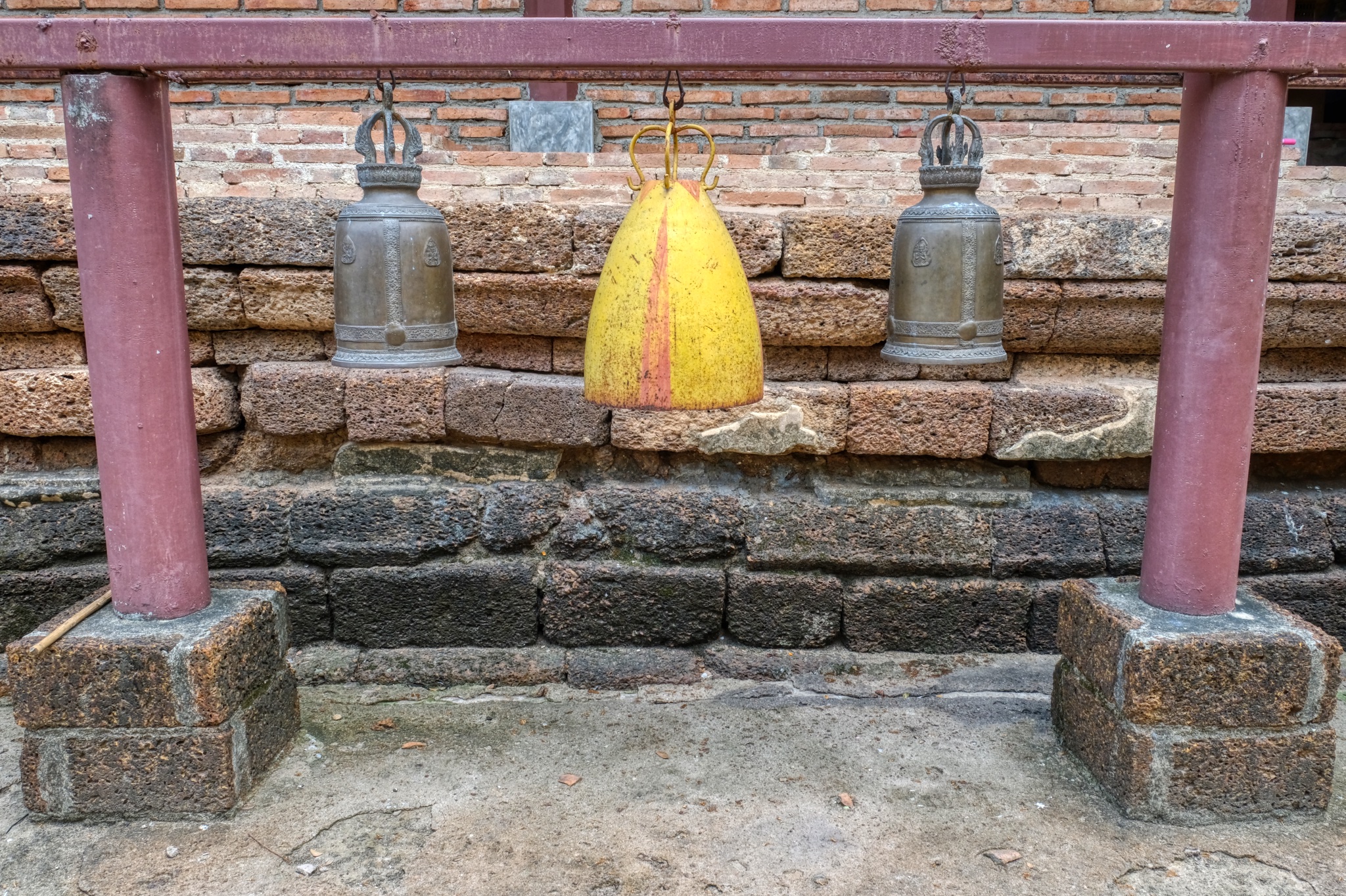 I left the Buddha hall to wander around the wat grounds.
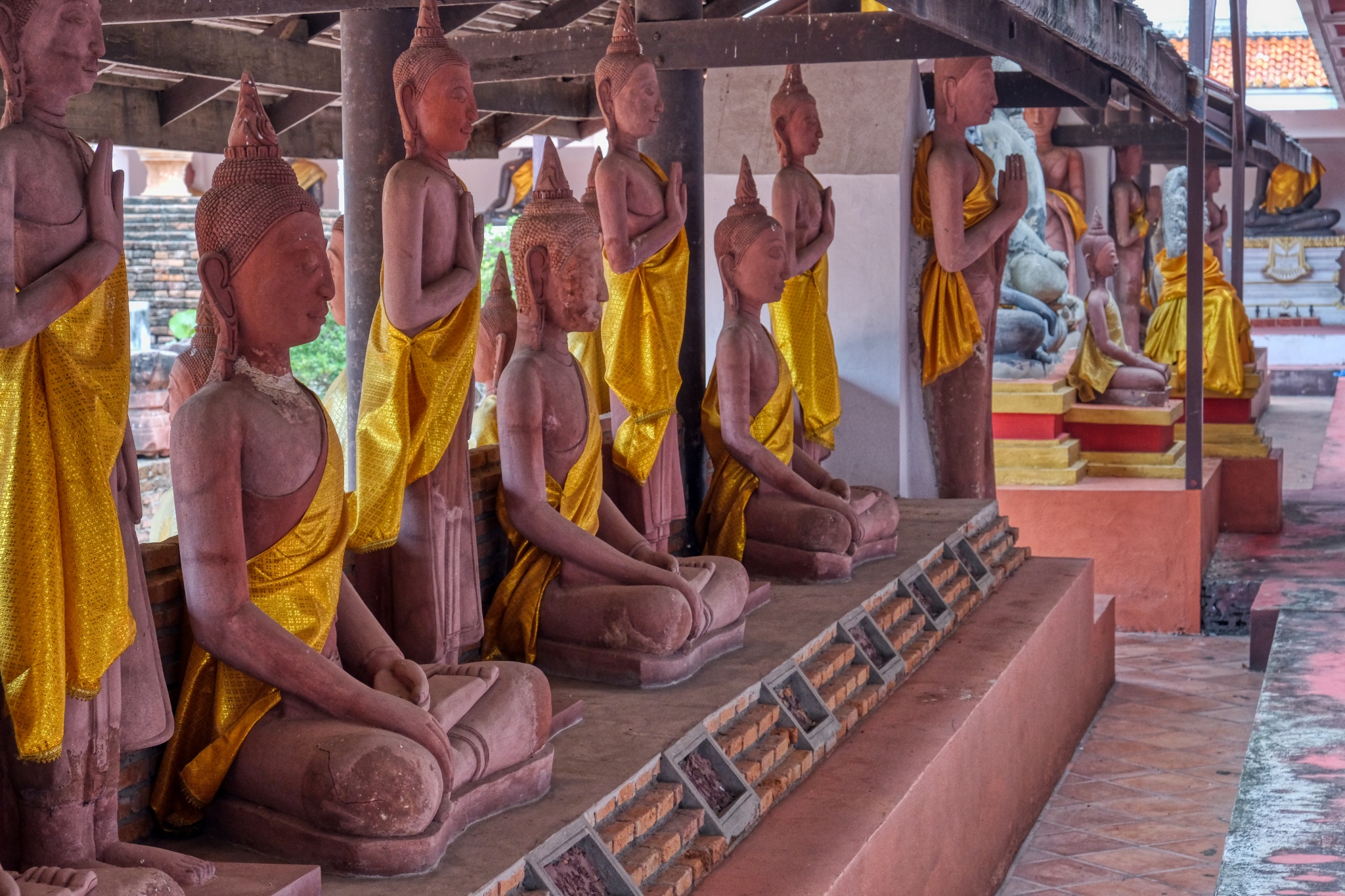
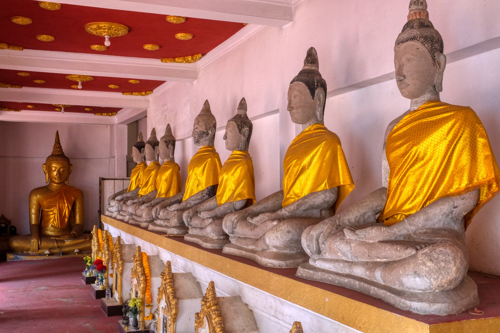 Like many Thai wats, there are covered halls lined with Buddha images, often as markers for the cremated remains of former monks and doners, as is the case here.
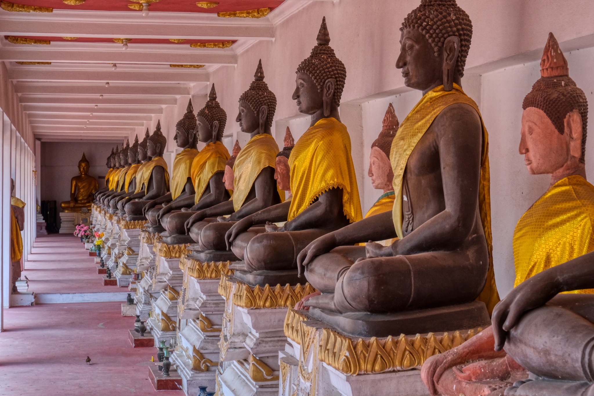 Such a beautiful sight.
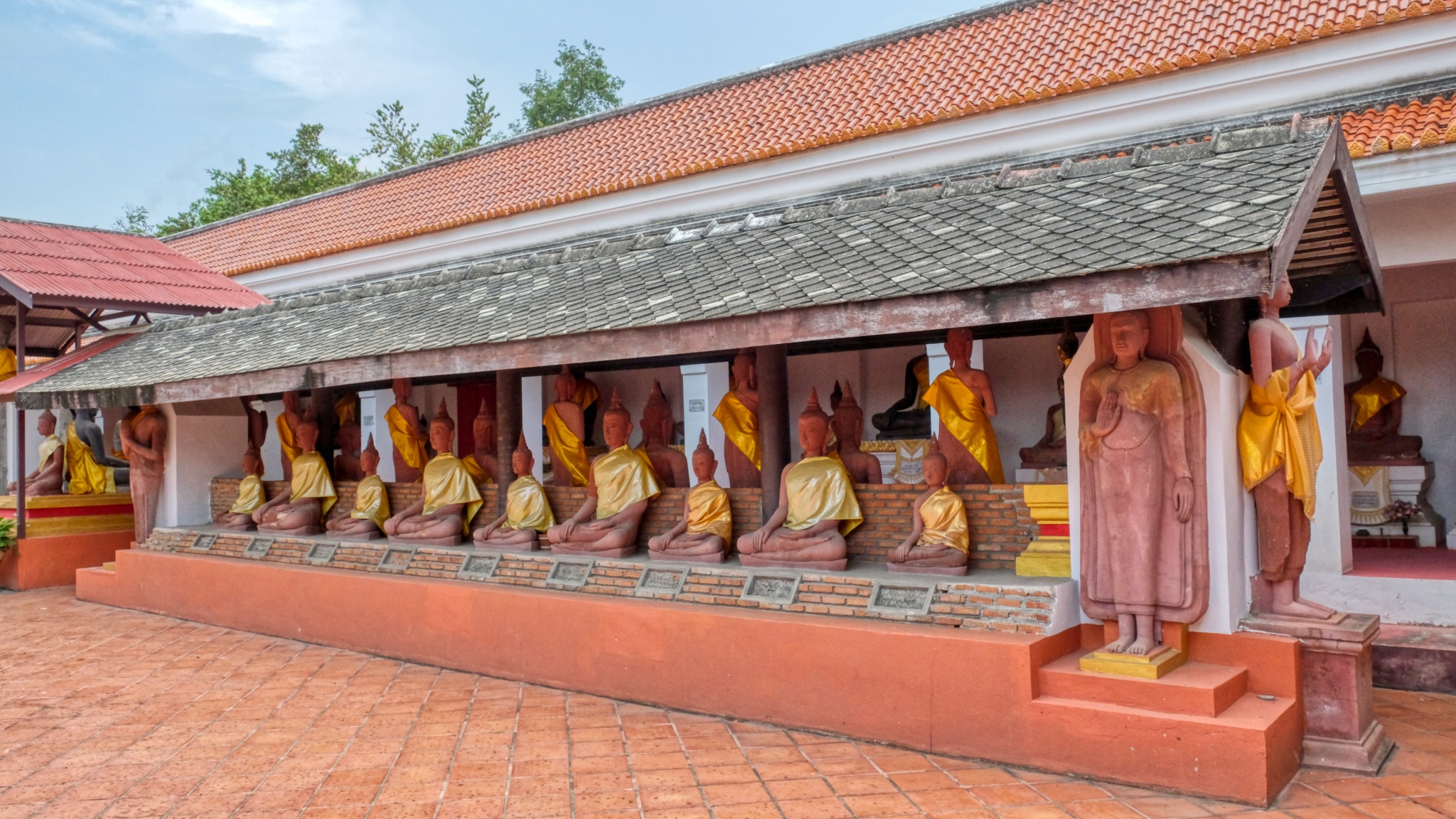 In fact, there are several rows of these grave marking Buddha statues.
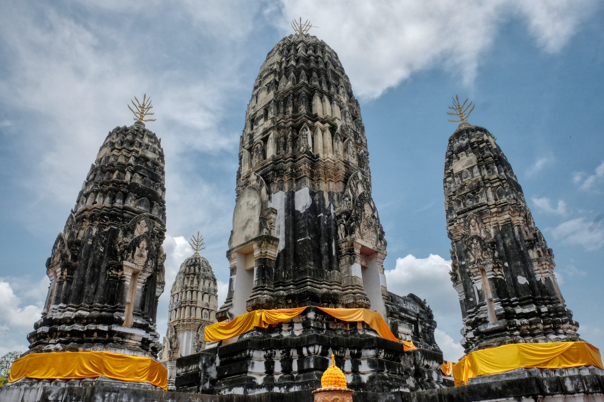
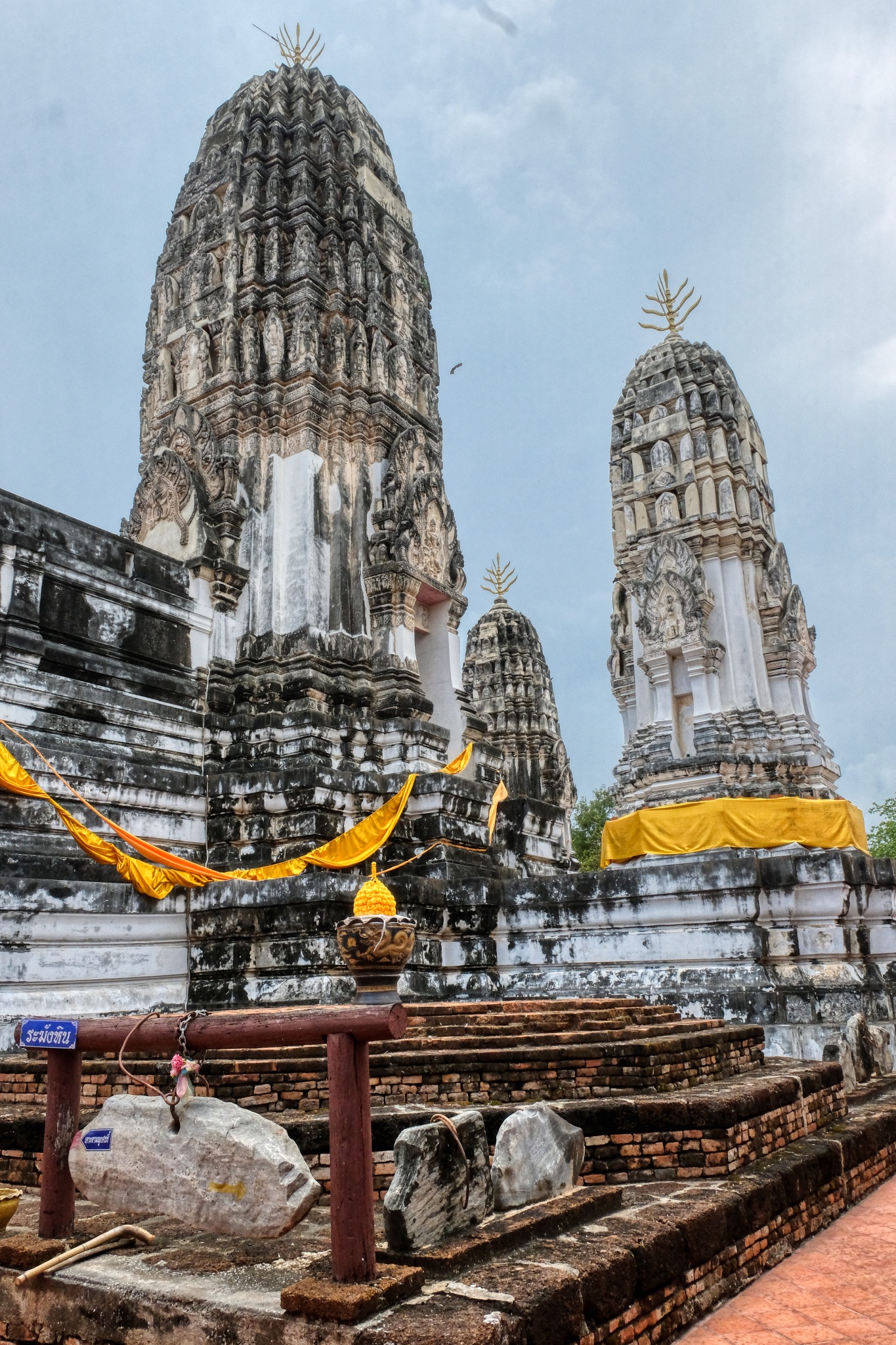 The Five Prangs. At the center of th Wat is a large courtyard enclosed by a cloister. At the center of the courtyard stand five massive parangs, known as "Phra Prang Ha Yod", or five peak prang. The Khmer/Lopburi style towers were constructed during the Sukhothai era.
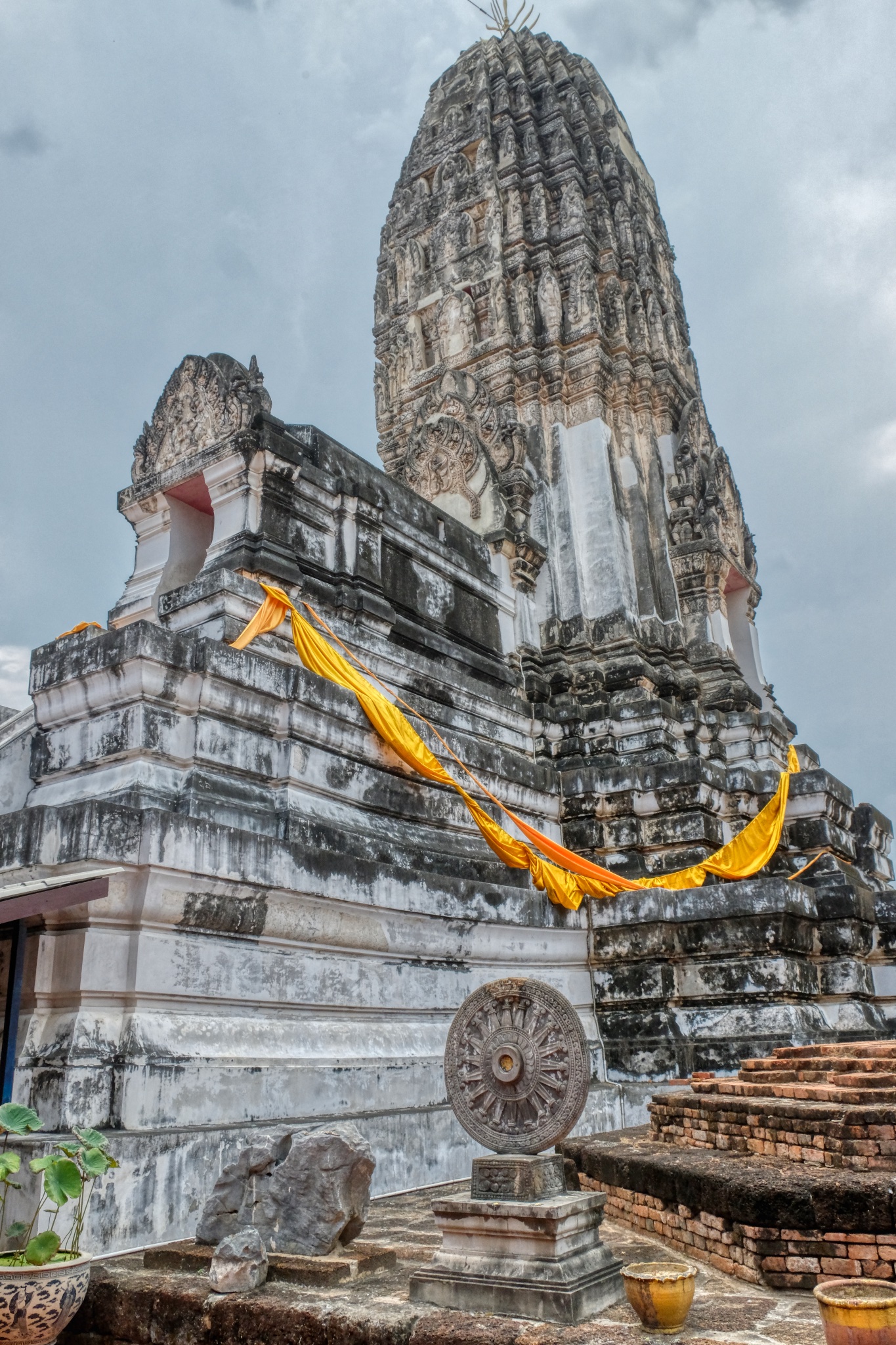
"Surrounded by four smaller ones, the tallest central prang rising over forty meters enshrines Buddha relics. Enshrined in large niches on all of its four faces are standing golden images of the Buddha. The brick plastered prangs, decorated with fine stucco work are topped with a trishula, a three pointed spear, the weapon of the Hindu God Shiva. Sheltering them is a small multi tiered ceremonial umbrella" (citation)
 Extraordinary.
 Ah! A phone message from my wife: she is on the 16th hole. Time for me to leave this amazing place. I headed back out along the Buddha colonnades.
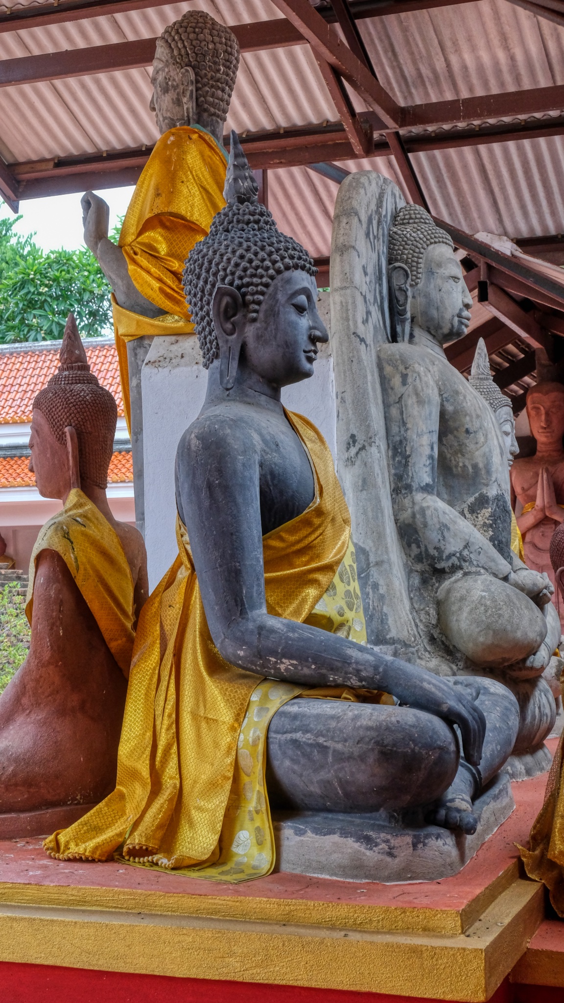 A wide variety of Buddha images present.
 A fine reminder about my mortality and a questioning about what I am doing with my conscieness.
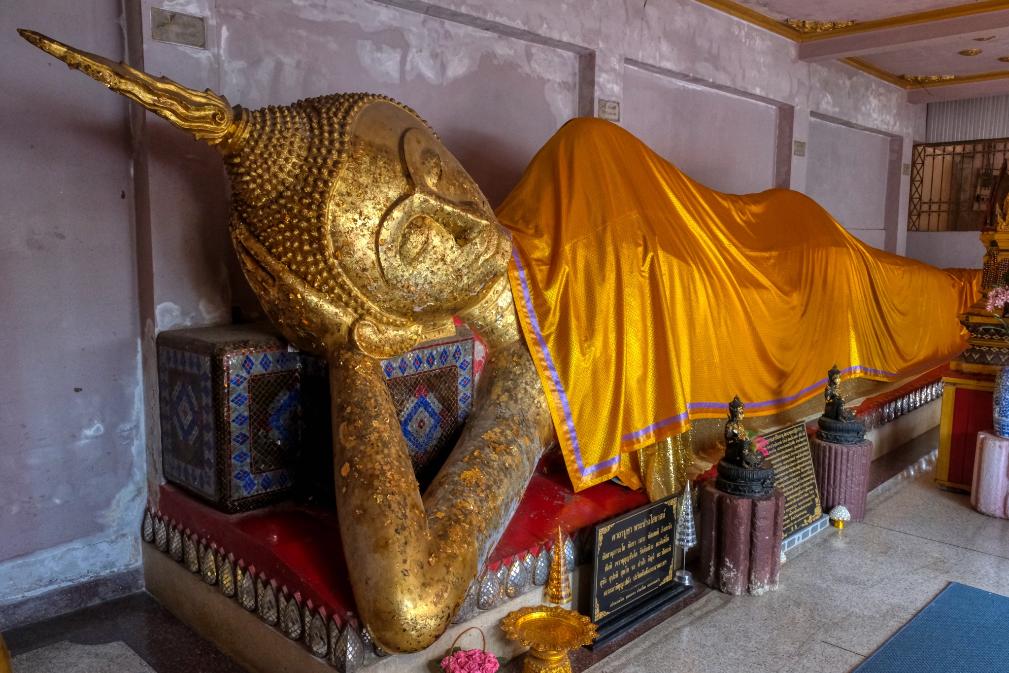 One last grotto . . . to visit a reclining Buddha.
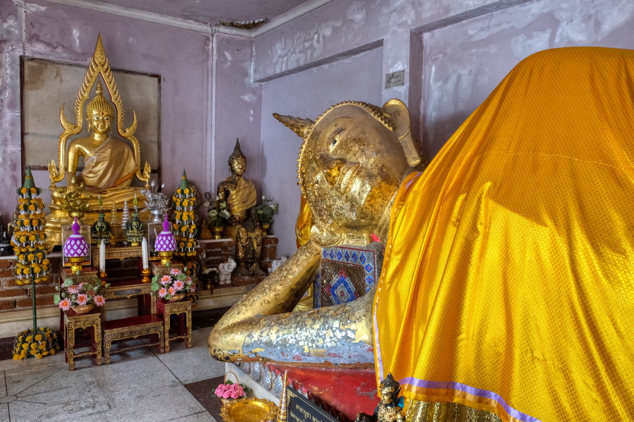 Such a beautiful display. An old 'nun' altar keeper offered me a bottle of water here, which I took. It was a hot day!
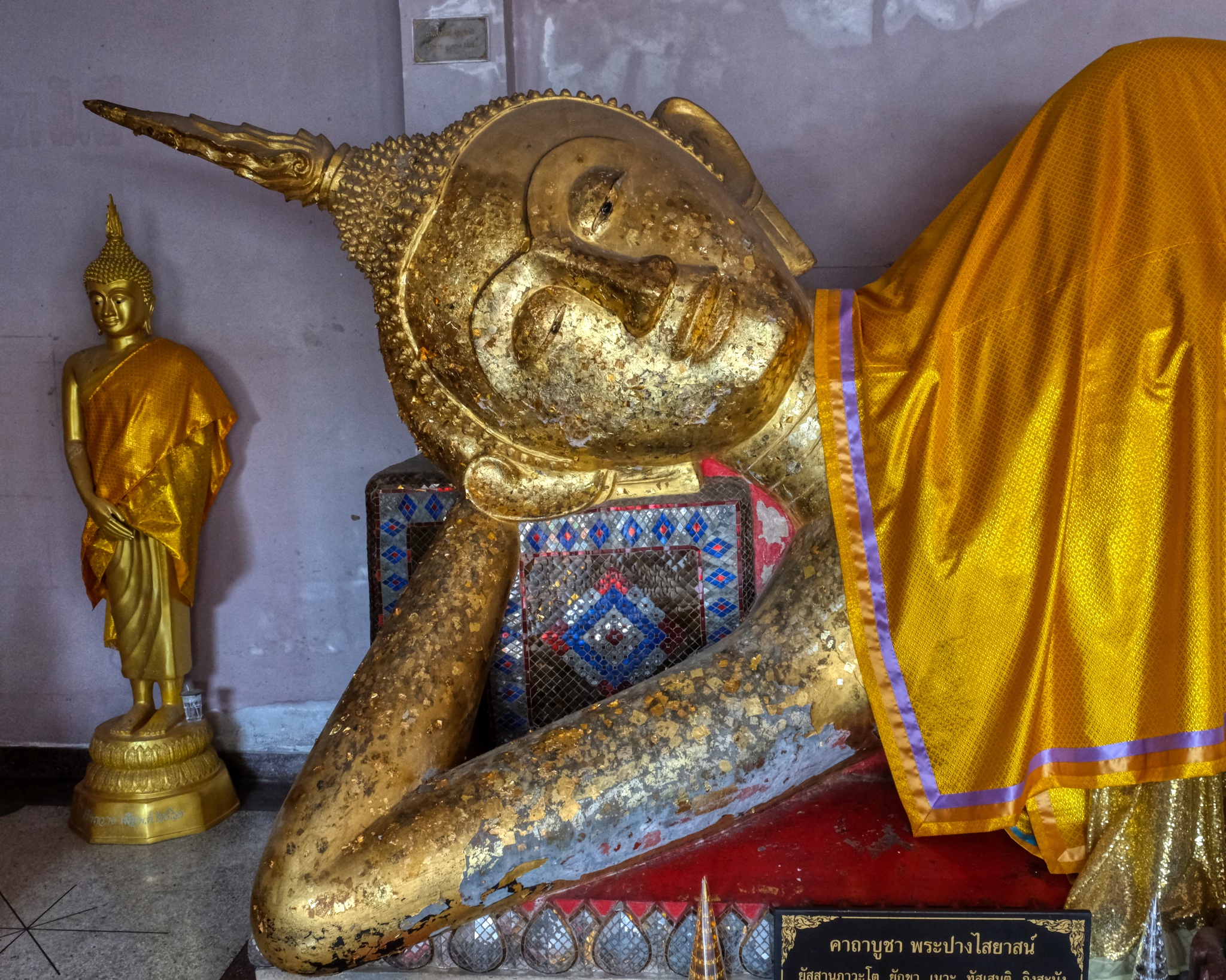 I lingered in this space to pay my respect to the Buddha. I also left my donation here.
 My last stop. Then the 25 minute drive to pick up my wife at the golf course and the 1 hour 45 minute drive back to Hua Hin. A wonderful day . . . .
 Back on the balcony for a gin & tonic and this strange blue sea . . .
USA Road Trip: The Wild West - Pipe Springs and Cove Fort
PIPE SPRINGS, ARIZONA
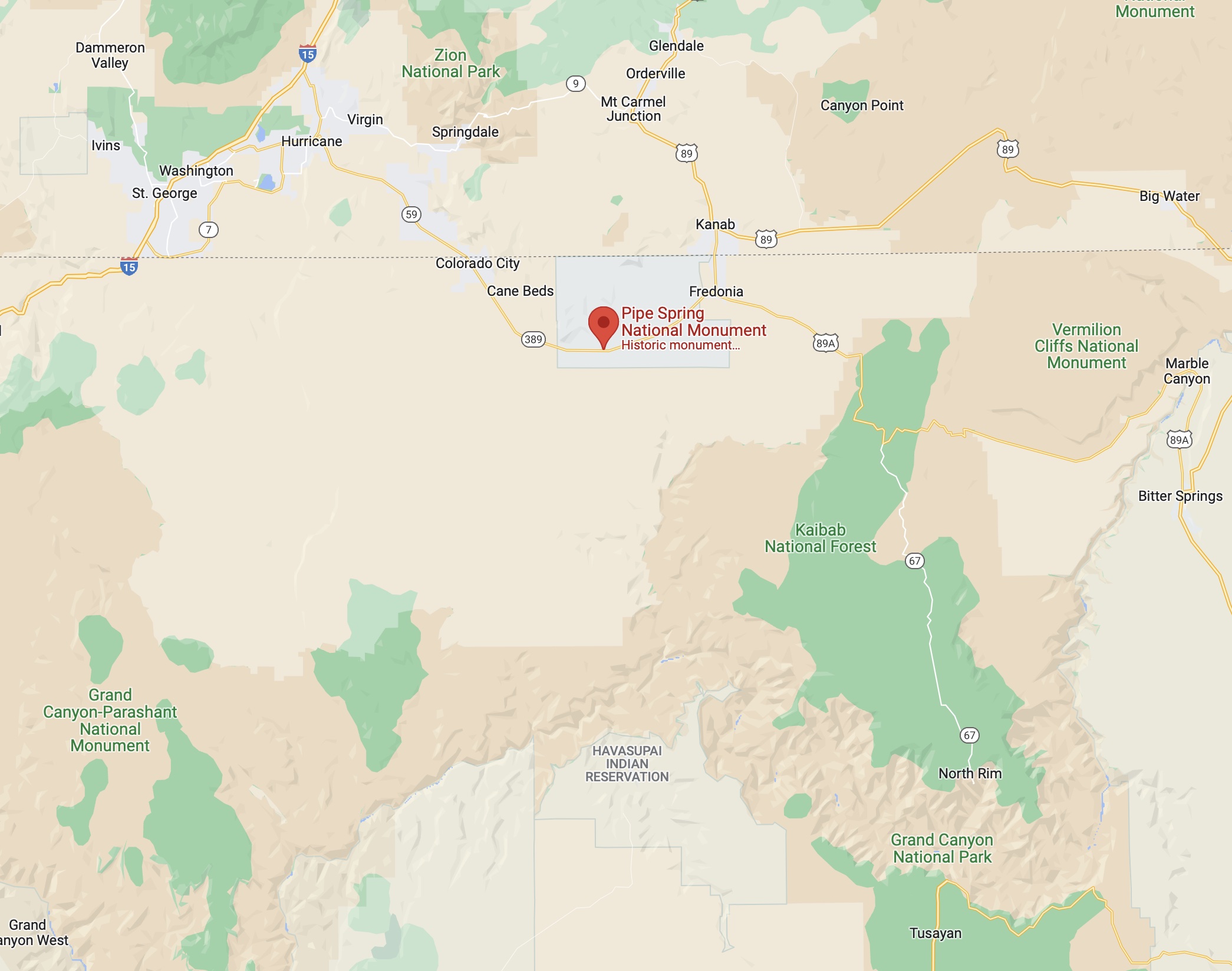
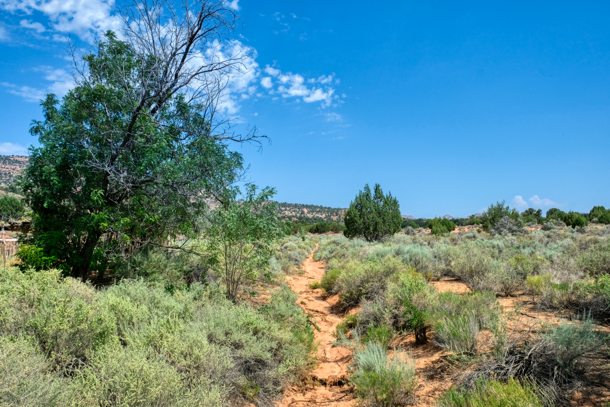
 Out on the dry, high elevation chaparral of Northern Arizona, along the road between Zion National Park and the North Rim of the Grand Canyon . . . a remnant of a bygone era . . . The Wild West . . . Pipe Springs National Monument.
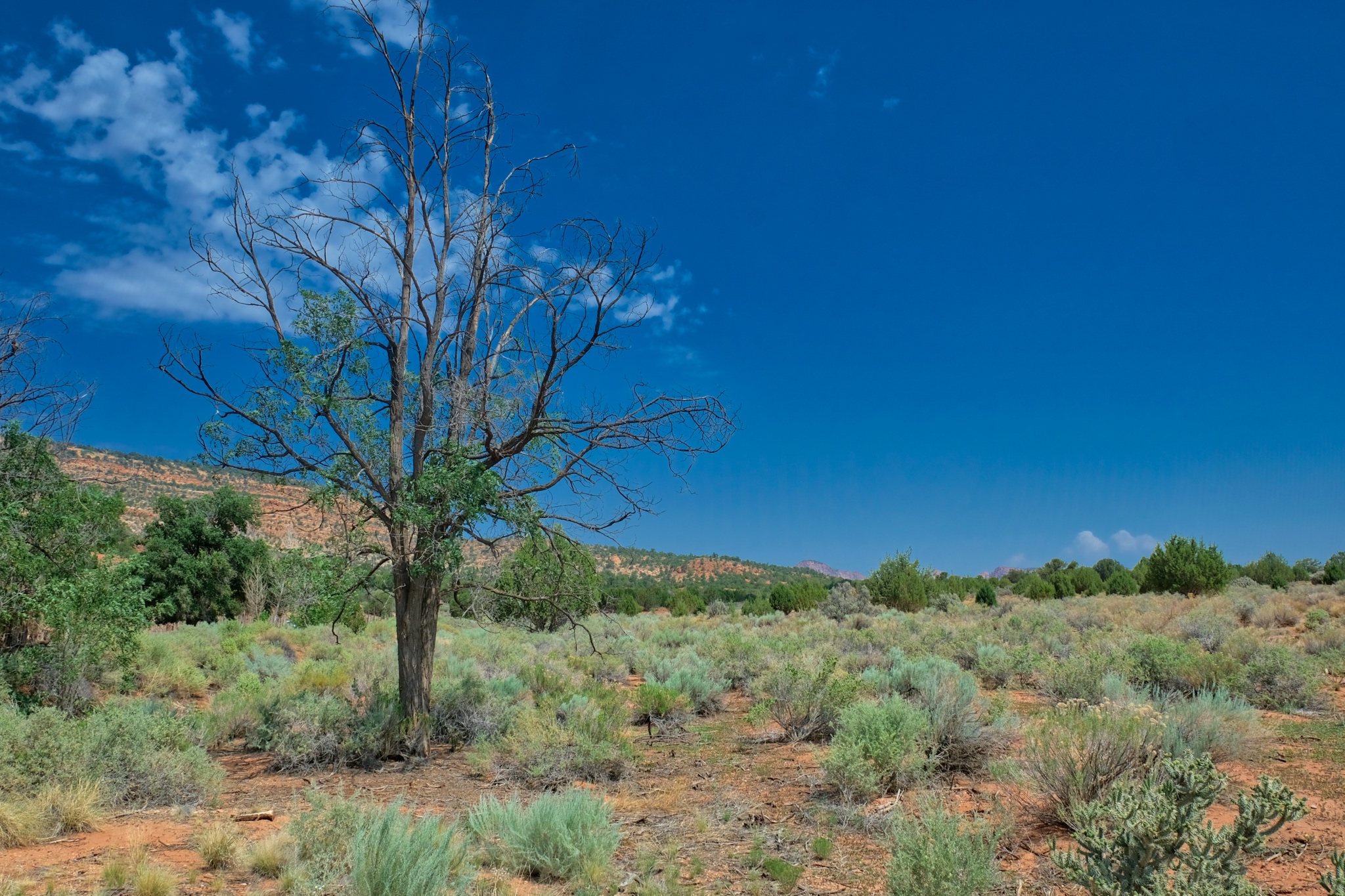
 My road trip took me along many wonderful roads.
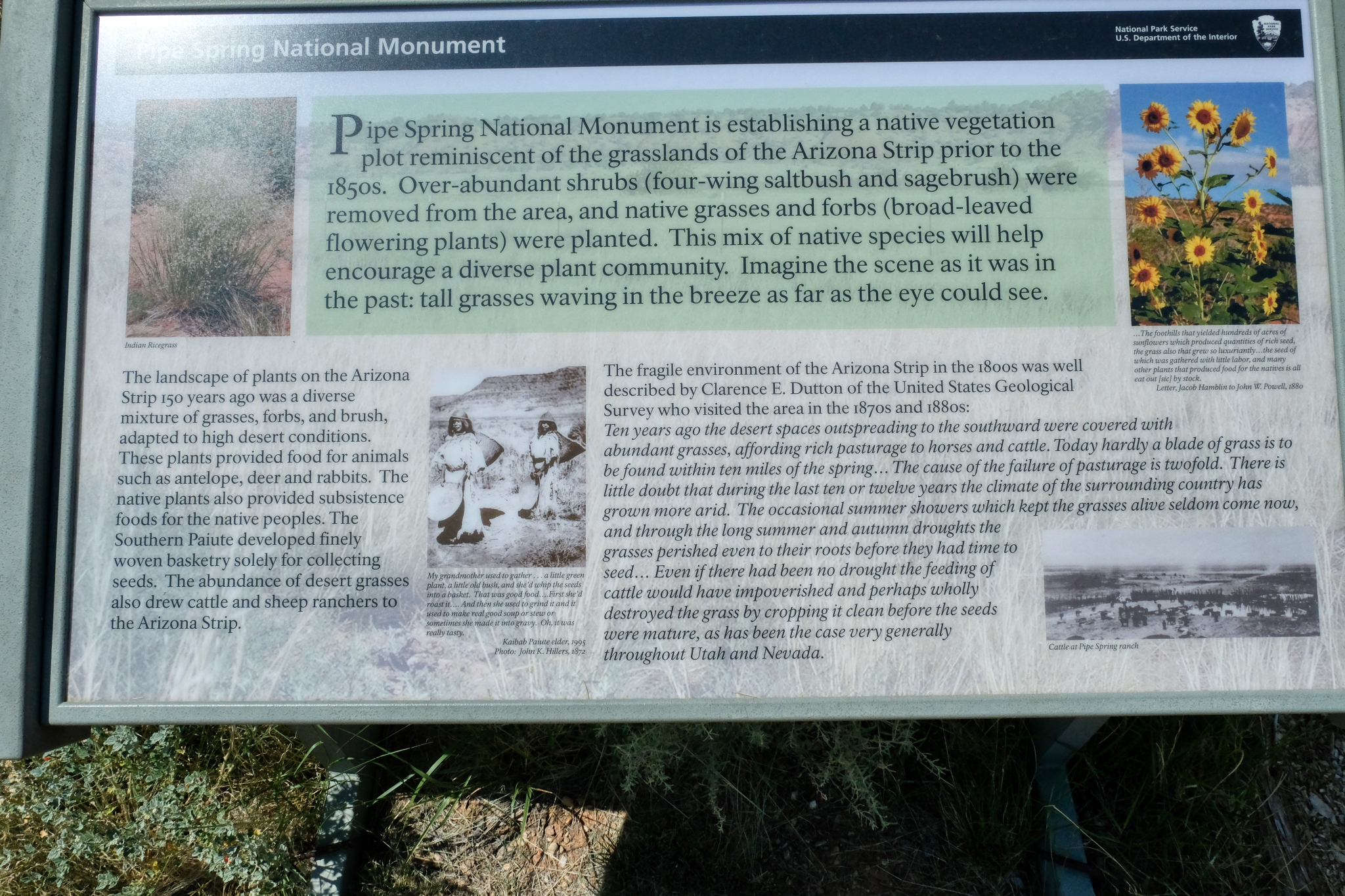
 Pipe Springs is established as a grasslands preservation area to reestablish the area as it was before settlers arrived in 1850.
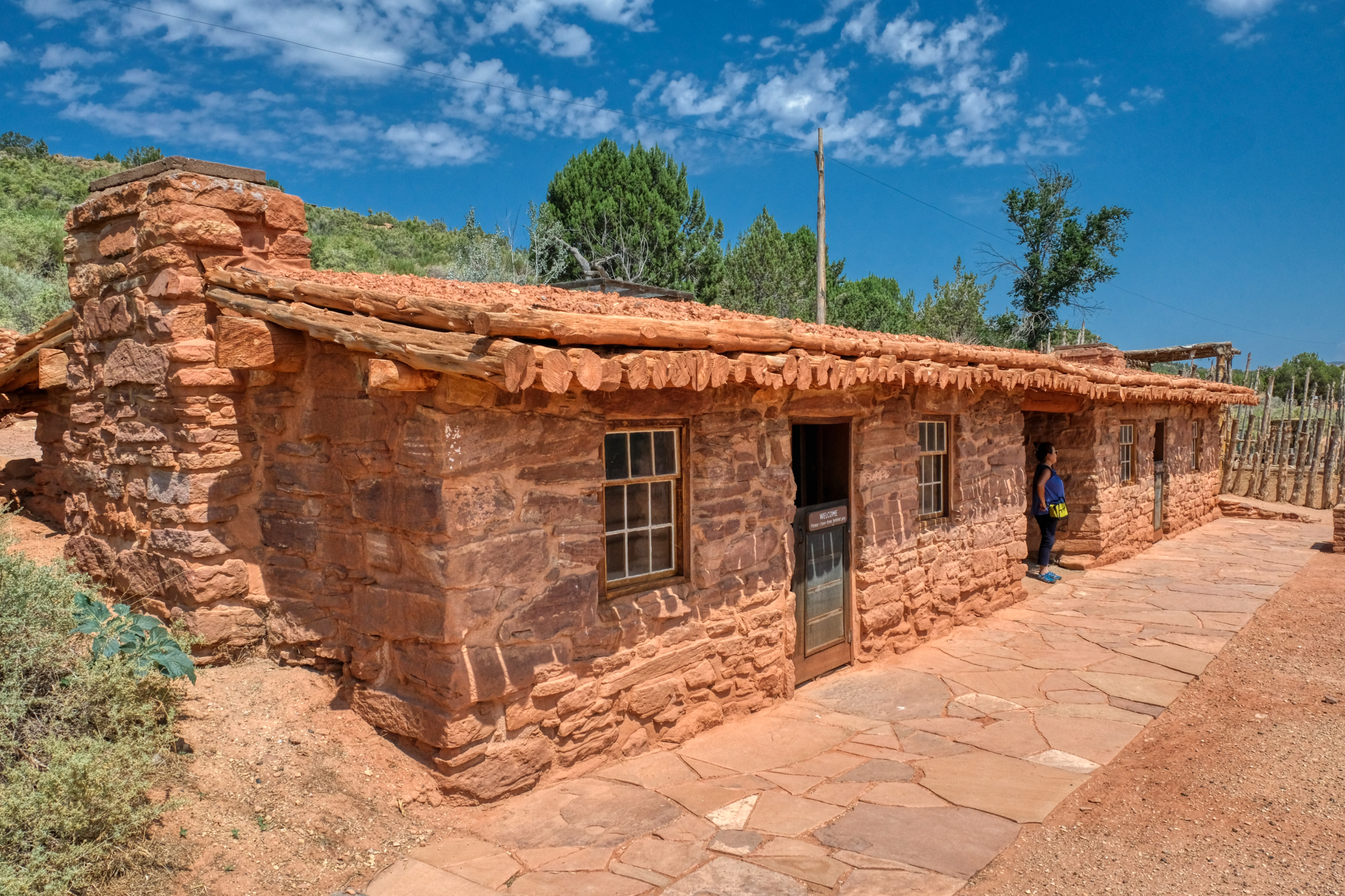
 In addition to very informative signage, there was also a fine visitors center.
 A nice place for a walk to nowhere.
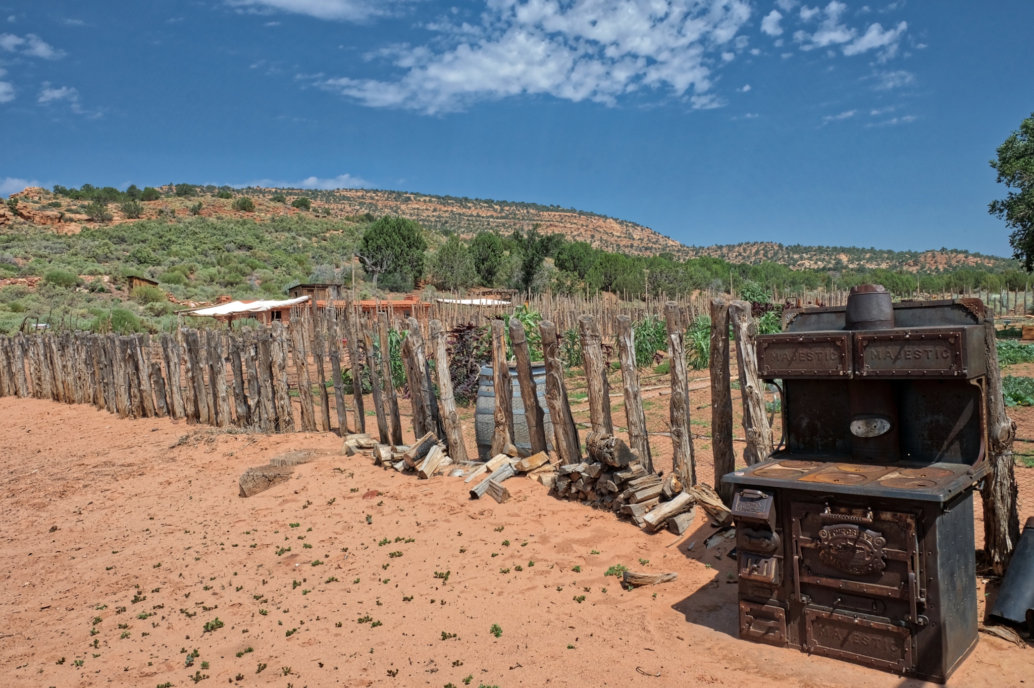 Pipe springs was established at a natural spring as a U.S. Army Calvary Fort, but it was also a self-sustaining farm to support the soldiers stationed there during 'The Indian Wars' in the region.
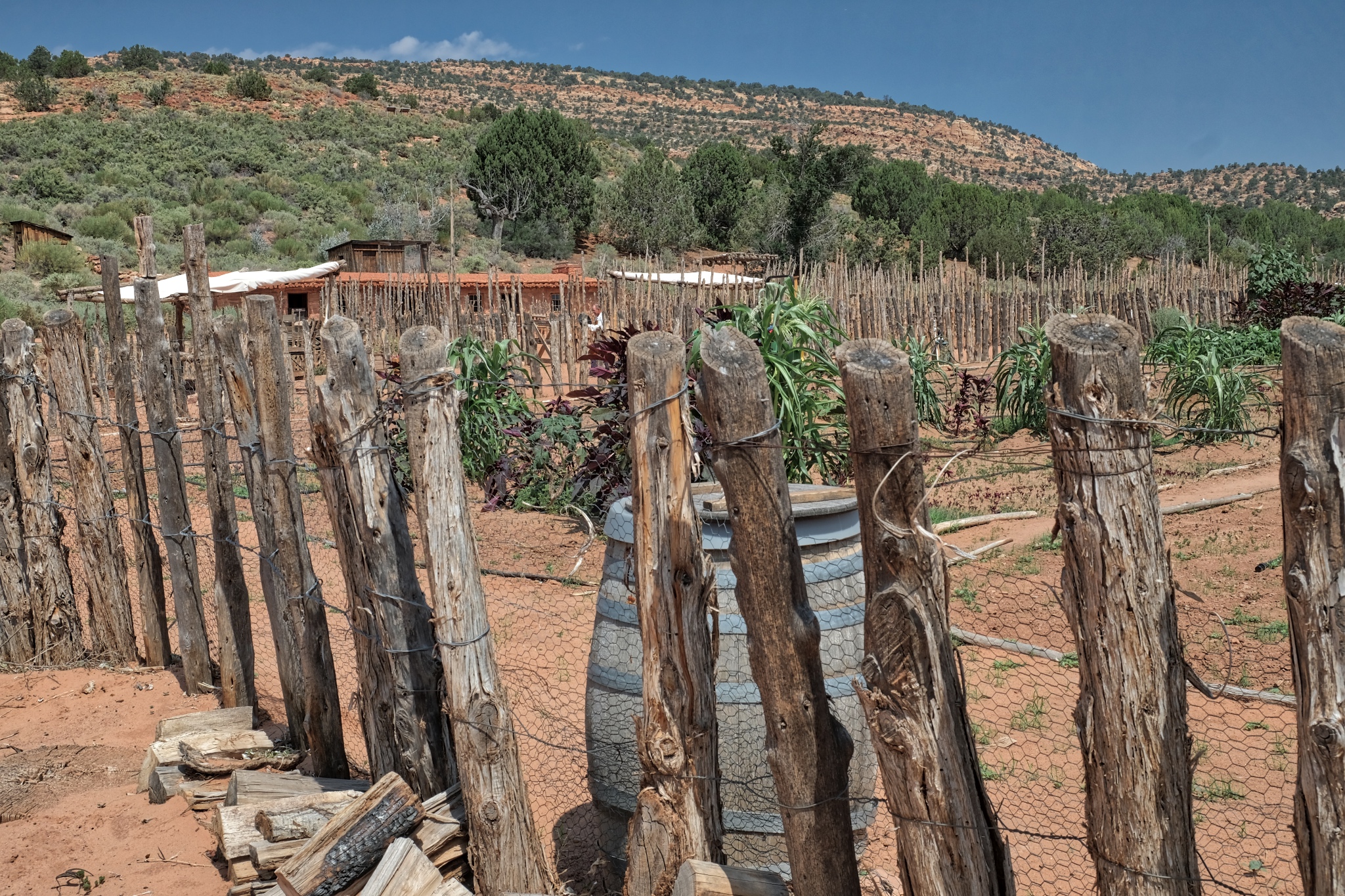
 The National Monument still maintains a farm on site in the manner of the settlers and soldiers around 1850. A very nice depiction of the living conditions and methods of the early Western settlers.
 A nicely restored period blacksmith shop and tack house.
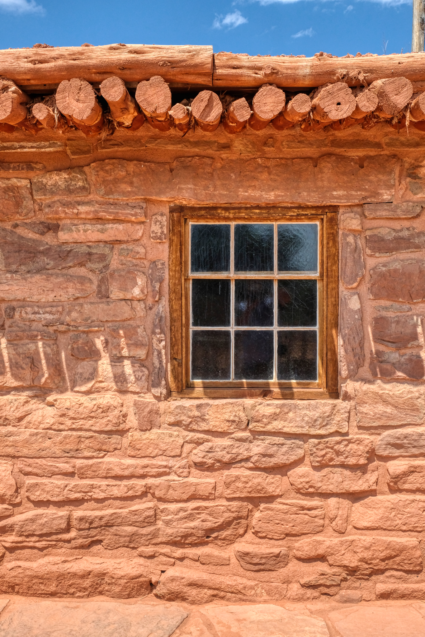 Beautiful stone construction.
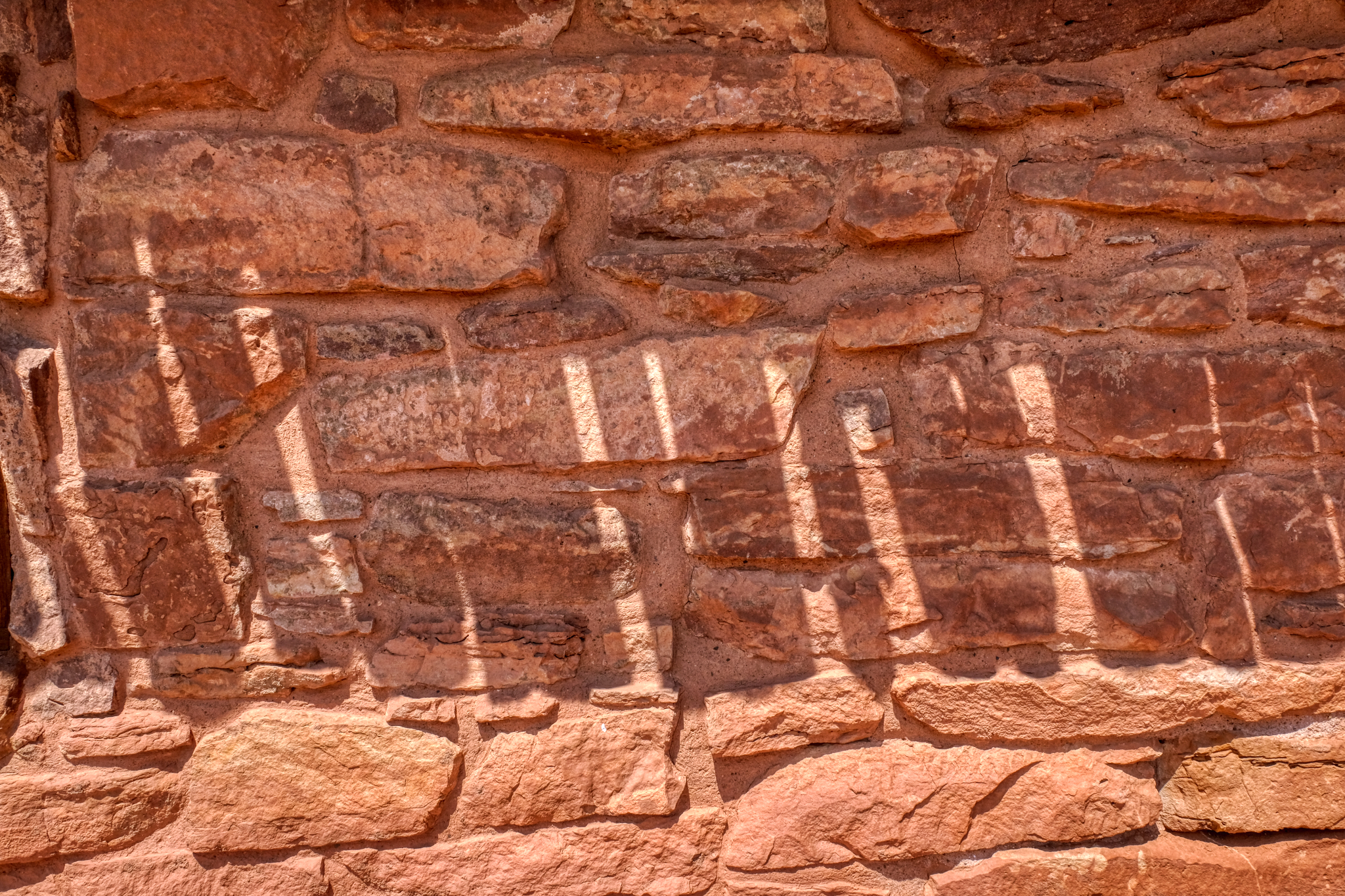 It was a hot day near noon when we arrive . . . wonderful shadows on the orange stone tack house.
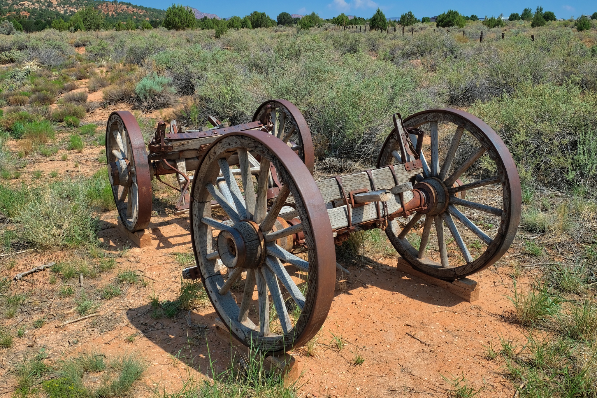
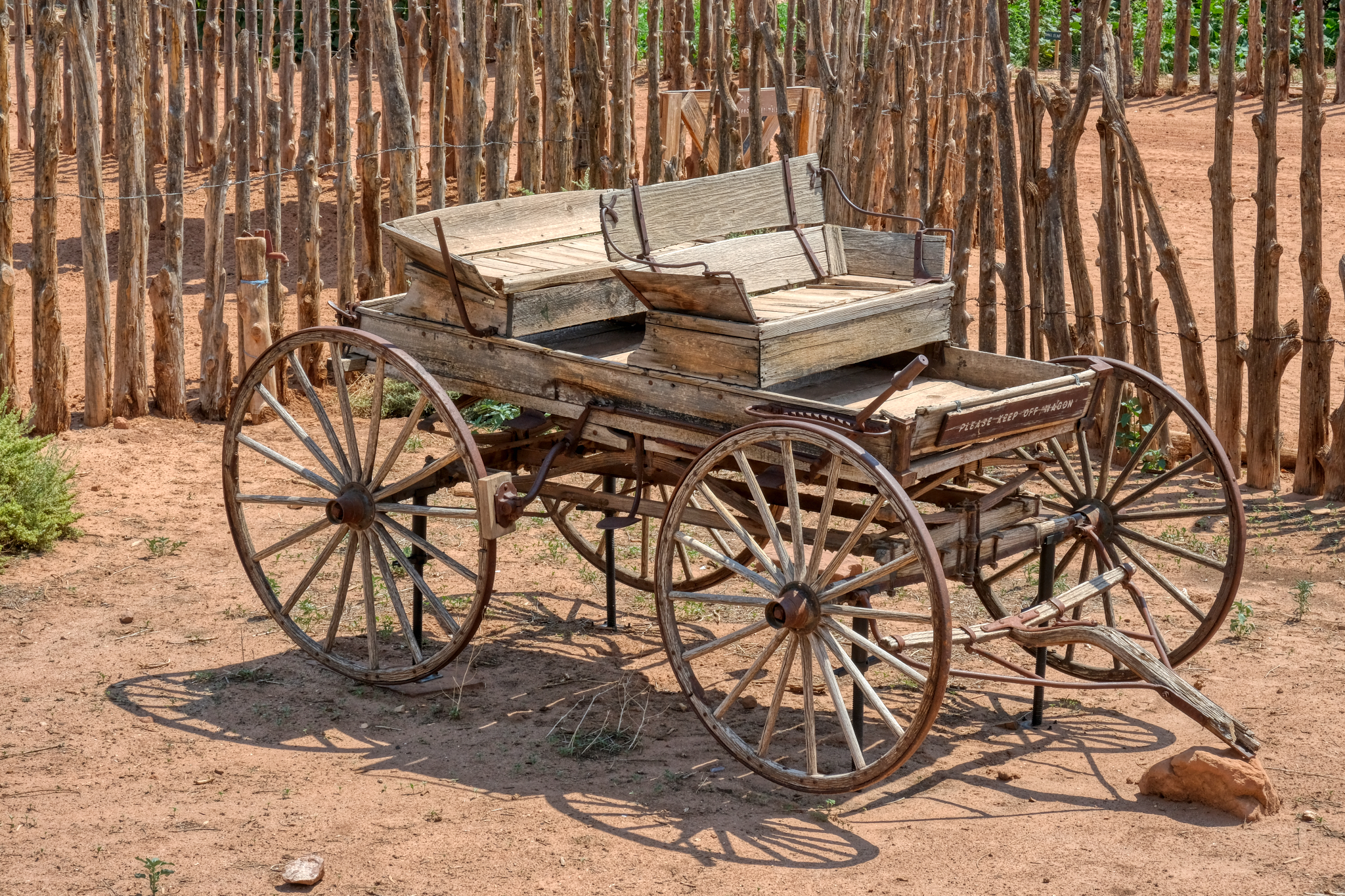 There were some beautiful antique wagons sitting about the grounds. This buggy was fantastic.
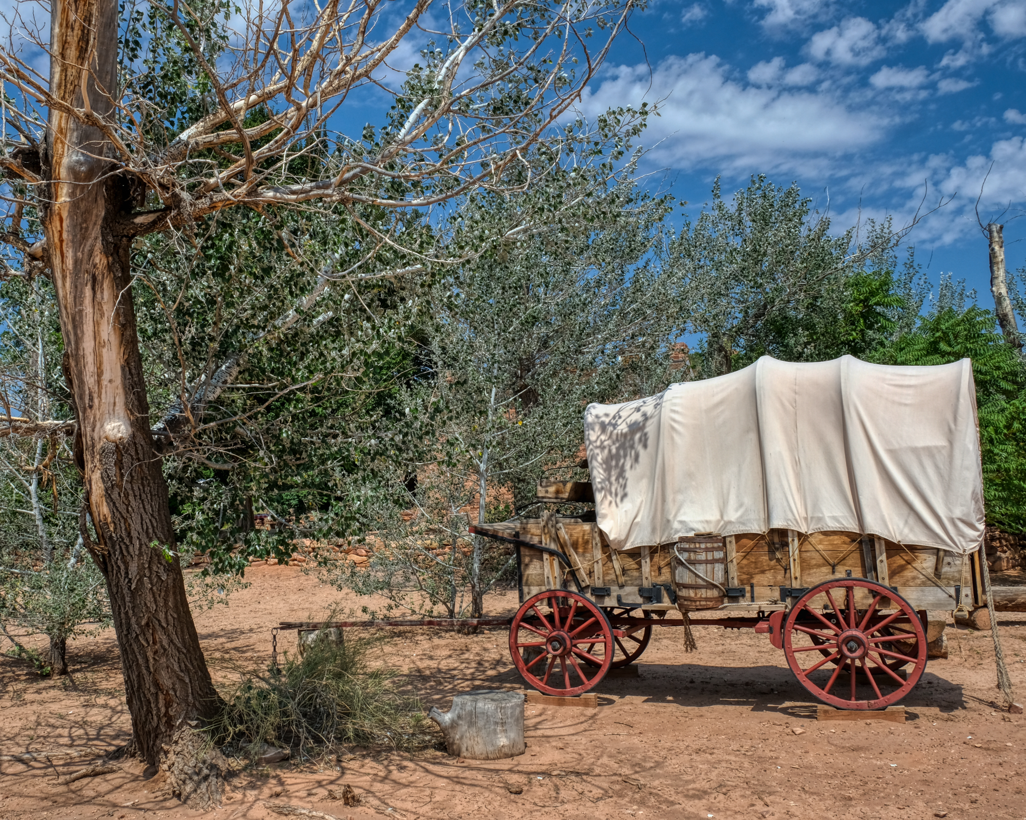 The classic western covered wagon.
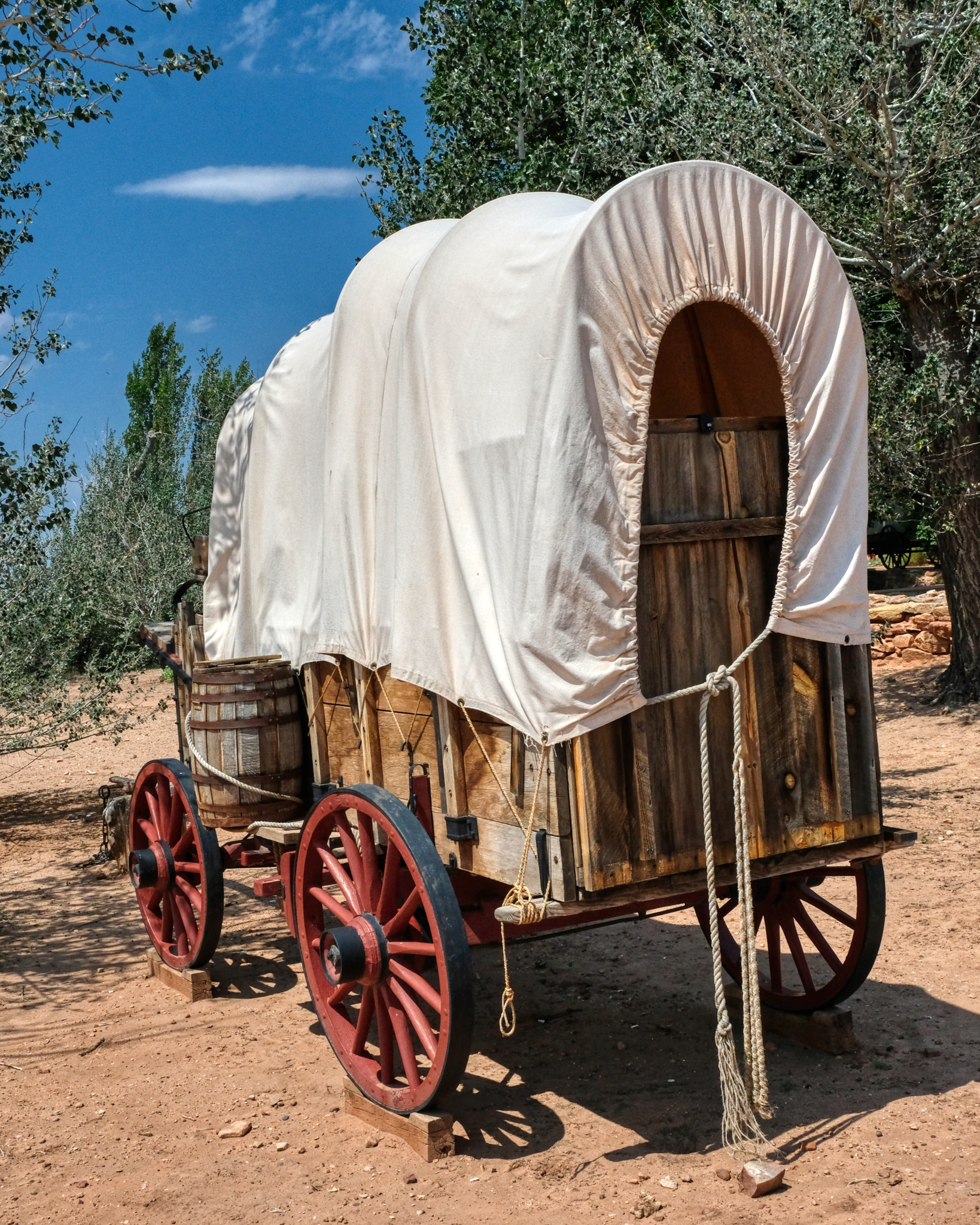 Can you imagine being one of the many thousands who crossed the breadth of America in one of these covered wagons. The faith, hope, and fortitude they must have had!
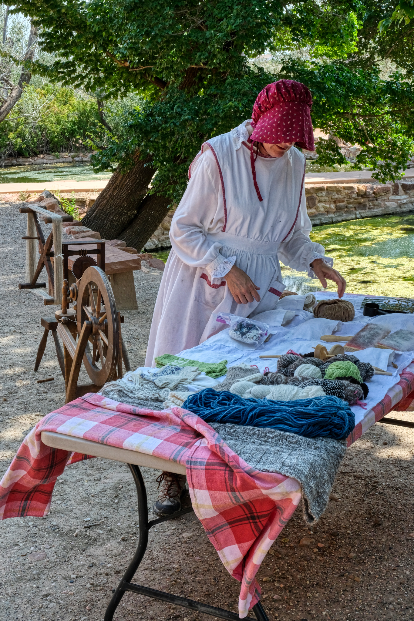 One of the park staff dressed in period costume displaying the kind of textiles the pioneers there would have been making in the 1860s.
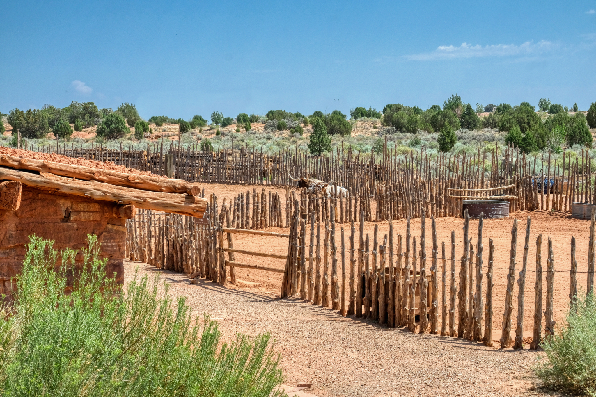
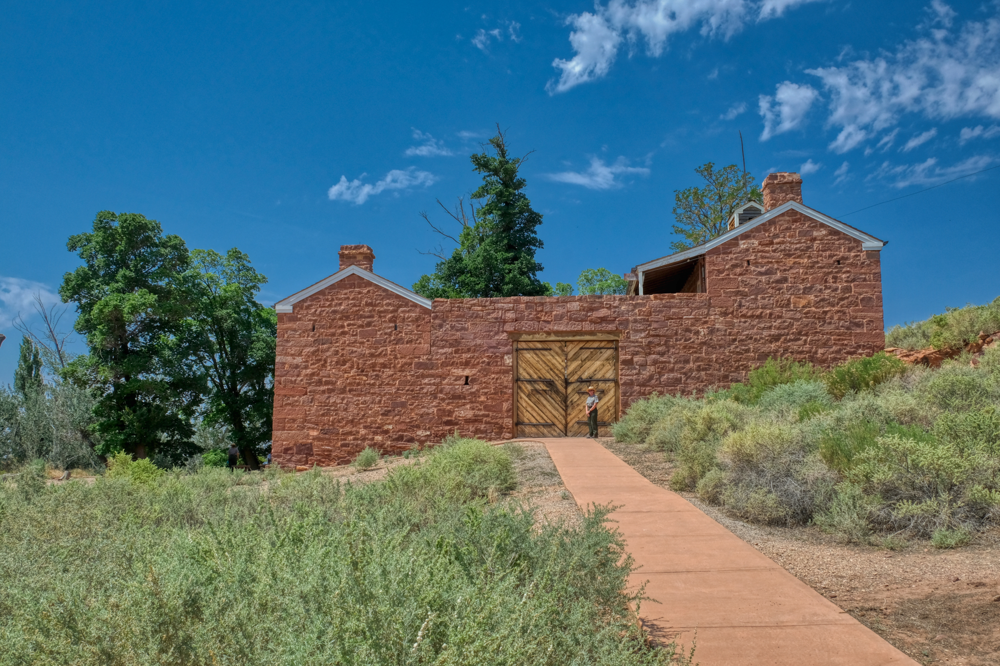 The real purpose of Pipe Springs was as a military fort to provide safety and security for settlers and ranchers during periods of 'Indian trouble.'
 It looks very secure to me. We did not go on the inside.
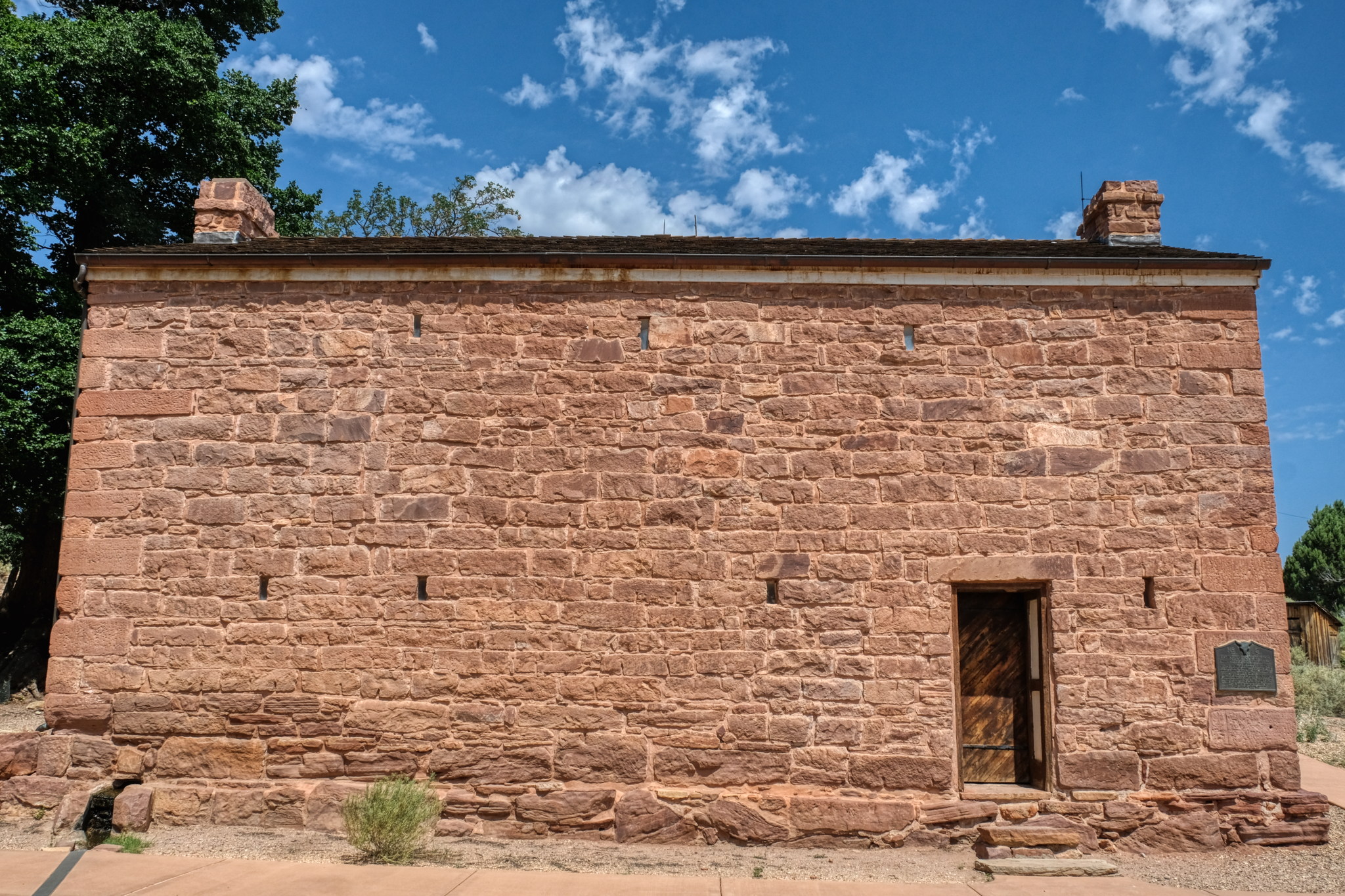
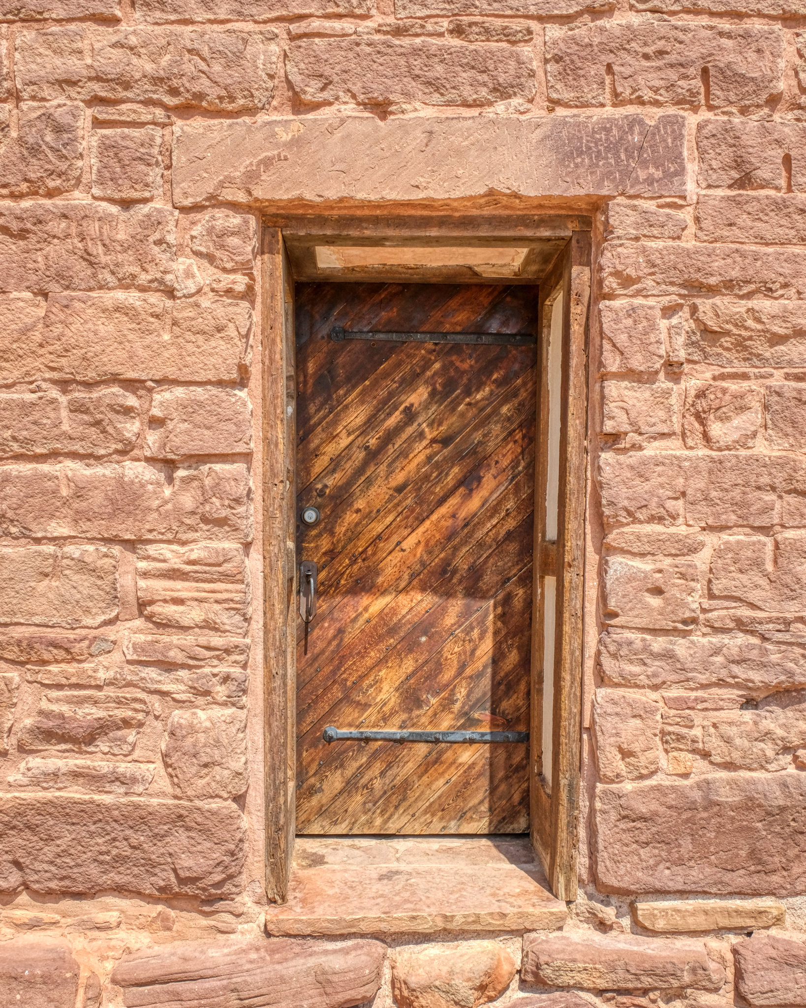 A very photogenic old door at Pipe Springs Fort.
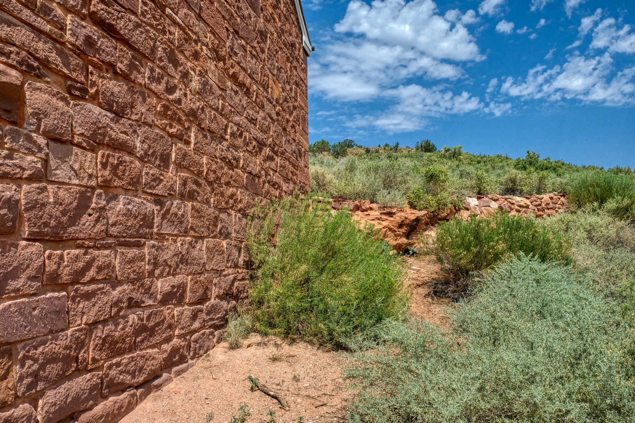 This photo represents, for me, the isolation of the fort within the vast western landscape.
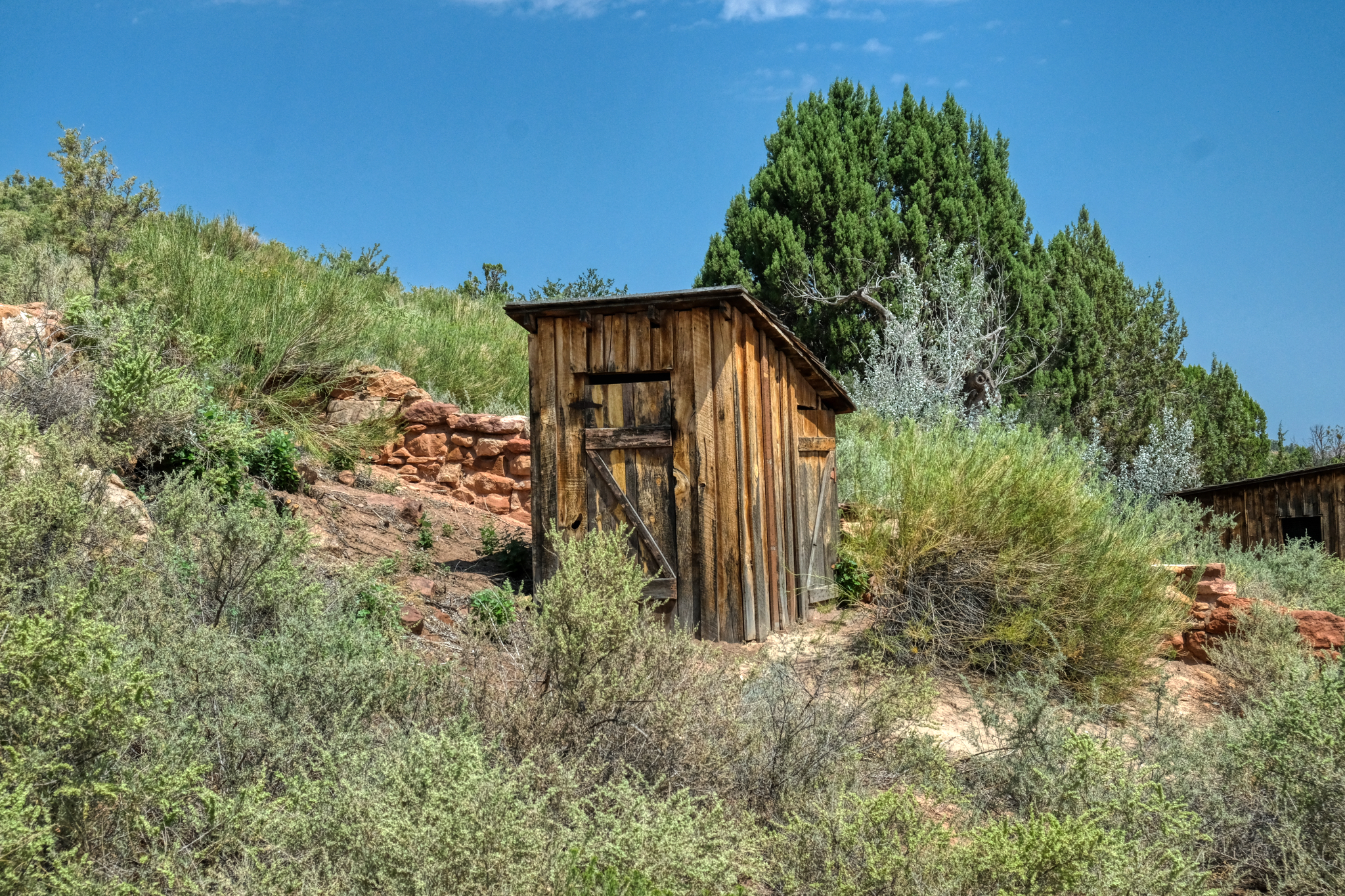 Yep, the outhouse.
 And so we left Pipe Springs to drive on toward the North Rim of the Grand Canyon.
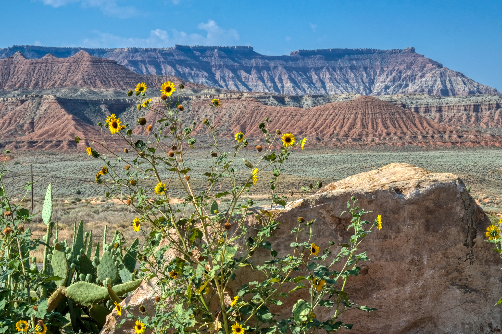 Driving along Arizona Highway 389 trough beautiful mesa country . . .with sunflowers?
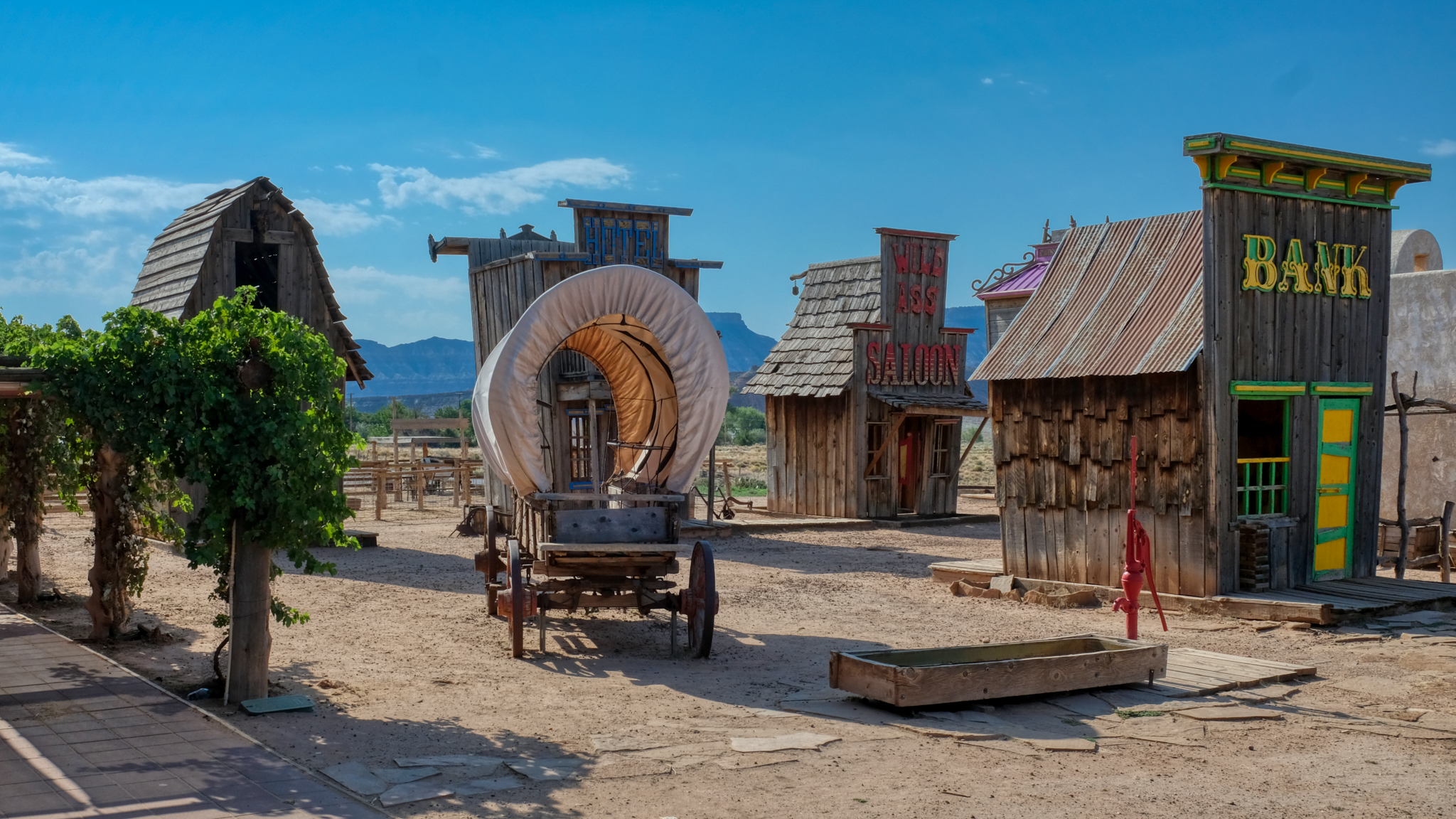 "Just another roadside attraction" . . . a "Wild West Souvenir Store" out along the highway with a cartoonish Wild West Town "Photograph You Family and Friends!" the sign said. I didn't pay the US$5.oo, but instead took photos through the fence . . . duh!
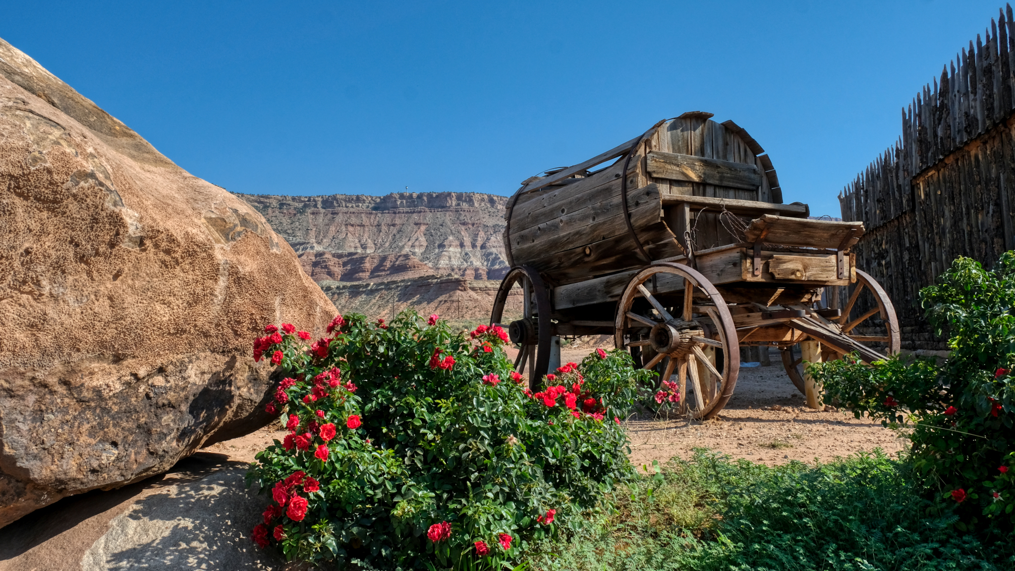 There was a magnificent antique water wagon out back of the store . . . a reminder of the realities of trying to survive in such a dry climate a century-and-a-half ago.
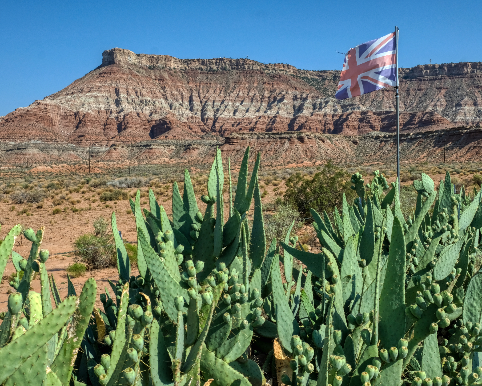 The Western Store was trying to lure tourists from the UK apparently.
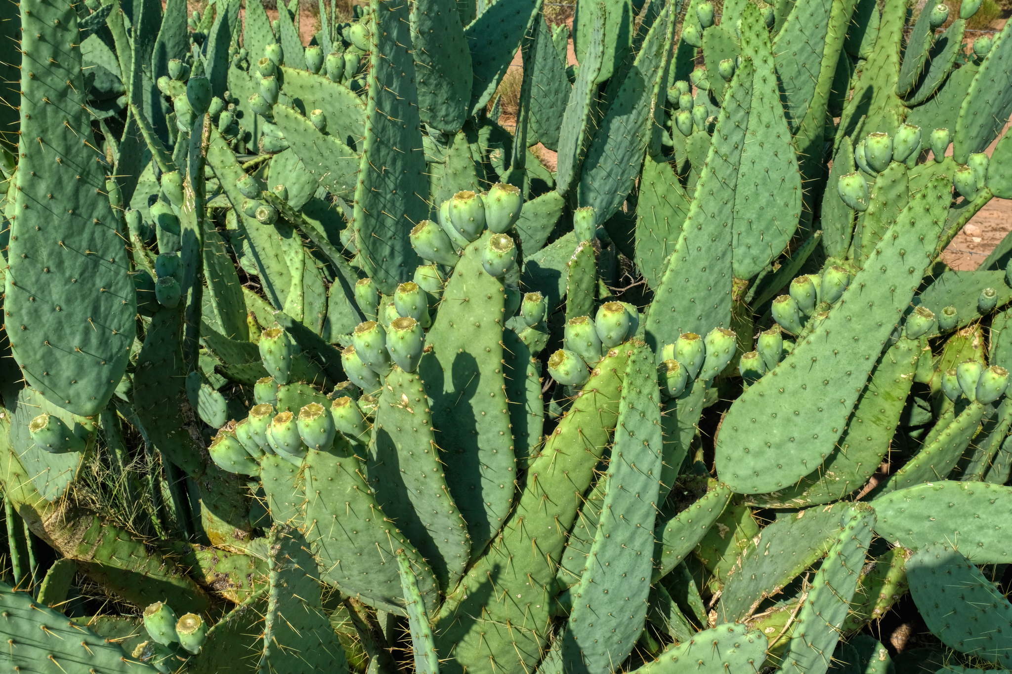 There was a fantastic clump of prickly pear cactus next to their fence.
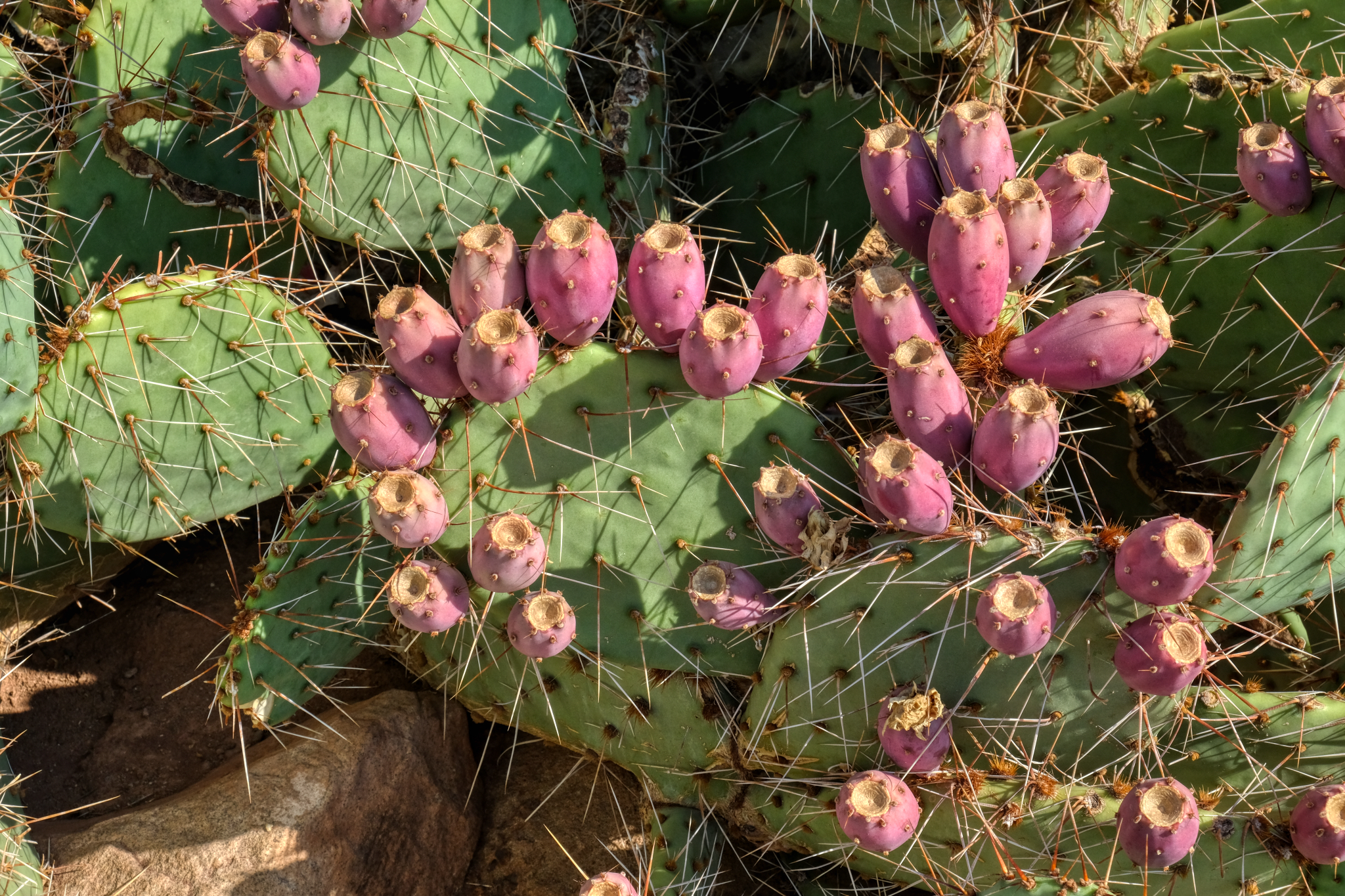 "The fruit of prickly pears (Opunita), commonly called cactus fruit, cactus fig, Indian fig, nopales or tuna in Spanish, is edible, although it must be peeled carefully to remove the small spines on the outer skin before consumption. If the outer layer is not properly removed, glochids can be ingested, causing discomfort of the throat, lips, and tongue, as the small spines are easily lodged in the skin. Native Americans like the Tequesta would roll the fruit around in a suitable medium (e.g. grit) to "sand" off the glochids. Alternatively, rotating the fruit in the flame of a campfire or torch has been used to remove the glochids. Today, parthenocarpic (seedless) cultivars are also available. The seeds can be used for flour." ****
_____________________________________________
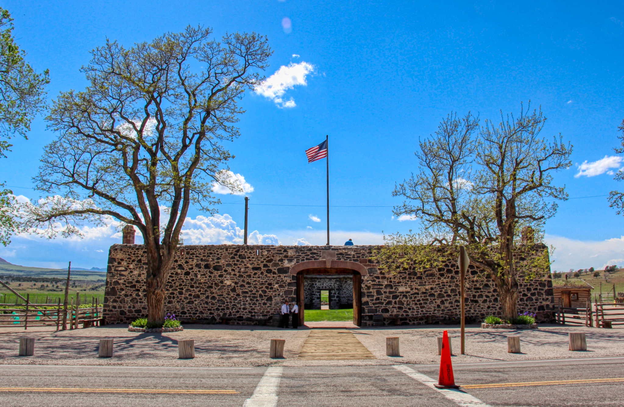
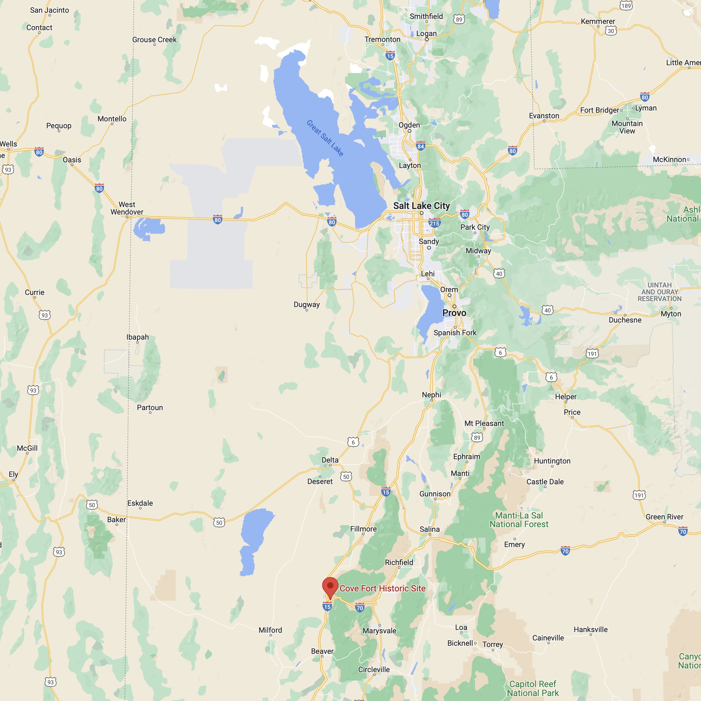
COVE FORT, UTAH
 One of the joys of a road trip in the USA are the highway signs announcing "Historic Site Next Right Exit. Fort Cove". So, you take the next right off of I-15.
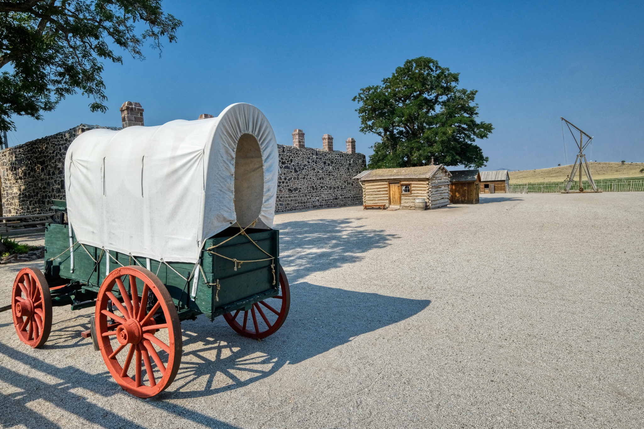
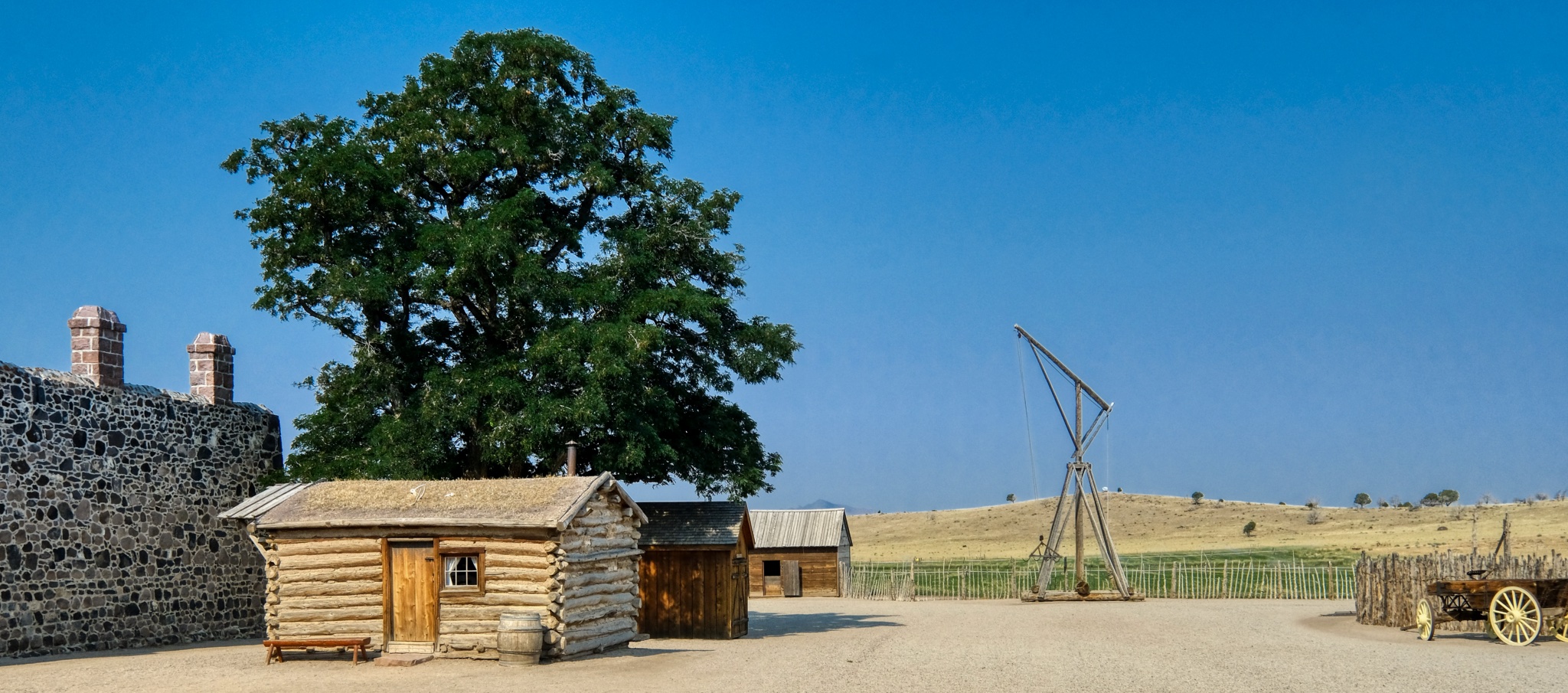
"Cove Fort is a fort, unincorporated community, and historical site located in Millard County, Utah. It was founded in 1867 at the request of Brigham Young. One of its distinctive features is the use of volcanic rock in the construction of the walls, rather than the wood used in many mid-19th-century western forts. This difference in construction is the reason it is one of very few forts of this period still surviving." ***
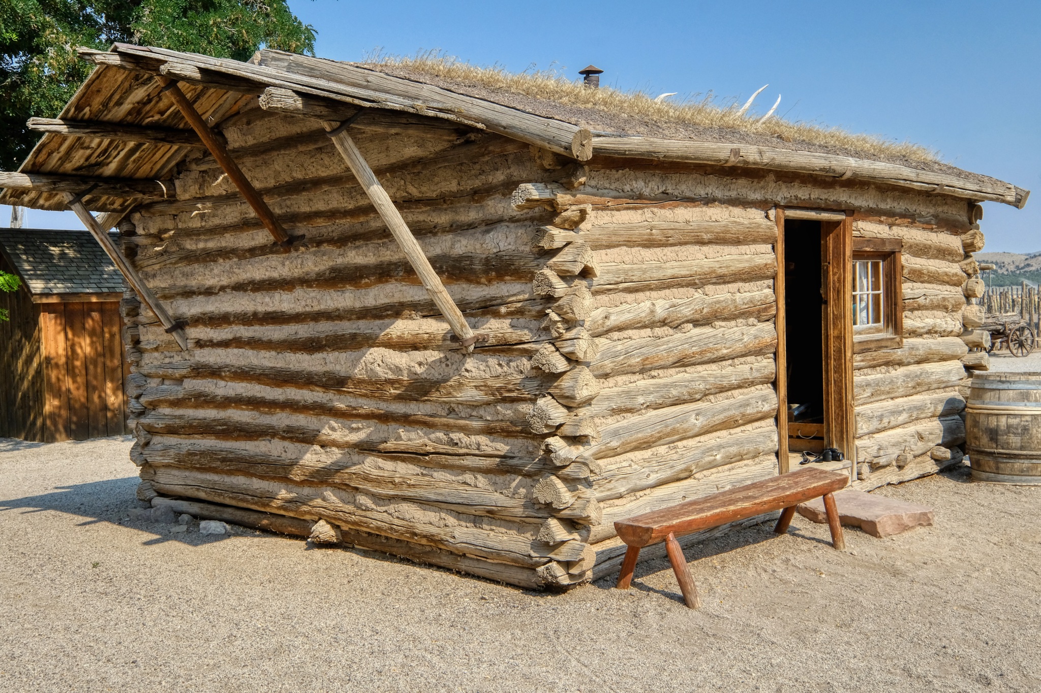 A very nice recreation of an early pioneer cabin.
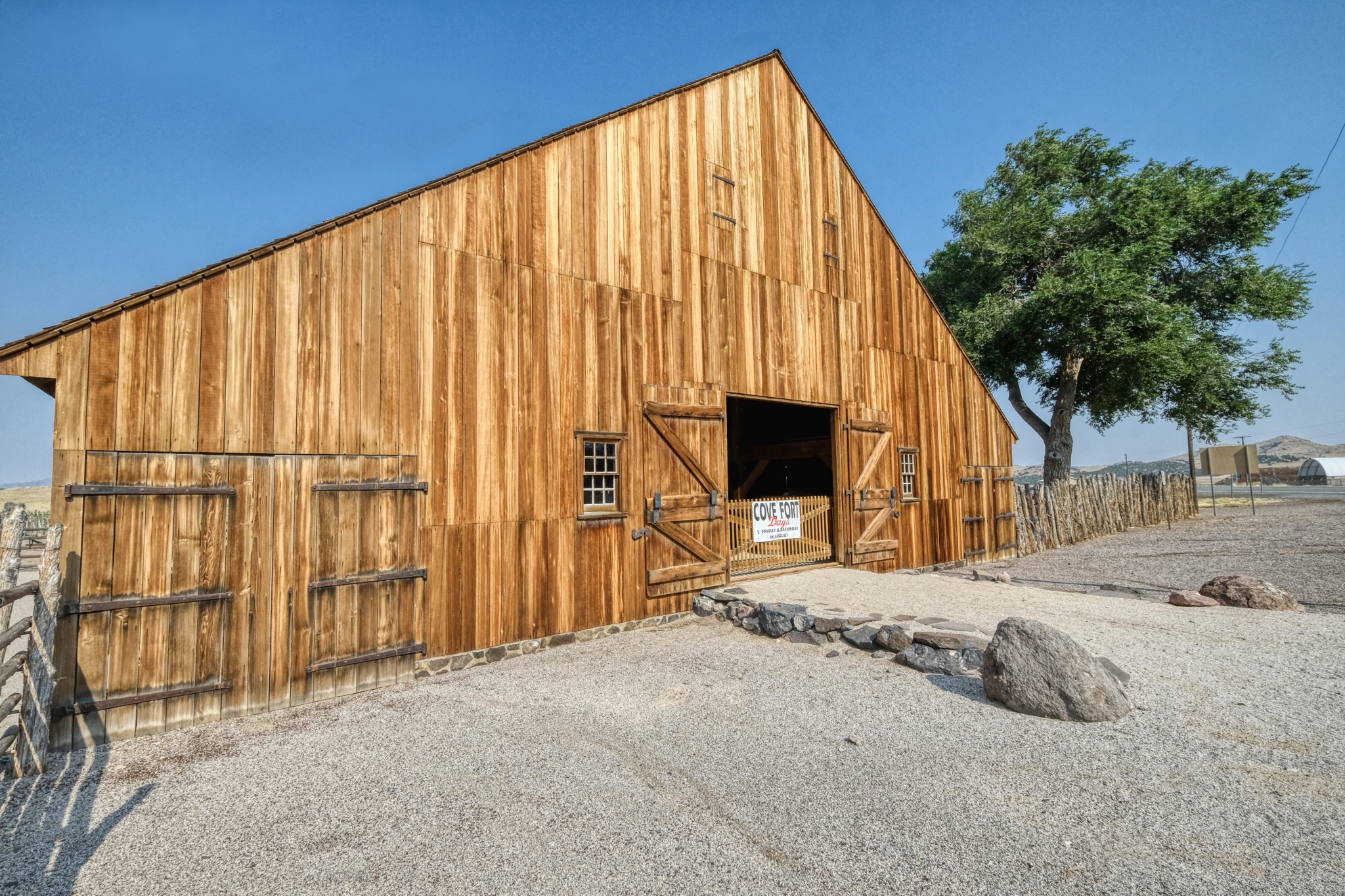 There was a fine reproduction barn, nearly new.
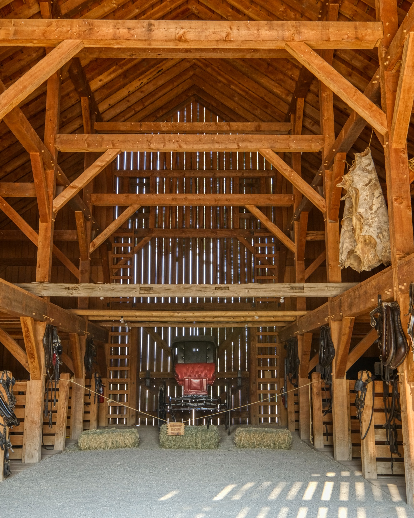 The interior of the big barn had displays of period items, well, related to barns.
 Fort Cove, Utah (Photo from Wikipedia)
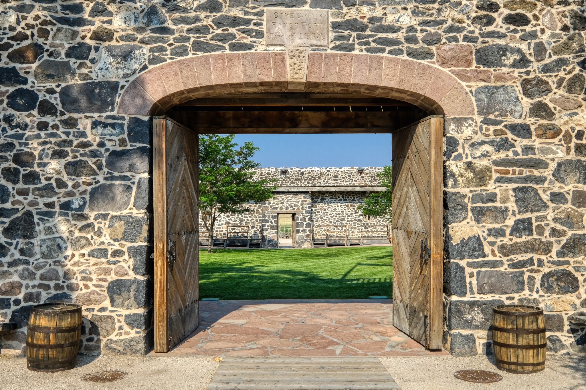 The 1867 Fort Cove gate.
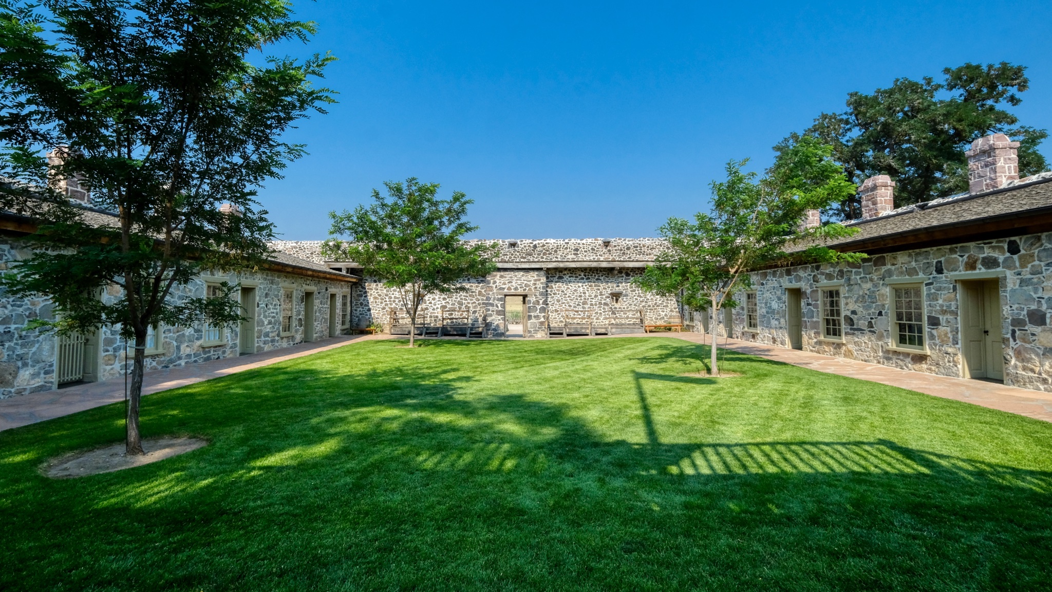 I was surprised by the verdant green, lush lawn in the fort's inner courtyard. Imagine how wonderful this would have been to the soldiers posted here and the passing visitors in their covered wagons!
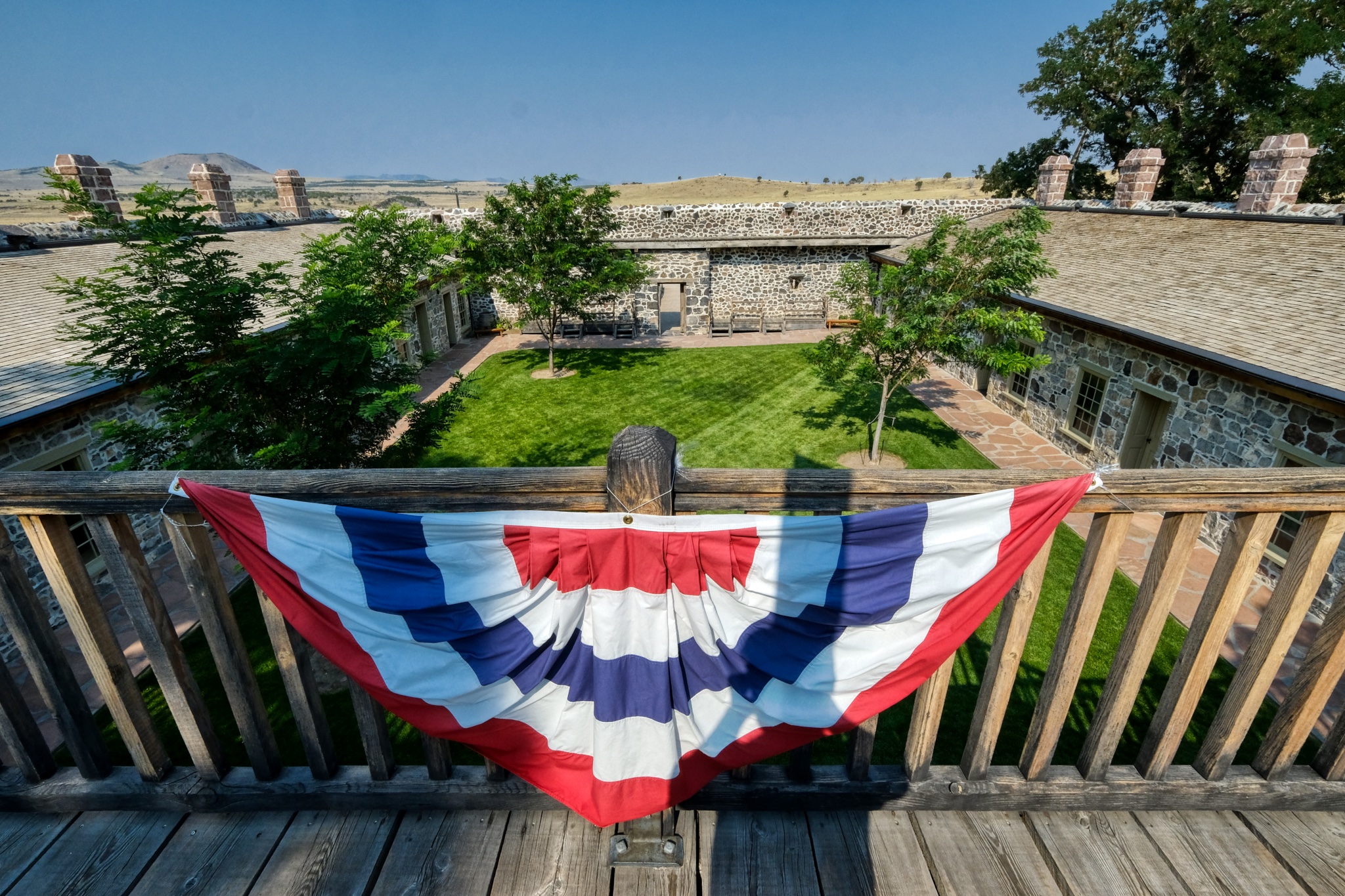 We went up the stairs to the roof of the fort for the view.
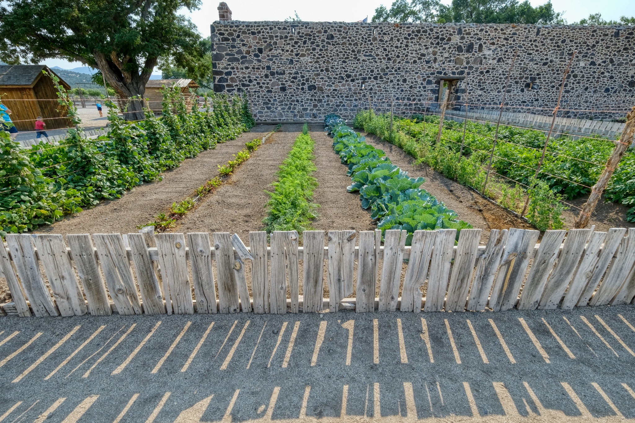 Behind the fort was the vegetable garden.
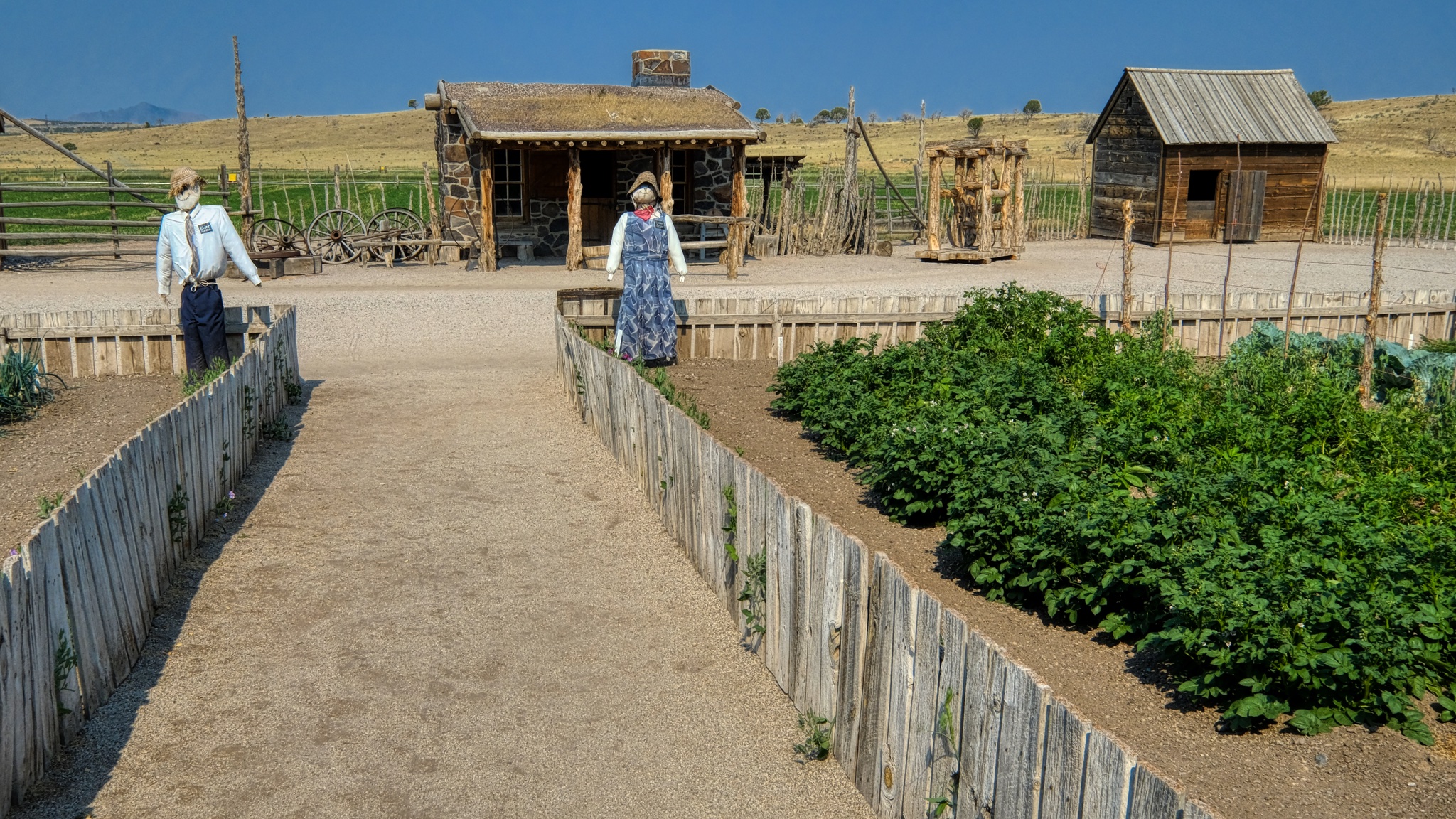 The garden path leading to displays of various Mormon settler shacks, sheds, and cabins that were trucked to the site and restored.
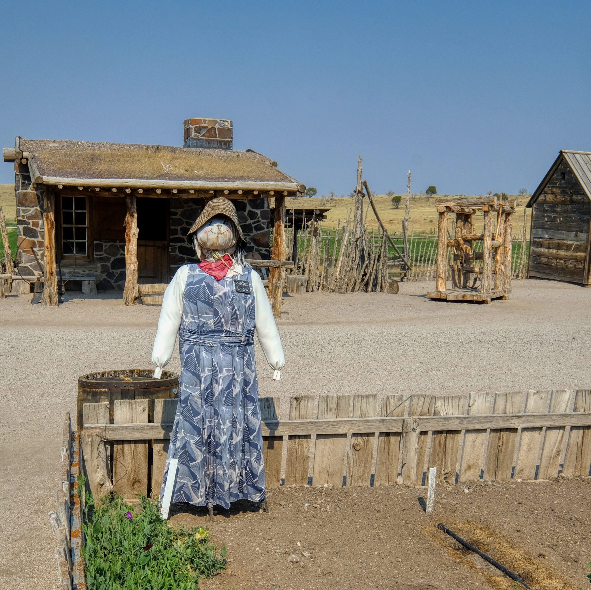 A superb scarecrow!
Then back out on the highway I-15 north . . . and an Allison Krauss and Willy Nelson concert in Bend, Oregon!!!
USA Road Trip: Collier Logging Museum, Oregon
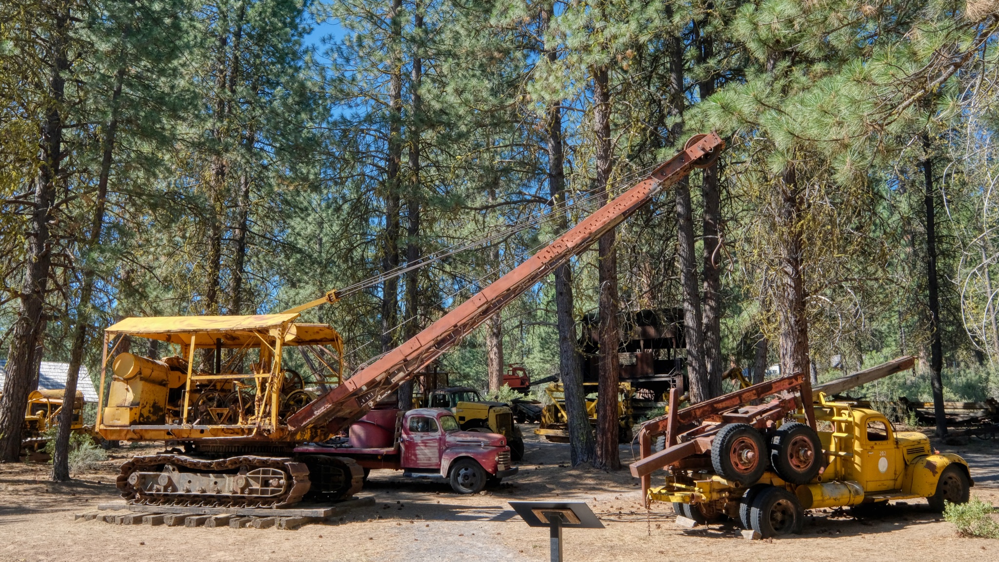 Heading south on old highway US97 -- taking the long way from Bend, Oregon to Lake Tahoe, California -- we happened upon the Collier Logging Museum. Of course I had to stop.
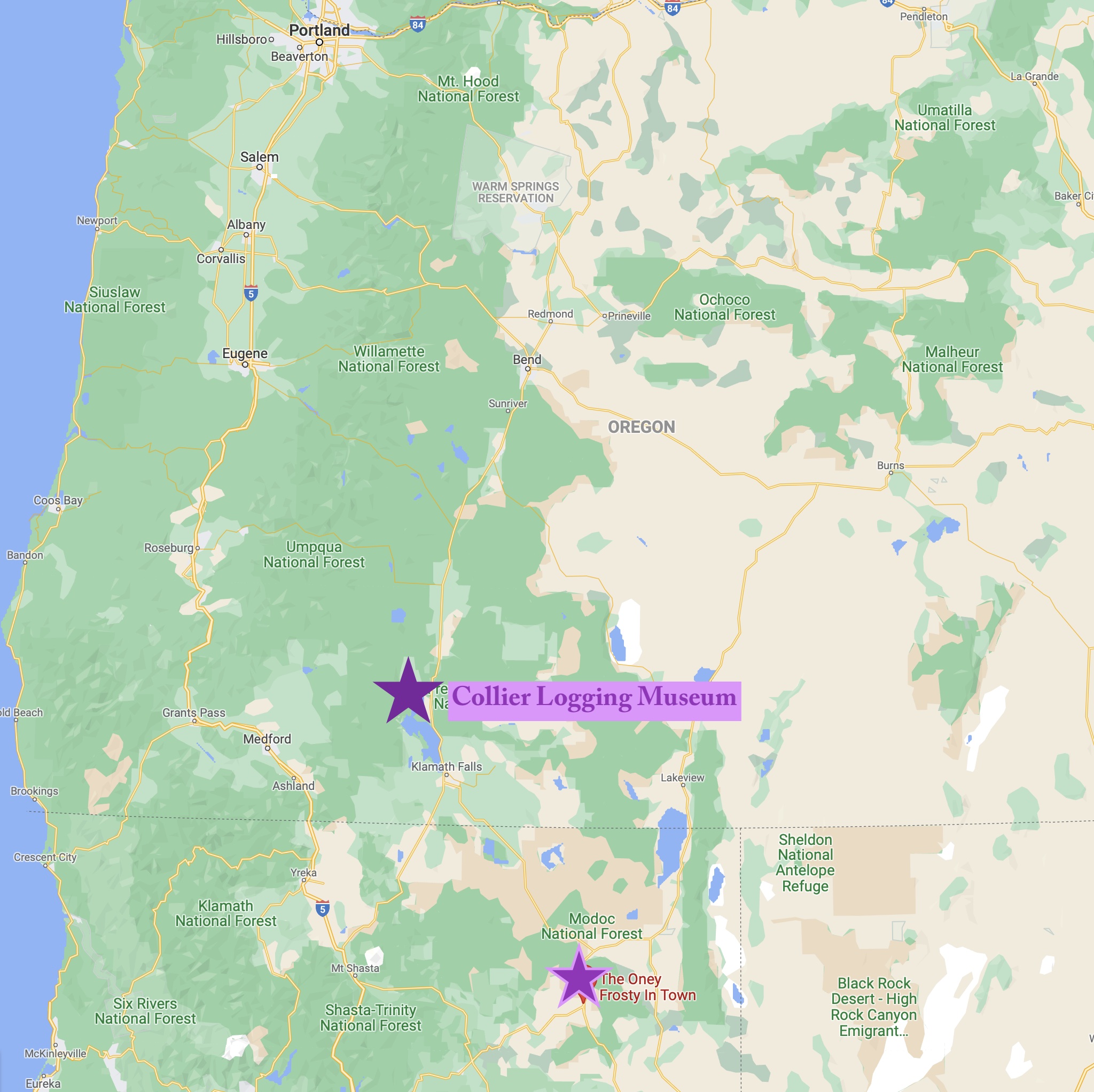 In southern Oregon, not too far from the California boarder . . . The Collier Logging Museum.
 I HAD to stop. I love these old machines . . .
 As a child I loved trucks of all kinds.
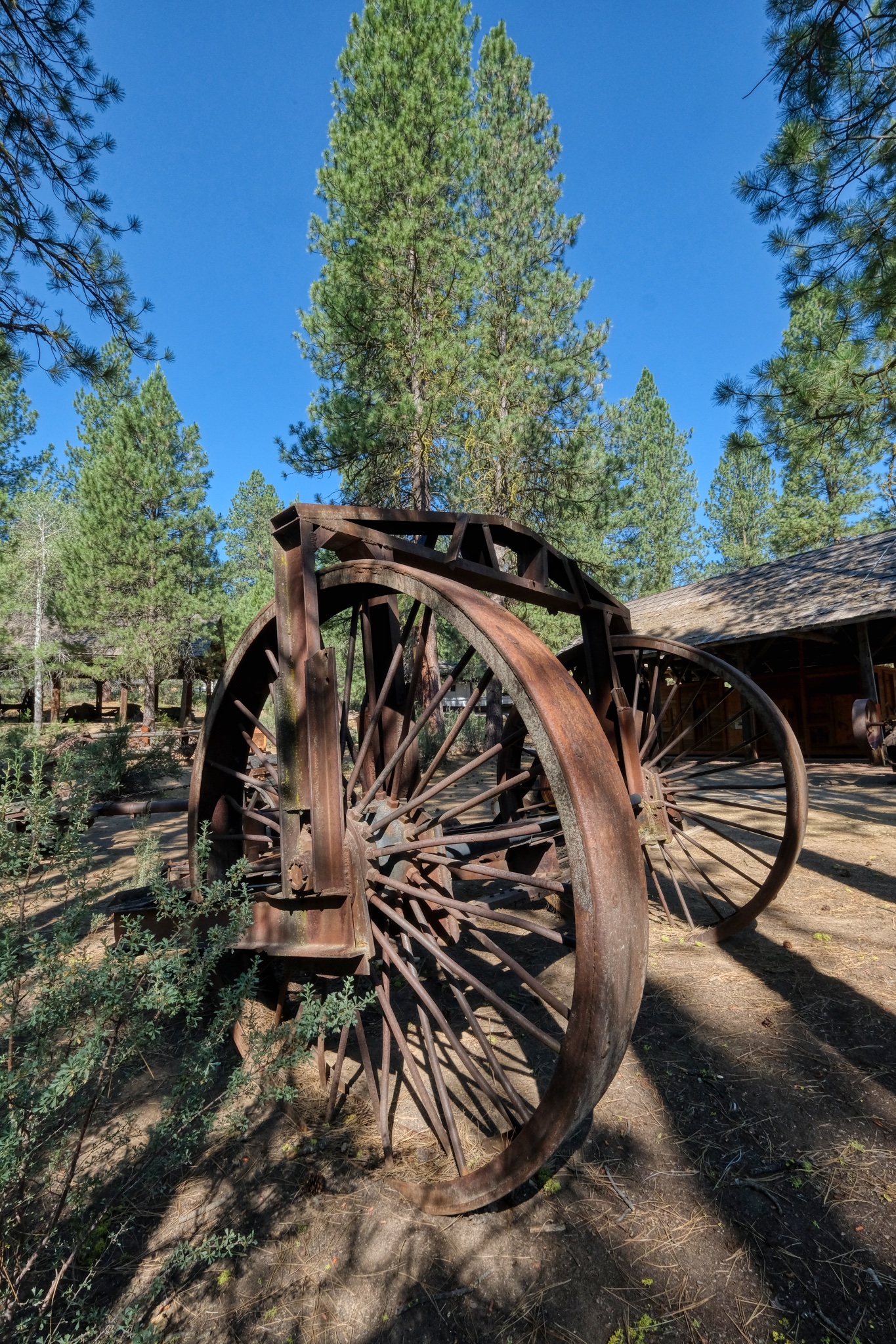
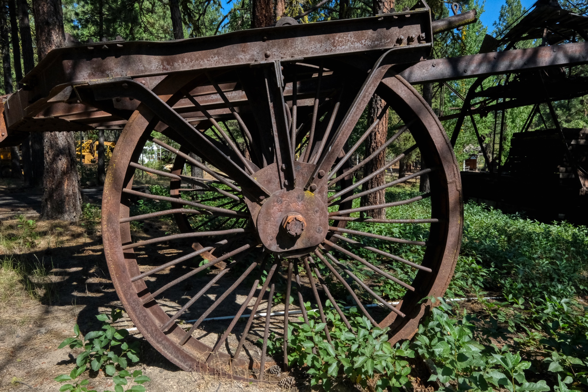
 Giant steel wheels on this ancient road grader meant to be towed by a bulldozer.
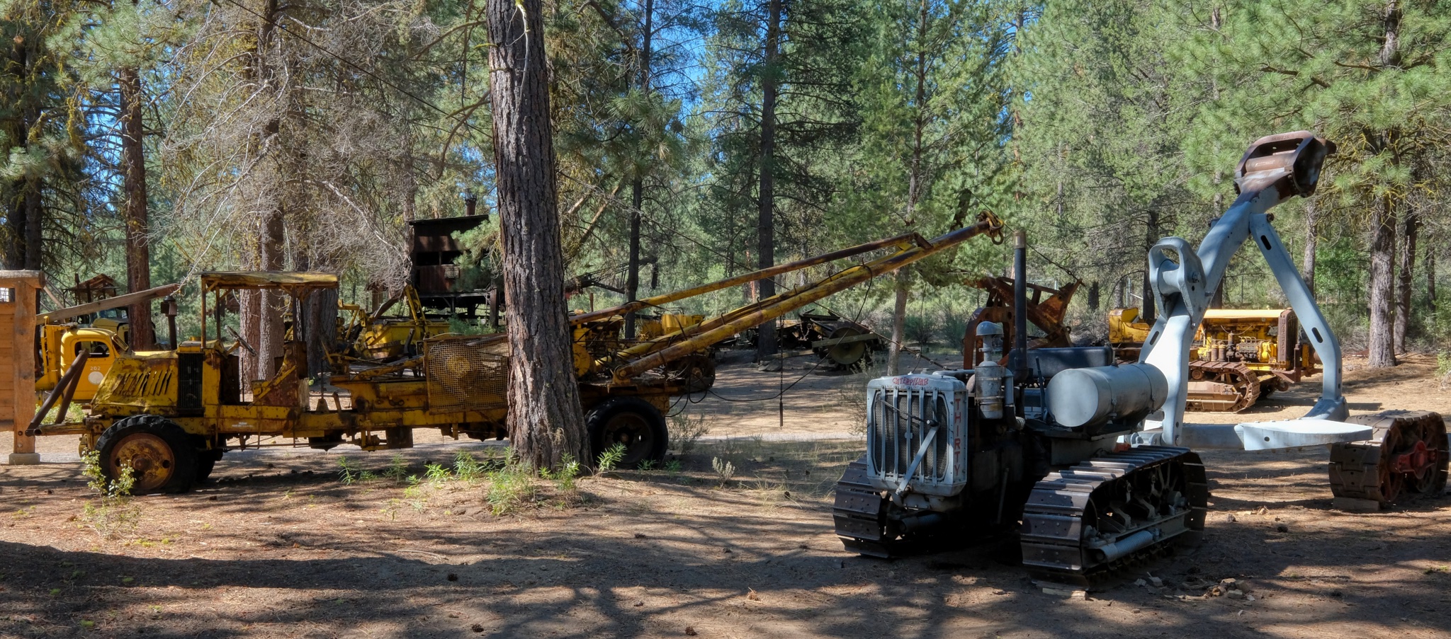
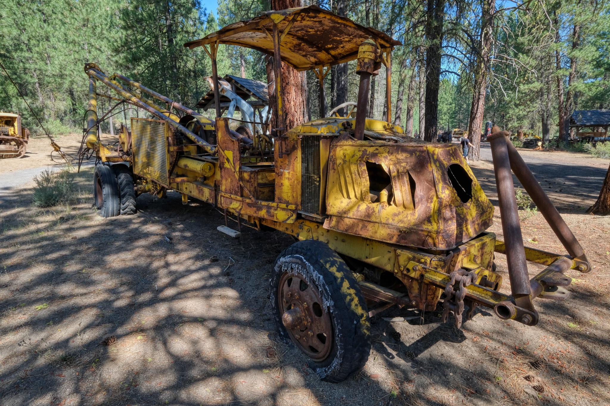
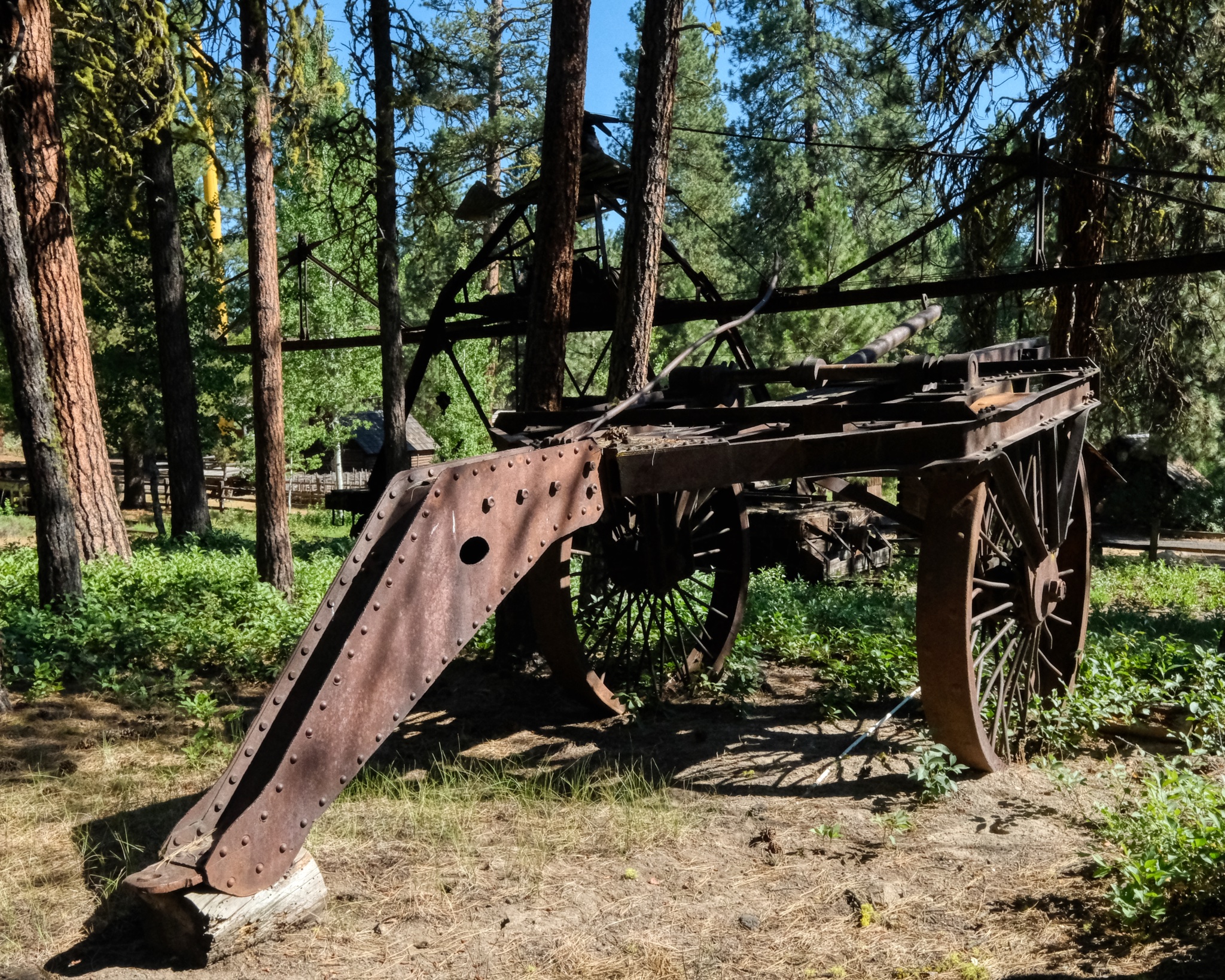
 A pull along log skidder, also pulled by a bulldozer.
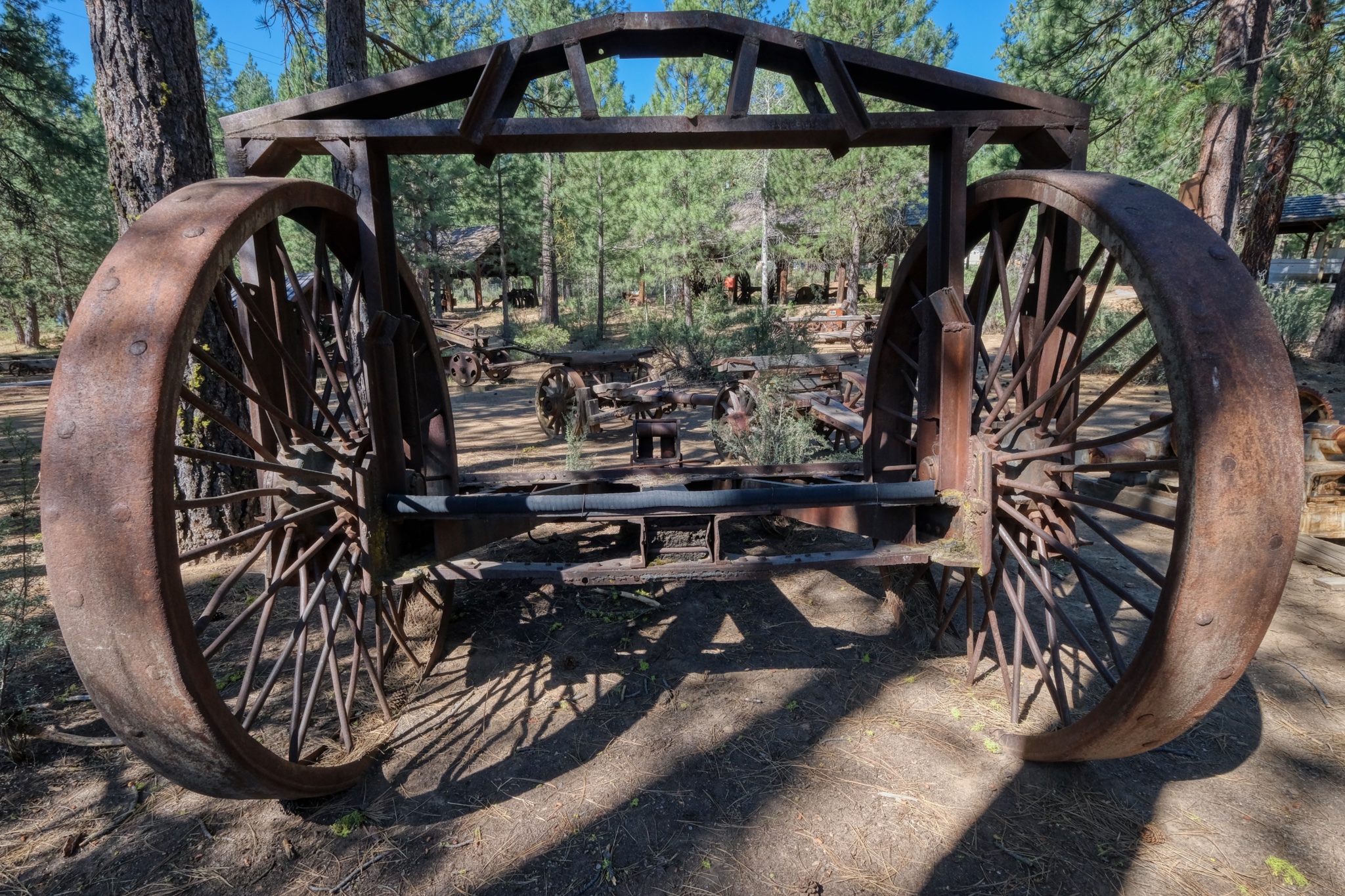 The front of a giant log would be lifted by this rig and then the other end dragged ("skidded") along in the forest floor.
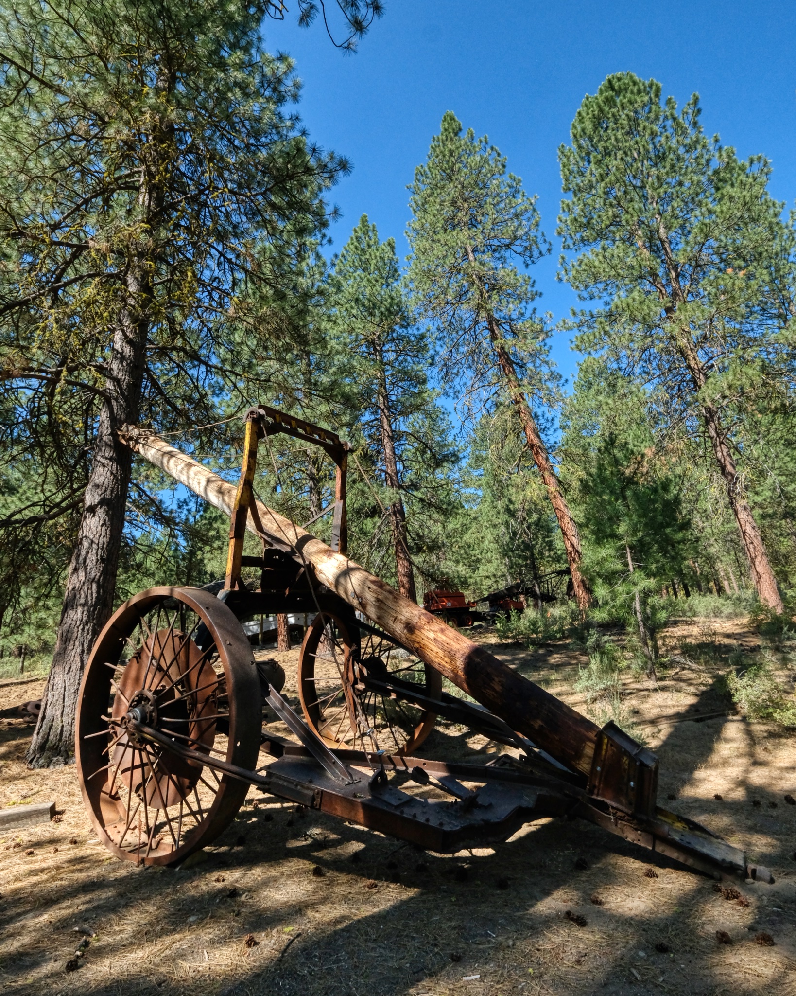 Another approach for skidding logs . . . .
 The front of a log, or logs, were lifted and then skidded out of the forest to a roadhead for loading on trucks, or small gauge rail systems.
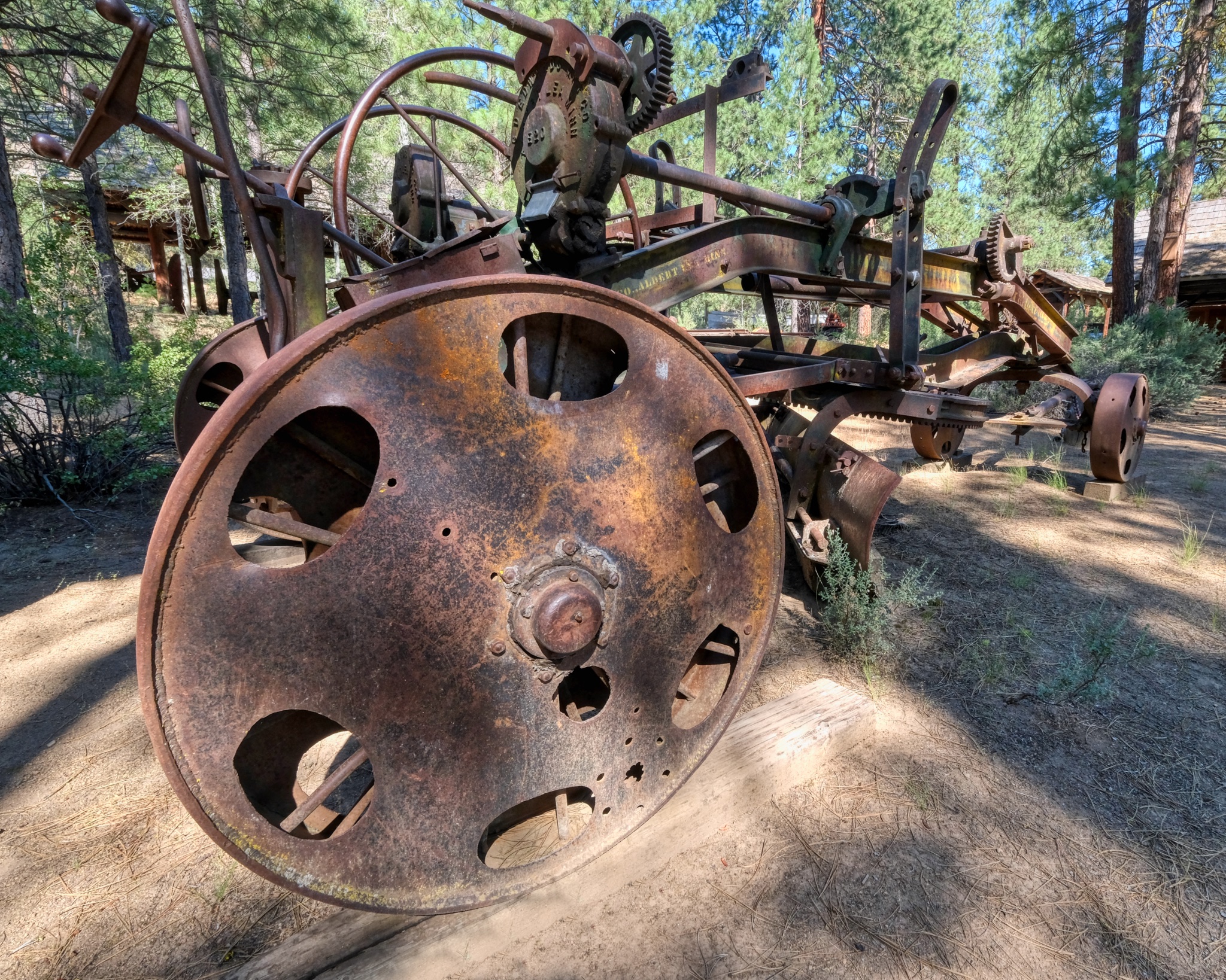
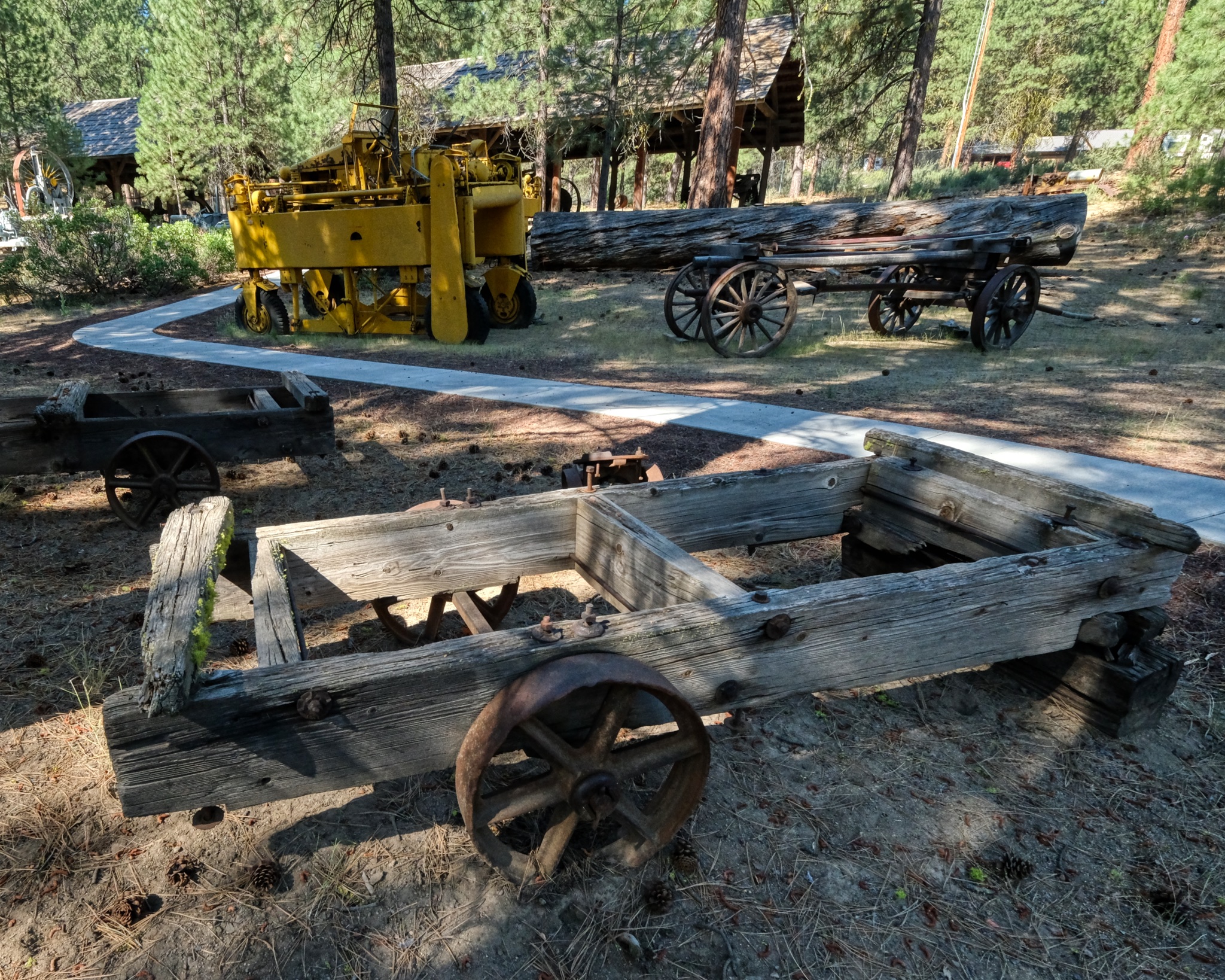
 There were many of the large iron-wheeled wagons sitting out in the forest of the museum.
 Big wagons for big work in the big forests of Oregon.
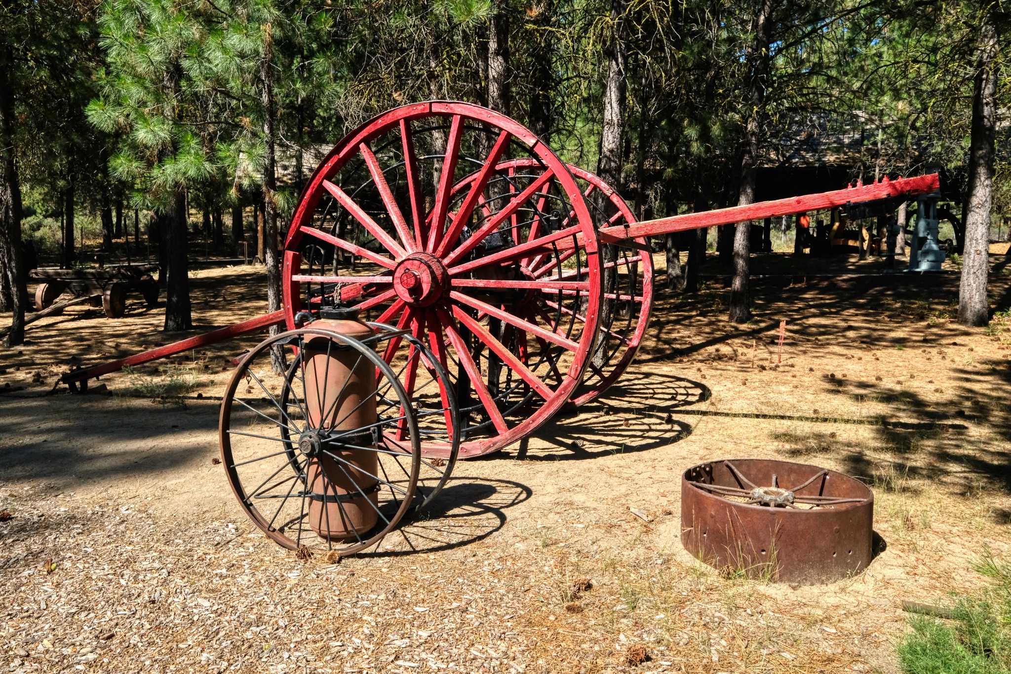 Big red wagon wheel . . . .
 One can imagine an old dozer chugging through the forest pulling one of these steel-wheeled skidders.
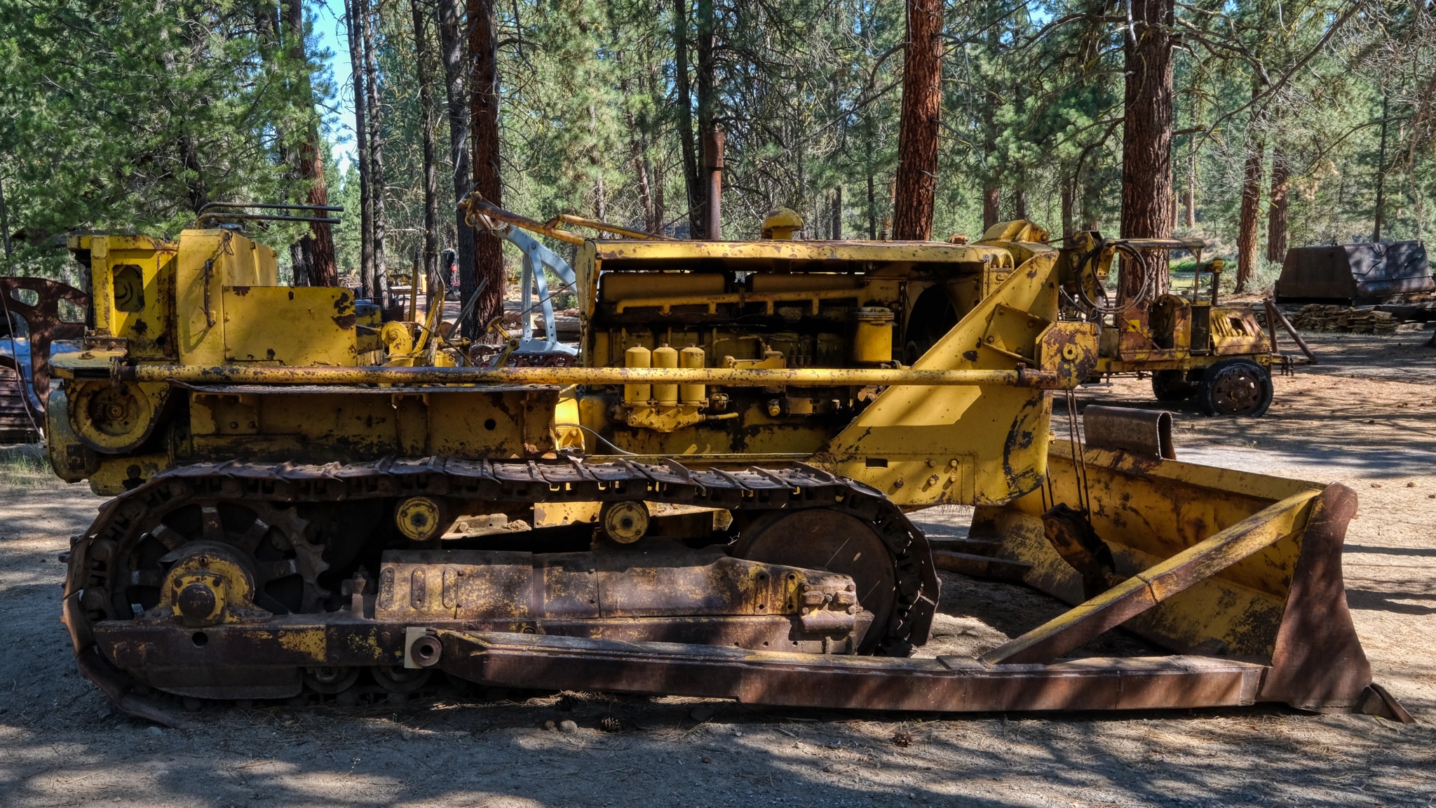
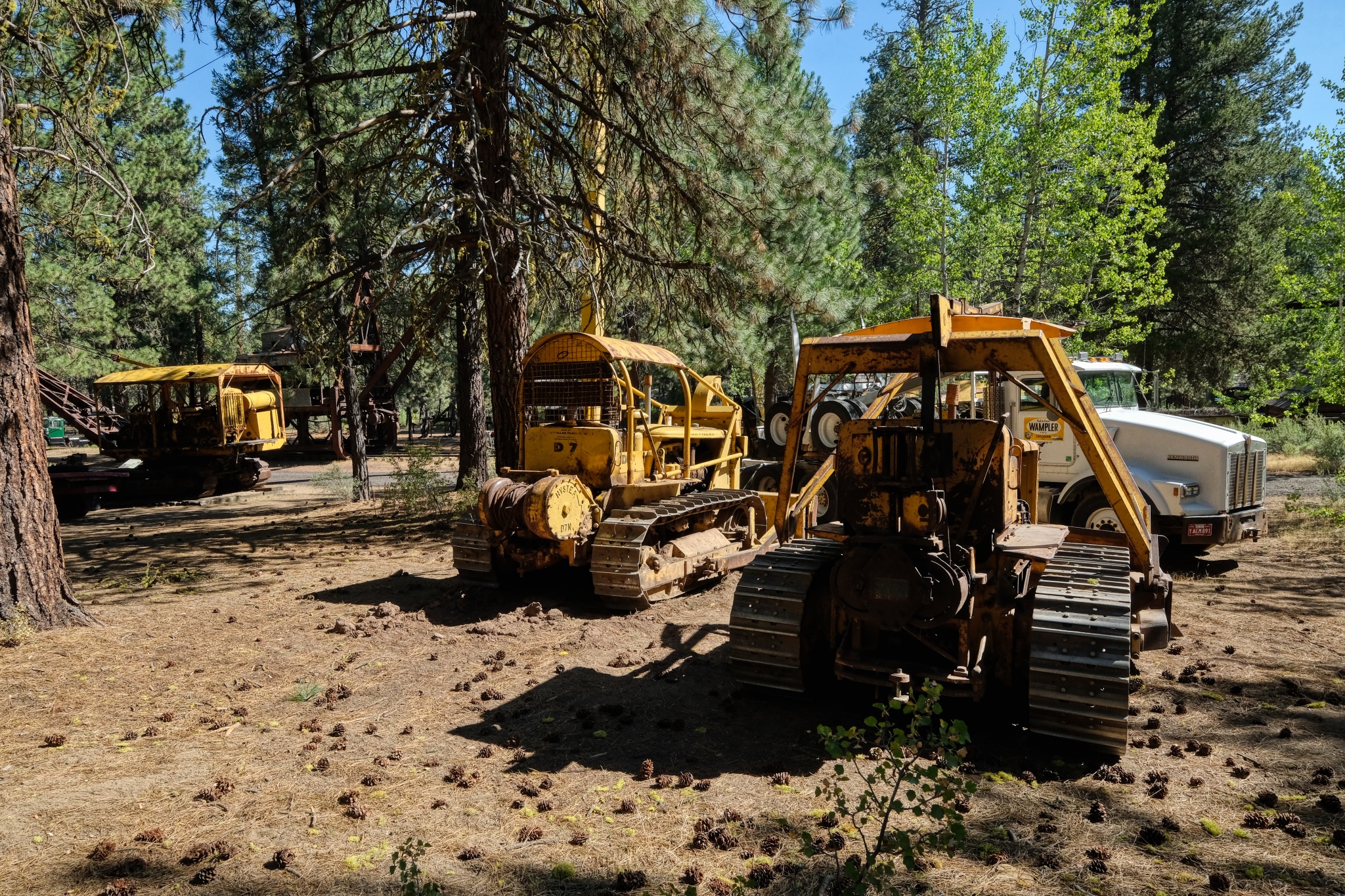 There were many old dozers sitting around in the pine straw.
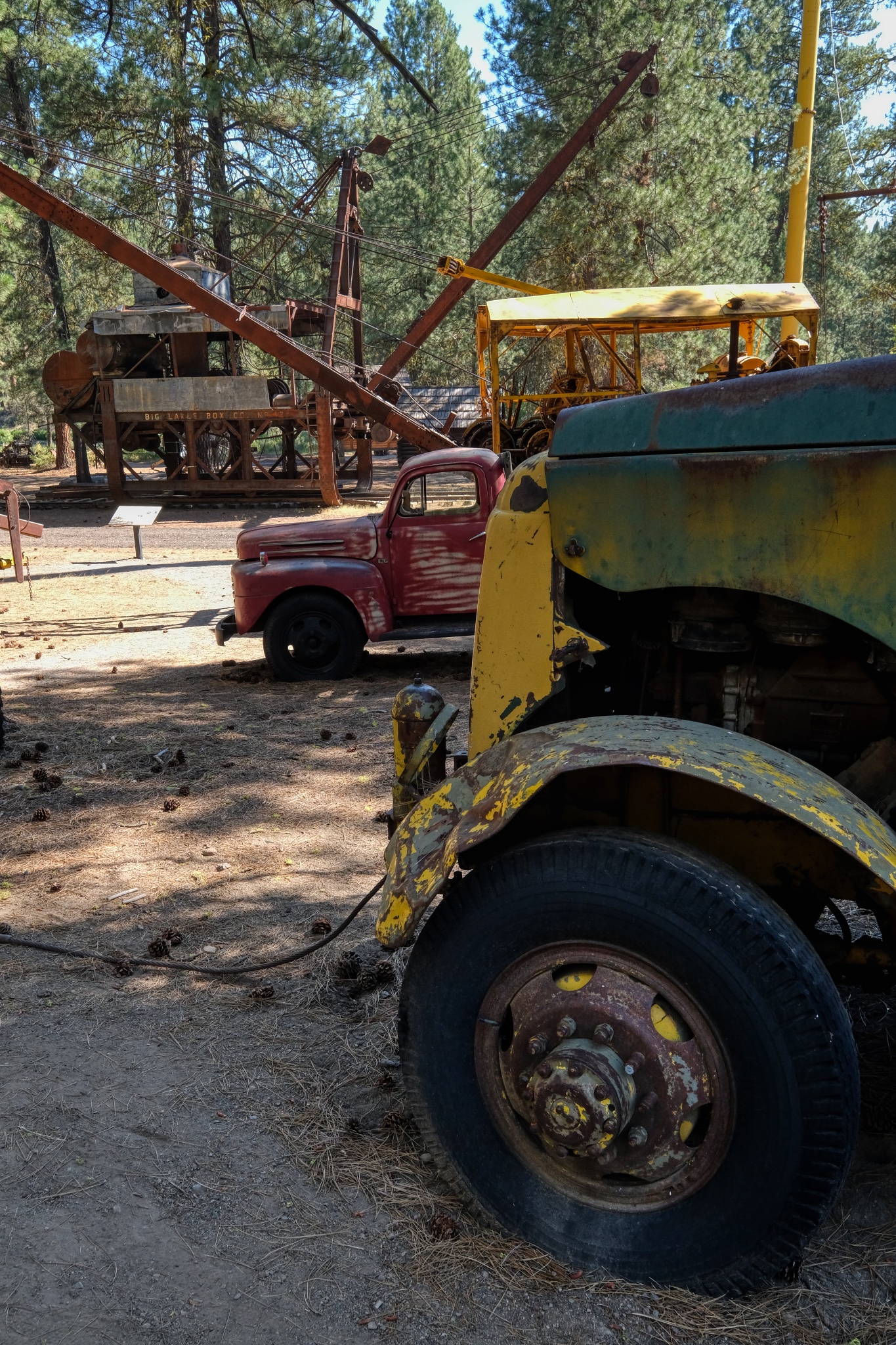
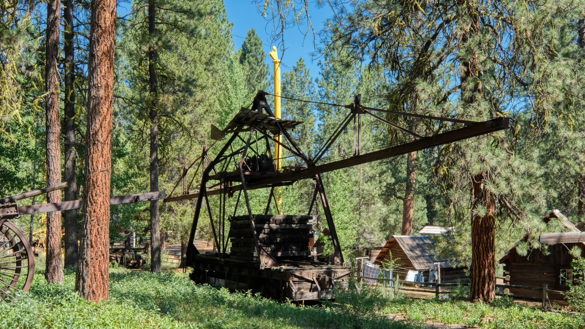
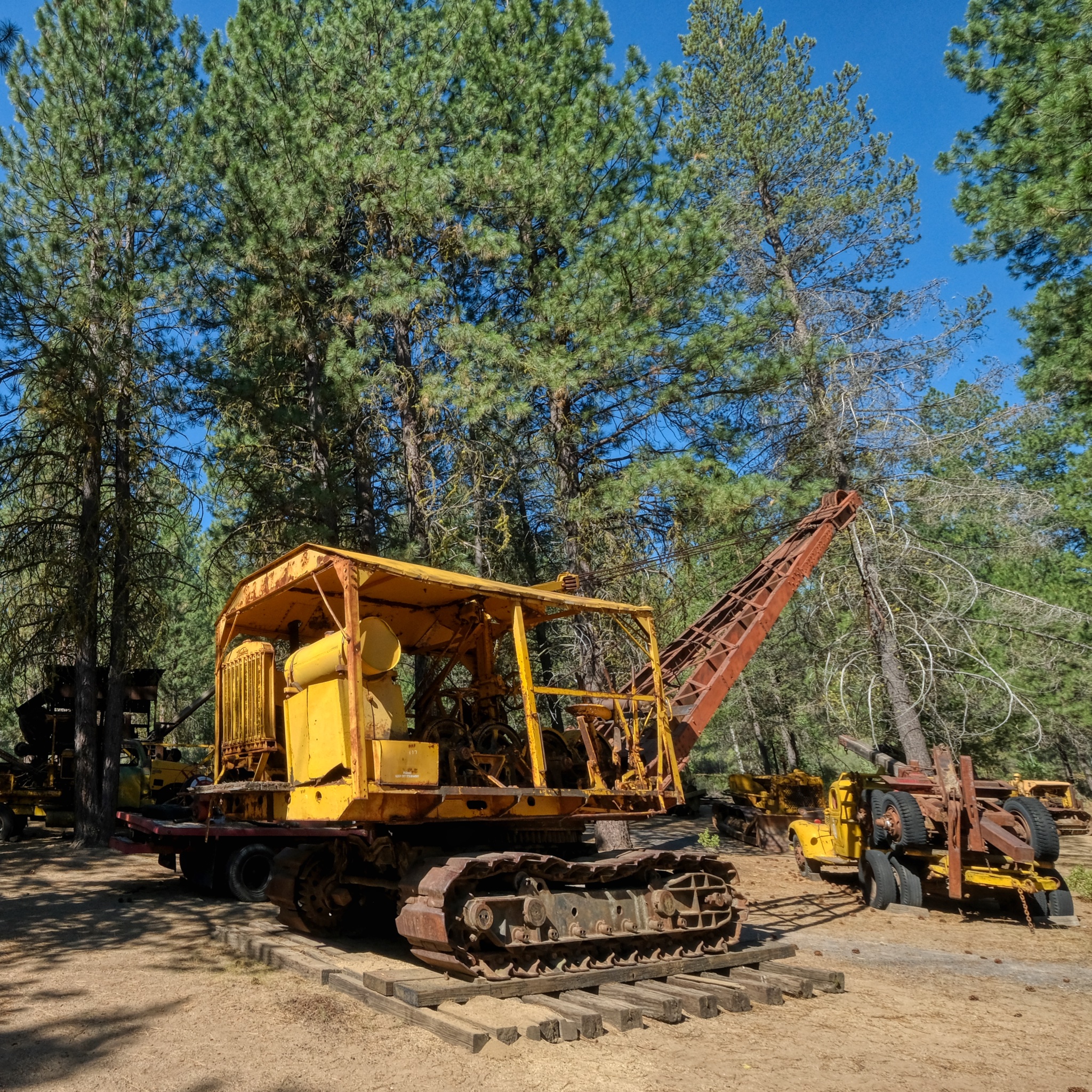 Once the logs had been skidded to a landing, a crane, perhaps like this one, would load the logs onto trucks or a rail car.
 Very early on, a steam powered crane/log loader would be rolled out on rails.
 In the foreground is an old "mule" diesel locomotive used to push around cranes and other rail cars out in the logging site. By the 1950s and 60s, road worthy truck-mounted cranes, like the one in the rear, became more widely used.
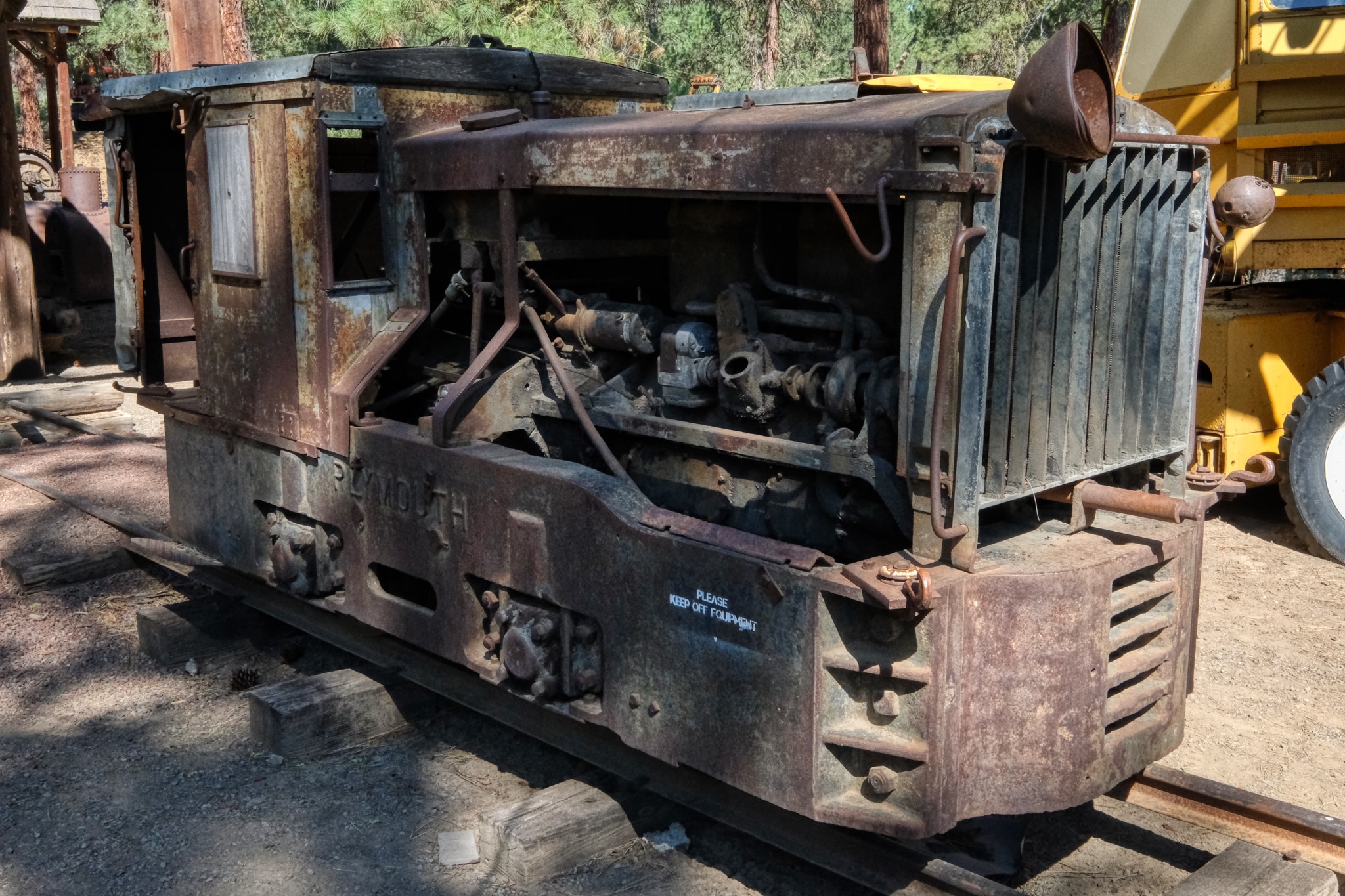 The little "mule" diesel locomotive.
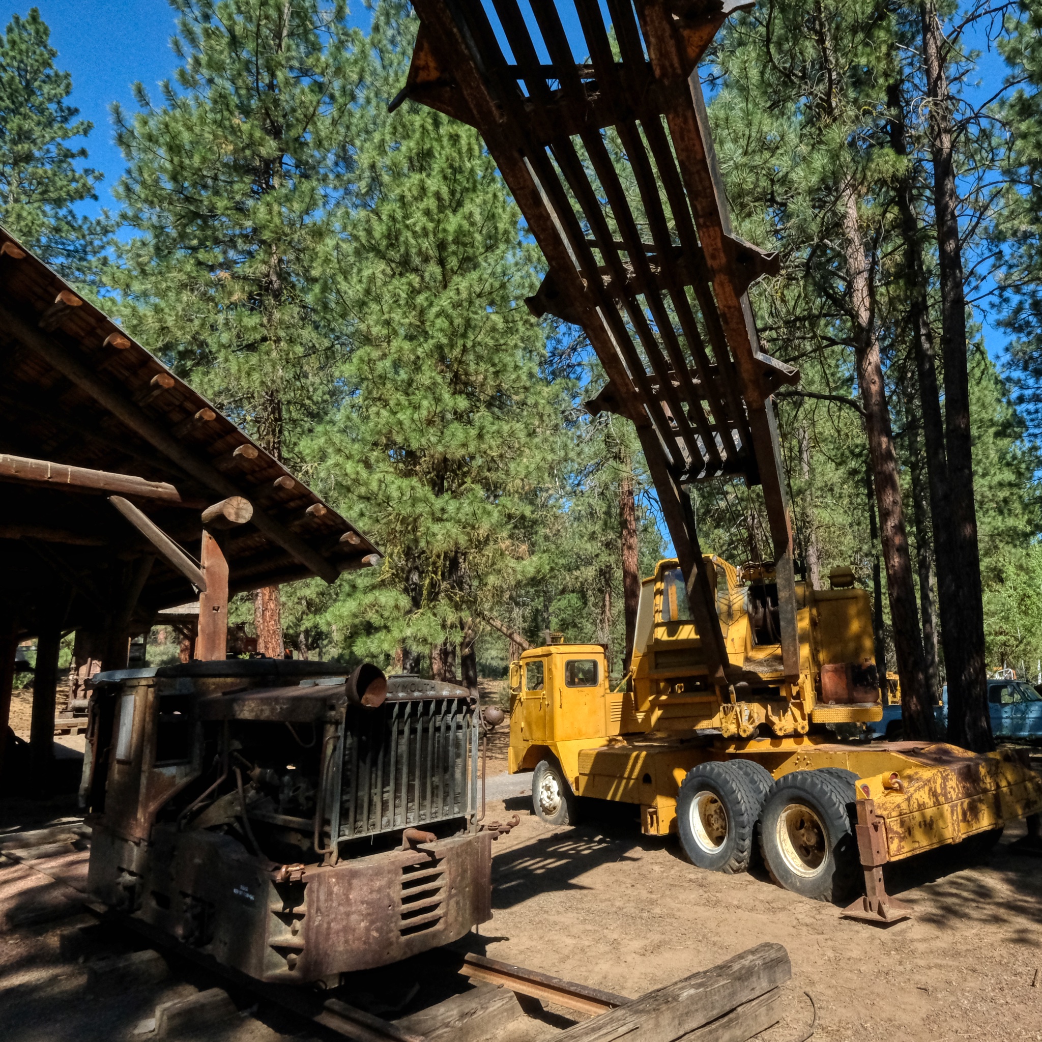
 Old log trucks and log loaders to satisfy my little heart's content!
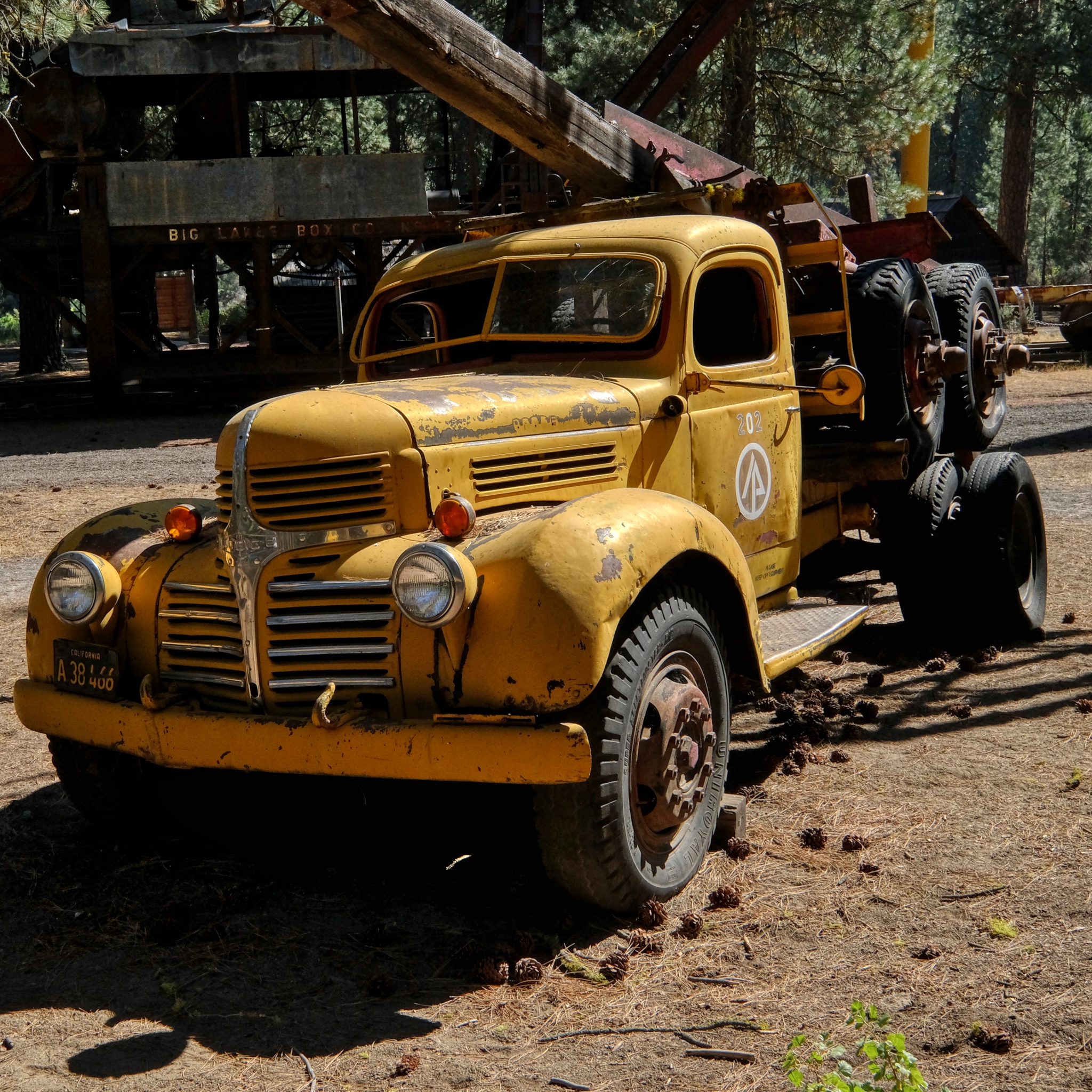 Much of the lumber used to build the houses on the west coast of the USA rode to the lumber mills on trucks like these.
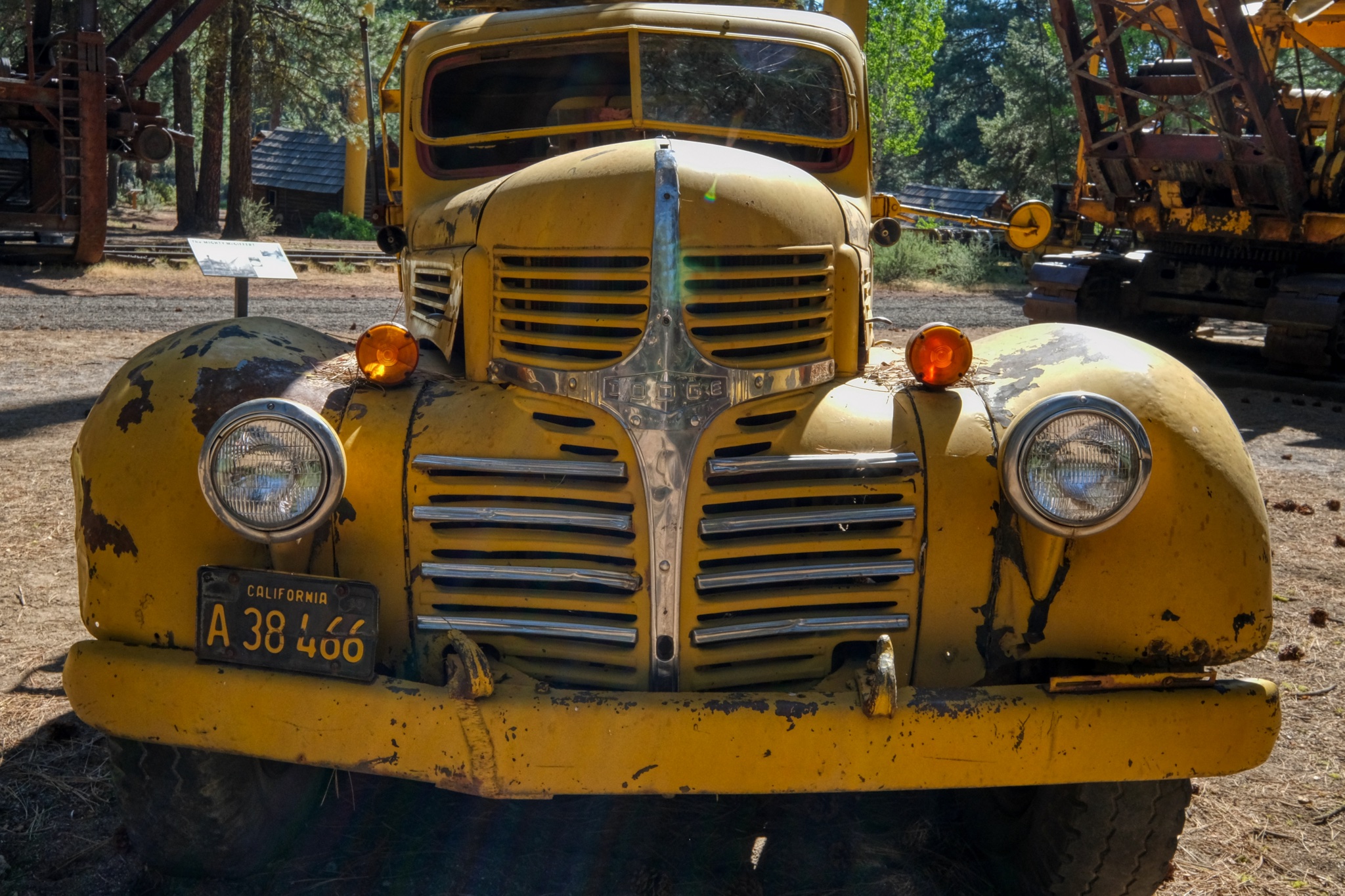 Not something you would want to see in your rear view mirror while going down a steep hill!
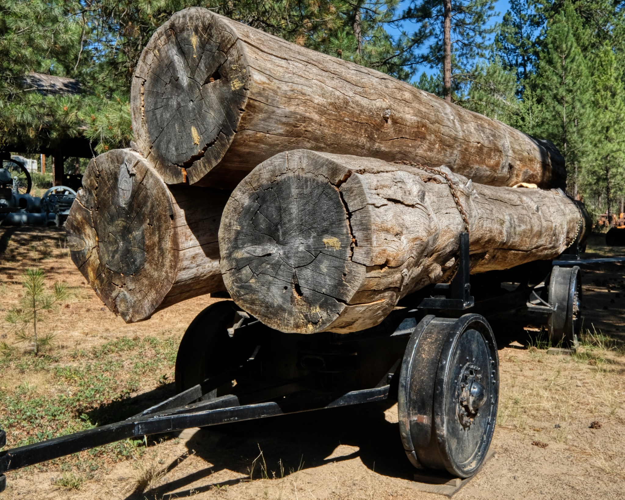 A very old steel-wheeled log trailer.
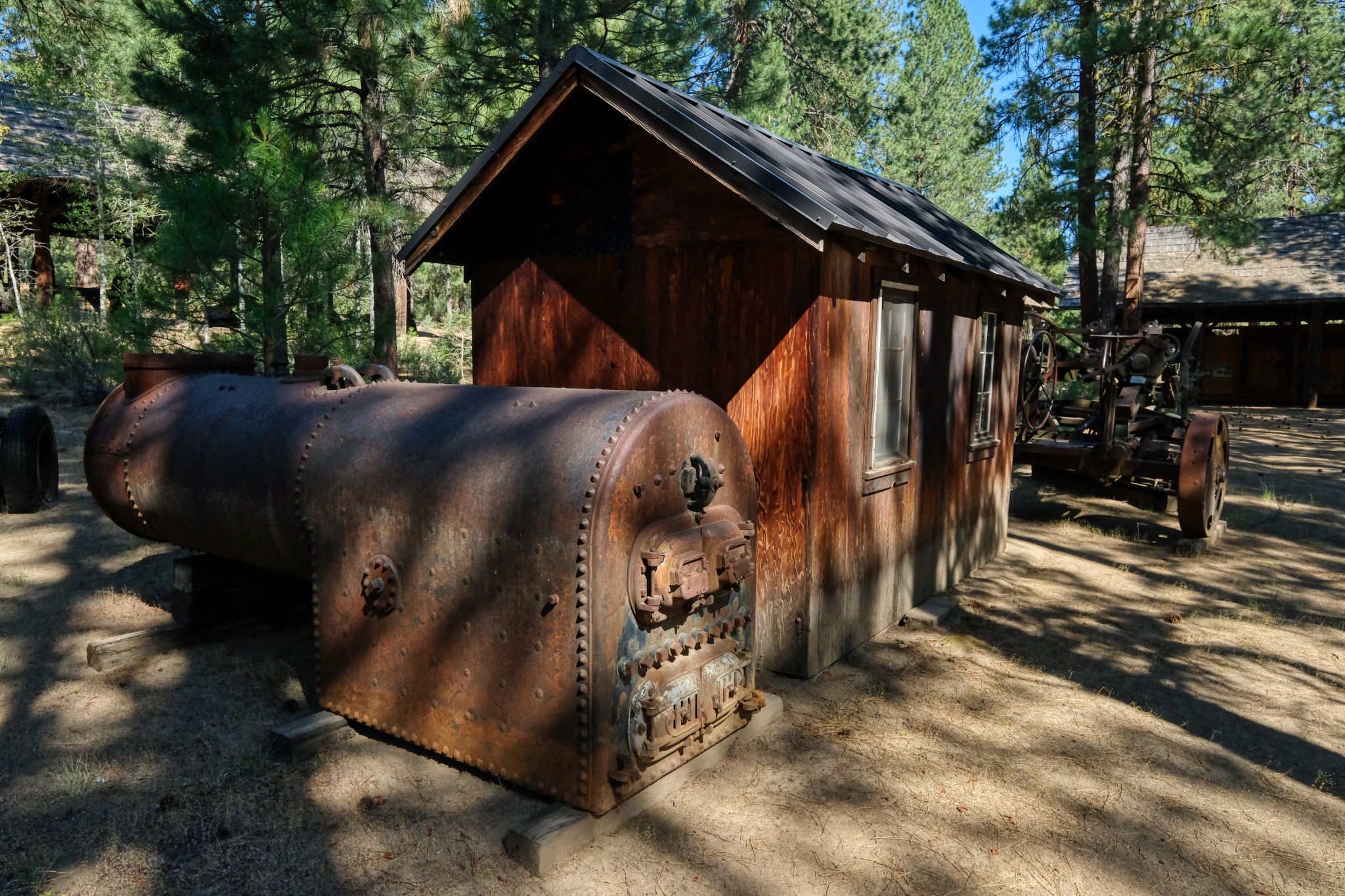
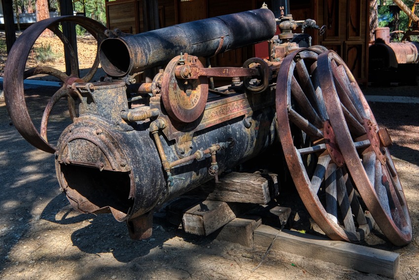 Steam powered pumps used in the wild woods early last century.
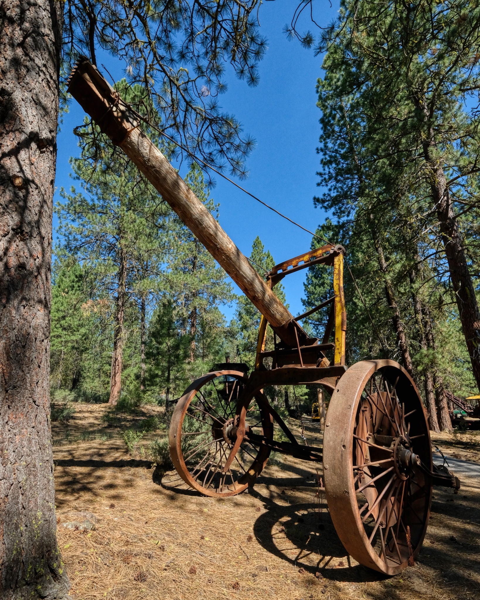
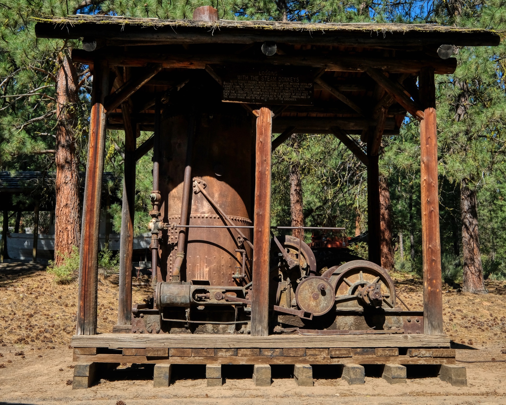 An antique steam powered winch . . .
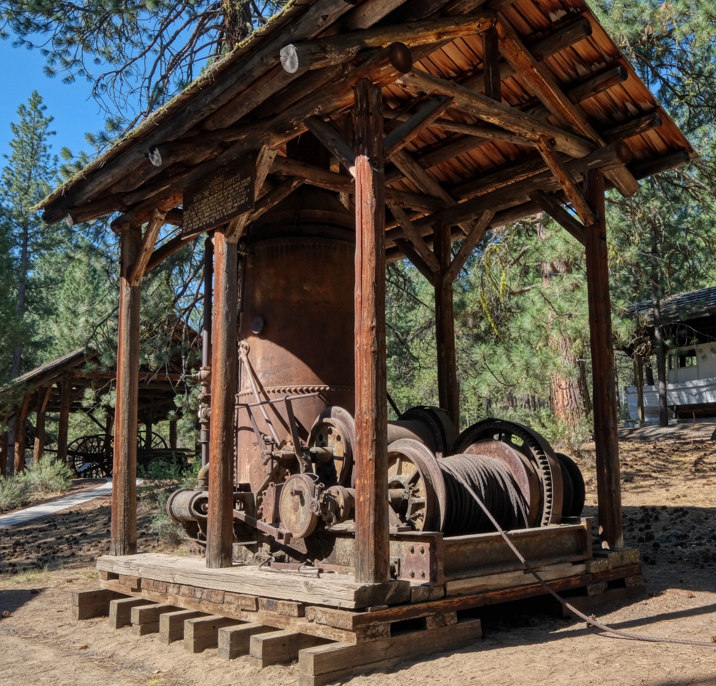 Steam winches mostly used for powering 'high lead' cables to drag logs up steep hills and across deep canyons.
 Remnants of big steam power systems laying around. Imagine dragging these up into the woods a century ago!
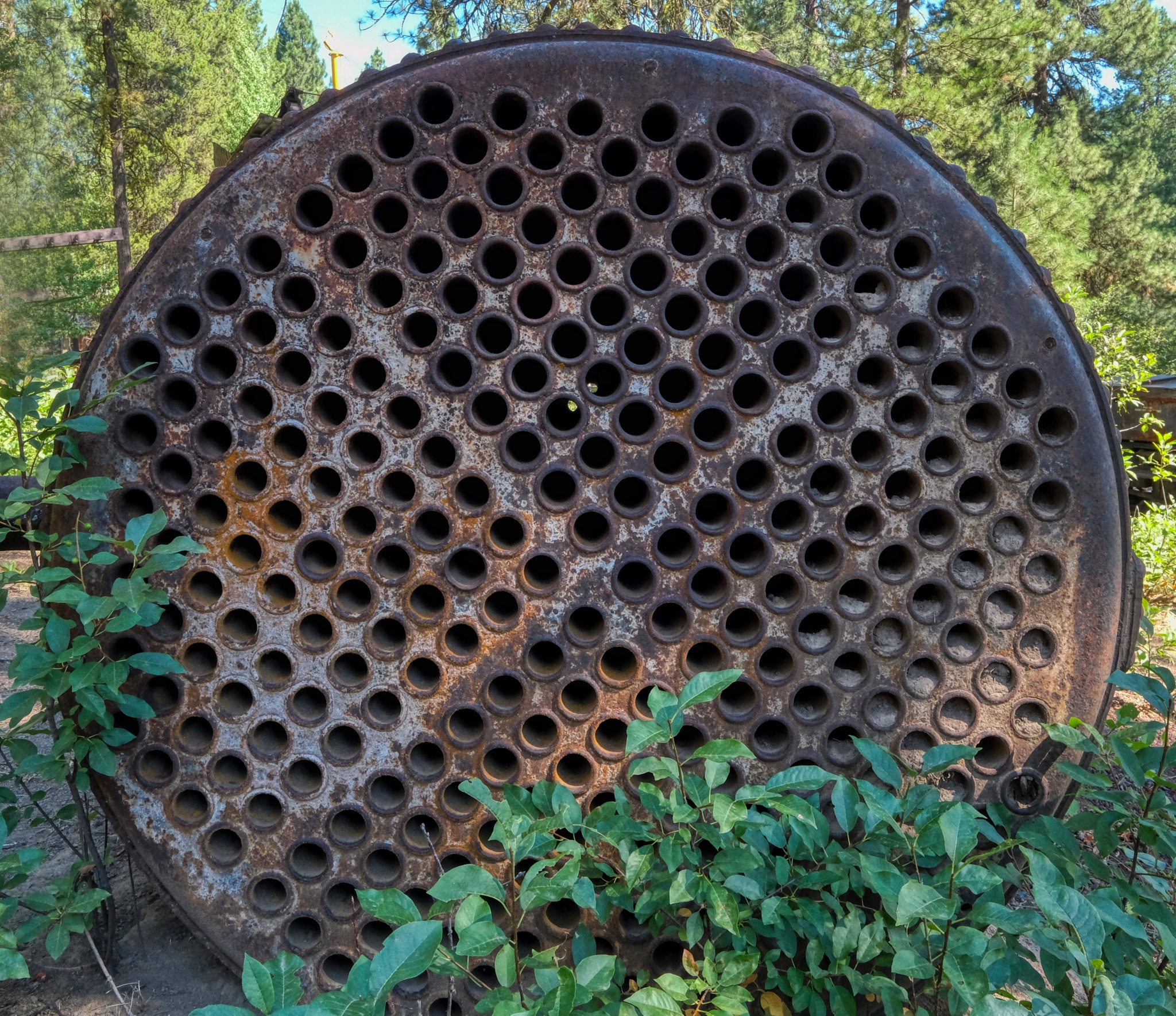 Boiler tubes.
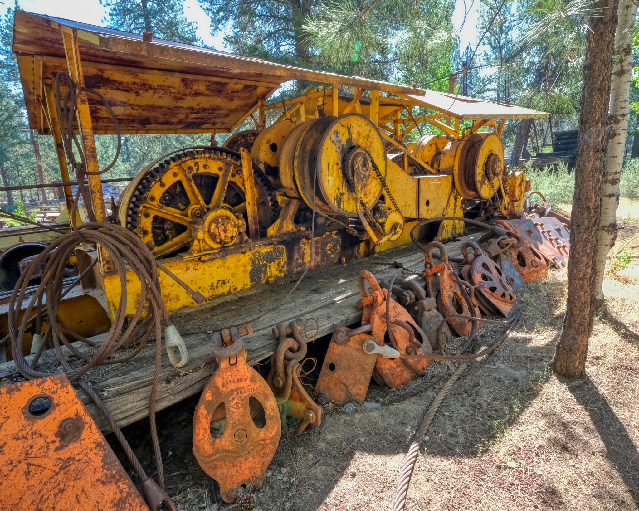 Big sled winch used for high lead logging. Nice rigging blocks.
 Wheeled steam pump wagon.
 Marvelous machine work from a bygone era.
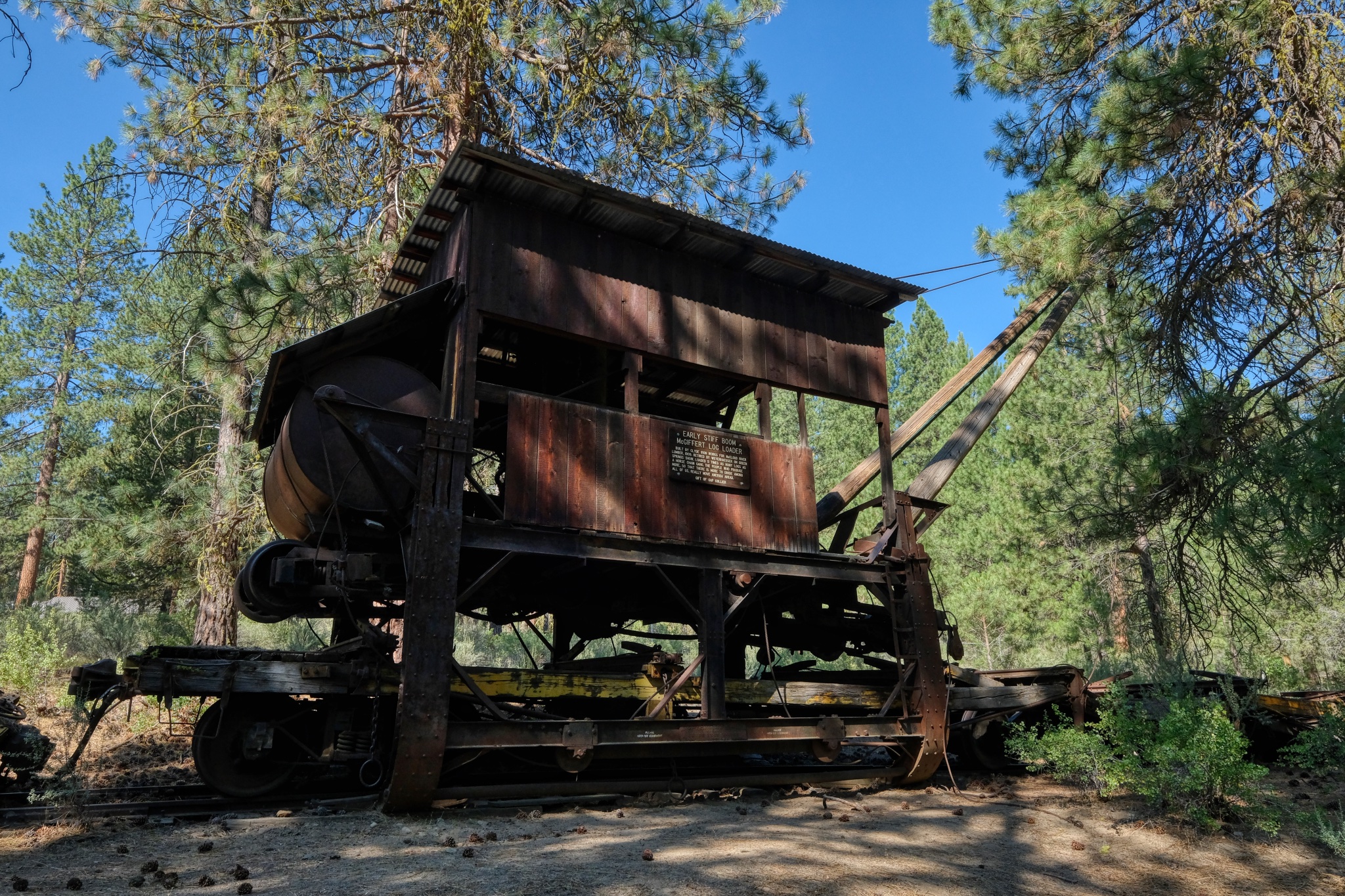
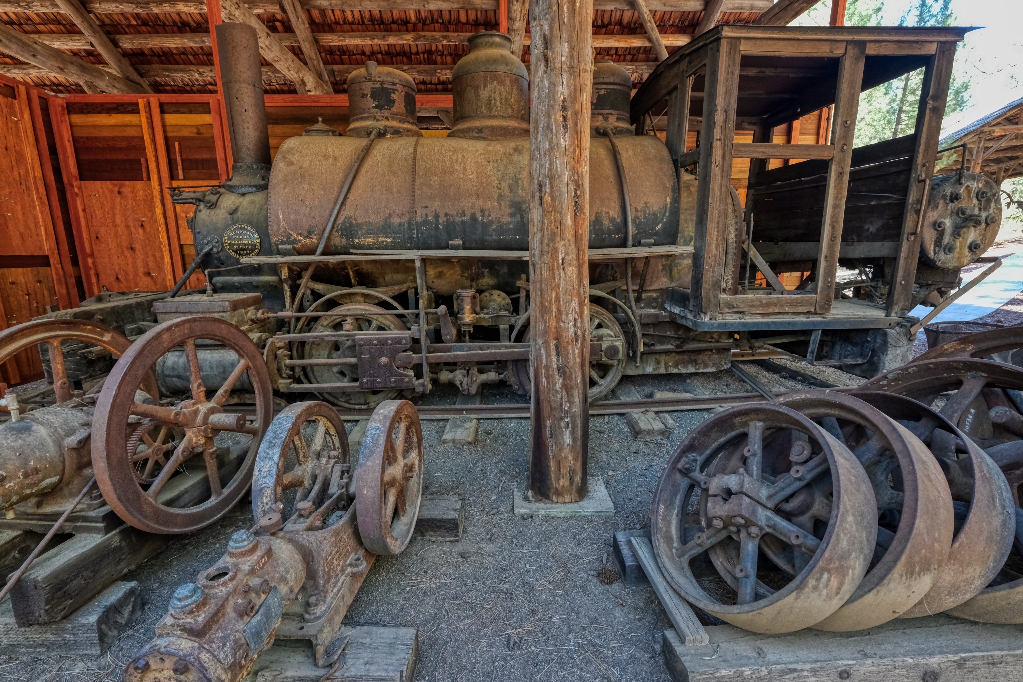 1880s locomotive shed with lots of old machinery here and there.
 A rail track-laying crane needed to build access rail lines into the old forests.
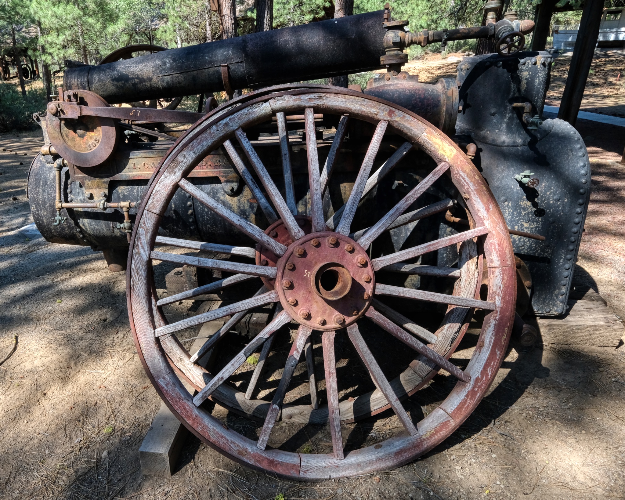
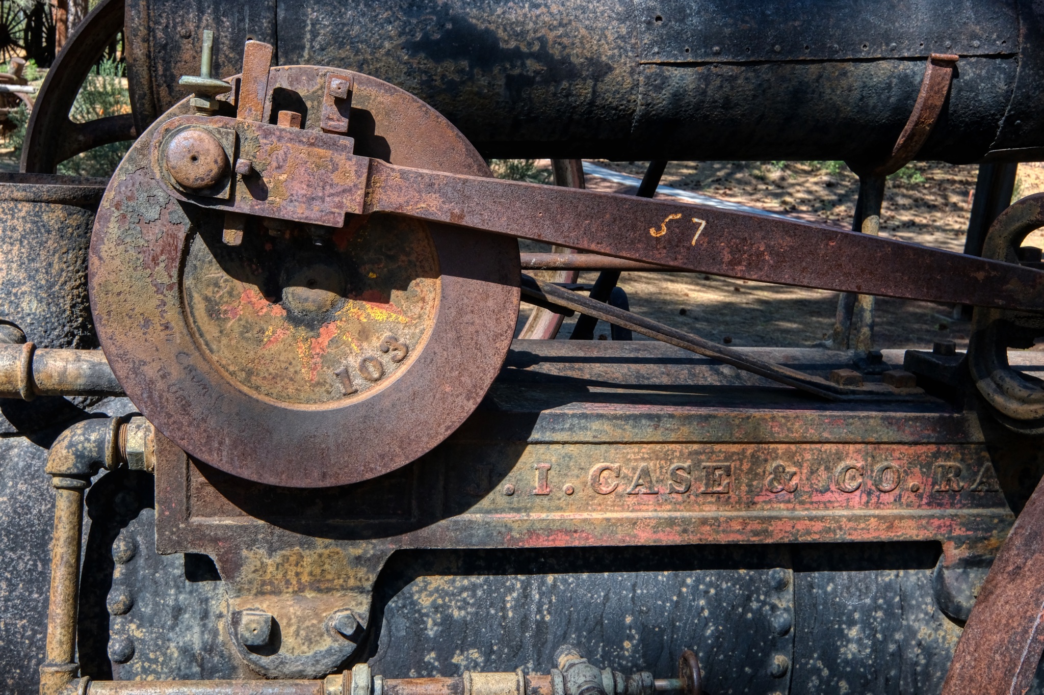
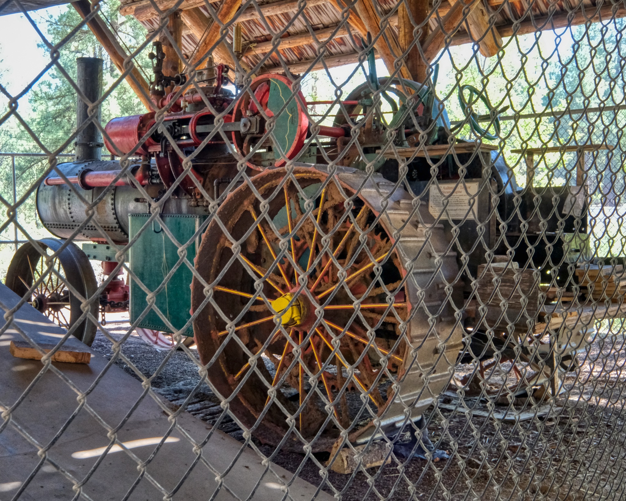 1912 Aultman-Taylor steam engine . . . WOW!
 These lumber movers (yellow machine in the back) were still common in Oregon lumber mills in the late 1970s (when I worked in Oregon lumber mills!).
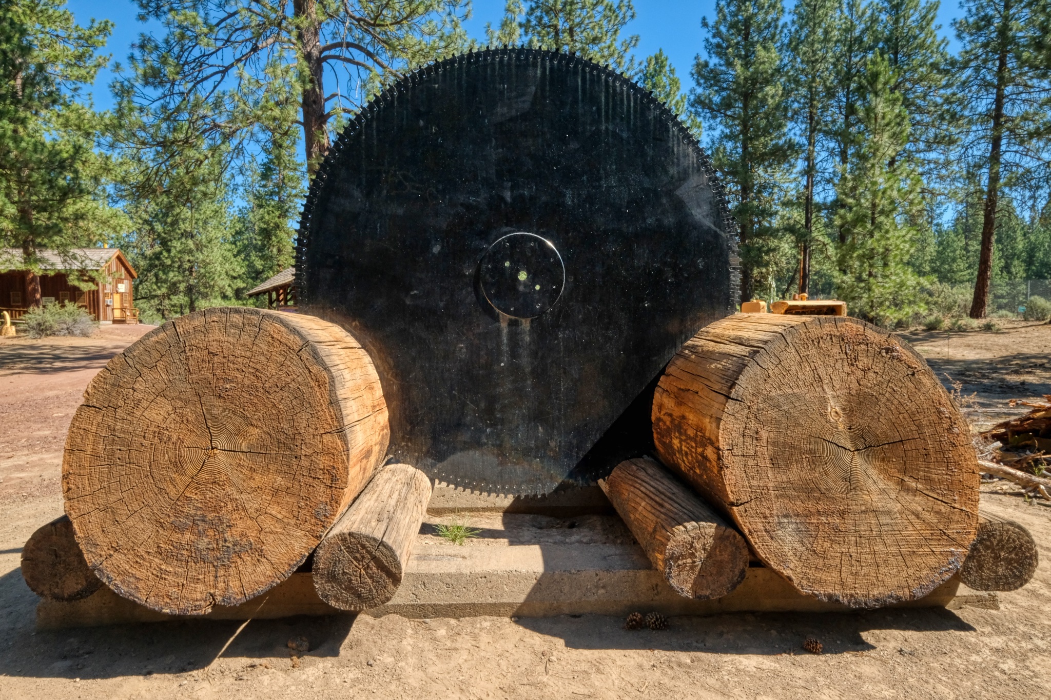 Yep, you need a saw blade ("head saw") this large to cut some of these giant trees in the lumber mill.
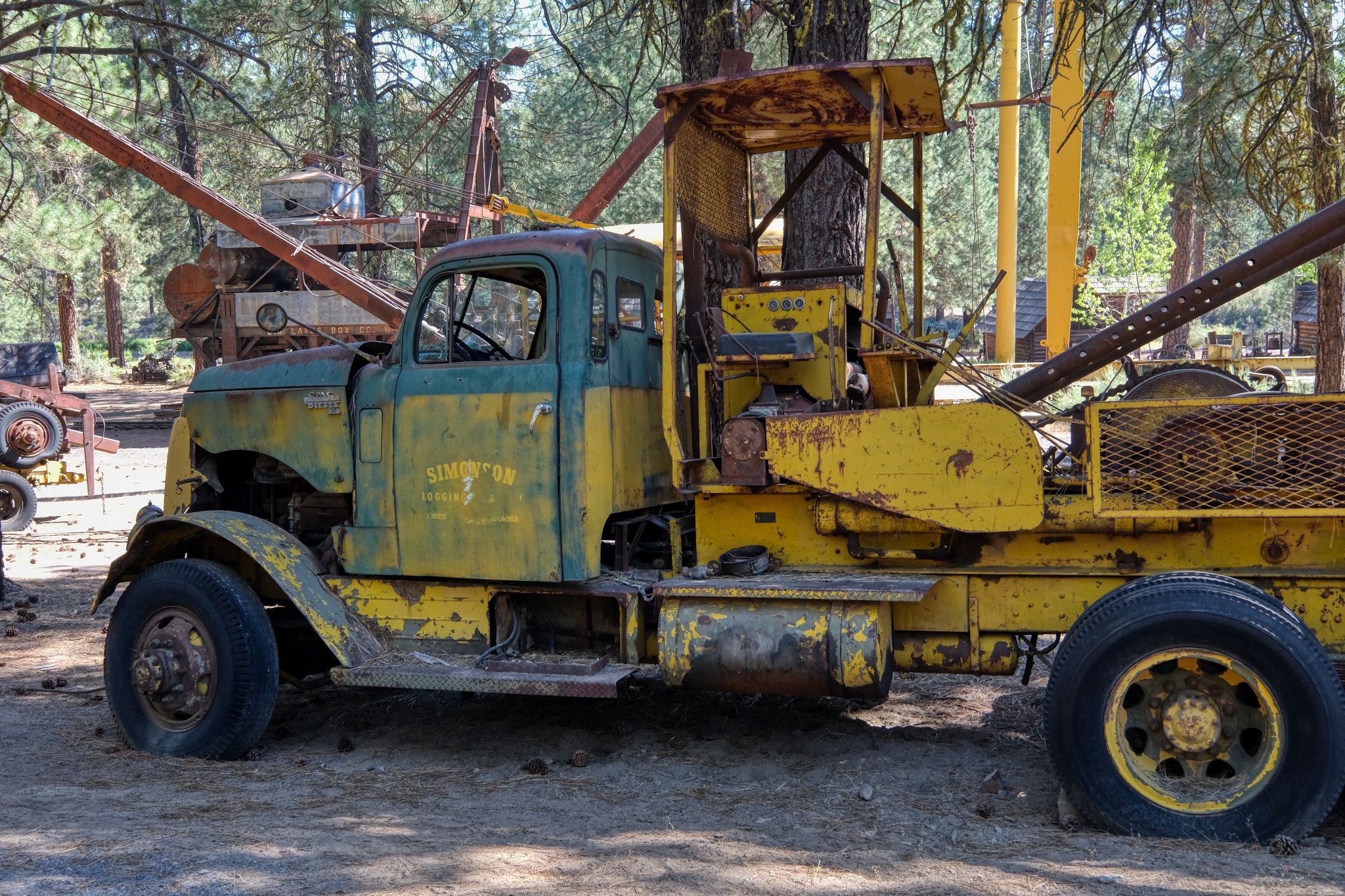 A well used high lead winch truck . . . Simpson Lumber Company.
ONEY, CALIFORNIA
 Located in the extreme northeast corner of California, Oney is a beautiful place . . . but the winters must be severe in such an isolated place.
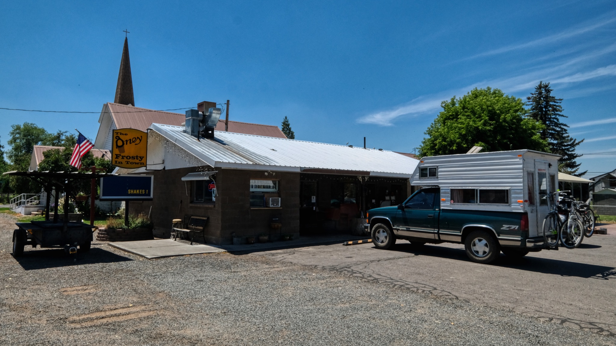 "The Oney Frosty In Town". -- in Oney, California. After driving a long stretch on winding two-lane mountain roads from Klamath Falls, Oregon, the Frosty was a welcome sight.
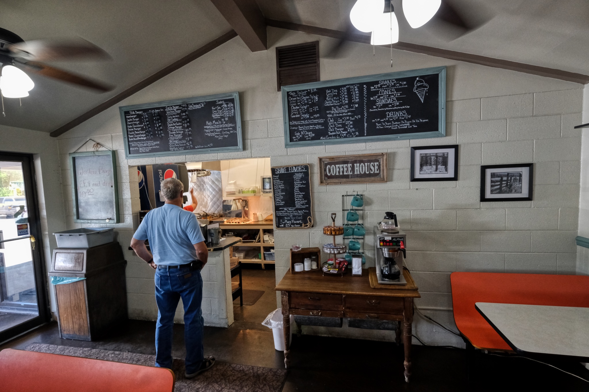 I was not disappointed! The choices were pure Americana . . . and delicious.
 Dr. Jeff Harper
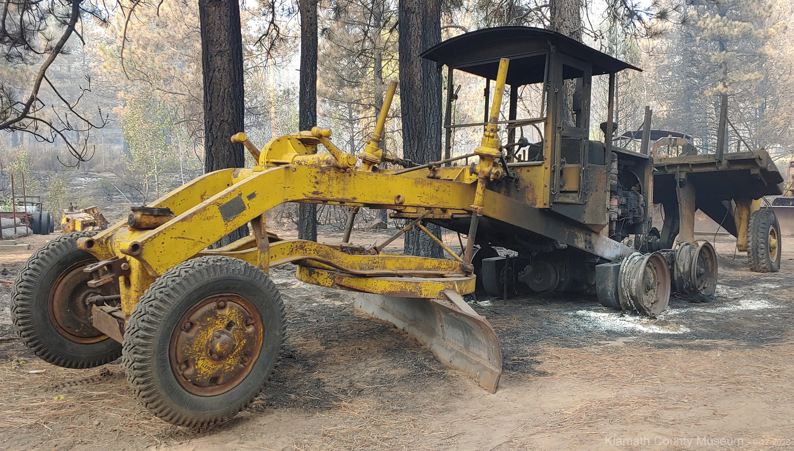
Unfortunately, the following year a major forest fire burned all around the Logging Museum . . . . but fortunately, only a few of the antique machines were damaged. The firefighters saved 90% of the collection!
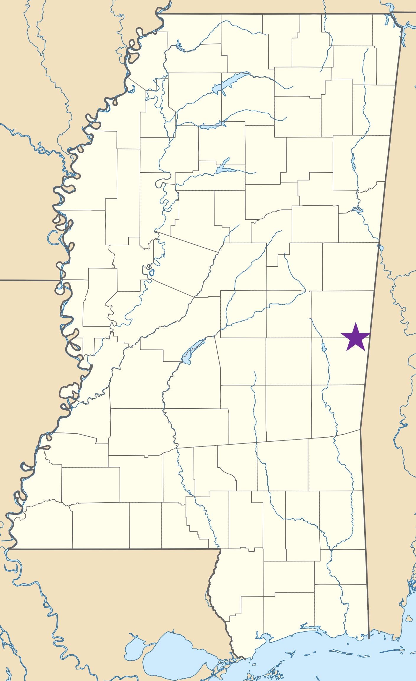
USA Road Trip: Old Country Store, Kewanee, Mississippi
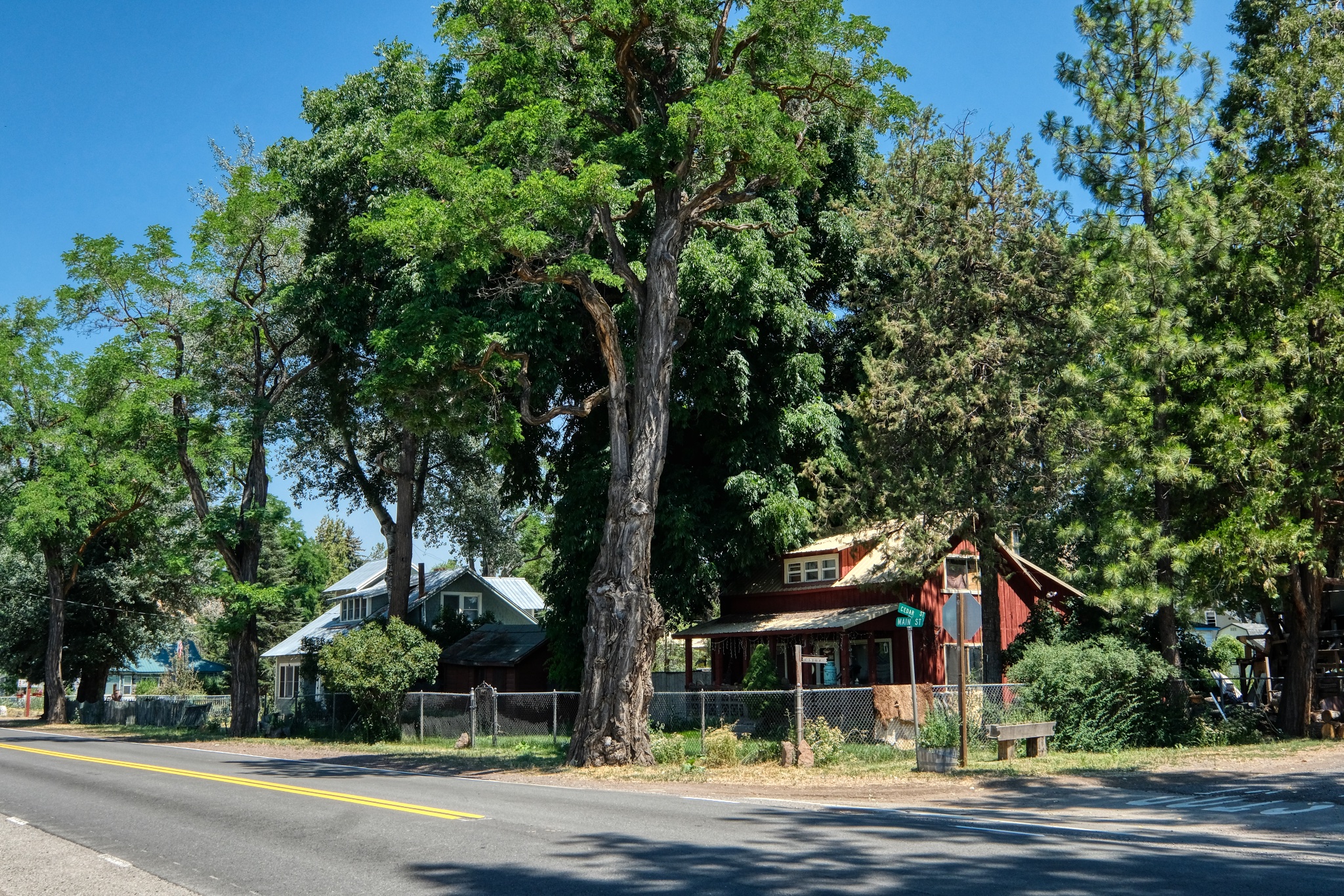
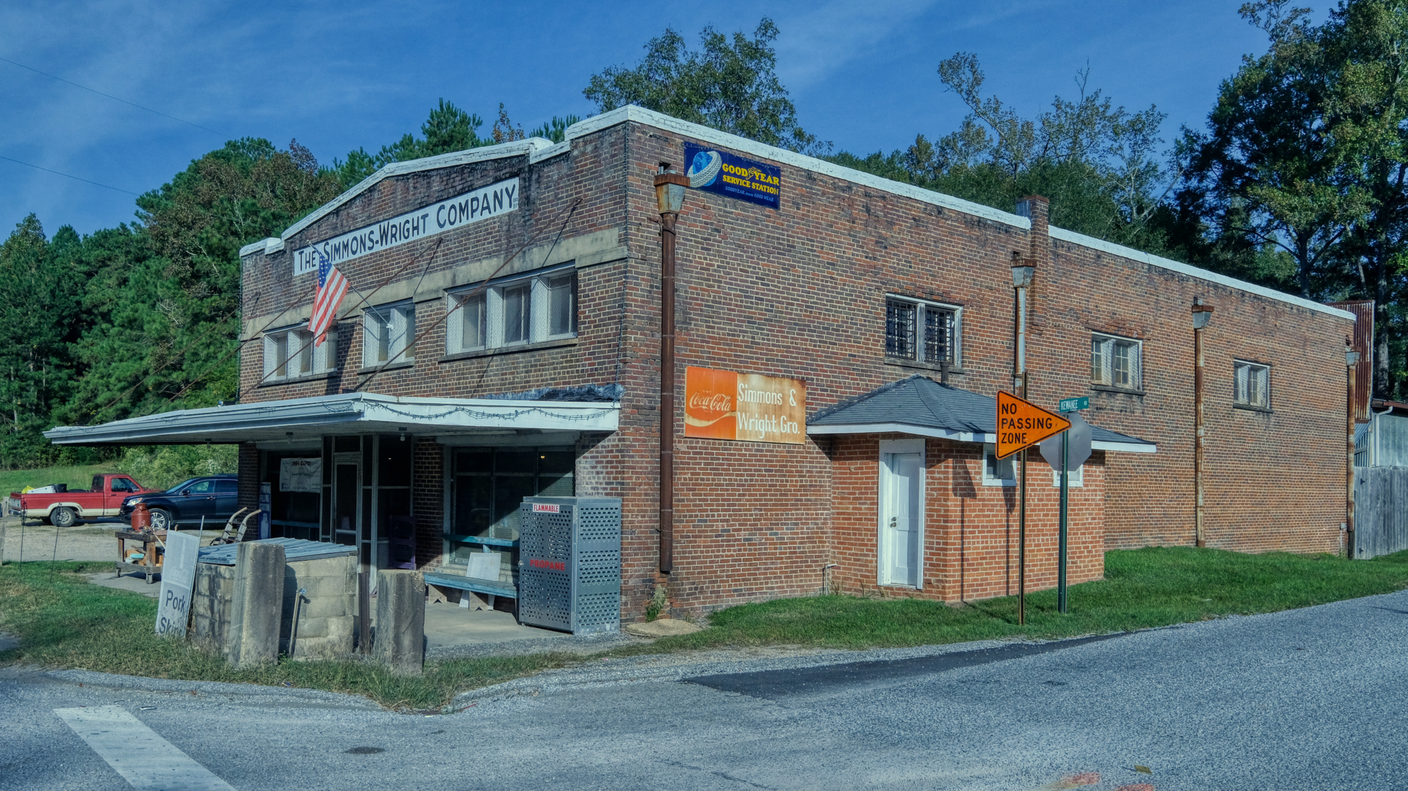 Just travelling along the highway from Leesville, Louisiana to Selma, Alabama, via Natchez, all the way across Mississippi with my friend Bud riding along, we pulled off on a side road to seek refreshment and saw this gem from an older America: The Simmons-Wright Company store.
 Only a mile or two before the Mississippi - Alabama state line.
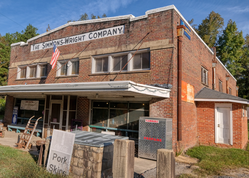 The Simmons-Wright Company is a historic general store established in 1884 in Kewanee, Mississippi, a small town just outside Meridian in Lauderdale County. The building was listed on the National Register of Historic Places in 2008. It looked inviting, so we walked right in.
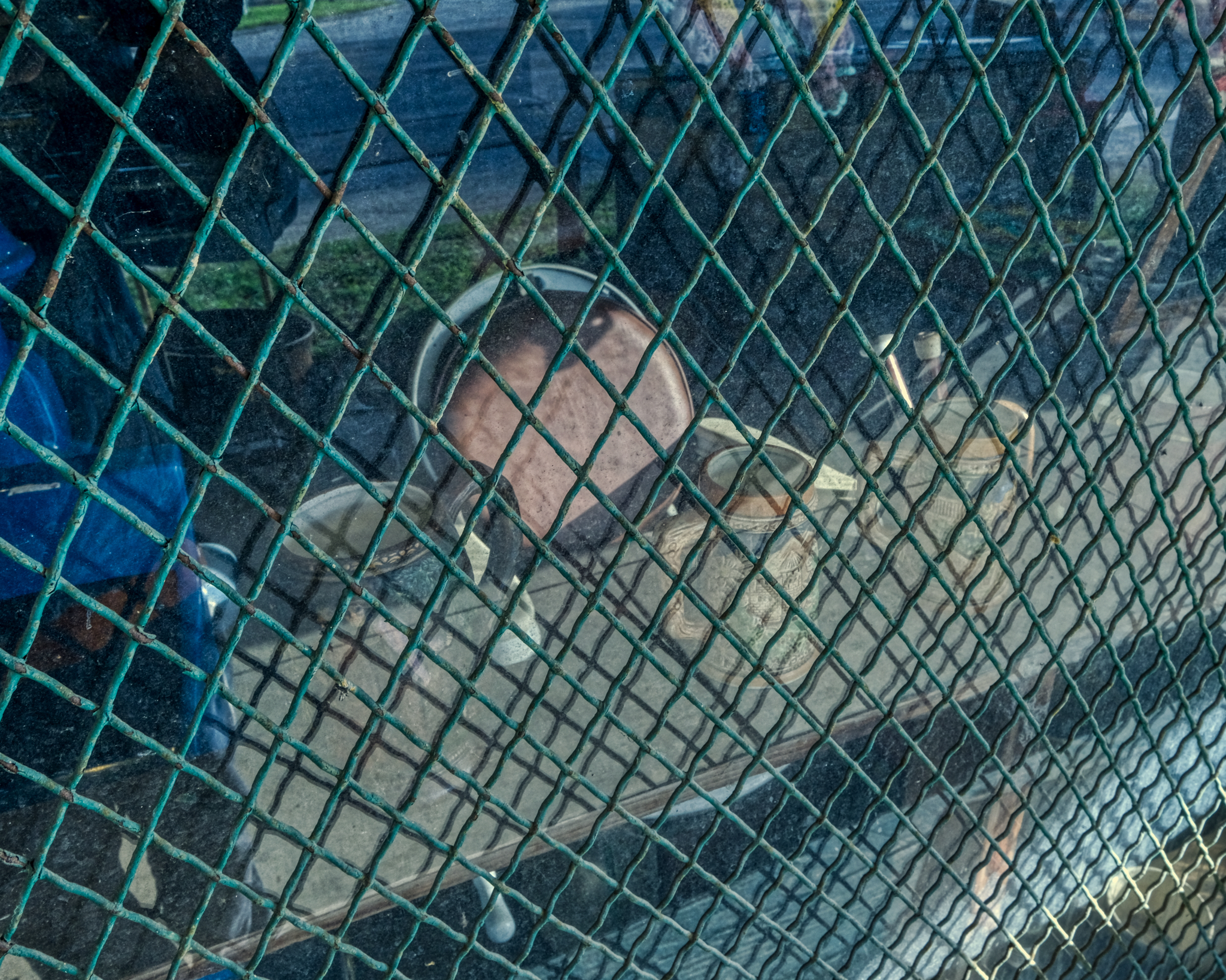 A peek through the dusty window before we entered foreshadowed the delights within!
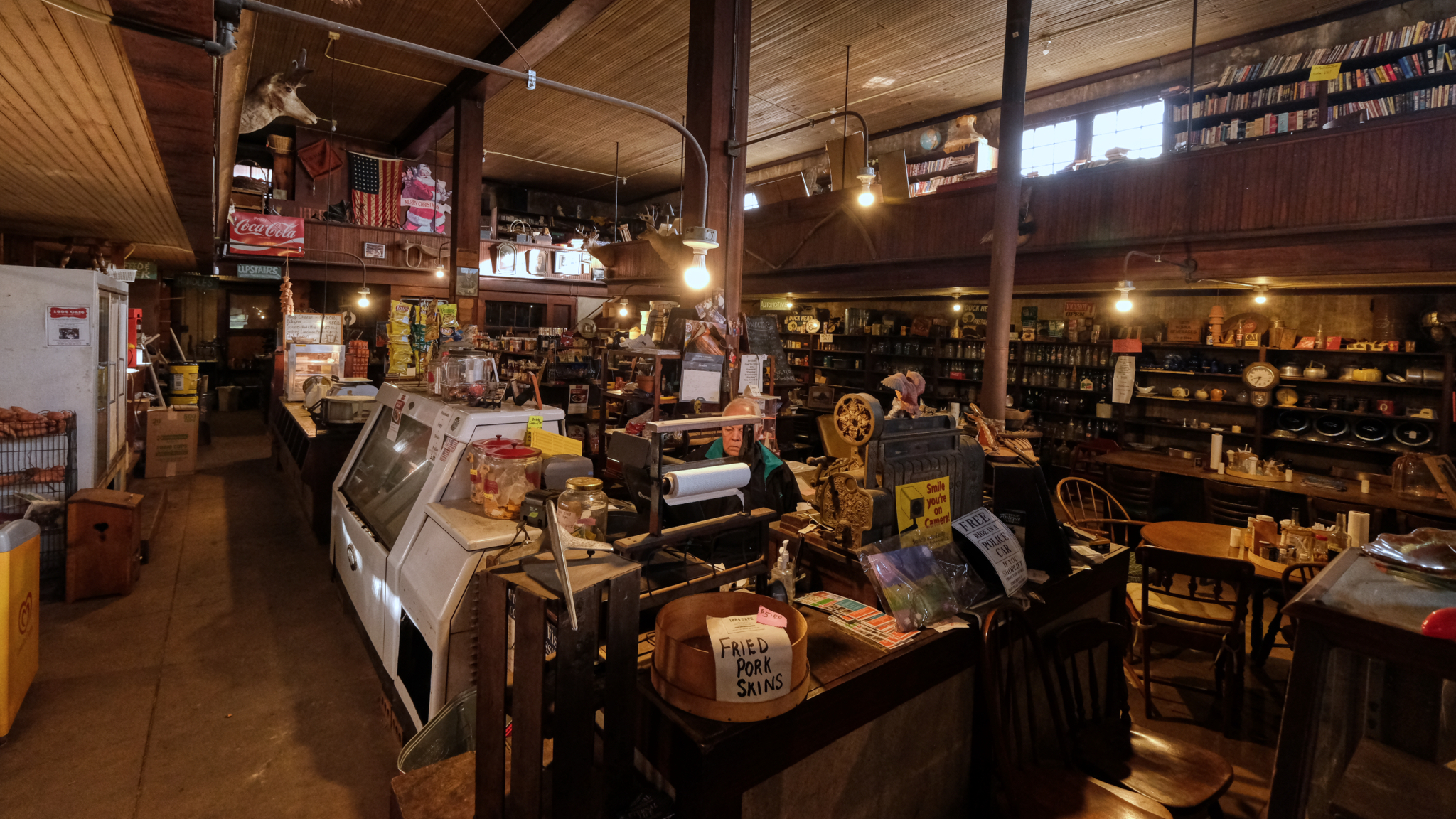 OMG! We walked in to find this time capsule of another era; the general store. I am old enough to remember these kinds of stores from my childhood living in The South, but never imagined one would have survived, intact from that time.
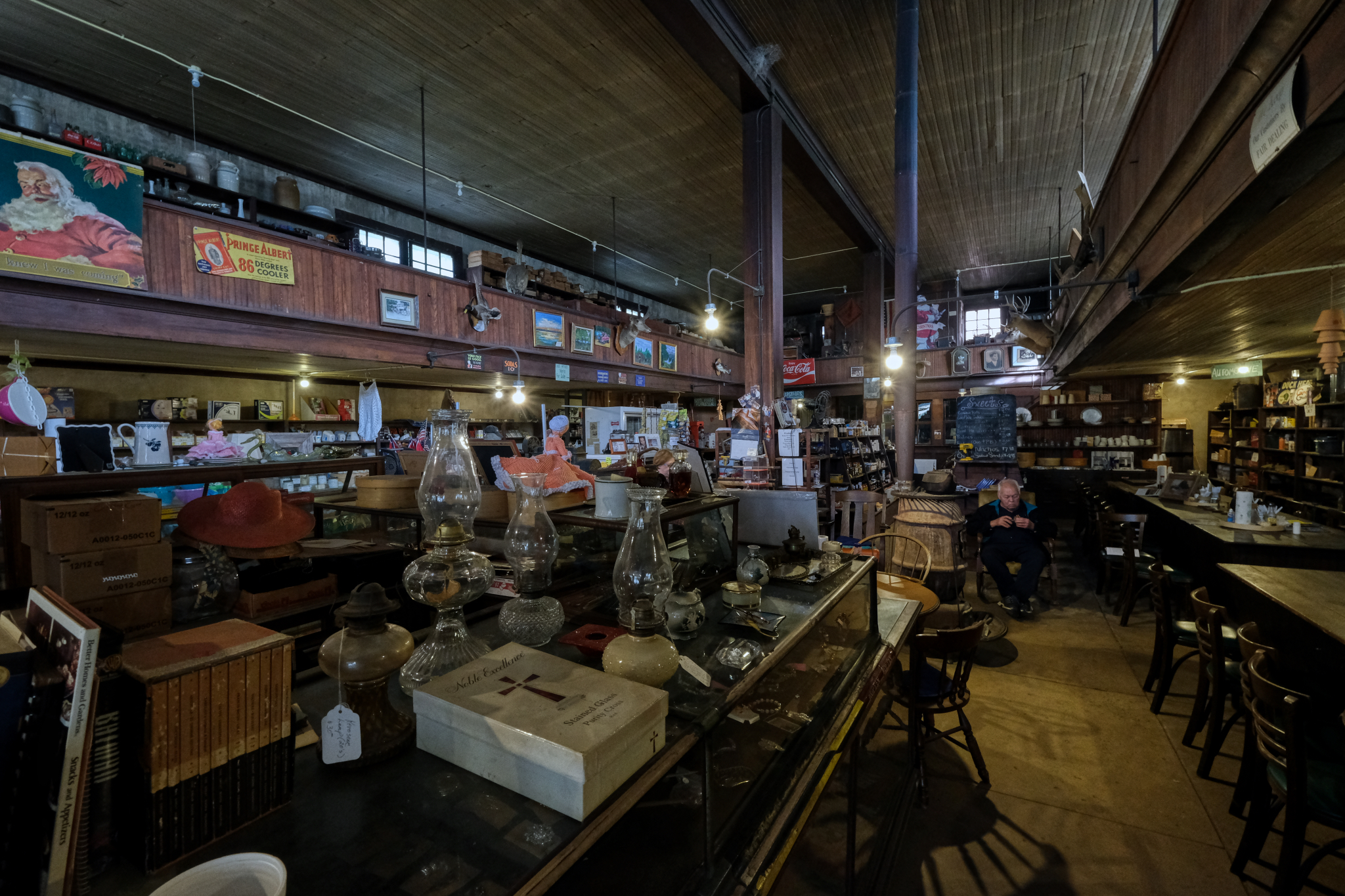 All original store fittings, shelves, coolers . . . .
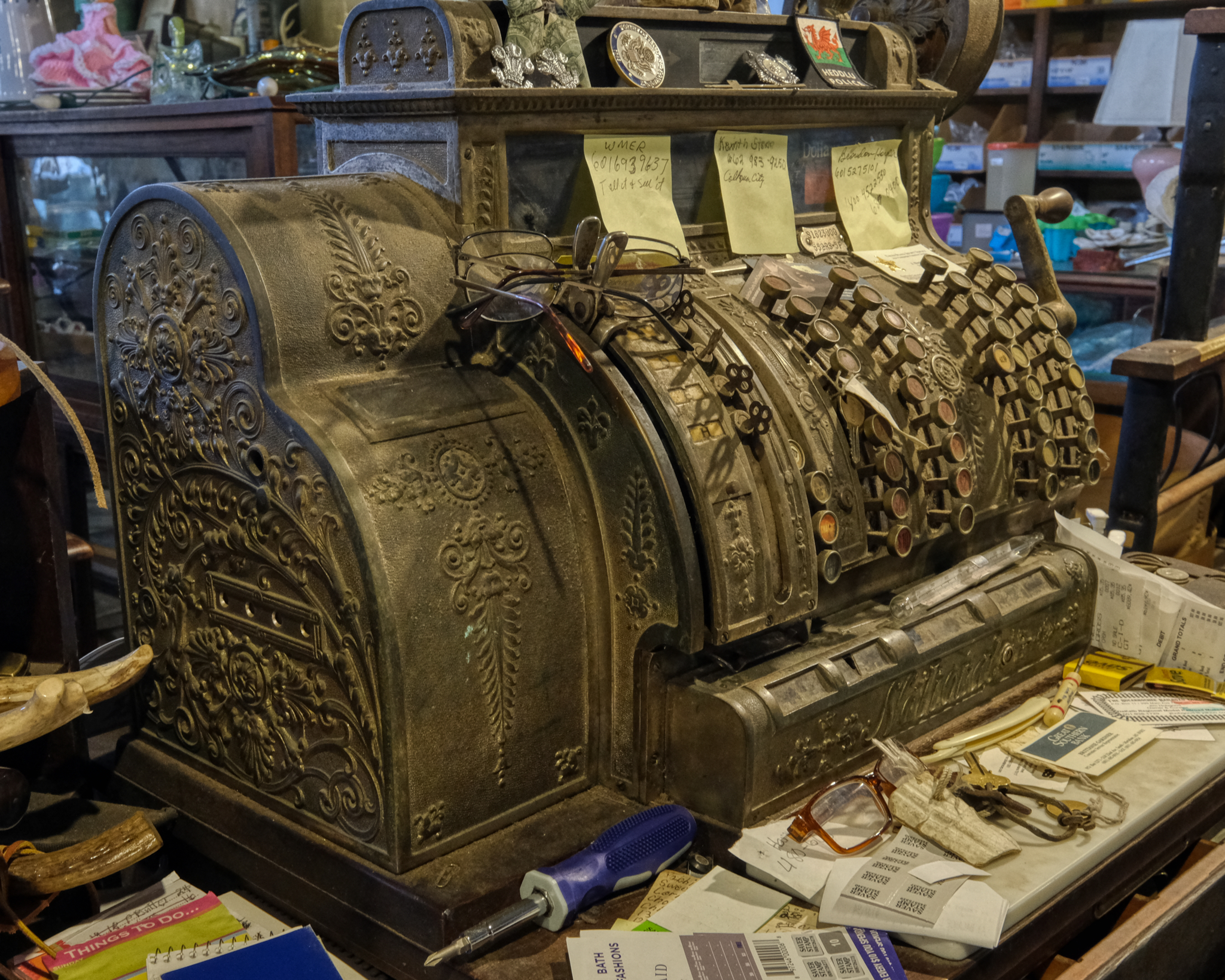 . . . there was even the 'origional' cash register. Amazing.
 The cash register was a masterful work of art from a bygone era. The mess around the store must have made it feel like a comfortable old shoe to the old man sitting behind the counter. He kept a good eye on us as we wondered around.
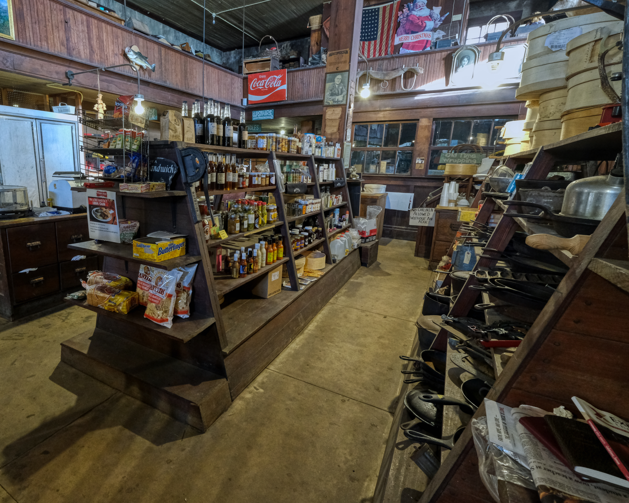 A little bit of everything a person might want to stop in and get on the way home from the mill job. I love the hand made "No Children Allowed Without An Adult" sign.
 No computerized stock control here, no bar code scanning or shelf space earning ratios. You have to know your customers tastes. The array of food choices on offer speaks to the local cultural preferences.
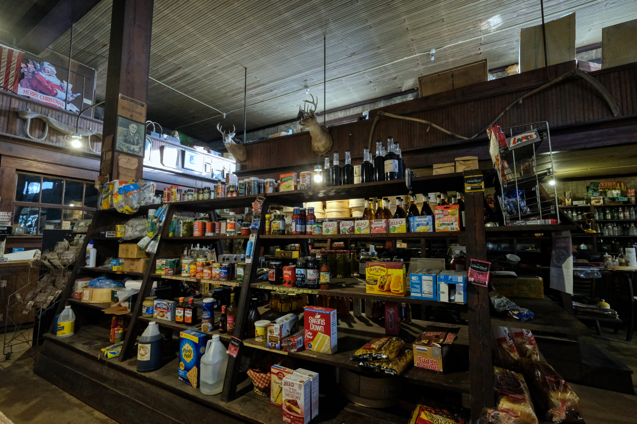
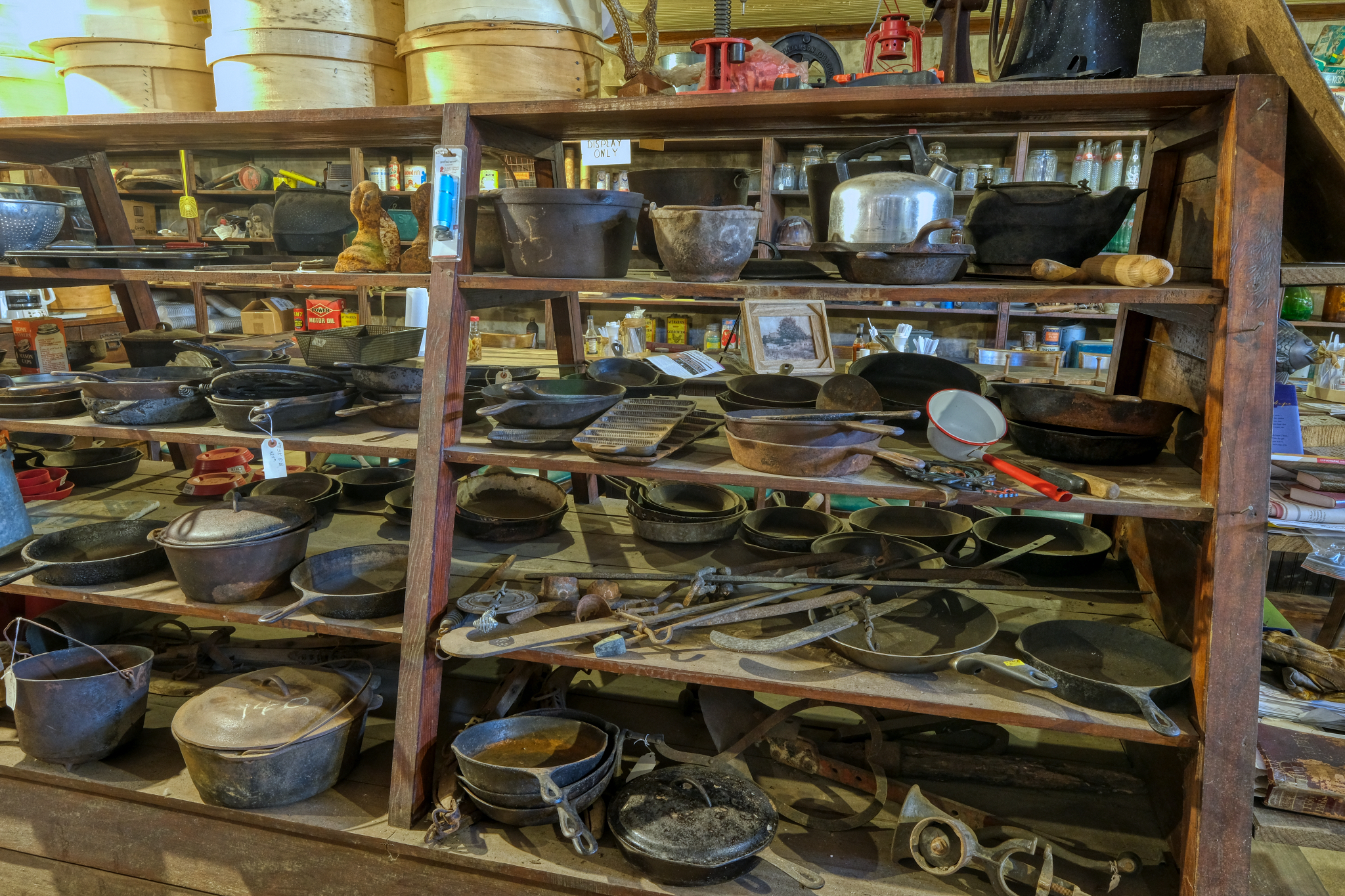 The dry goods isle was half merchandise and half museum display.
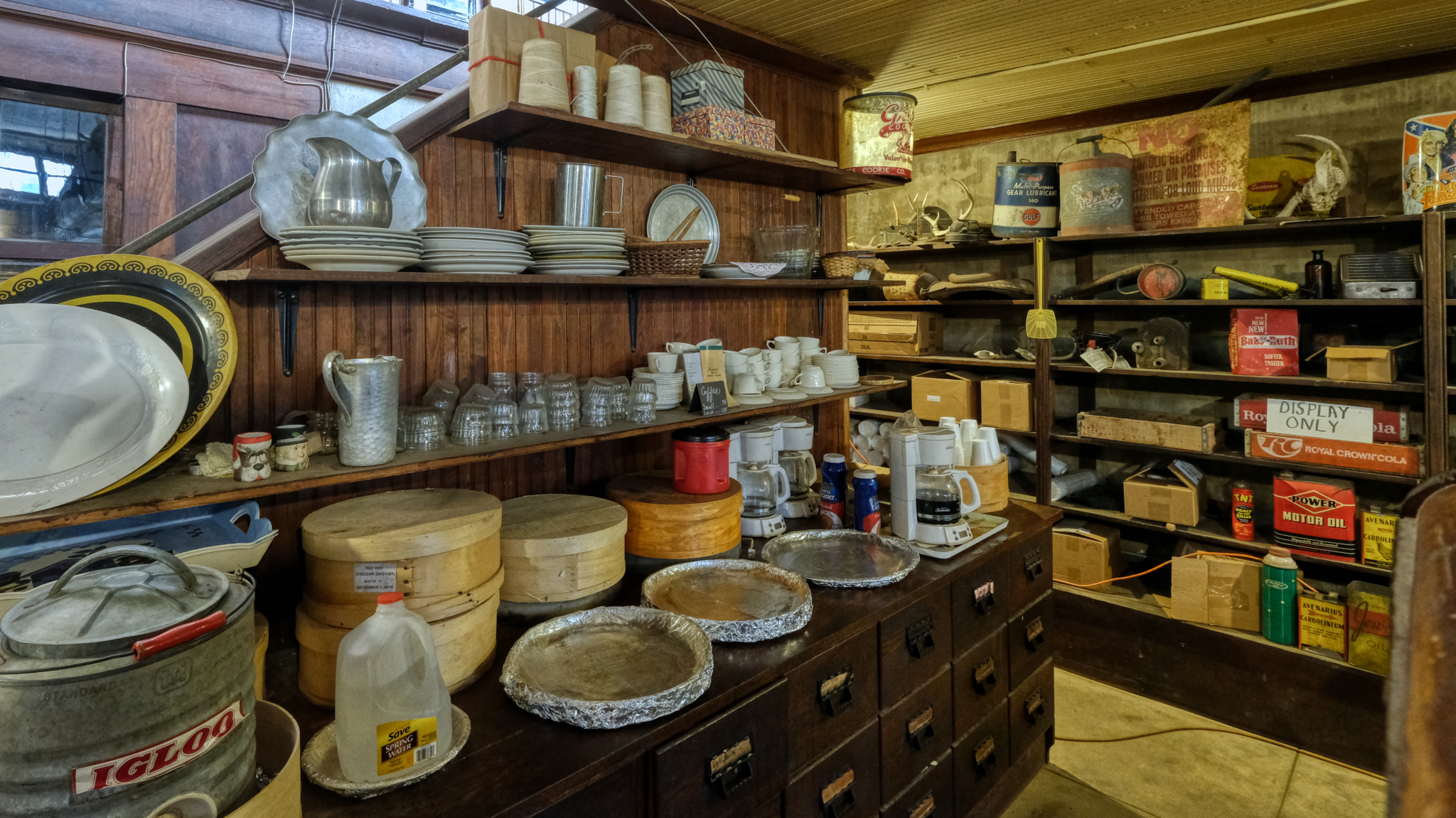 There was a small "kitchen" area in the back. Coffee, but it looked like we were either too late or too early for the cakes that go on the foil-covered trays.
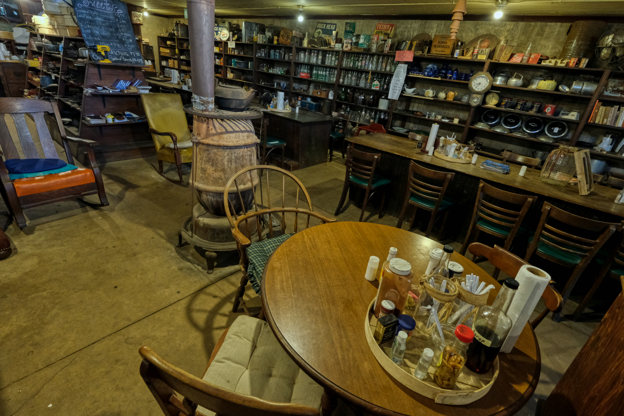 An inviting pot belly stove surrounded by the "eating area." I wondered if these seats filled up in the afternoon and evening with regulars who stop in to chat and for beer and snacks.
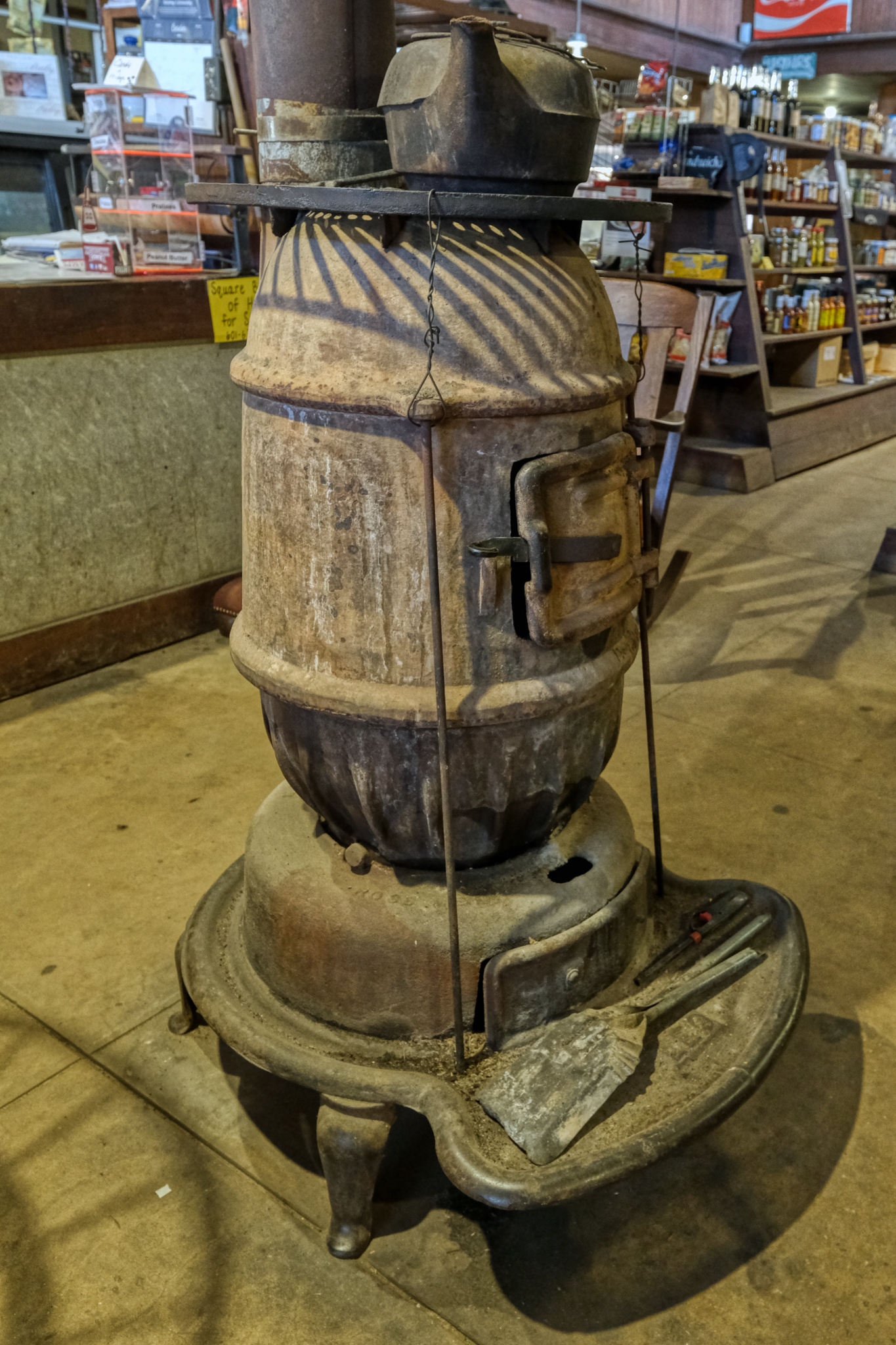 The pot belly stove was a work of art made of the patina of the passage of time.
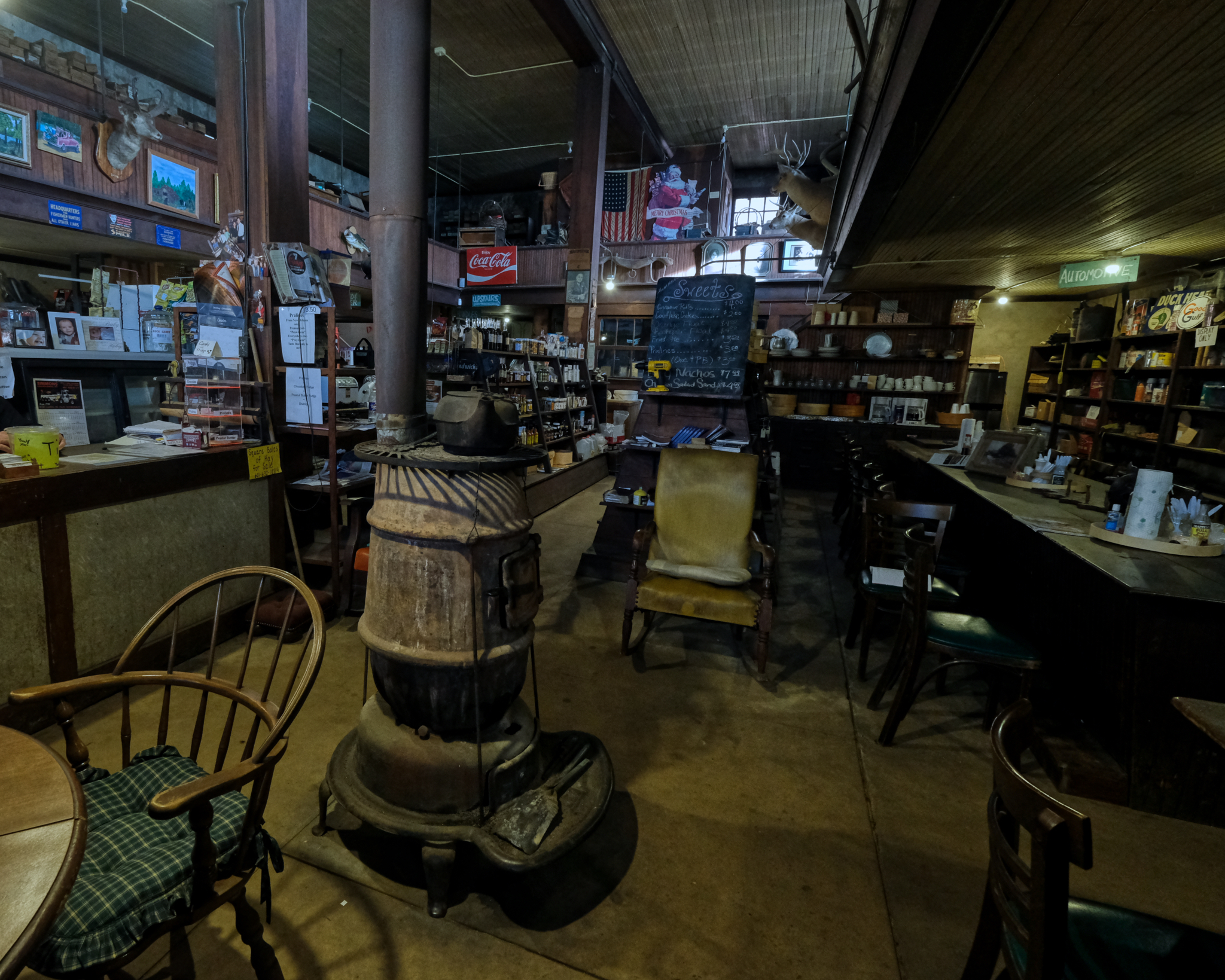 The pot belly stove stood in a place of prominence . . . in the center. It looked like it has been used right up into the present. It was early October, but not yet chilly in eastern Mississippi, so it had not been stoked on this day.
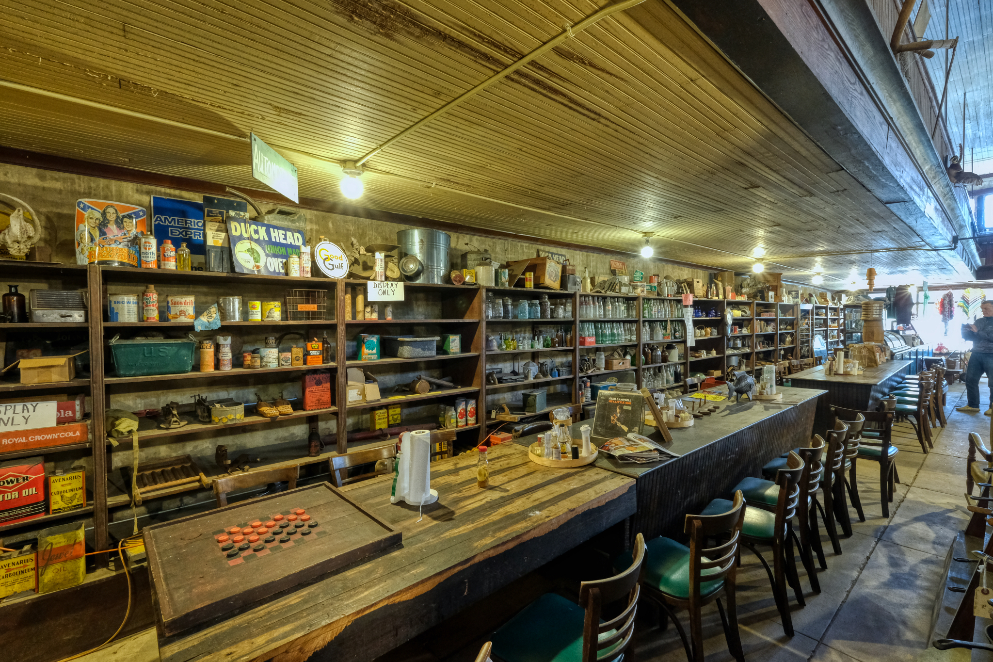 The long side wall was was reserved for the "display only" shelving.
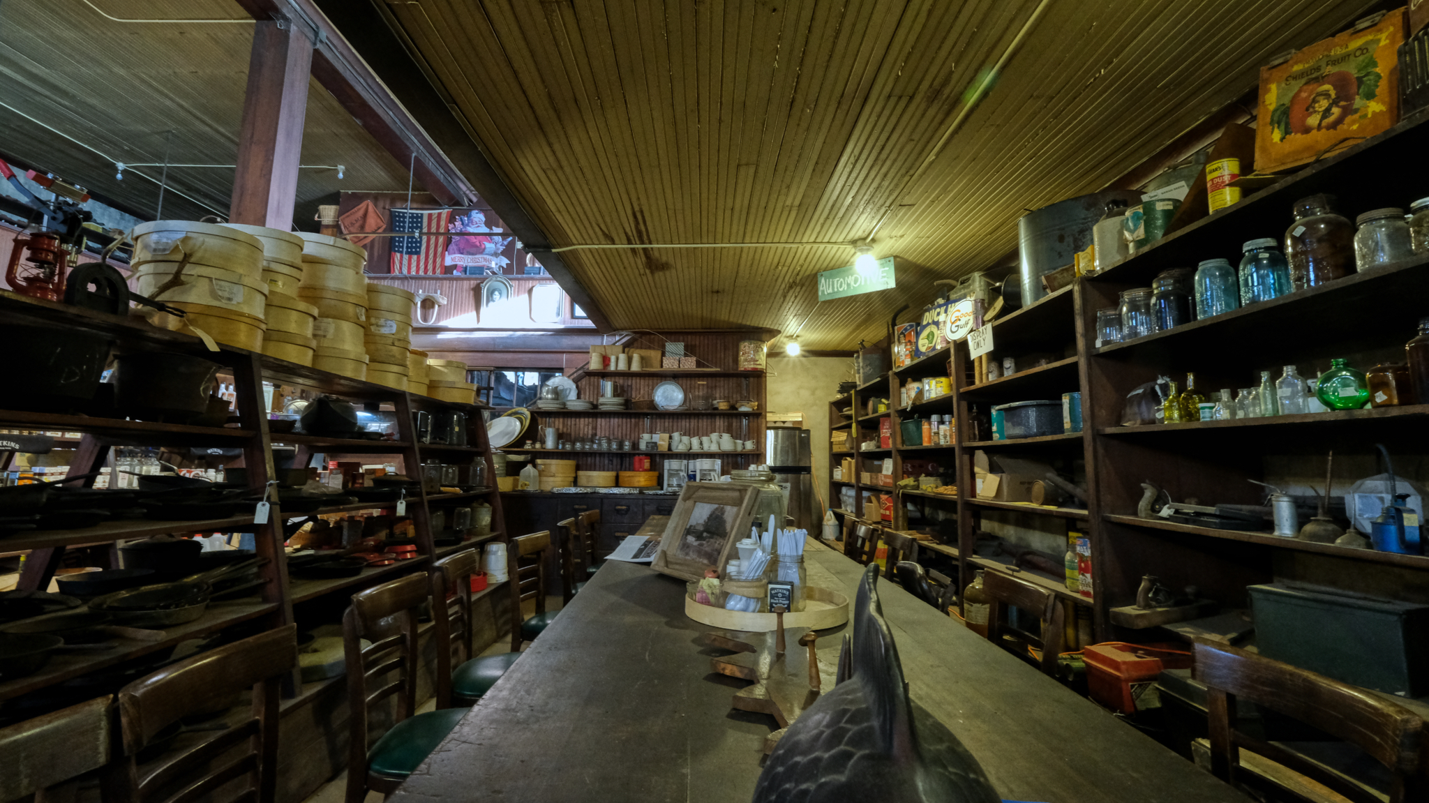 I walked around the old store in big loops taking photos and being stunned by the disheveled beauty of this space.
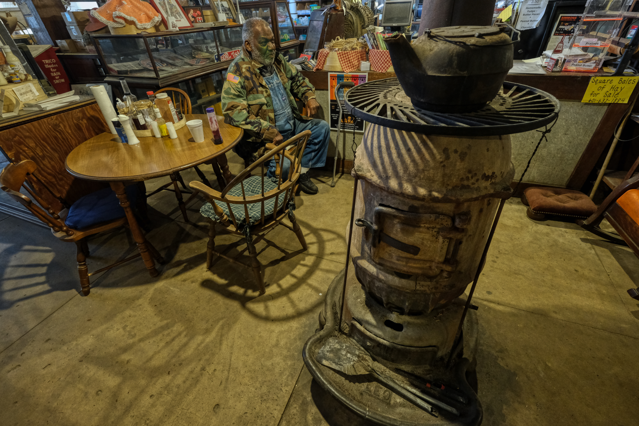 I hadn't seen or heard him enter, but at some point an old African American man came in and made himself at home. He and the proprietor exchanged some friendly conversation in low, almost silent tones.
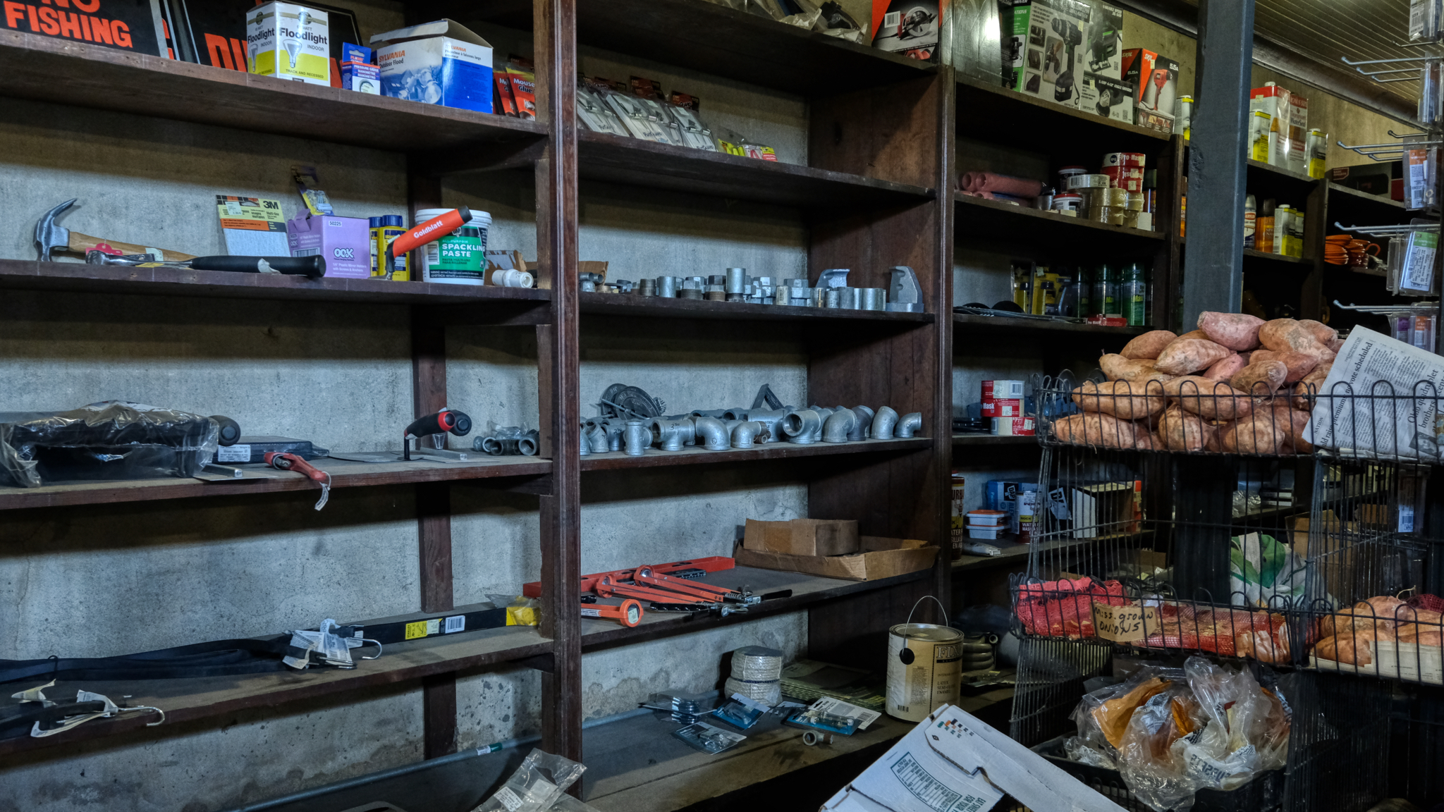 An "array of mixed plumbing supplies" and sweet potatoes.
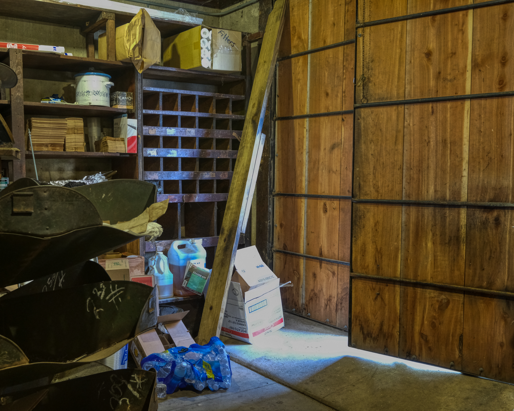 "May I take some photos out back," I asked. "Go right ahead," he replied as he pointed to this door next to the nail bins.
 Nice. A fine old, weathered back yard shed.
 I love old rusted corrugation . . . I live for dilapidation and rusted corrugation . . .
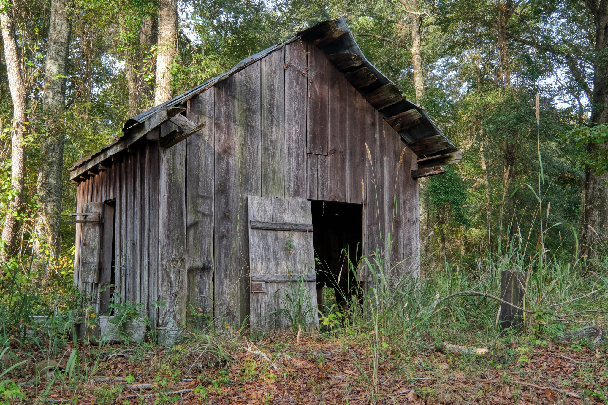
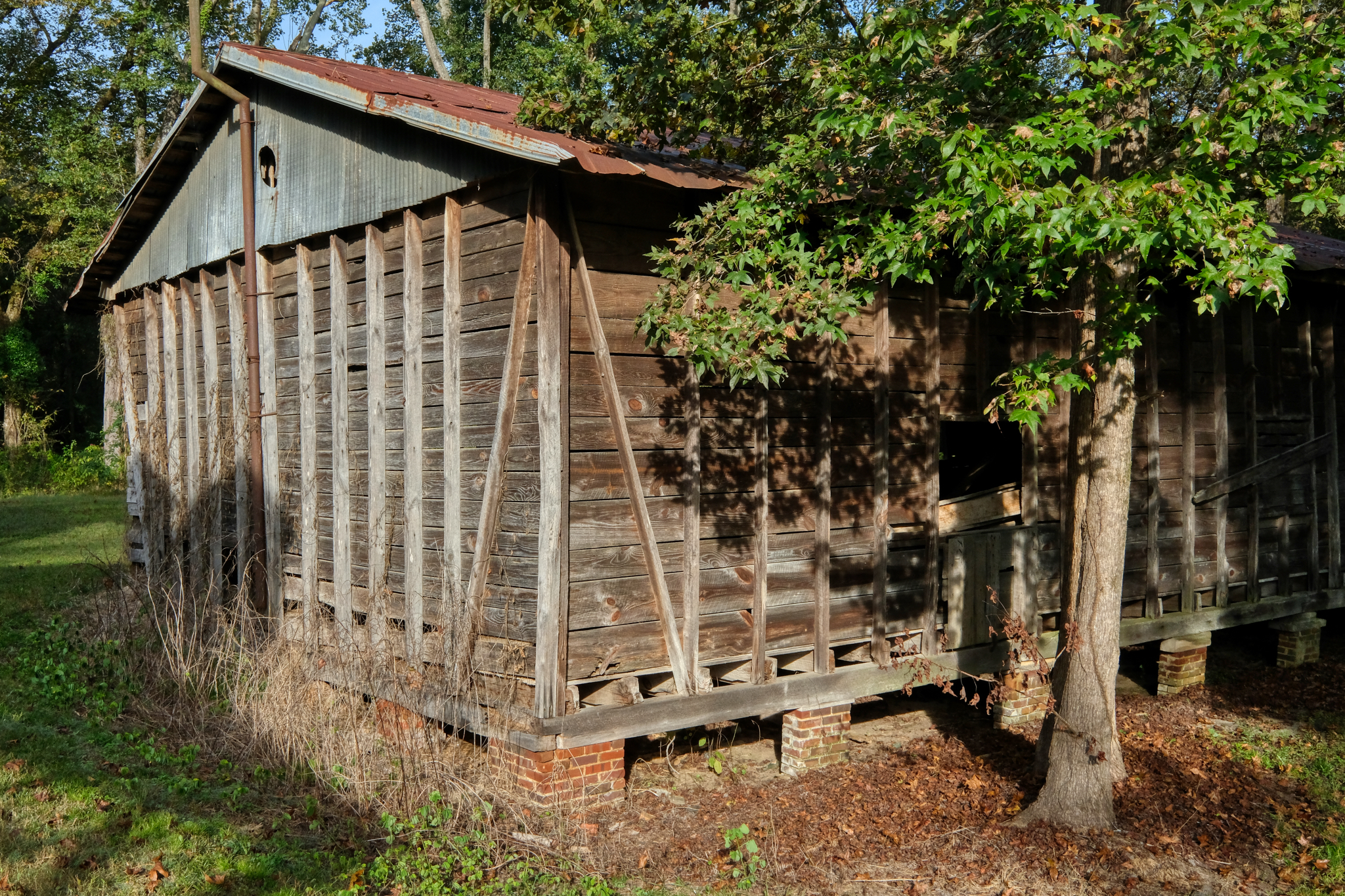
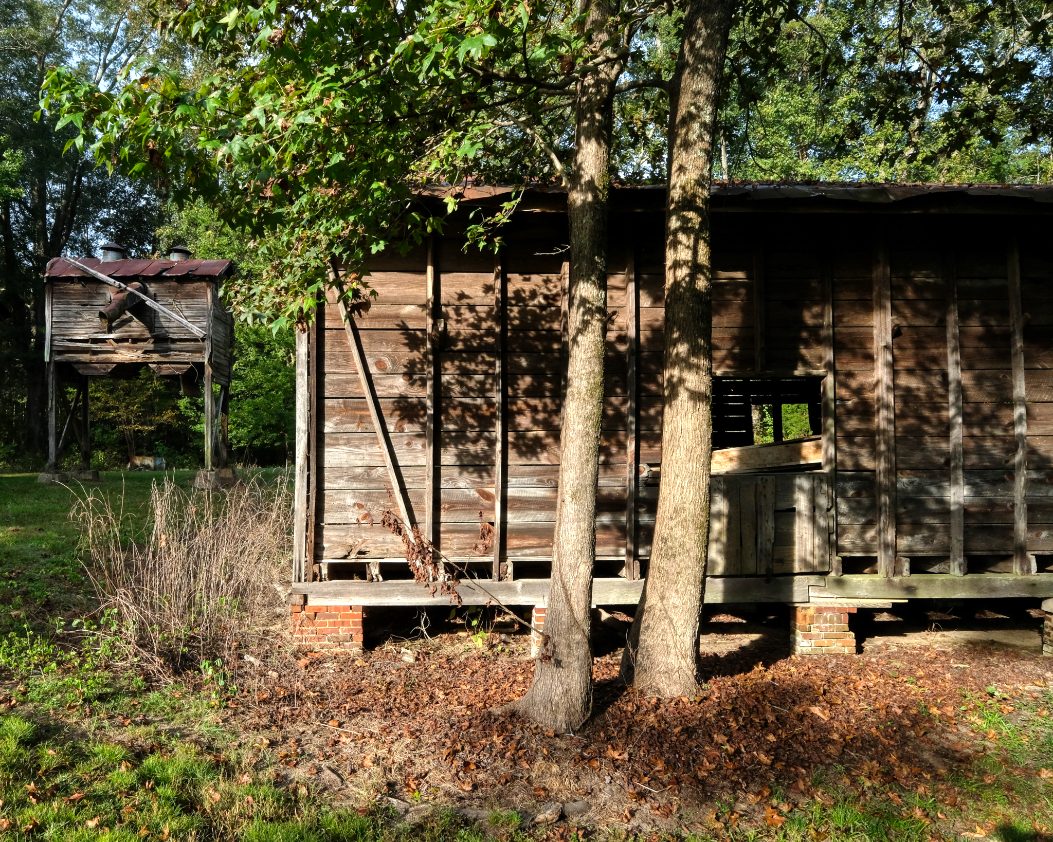
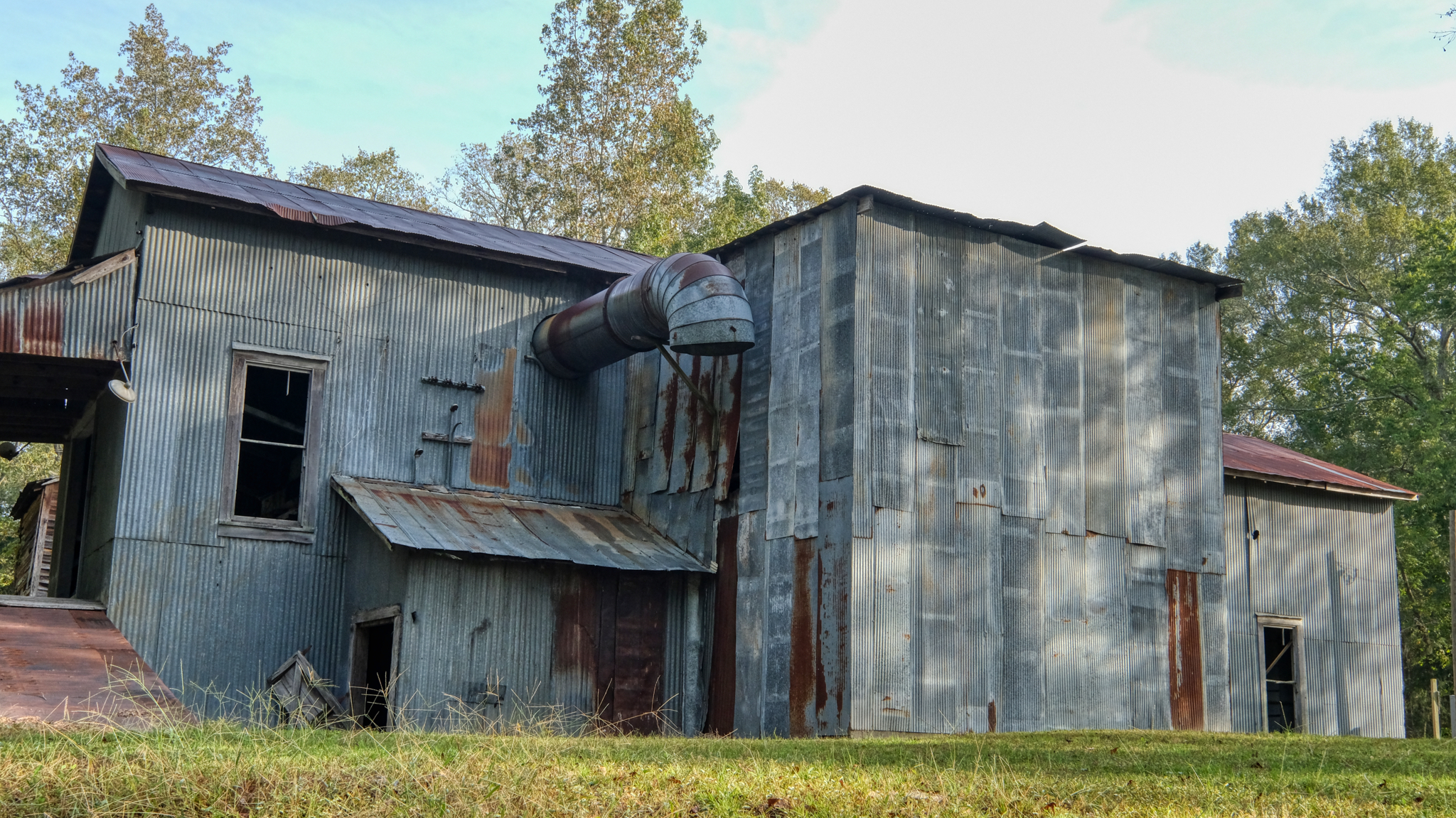 There was also an old "mill" of some kind behind the store. I decided to snoop around a little. An absolutely gorgeous corrugated building.
 This door to the mill was locked . . . but what a photo!
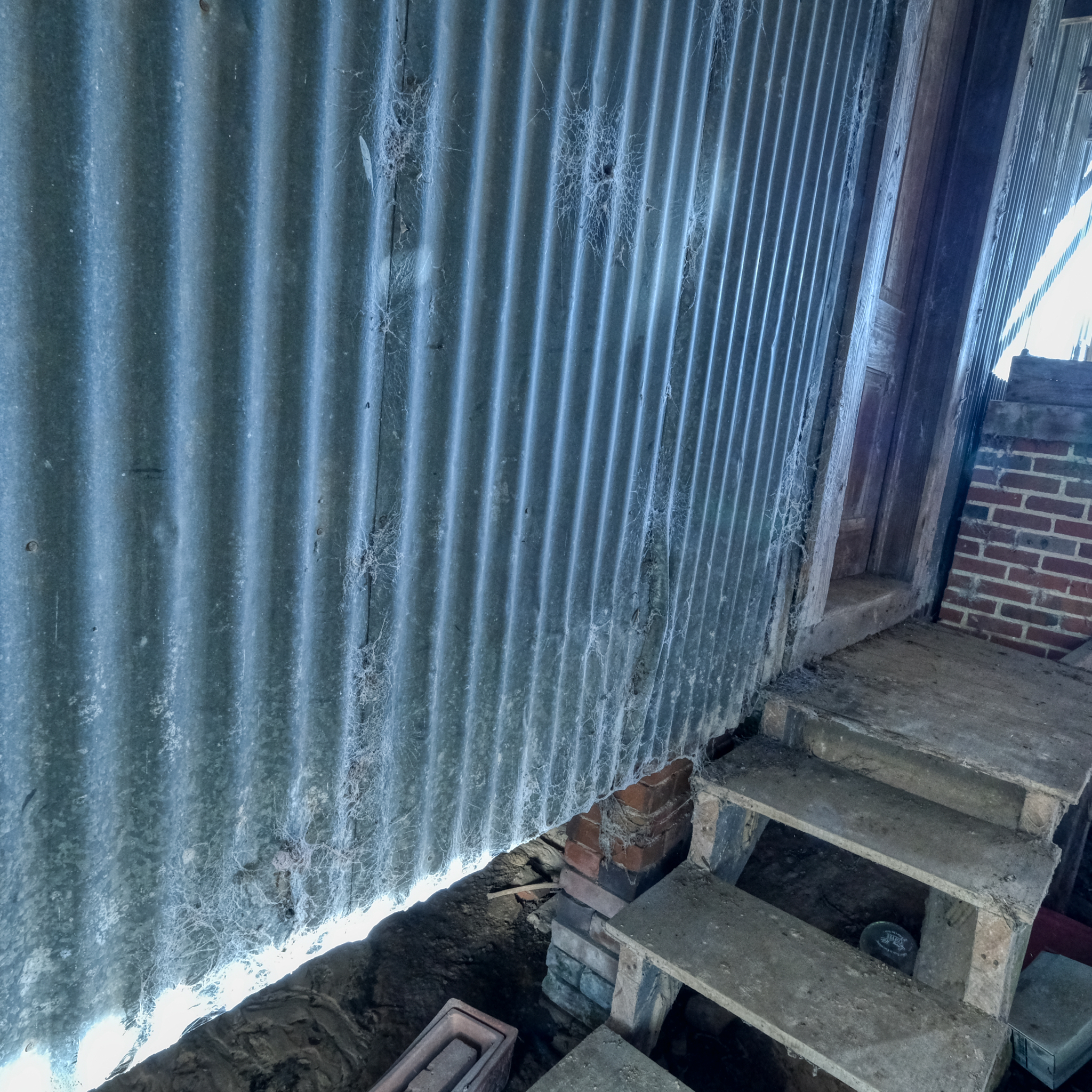
 This door was locked from the inside.
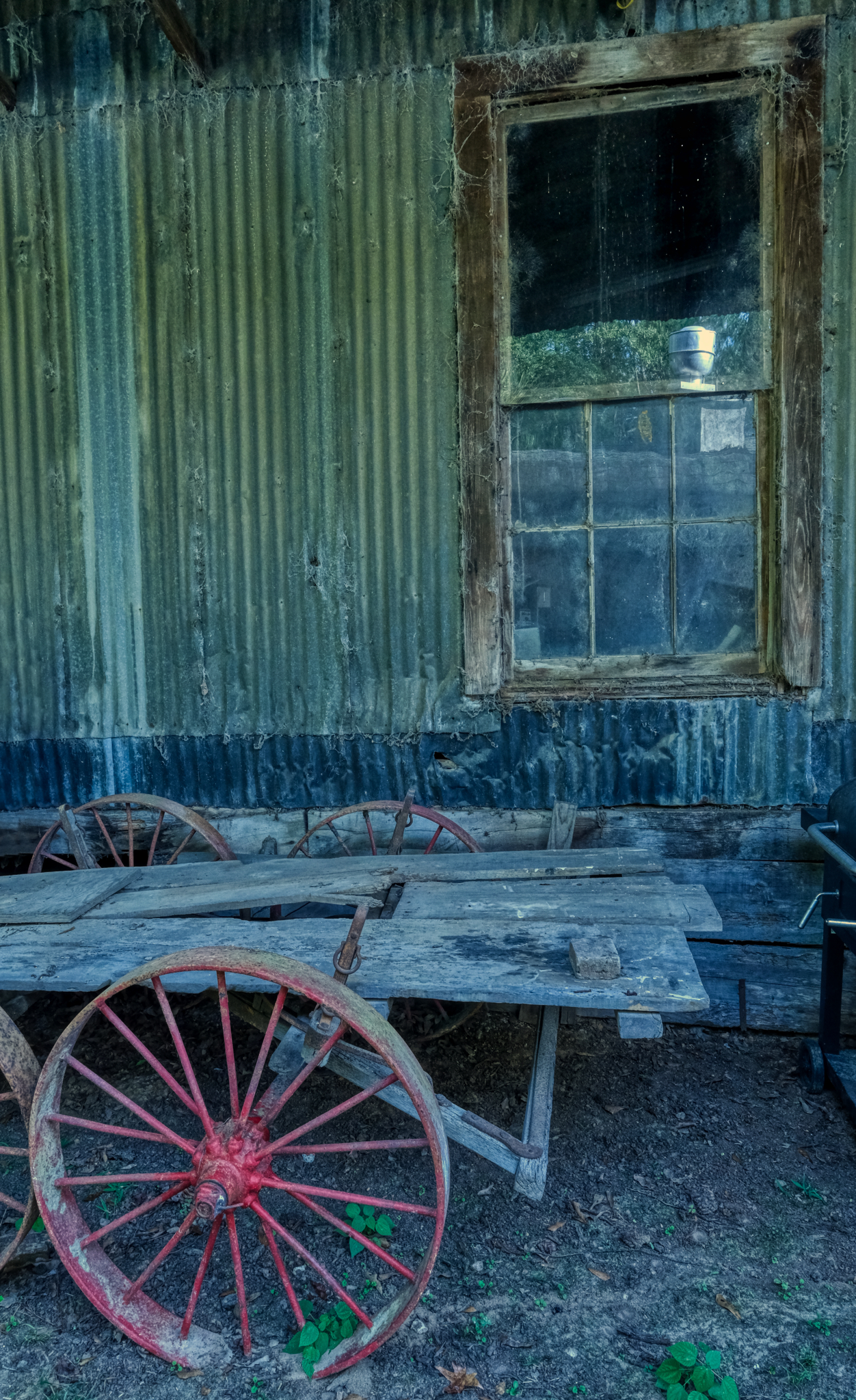 This image! The things in this photo were made, manufactured, built, and assembled by somebody working somewhere at some real time and place in the past. That cart was made for the purpose of moving around more than one man can hold at once. It is also a tool of work . . . it was the focus of labor for some person as a part of their paid employment, day after day.
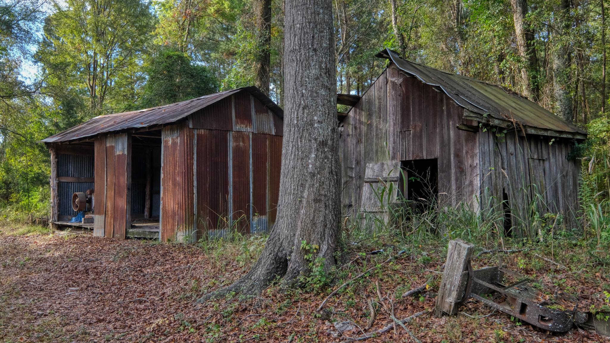
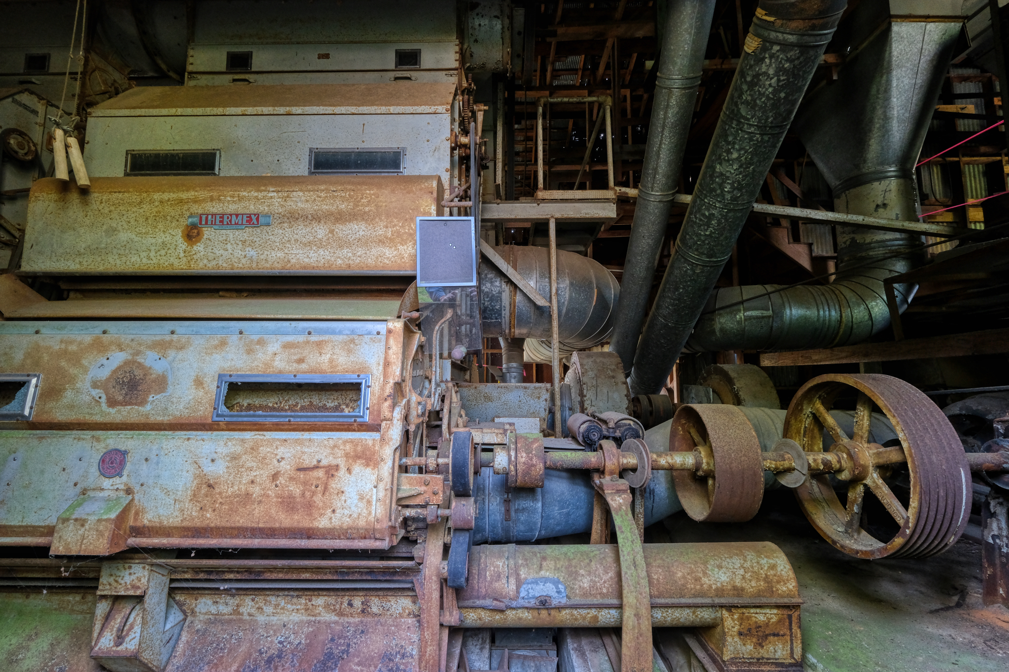 At last I found a large opened door on the side of the mill. This machinery was inside . . . I snooped around more inside, but for the life of me, I could not figure out what this machinery was used for. I even did a Google search . . . my guess was that it was a corn grinding operation at some time in the past.
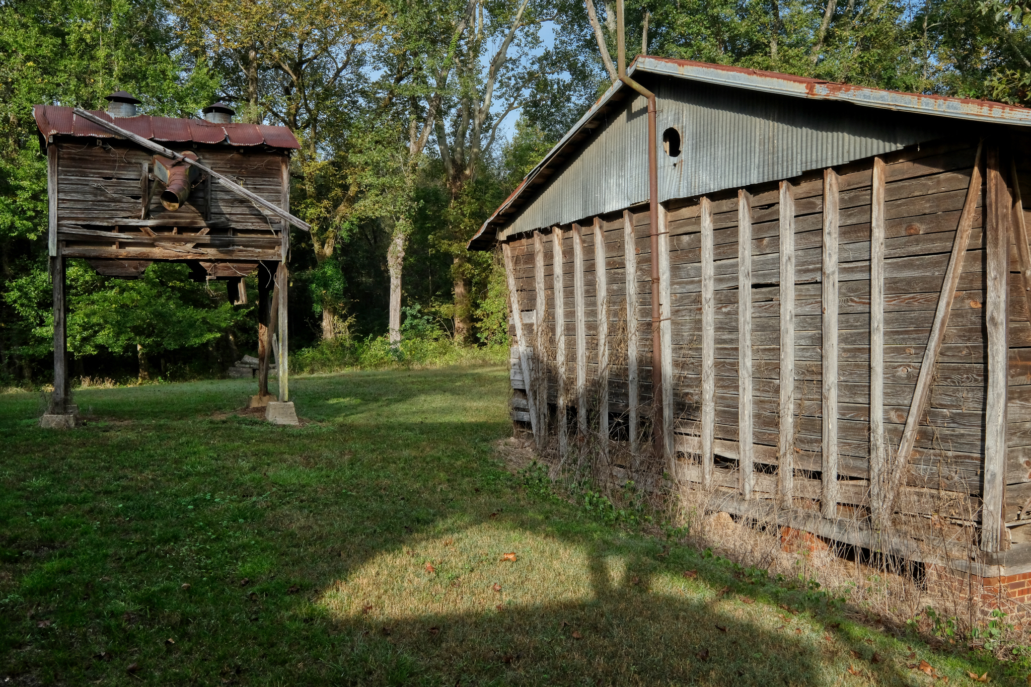 These structures next to the mill were hints as to the purpose of the mill. One looks like a 'corn crib,' but I am not sure.
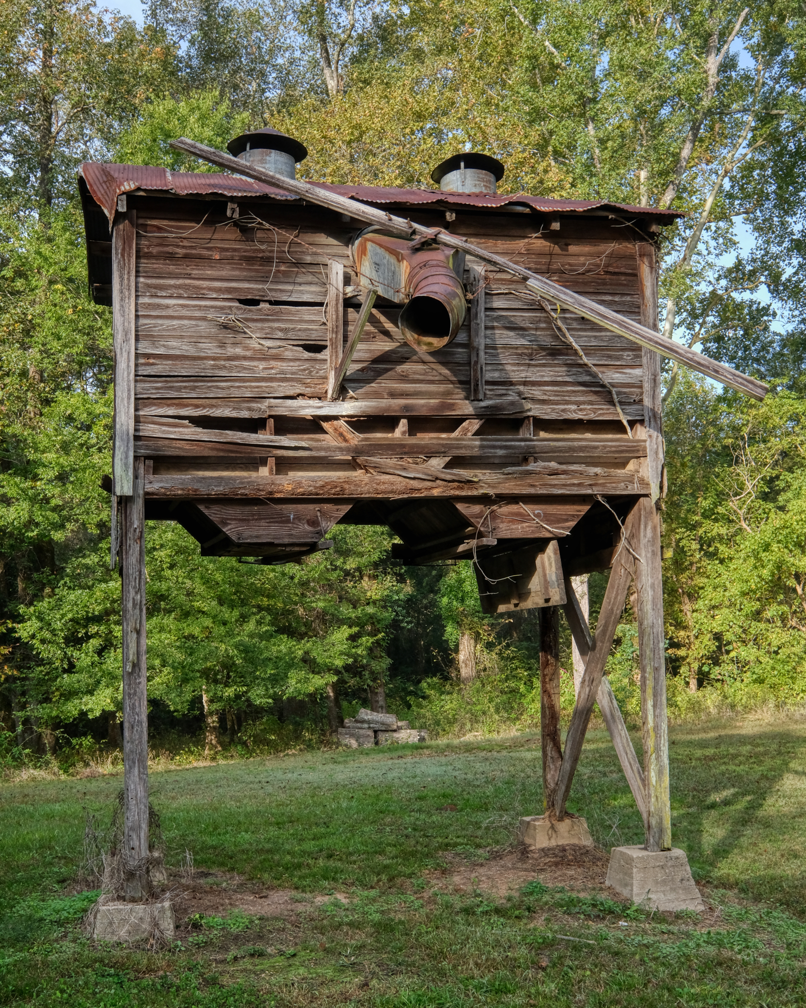 Was ground corn meal blown up into this hopper for loading into trucks or barrels? I don't know, but I loved the aged patina of the weathered wood . . .
 The sun broke through a thin cloud cover and the light became wonderful.
 Perhaps rooms for the hired seasonal mill workers?
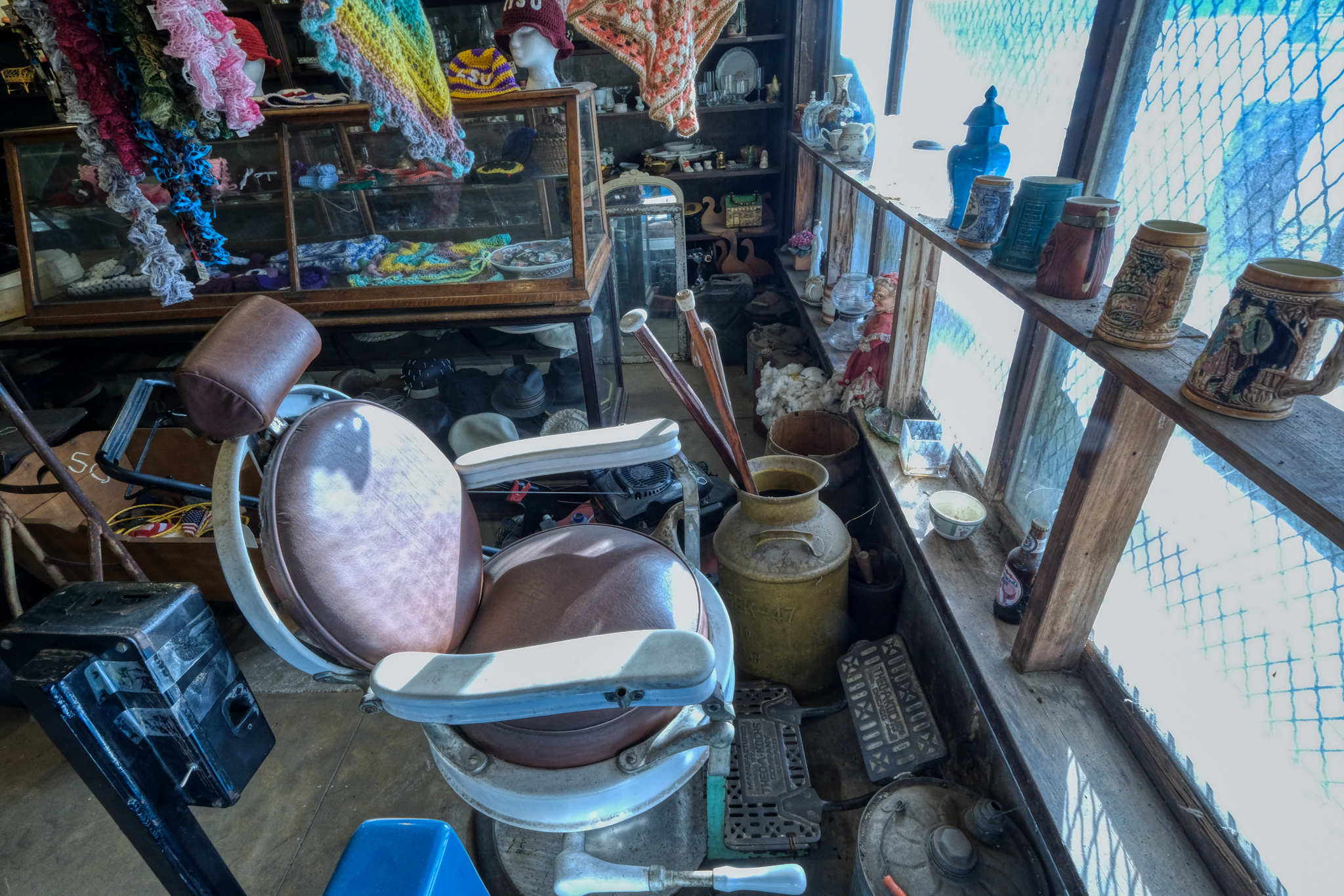 I hadn't noticed this barber chair on the way in . . . but . . . I could have spent all day in that old country store and its outbuildings . . . but Bud and I had to hit the road. We were heading for a place of great historical significance; Selma, Alabama, a place I have always wanted to make a pilgrimage.
USA Road Trip: Moab & Dead Horse Point, Utah
My year-long USA camper road trip/sabbatical continued on from Winslow, Arizona to Moab, Utah. Early October 2018.
 Rain. Yes, it rains in the desert.
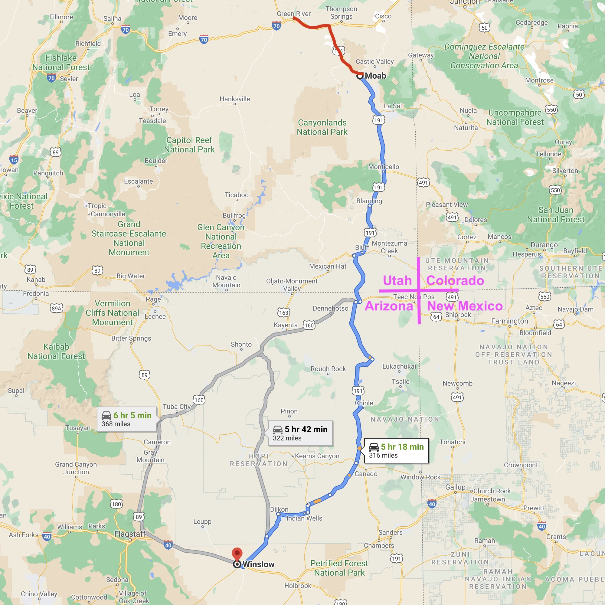
After an all day drive from Winslow, Arizona - through beautiful desert country in the Four Corners area of the American Southwest, I arrived in Moab, Utah in the middle of a major rain storm . . . record rain and a danger of flash flooding. I wanted to stay a night in a motel rather than in my camper . . . dry and warm. I Googled motels in Moab, looked up quite a few: all expensive and showing FULL . . . but one . . .
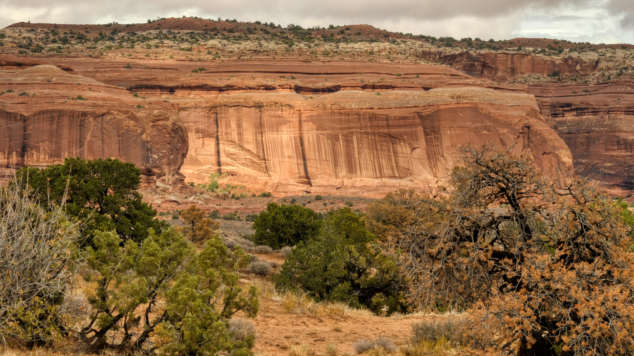 As I neared the town of Moab the rain increased, streaking the red cliffs.
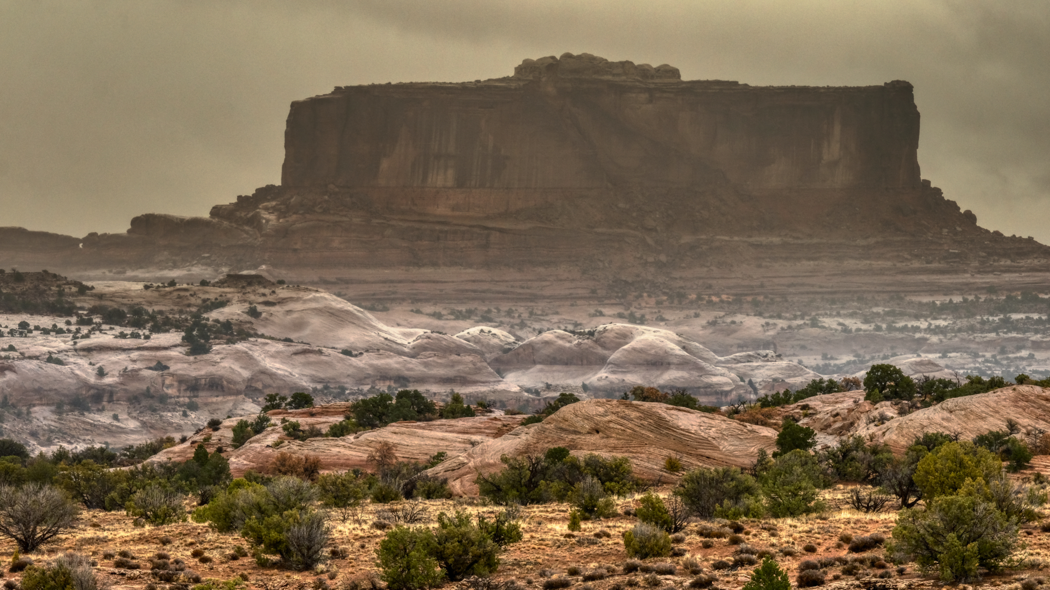
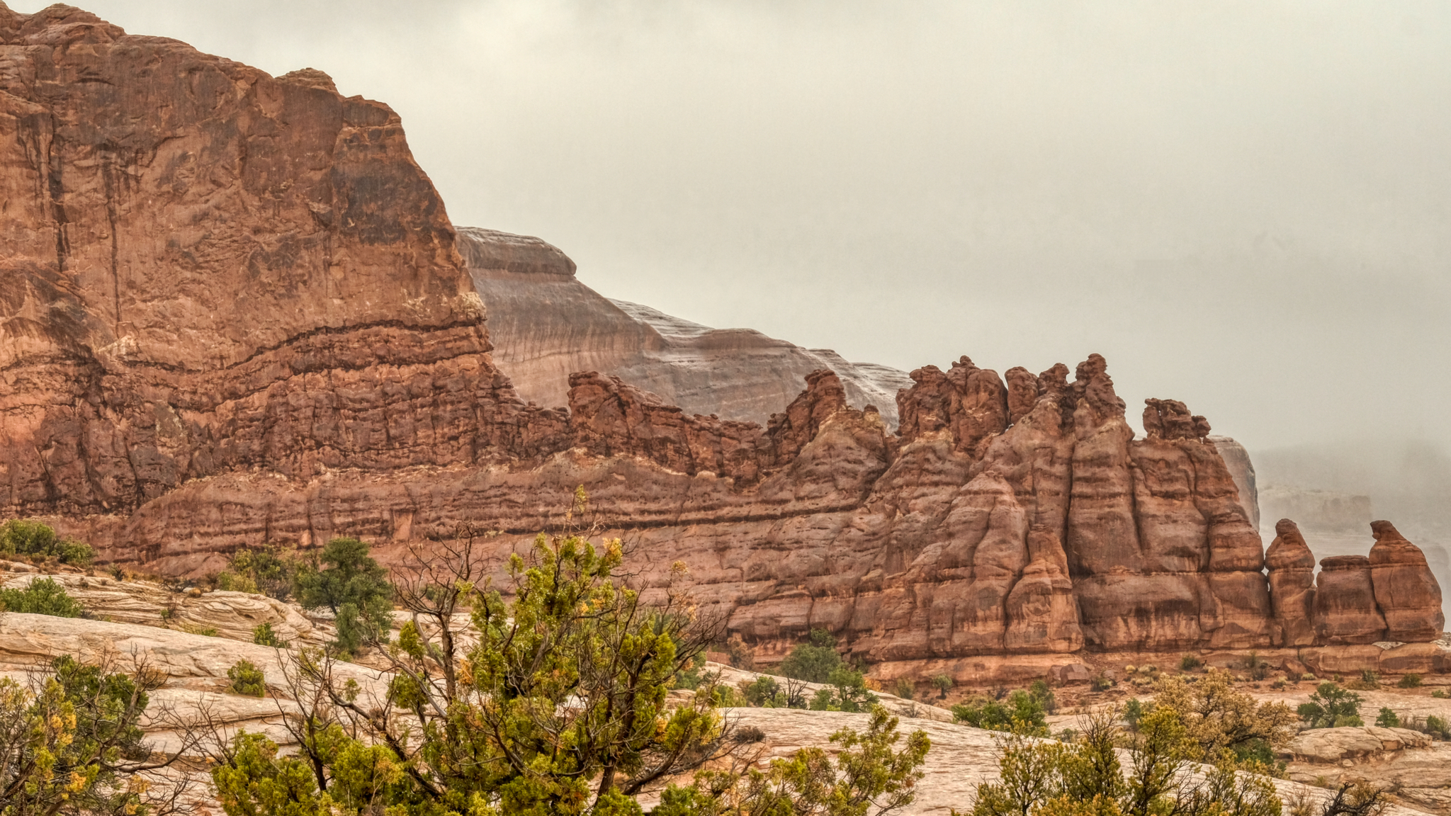 The red rock formations got wetter and wetter as I approached Moab.
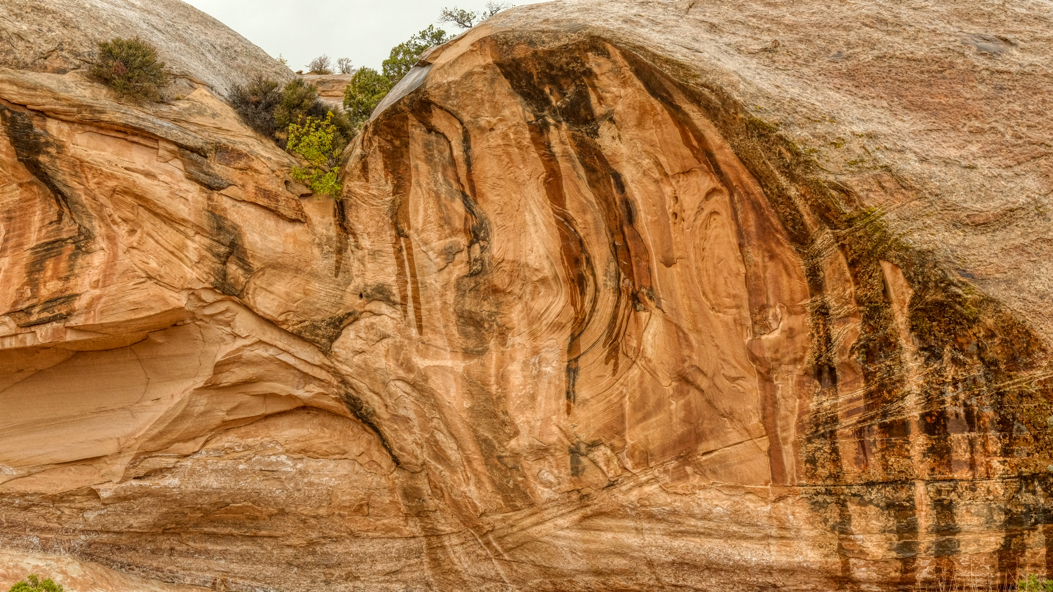 I discovered desert rock formations become even more fascinating when they are wet.
 And the rain continued to come down harder and harder. When I arrived at the only motel showing vacancies in Moab, I found out that the last room had just been taken, but I could come back the next day and stay for two nights. I booked it and went up the highway for 51 miles to Green River, Utah, on Interstate 70 where I found a room for the night.
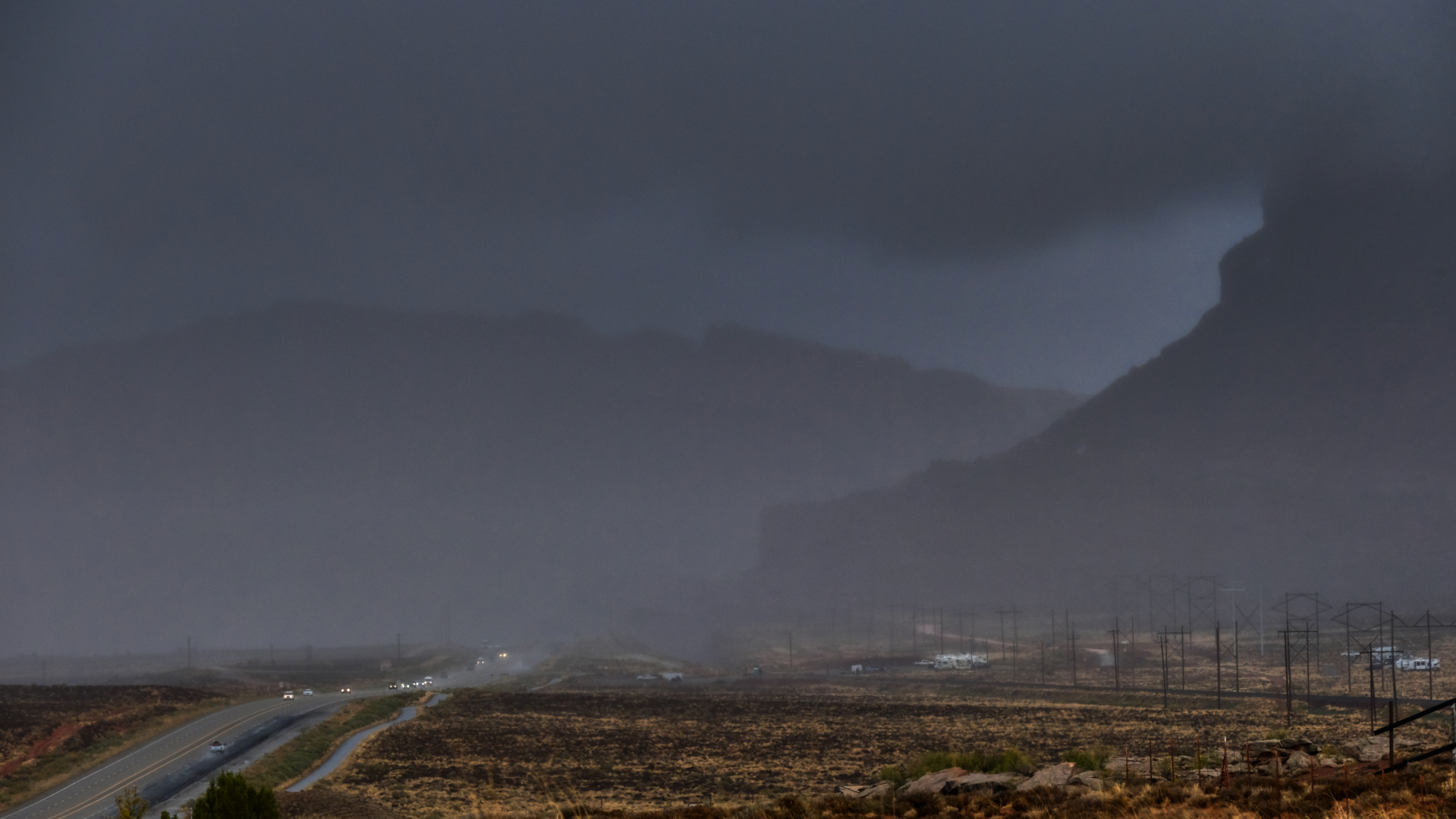 Driving north on Highway 191 out of Moab in a driving rain storm.
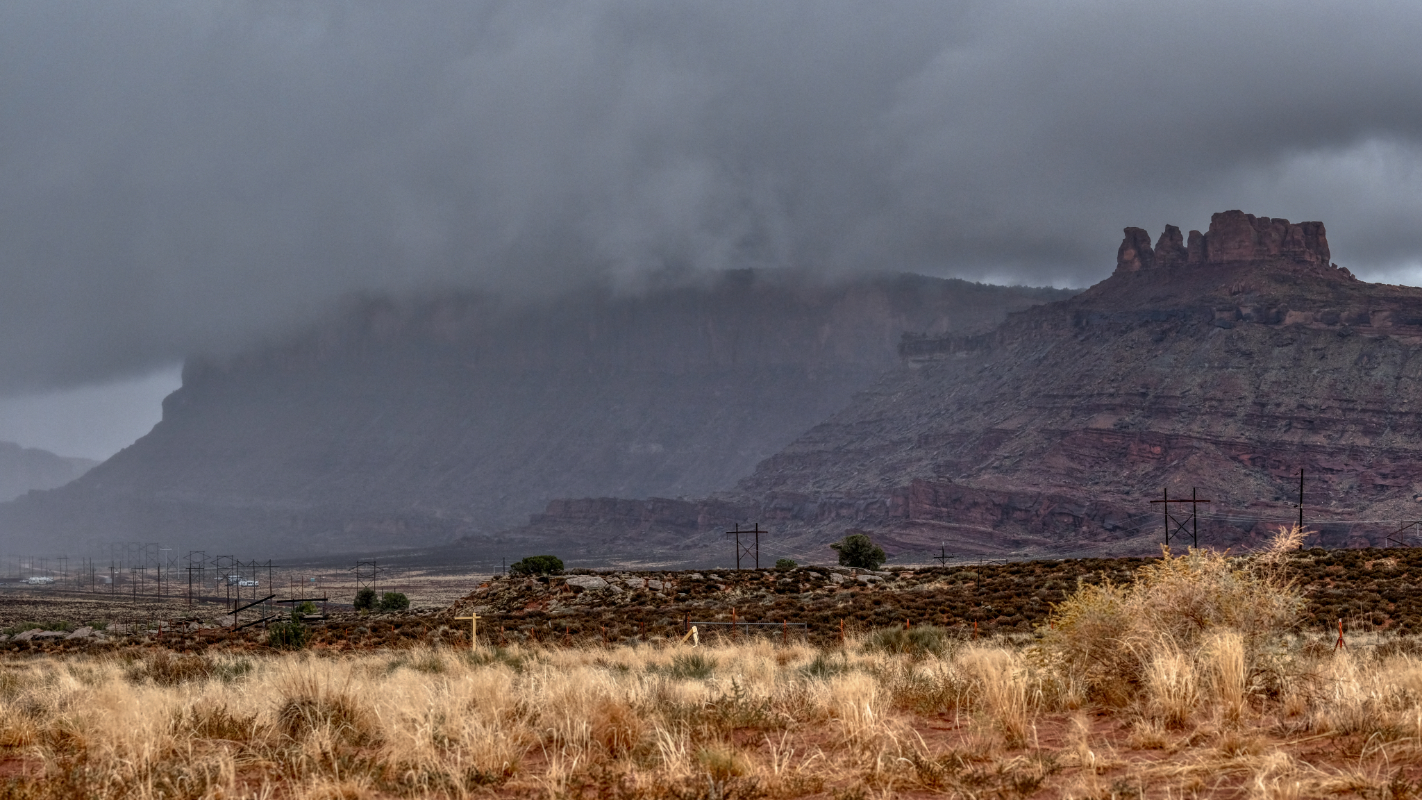 Water poured off of the mesas and buttes.
 After a Sunday night in a Green River, Utah roadside motel (where I was able to watch an NFL game), I drove back to Moab to check for motels there . . . still in a light rain. I found one and sat out the day on the internet and watching Monday Night Football, as the rain became heavy all day. The next morning it was cloudy, with clear spots, so I headed to an RV park and bought a slot for camper next to a German couple who had been on a one year camper road trip in the USA.
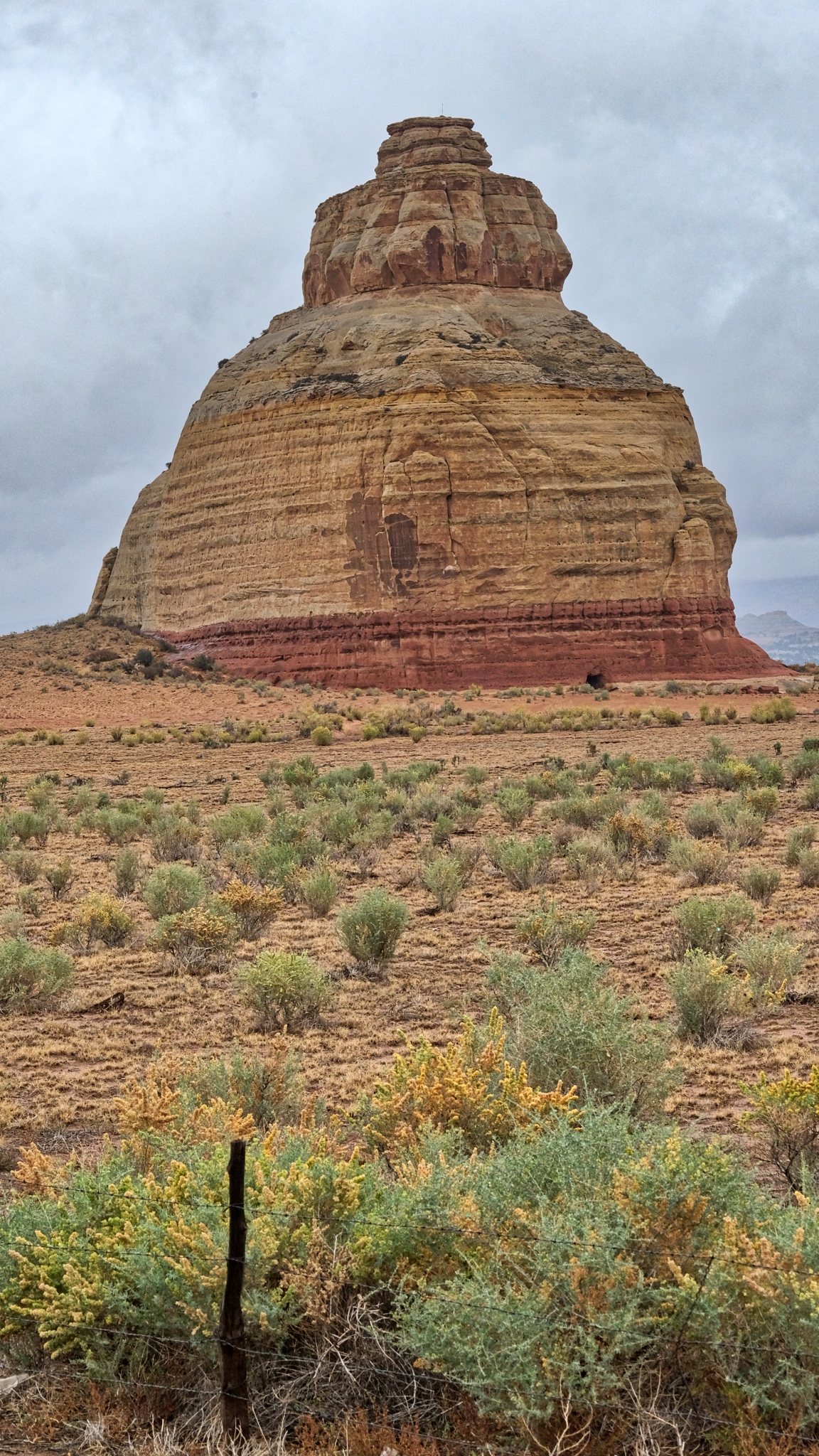
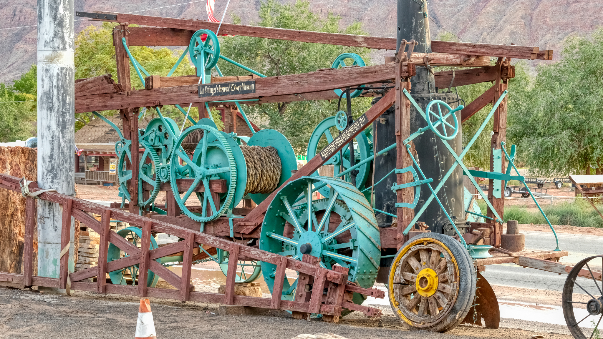
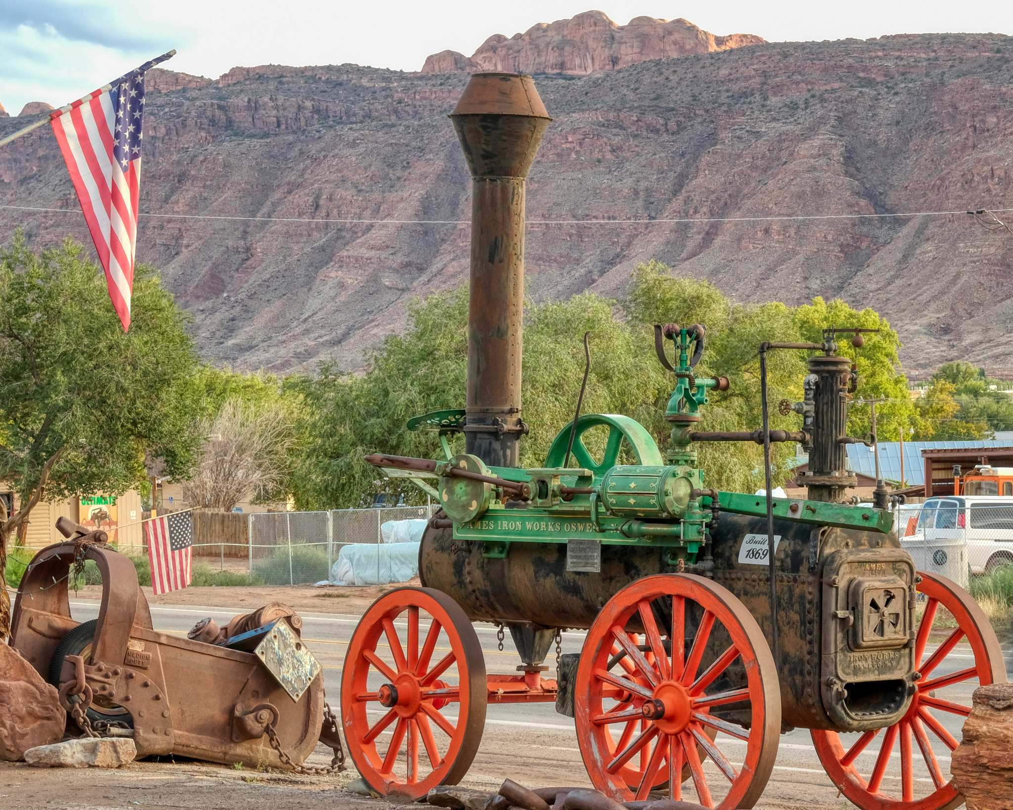 Moab is the "Outdoor Adventure Capitol of the USA" . . . and also a very interesting old mining town. I stopped in a gems and fossil shop to look for dinosaur fossils for my grandson at a place that had lots of antique mining equipment laying about . . .
 . . . an old mine winch . . .
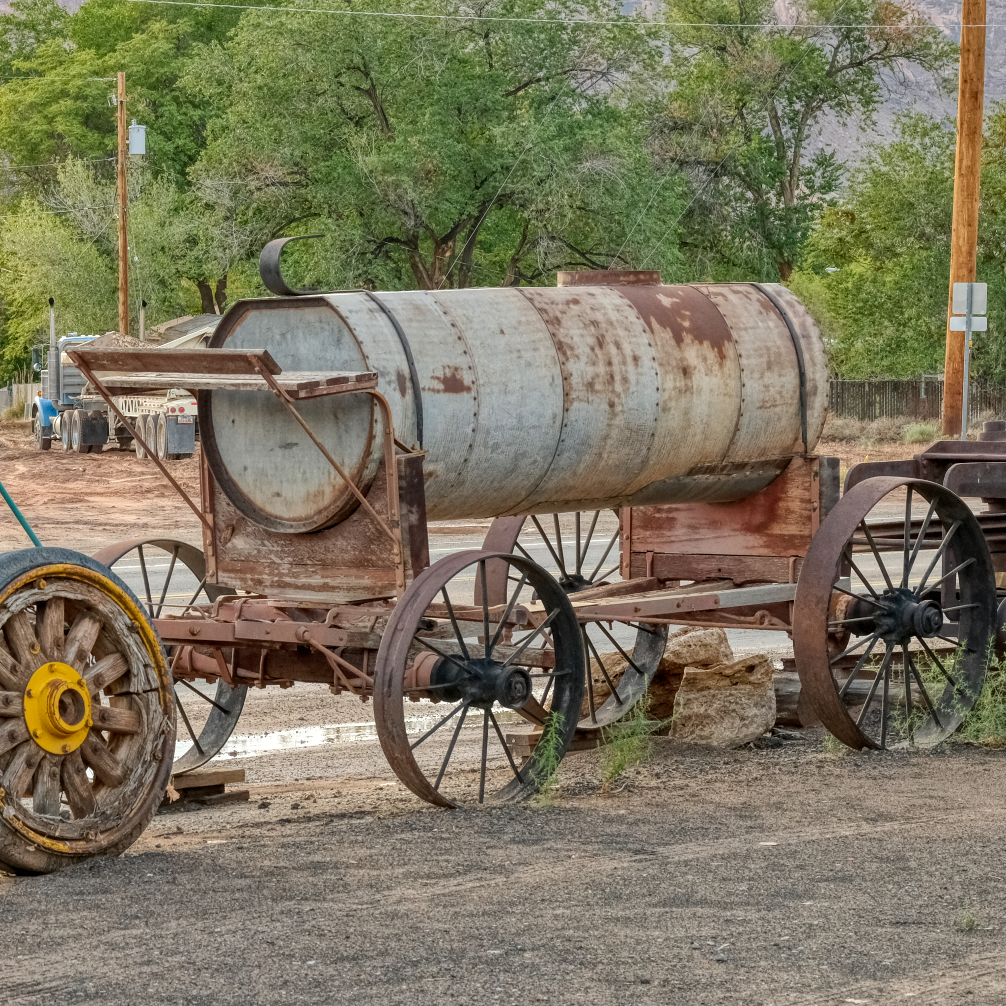 . . . a water wagon that once services a long forgotten mining operation.
 The good people in the rock shop advised that I go and see Dead Horse Overlook State Park, about 20 miles out of town . . . and through fantastic high desert chaparral country.
 The small paved road out to Dead Horse Overlook was GRAND!
 The sky became very dark and I was worried that I would lose another day in bad weather . . . I pushed on to Dead Horse Overlook.
 As I neared the overlook I knew I was in for something truly wonderful.
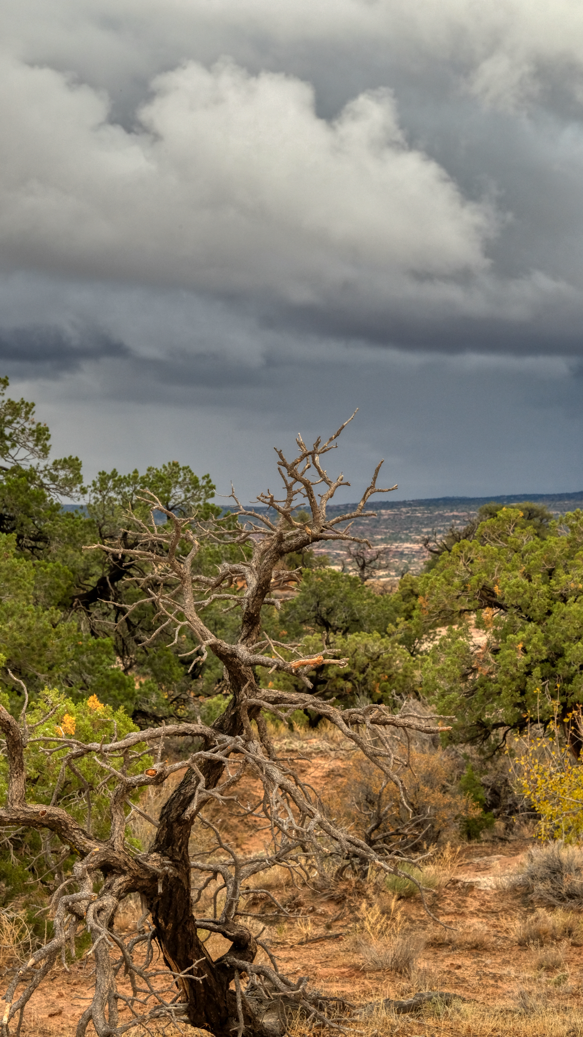
 Now and again I would get a glimpse through the roadside shrubbery of a grand landscape . . . .
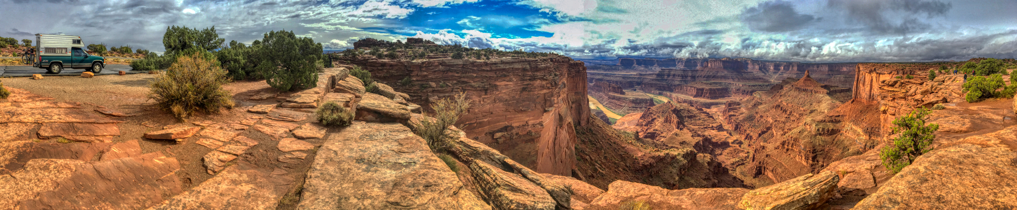
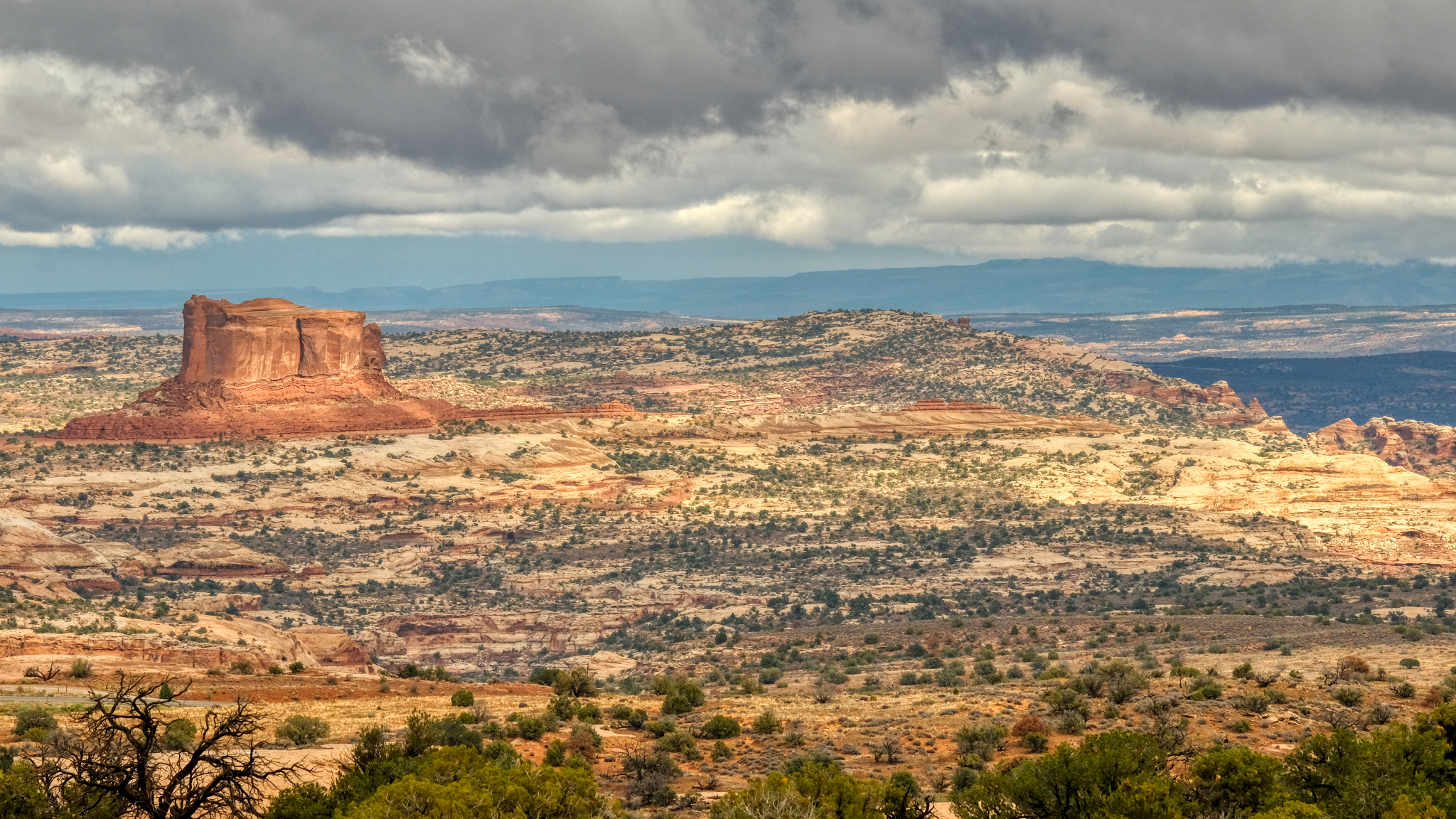
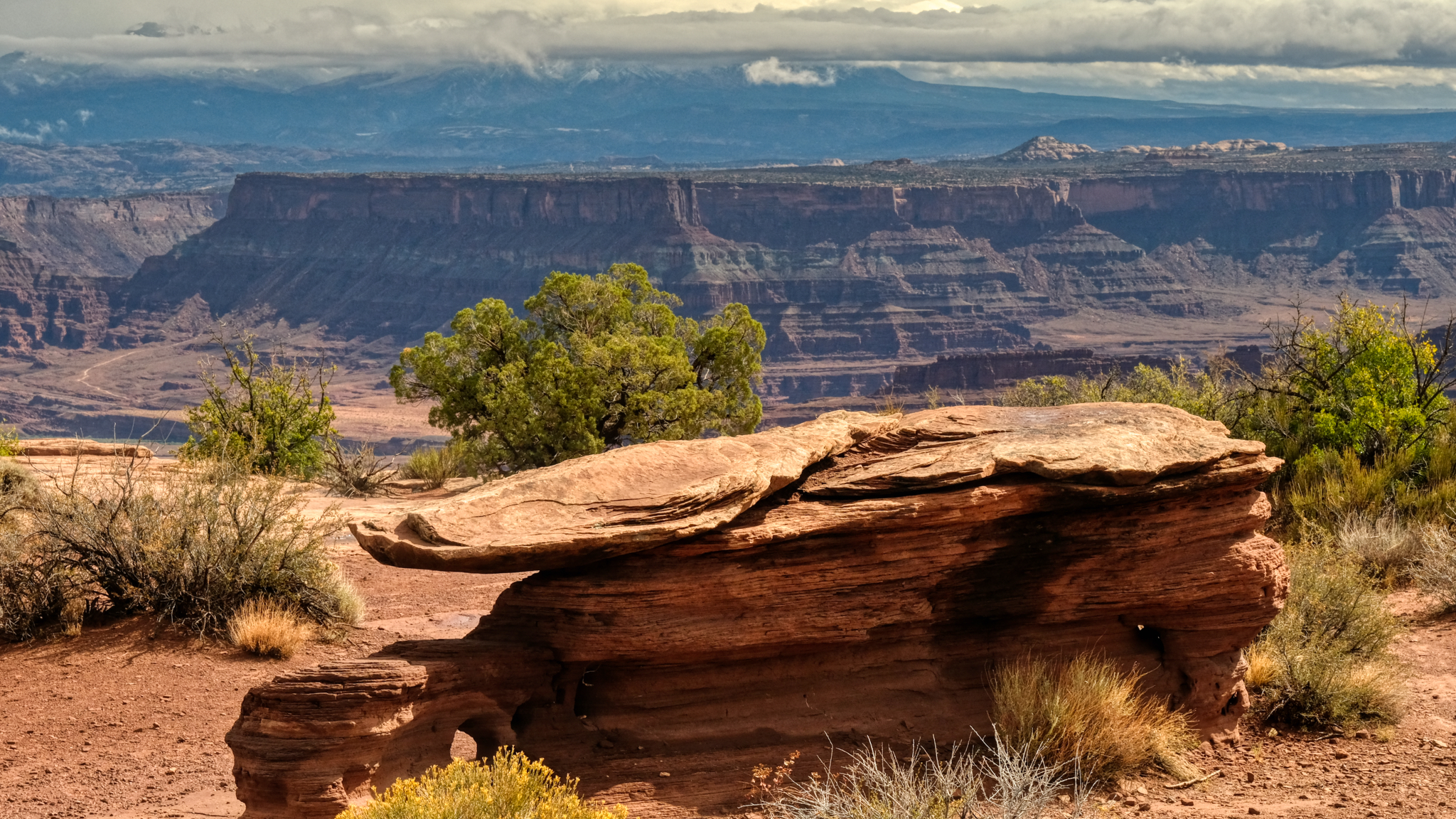
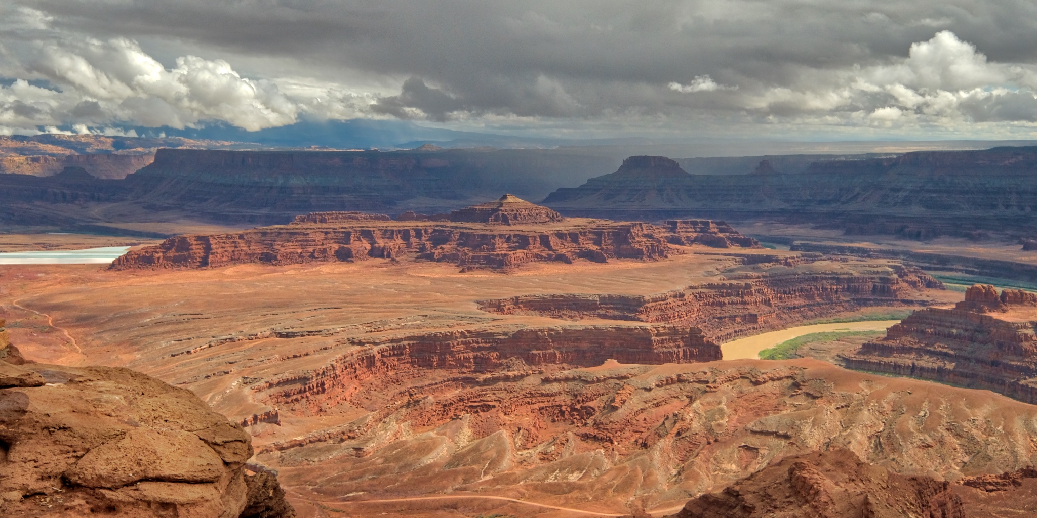
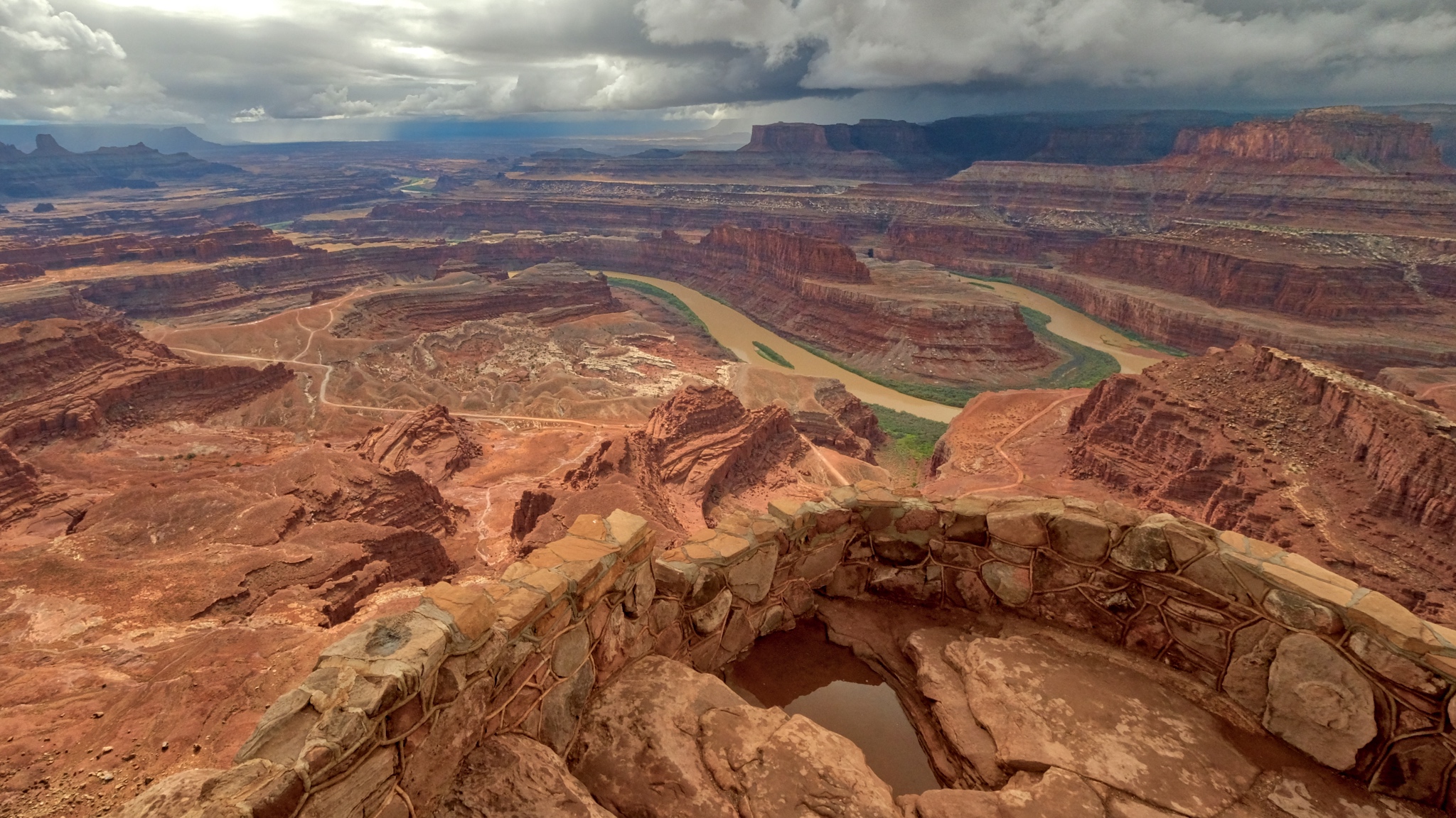
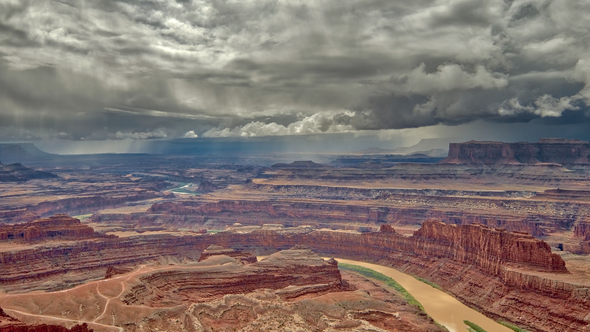
 When I finally arrived at Dead Horse Overlook I parked right next to the precipice of this amazing sight! The grandest view I have ever seen! I was parked out on a ridge that jutted out into this spectacular canyon! There was a 300 degree view from where I stood. This view is looking north.
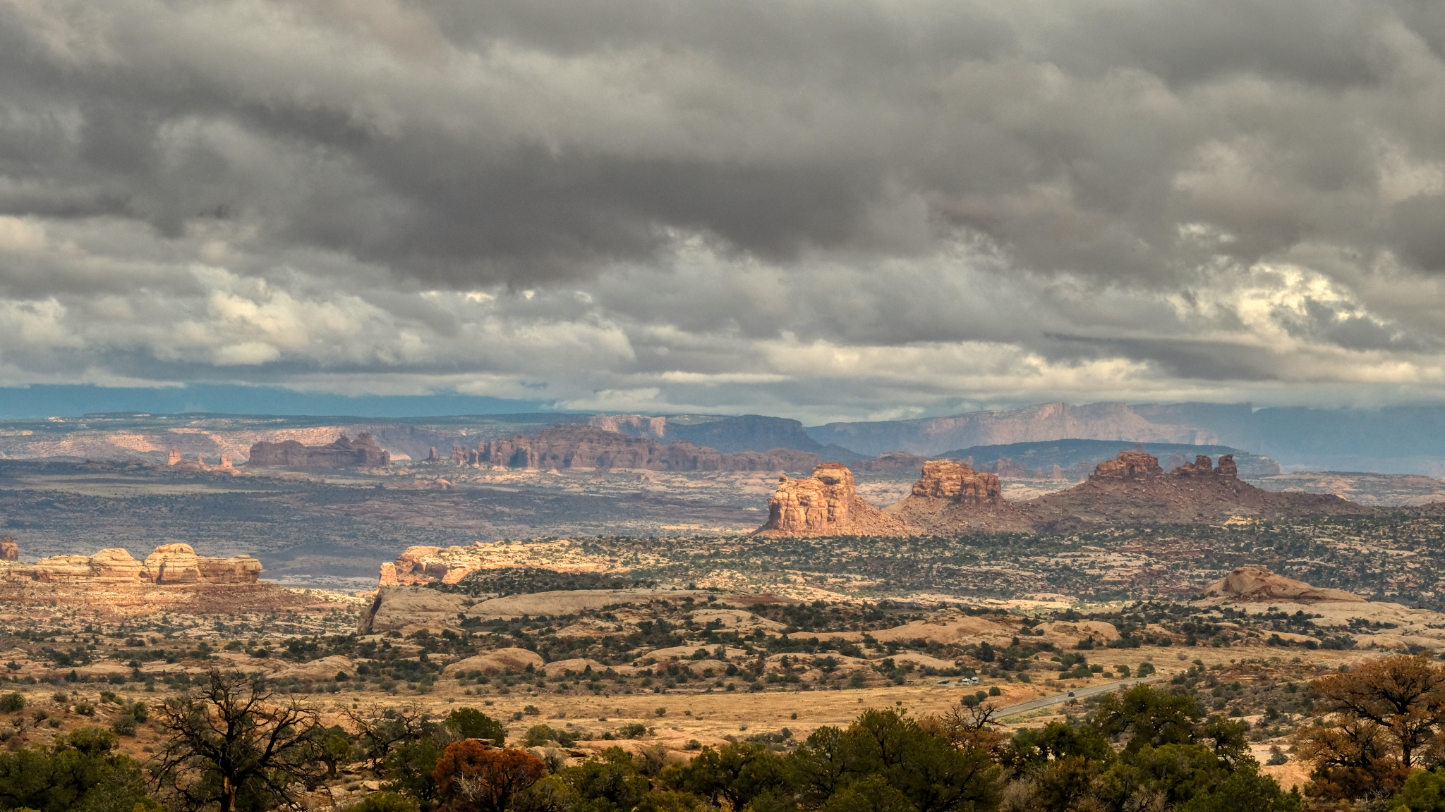
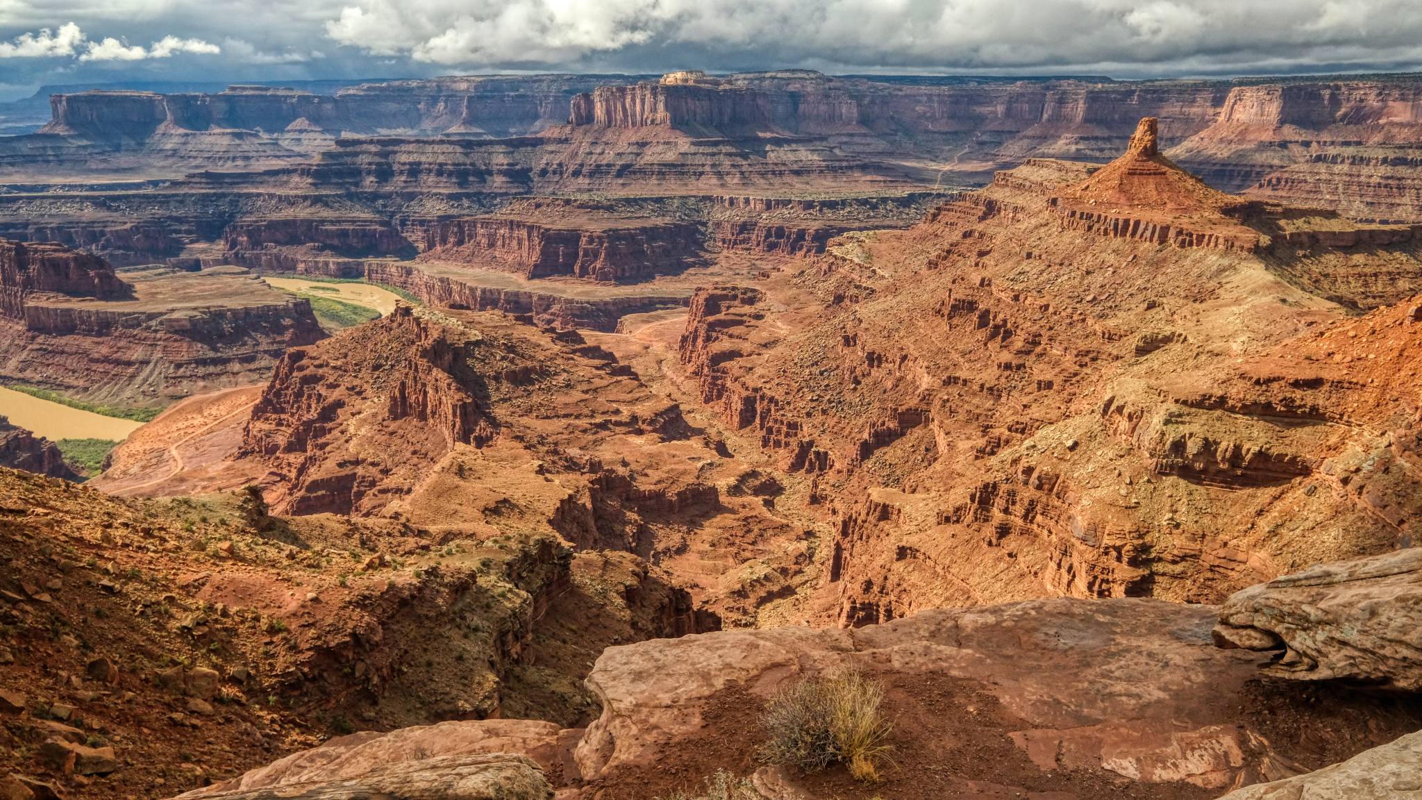
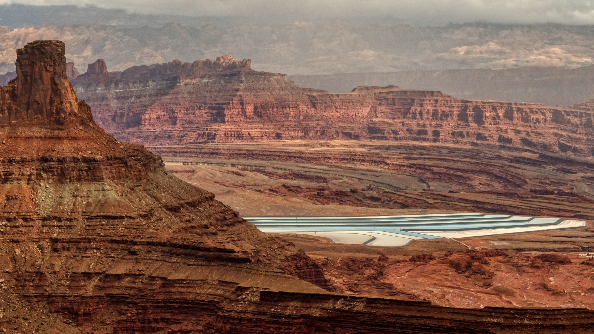
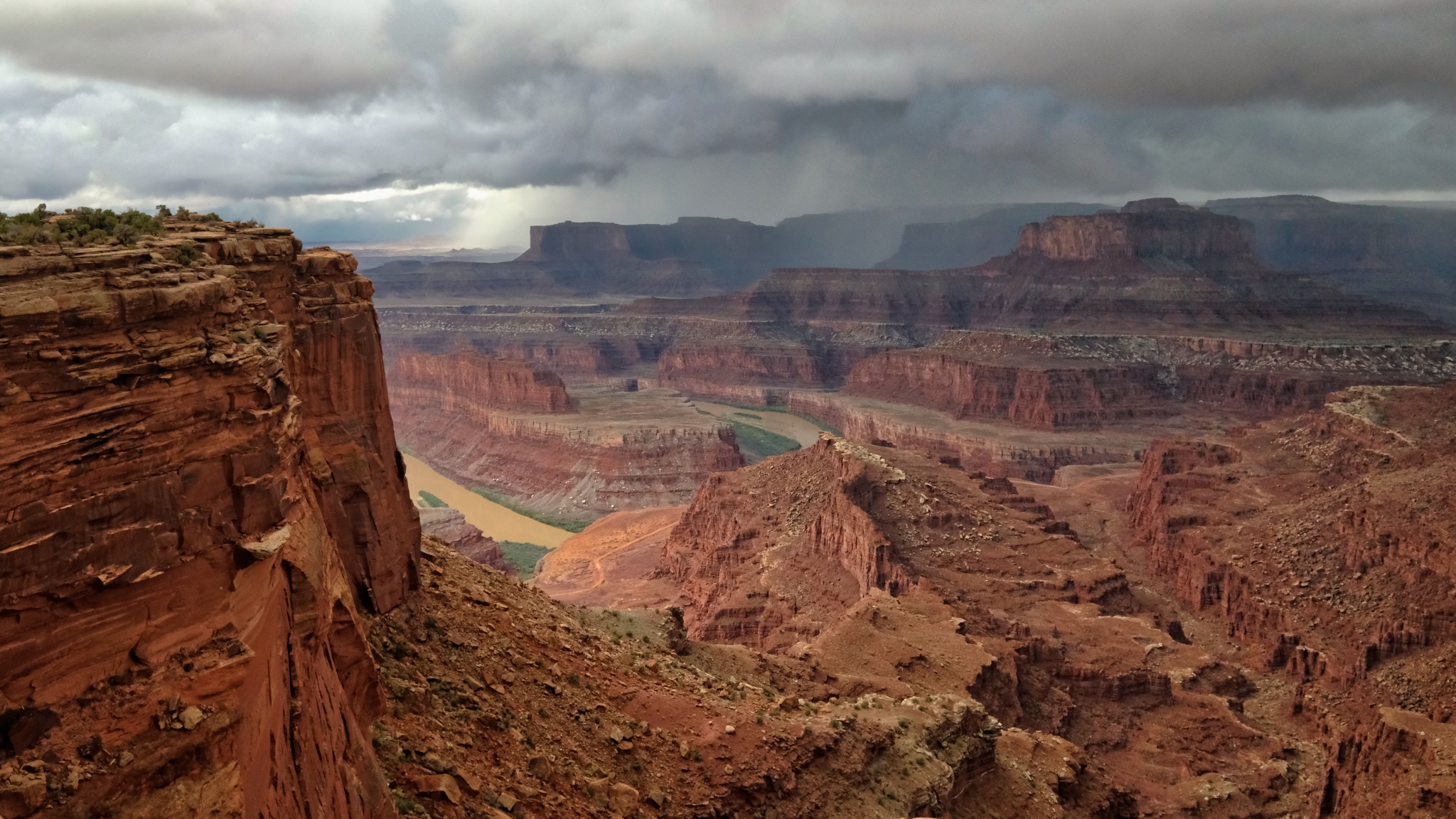
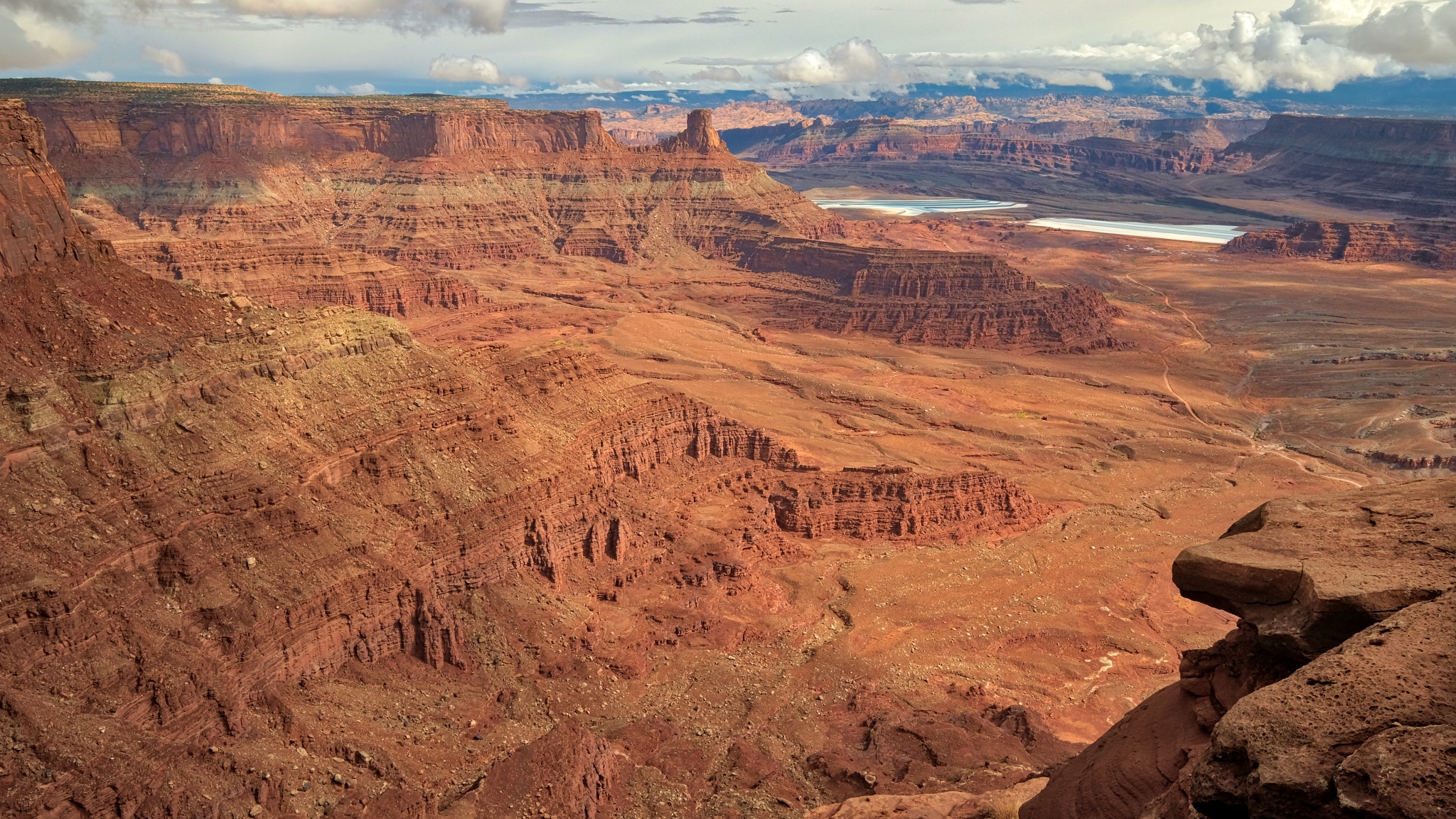 I walked across the road to this south facing view of the mammoth canyon!
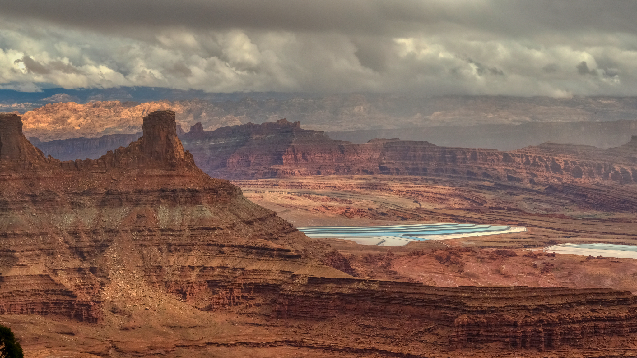 Potash evaporation ponds could be seen in the distance in the south side view.
 I was left speechless by the grandeur of this place . . . and so were the 15-20 other tourists there . . . walking around very slowly with their mouths open . . . in complete silence.
 Astonishing beauty.
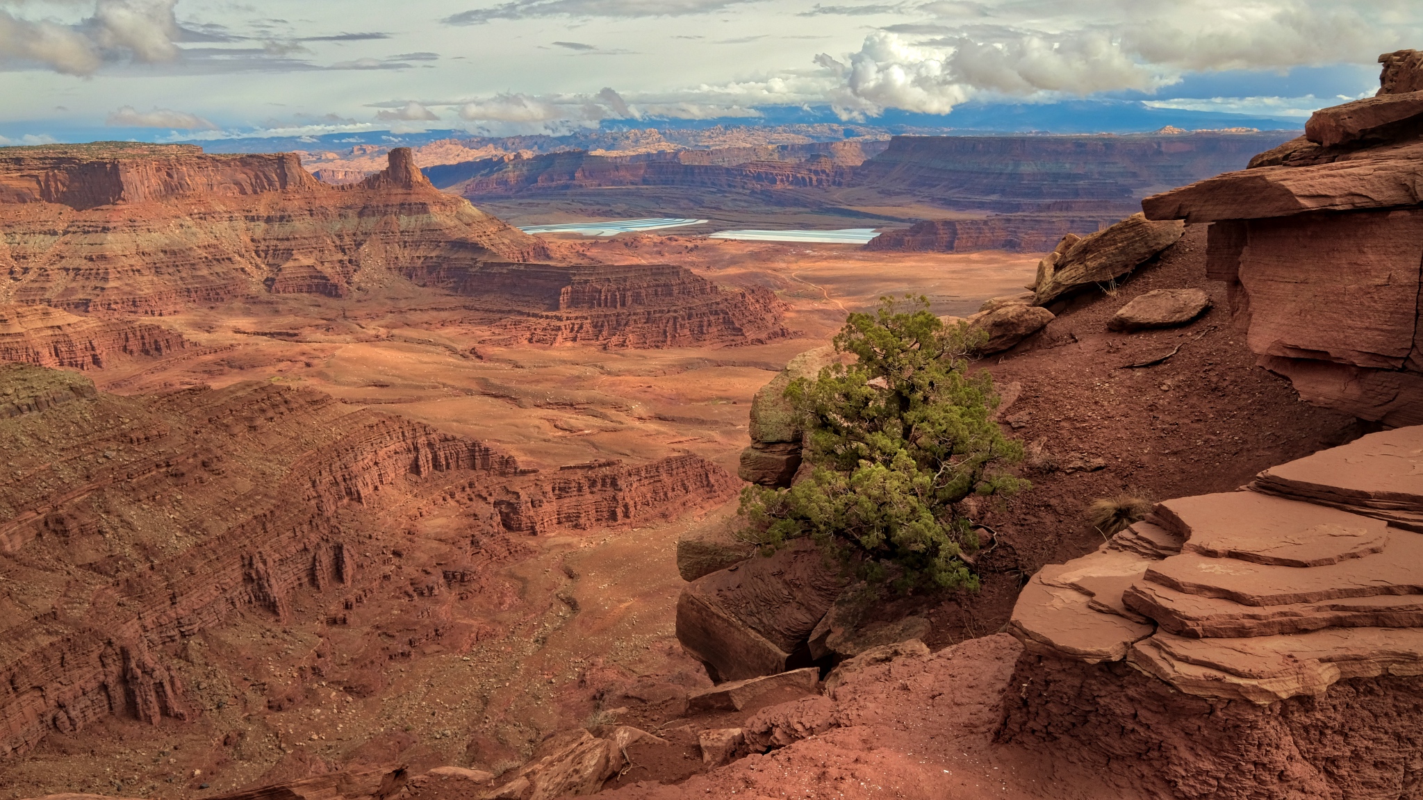
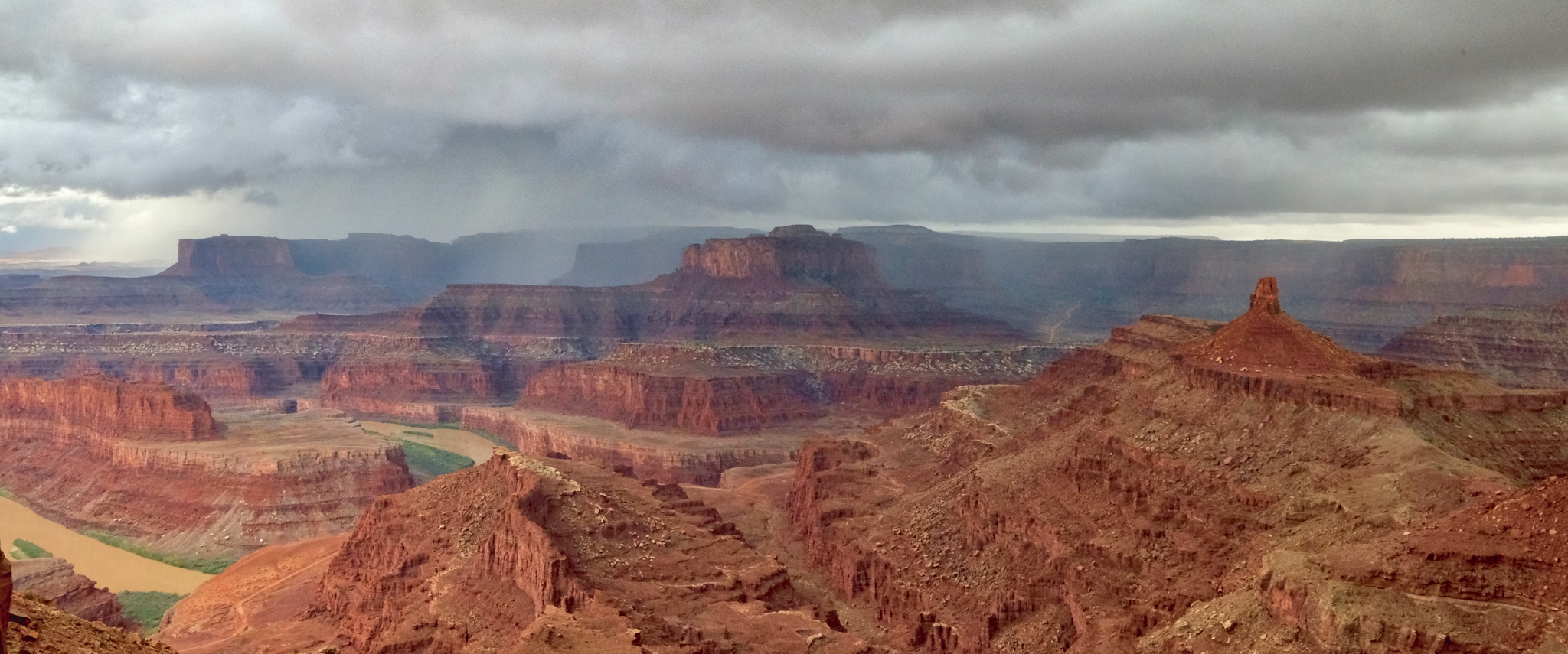
 I walked along the south edge toward the outermost point of the ridge . . .
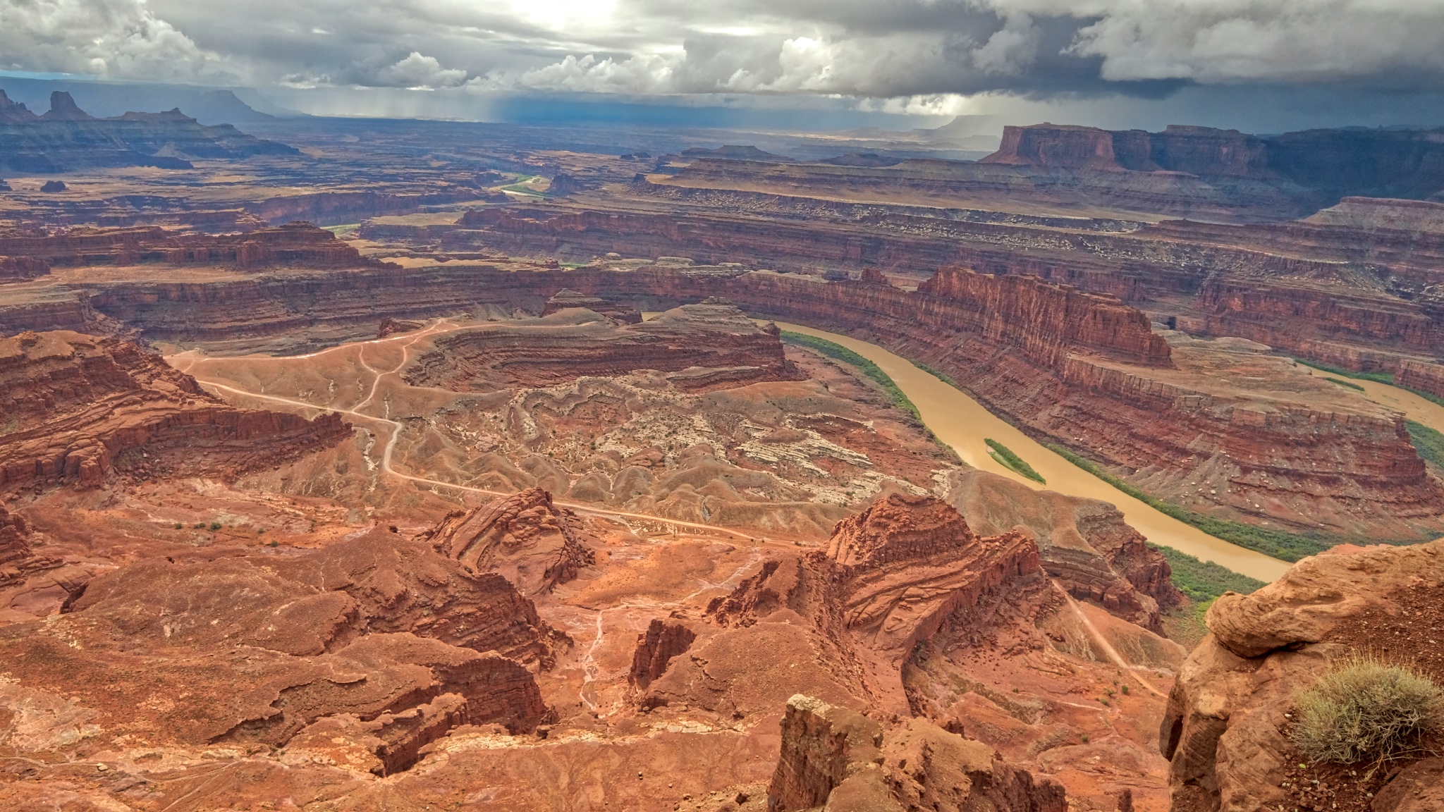 A meandering Colorado River cuts its way through the red rock.
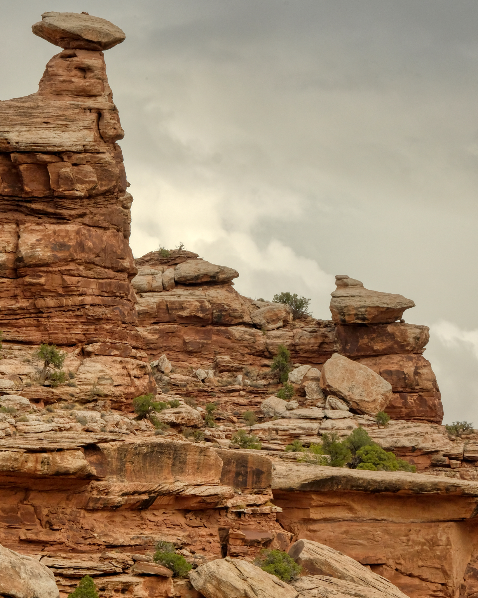
At last I stood out at the end of the ridge . . . with the entire canyon below . . .
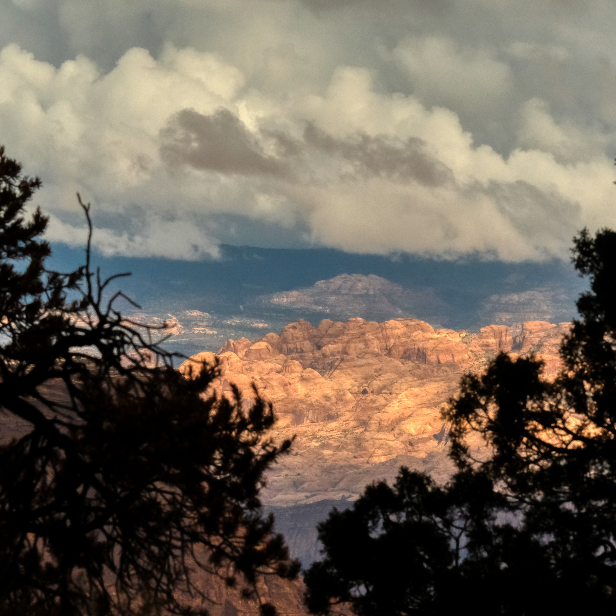
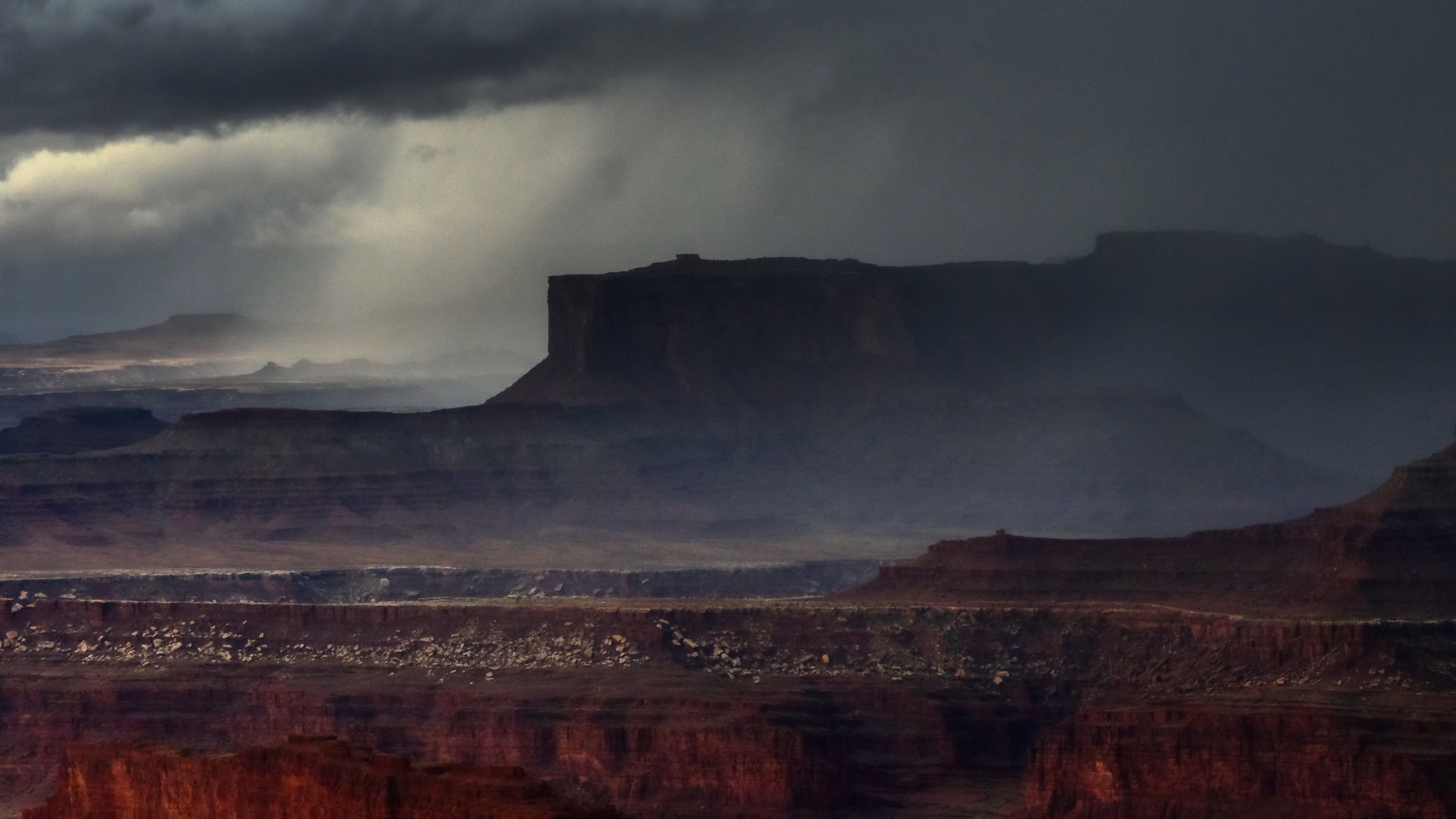
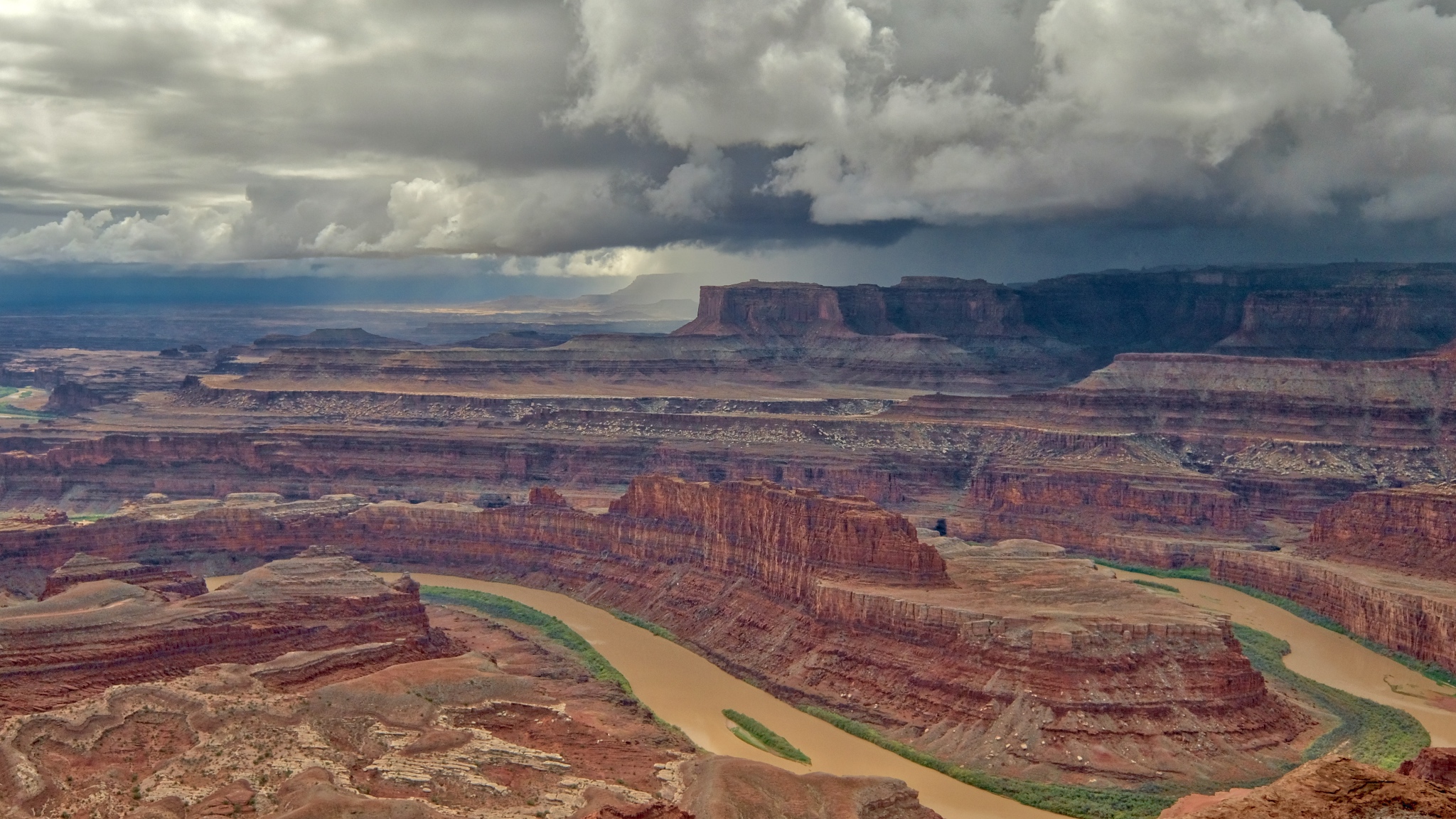 Looking north from the ridge point I could see the storm clouds gathering on the far canyon rim.
 Indescribable beauty.
 The rain moved rapidly across the canyon.
 The rain came swiftly . . . I ran to my camper.
 I hated to have to leave this incredible place . . . I slowly drove away from Dead Horse Point State Park, Utah.
 Back down the road through the rain toward my motel room in Moab . . . too cold and wet for a campground . . .
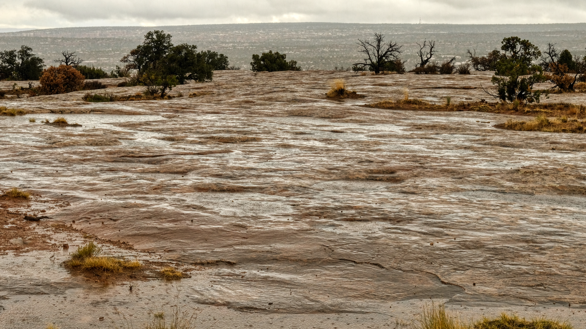 Hard rain on hard flat rock.
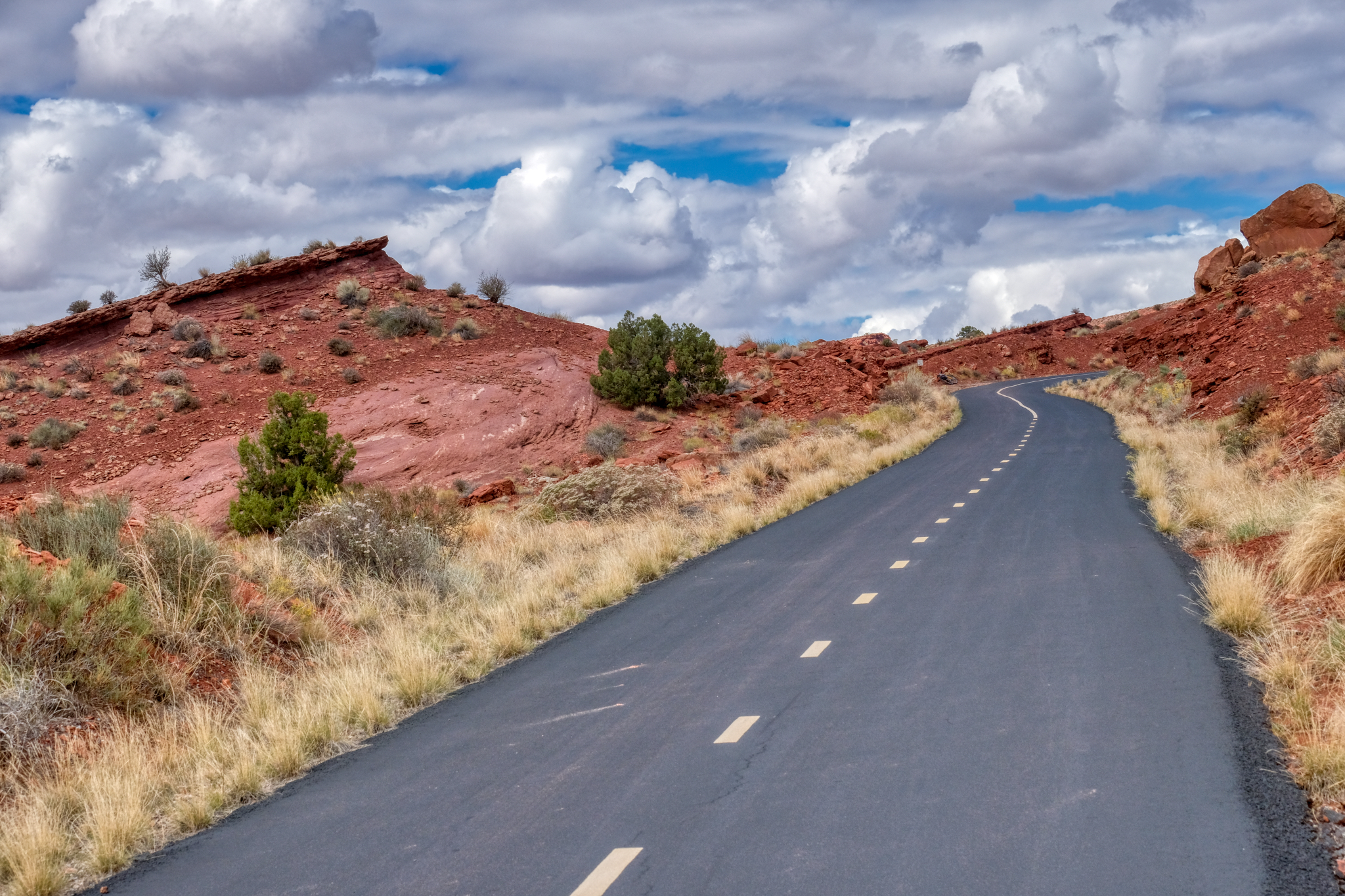
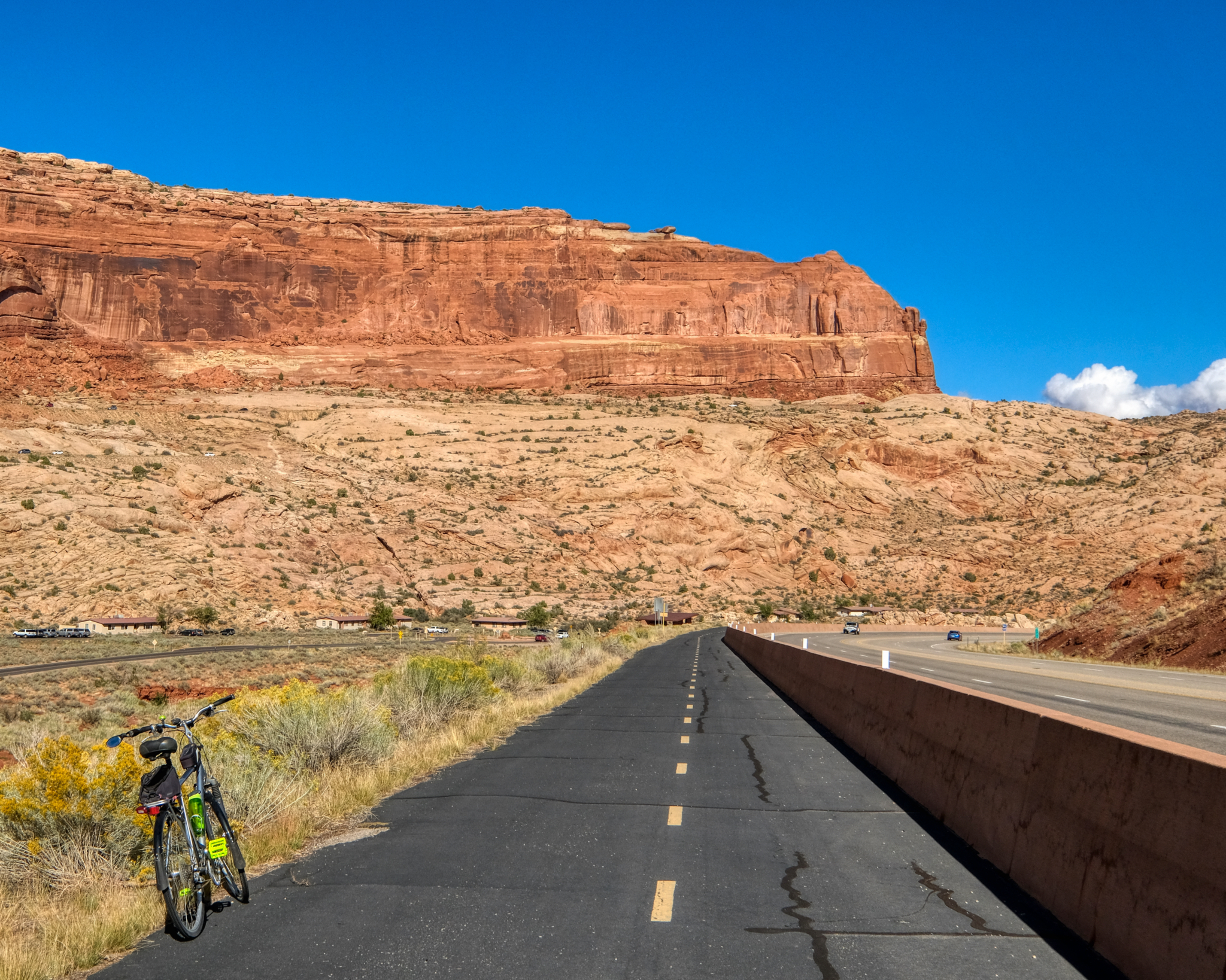
 The next morning broke bright and sunny. I left my motel and found a nice RV park at the edge of town, got a space, set up, and set off on my bicycle. As it turned out, my RV park was at the beginning of a long and paved bike trail that led out of town and up into the red rock canyons.
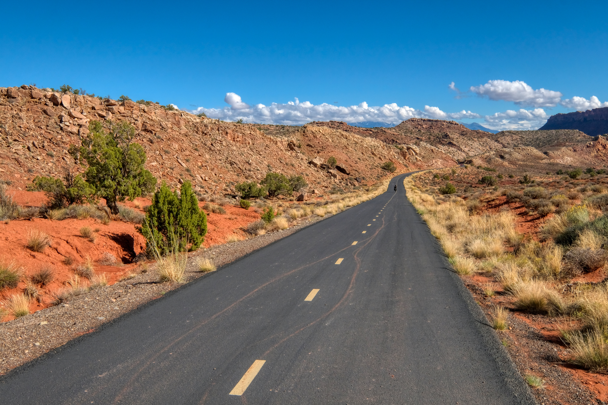
 The trail was beautifully paved and at a not too steep grade. Perfect.
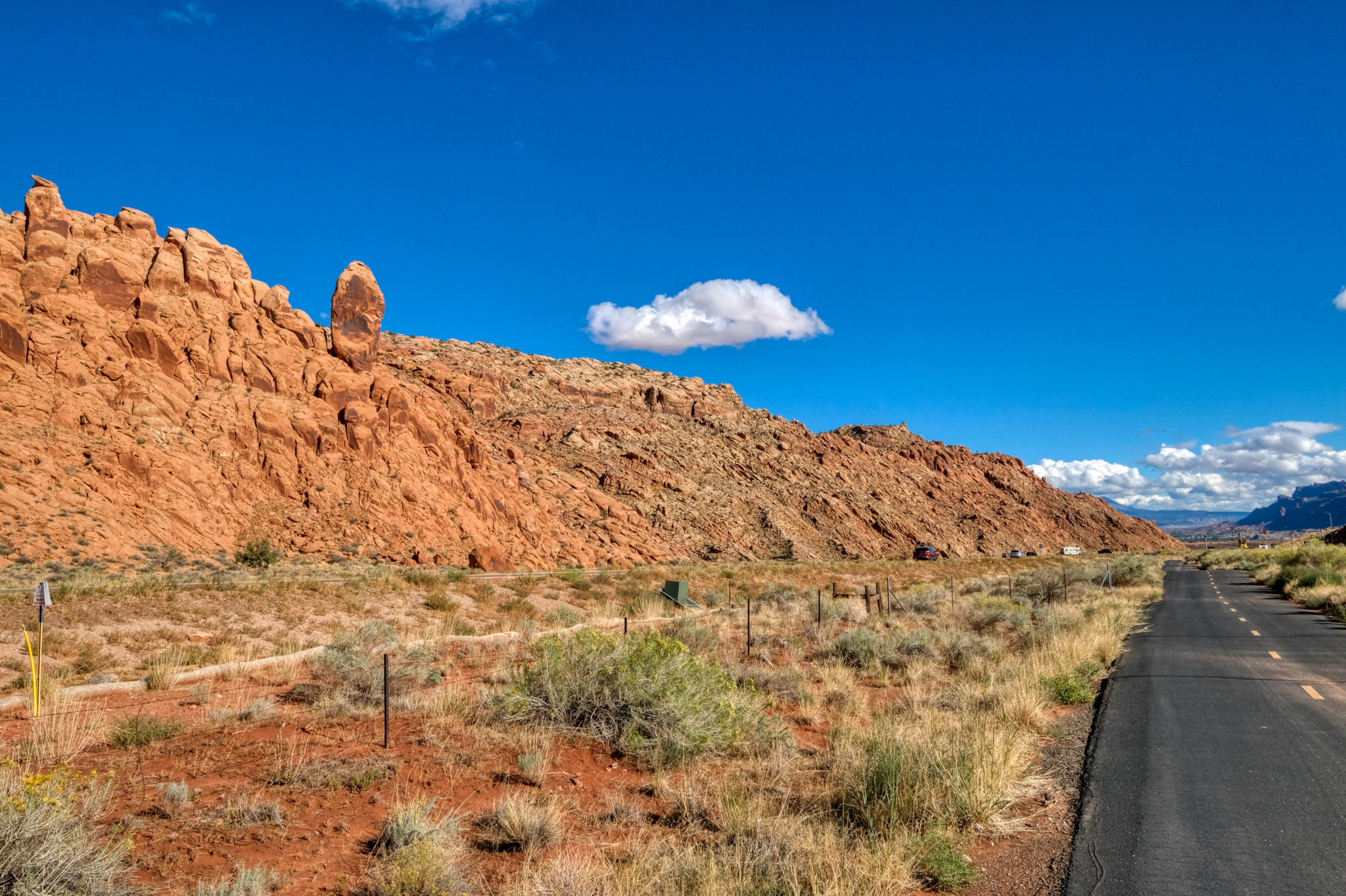
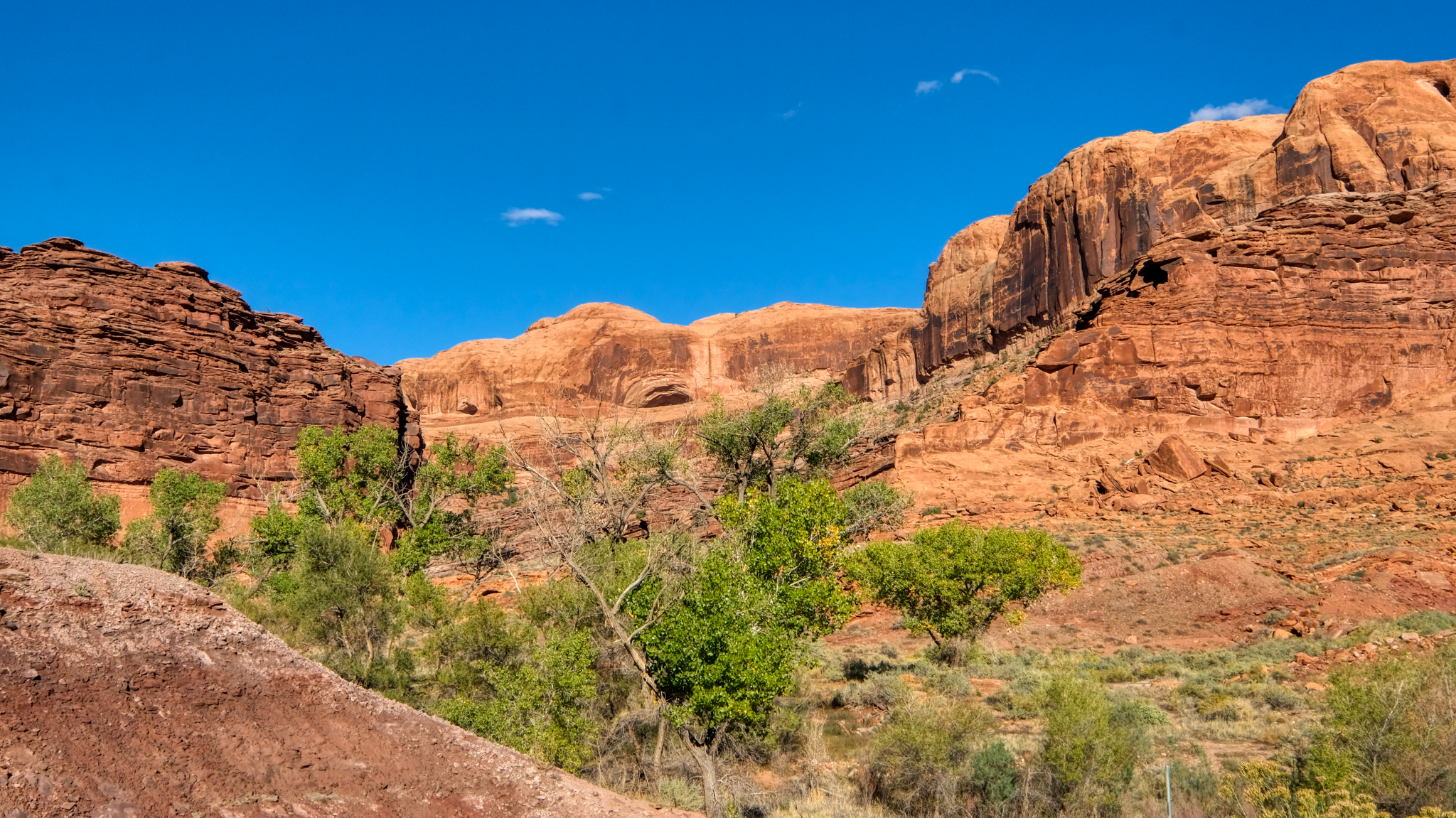
 The views coming up the bike trail out of Moab were spectacular!
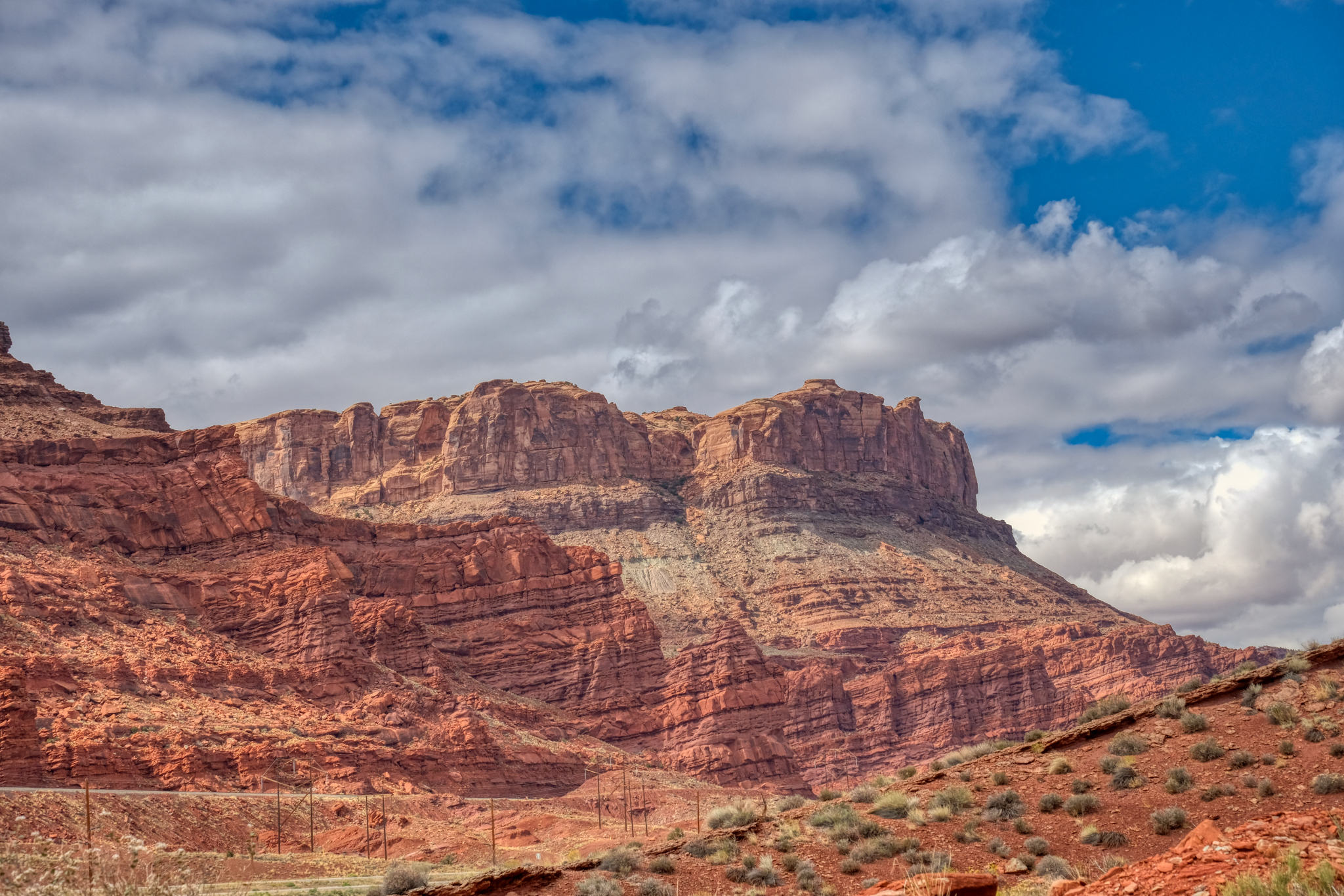
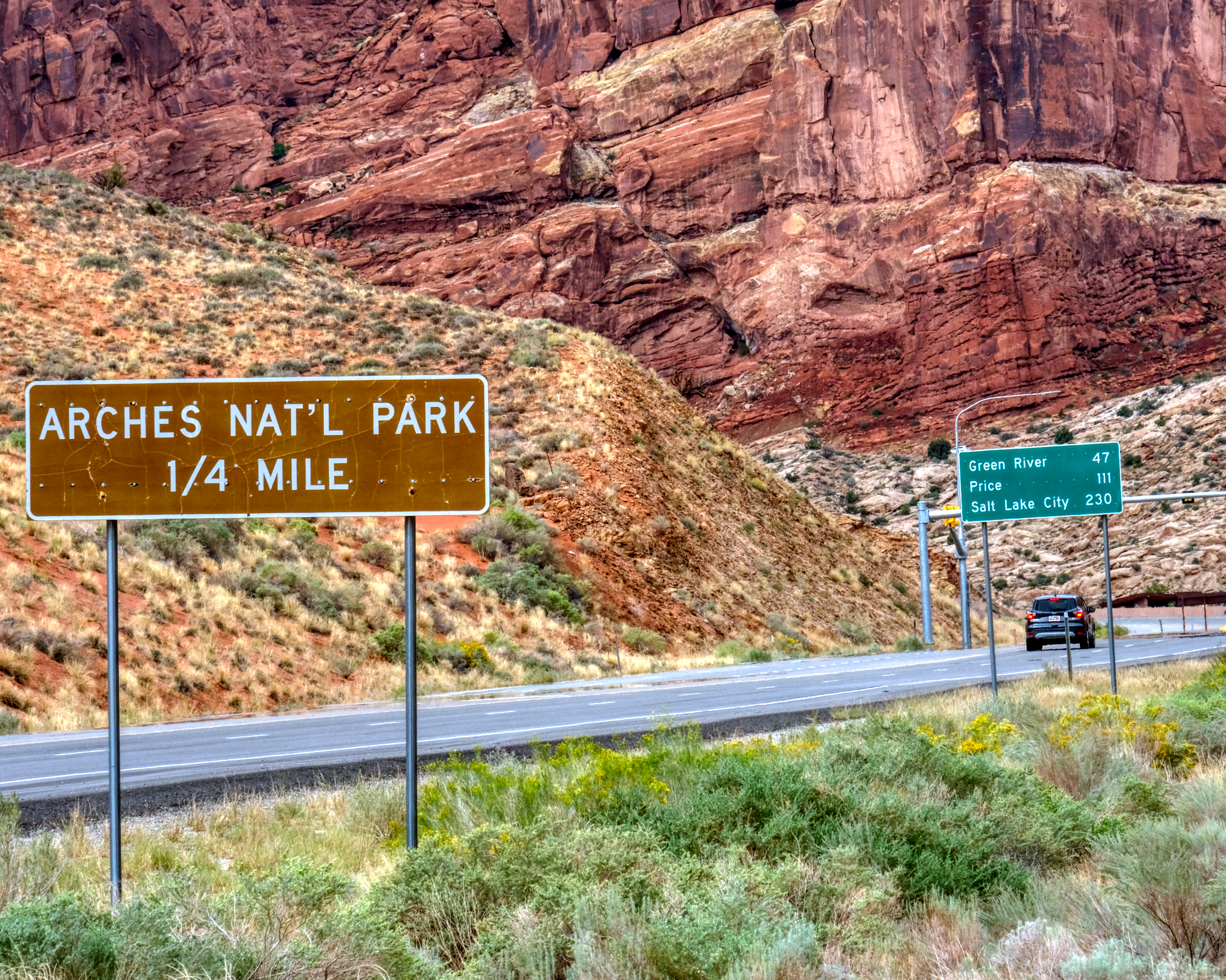 The cut-off road to the Arches National Park was just outside of town . . . .
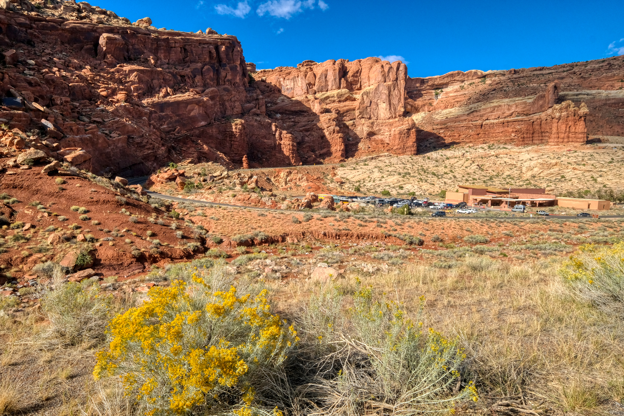 I thought about going into the Arches National Park, but the road was always busy . . . and so was the Visitors Center. I couldn't imagine seeing anything more impressive than Dead Horse Point overlook.
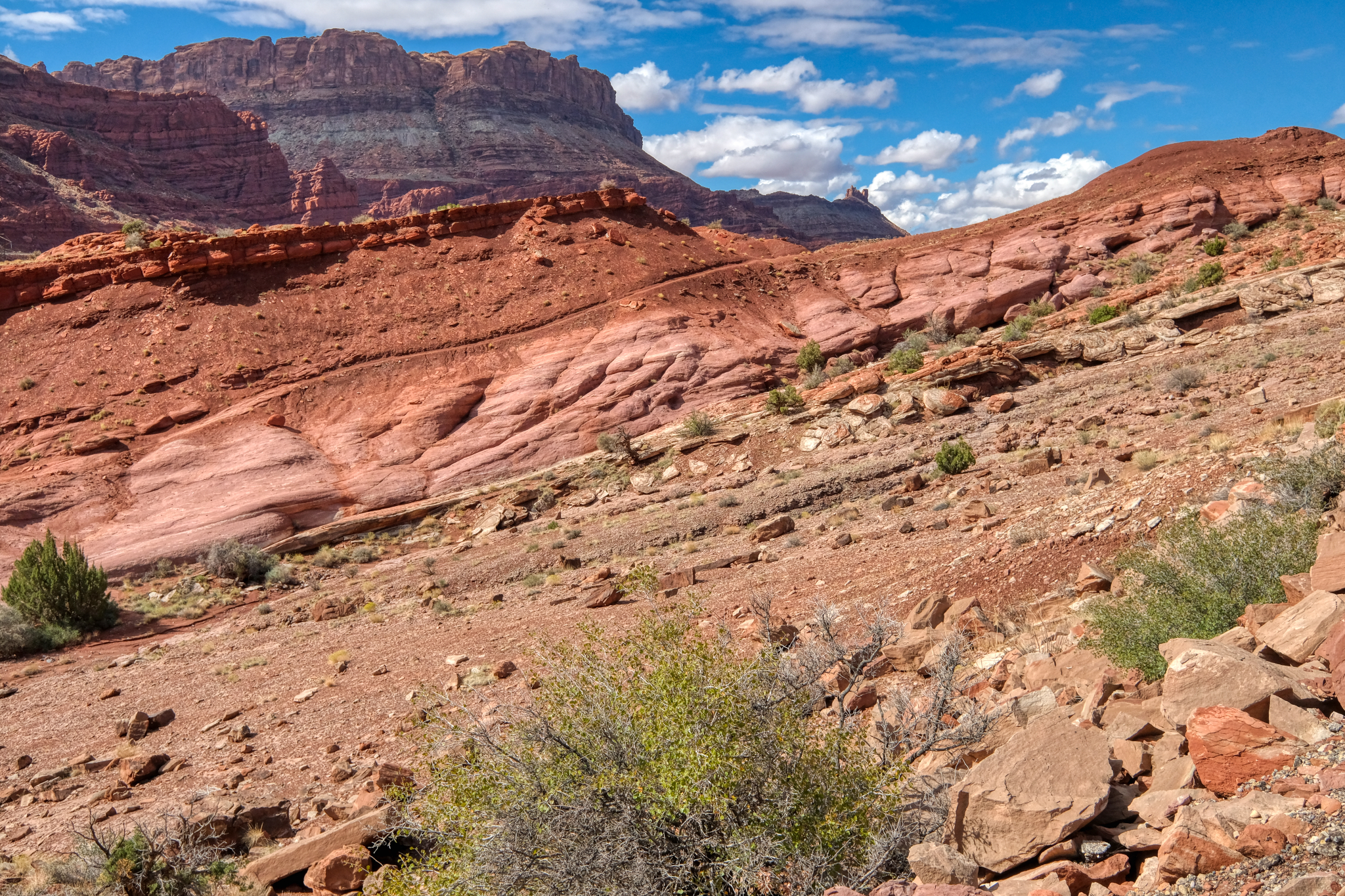 I must have been a geologist in a previous life. My college roommate was a 'geomorphologist' and I guess I got the geology interest from him. This scenery fascinates me no end.
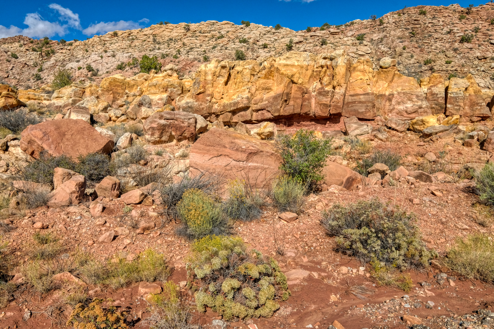
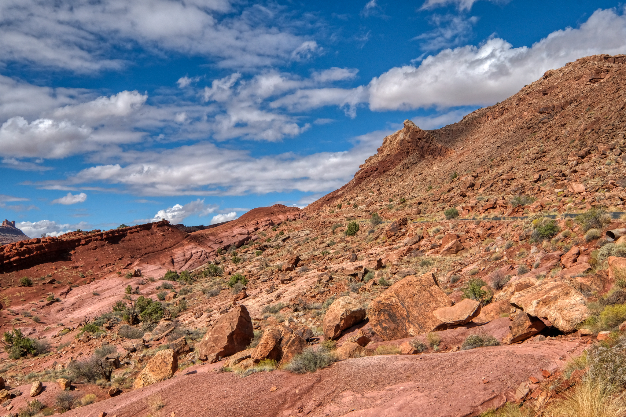
 Layered rock outcrops lined the bike trail.
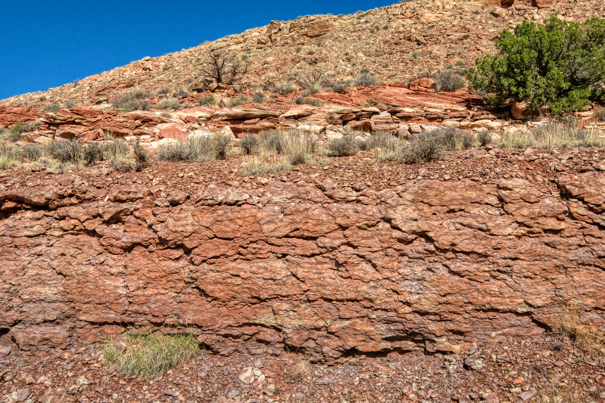 Layers of ancient, solidified mud (?) along the way.
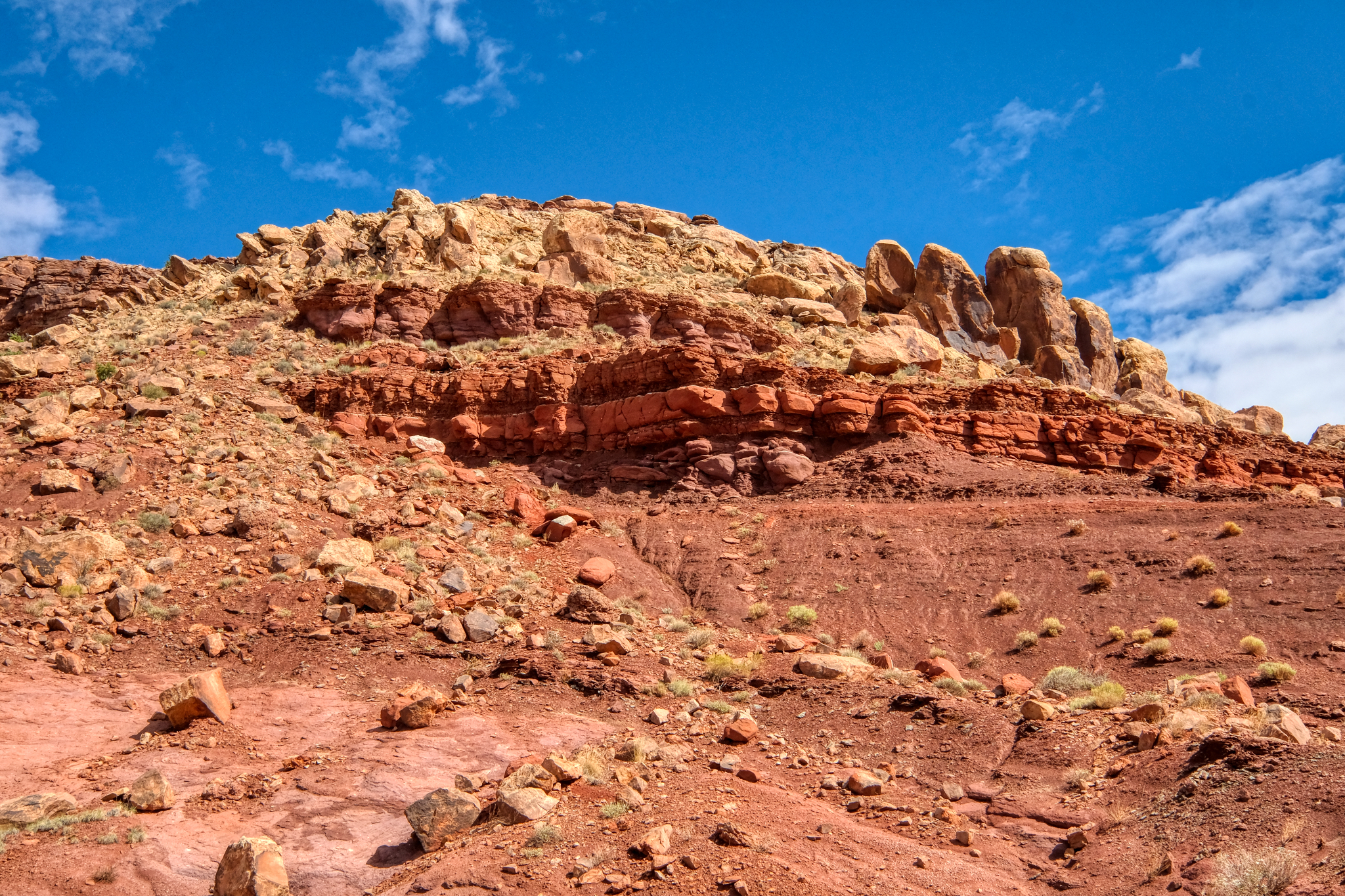
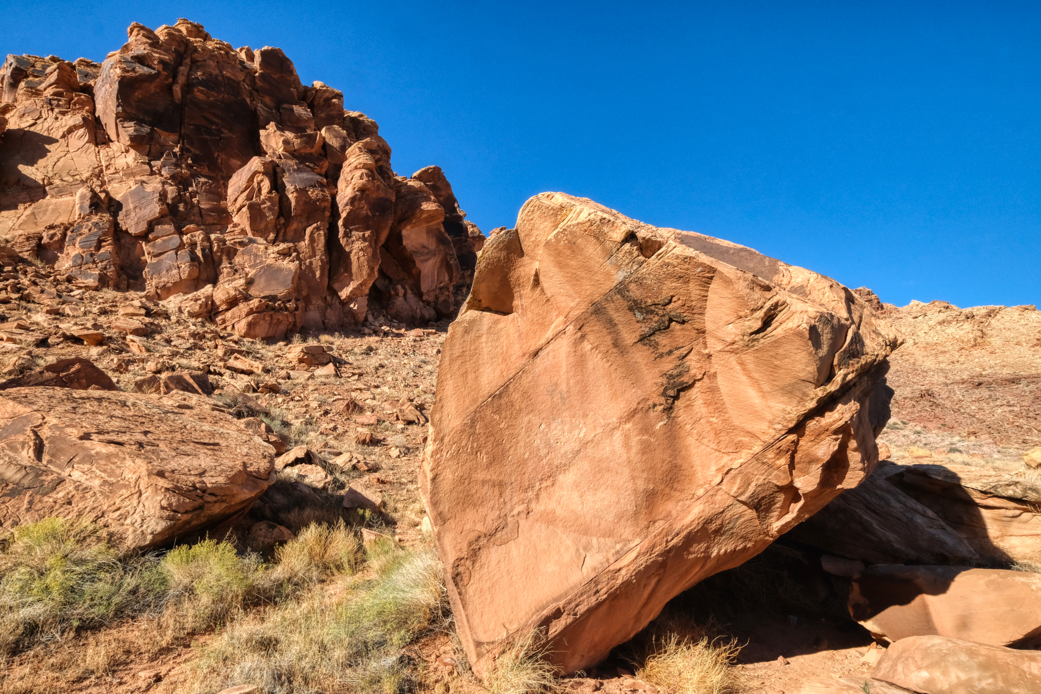
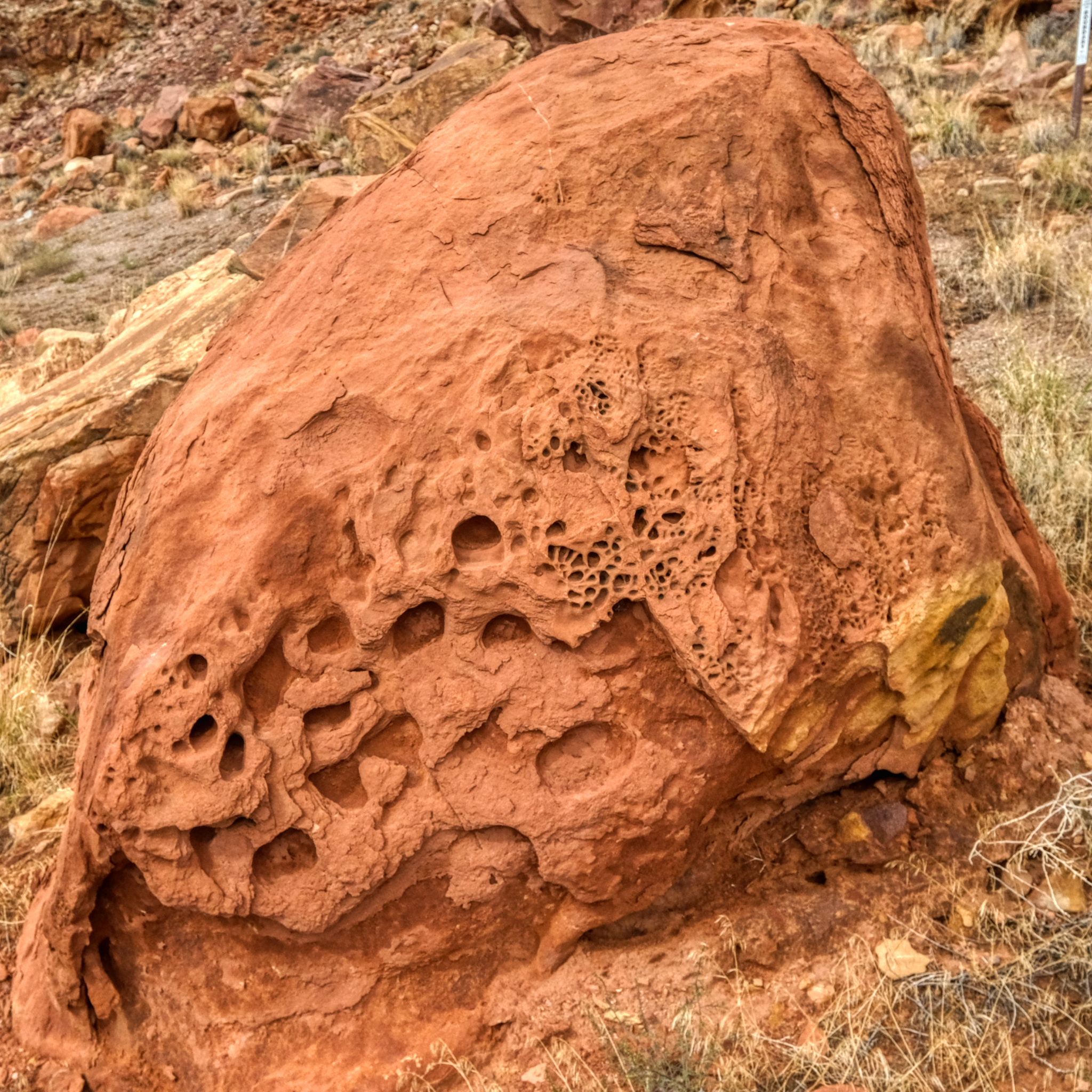
 The geological formations seemed to completely change every 200-300 meters.
 I stopped often (especially when the bike trail got steep) to snap photos and drink water. I packed a nice lunch too.
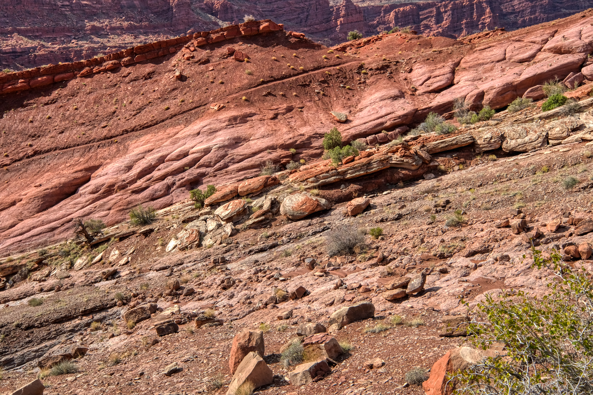
 A lovely spot to stop and be amazed by the geology of this fabulous place.
 The opportunities for dramatic nature photos were endless.
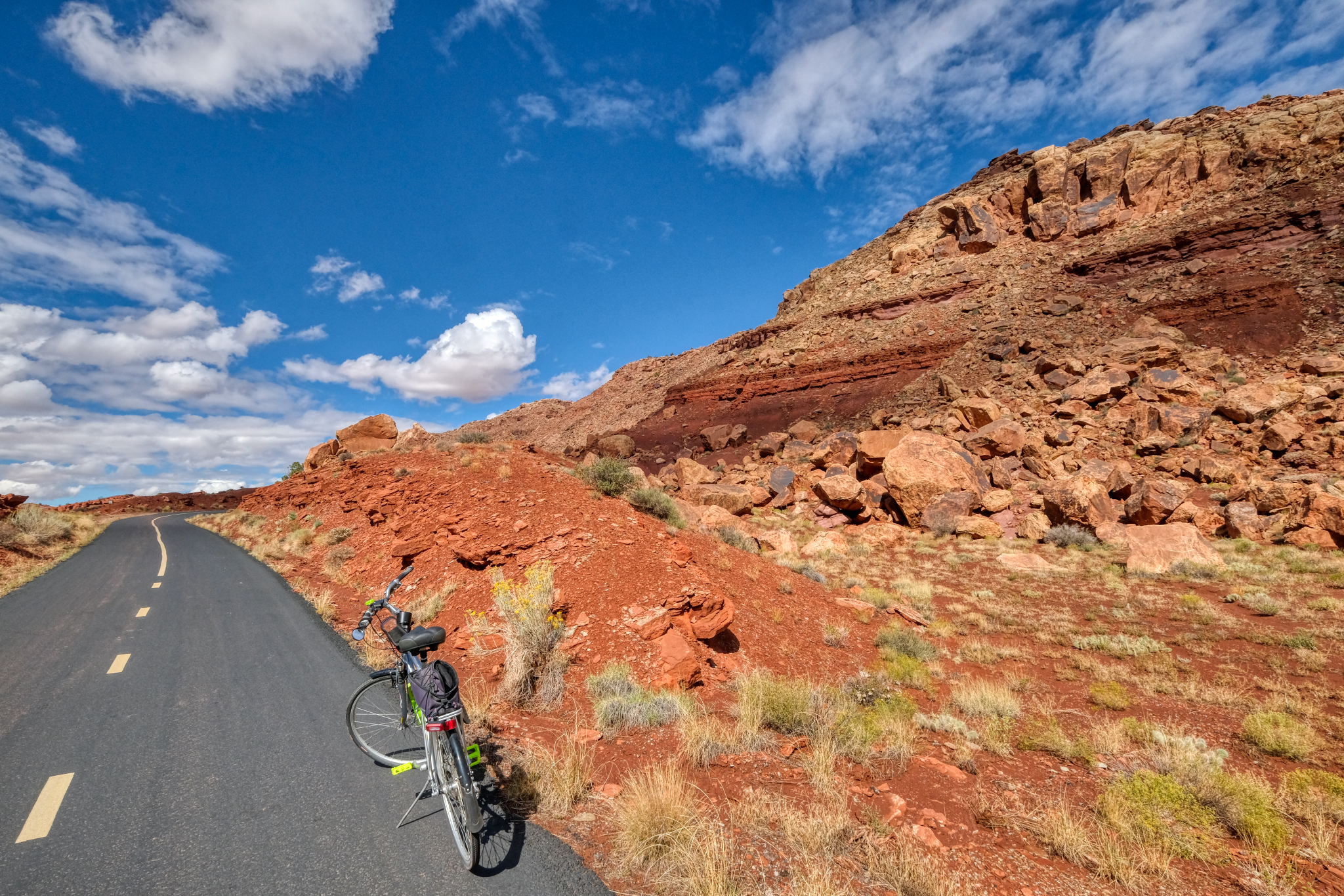
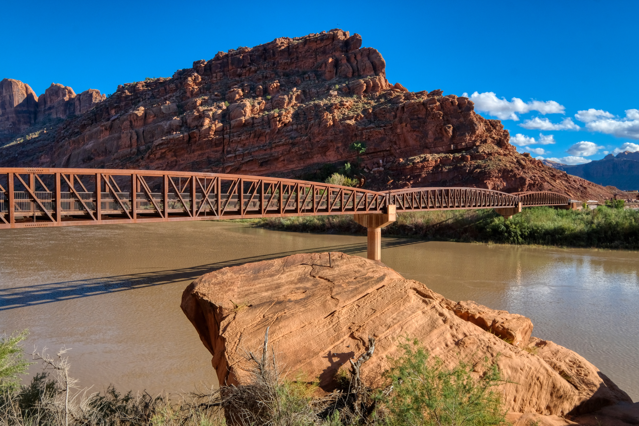
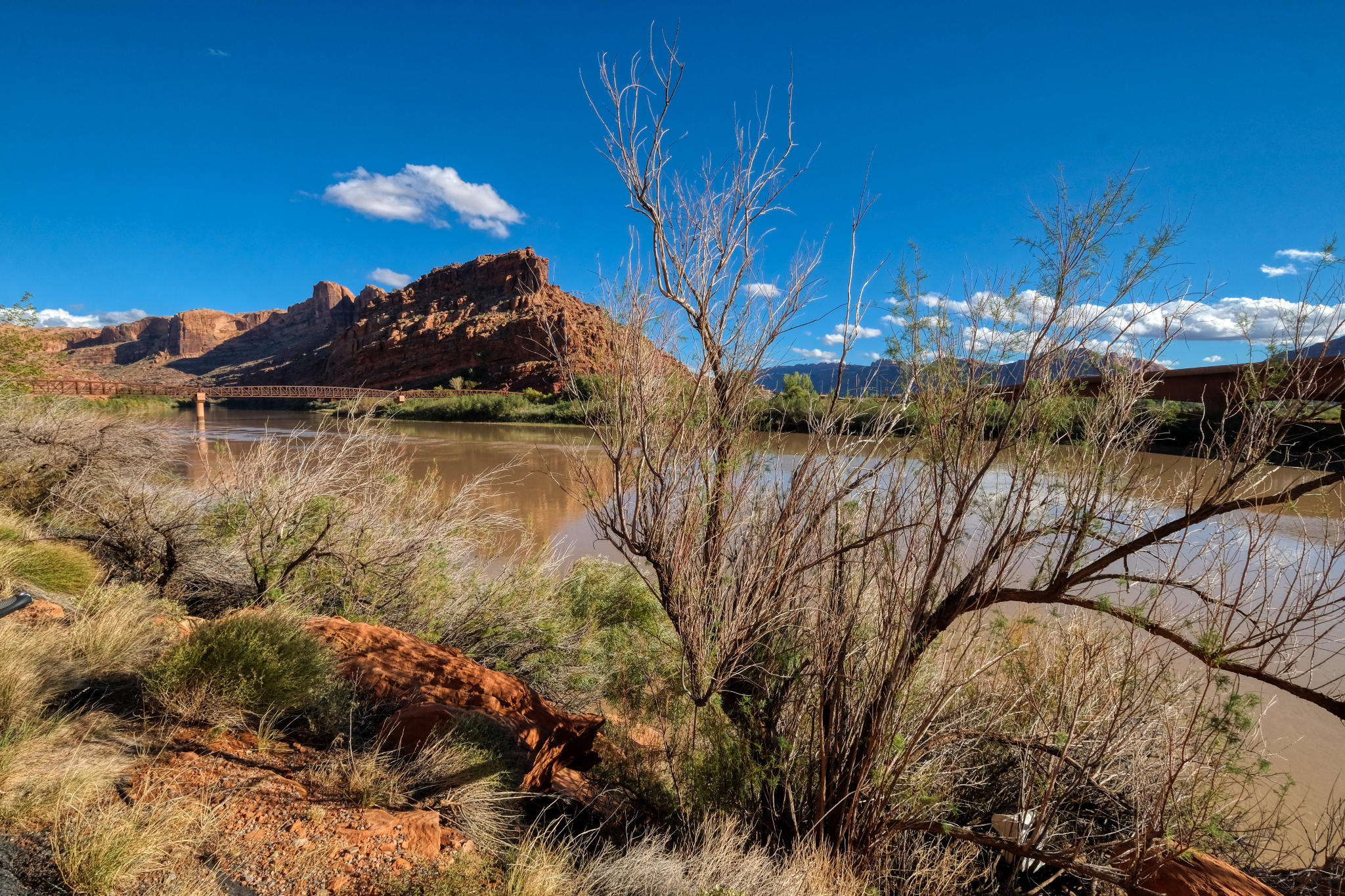 At one point just out of Moab, the canyon widened out as the Colorado River crossed under the bike path. It was the best bicycle bridge I had ever seen.
 Such a wondrous place for a long bike ride.
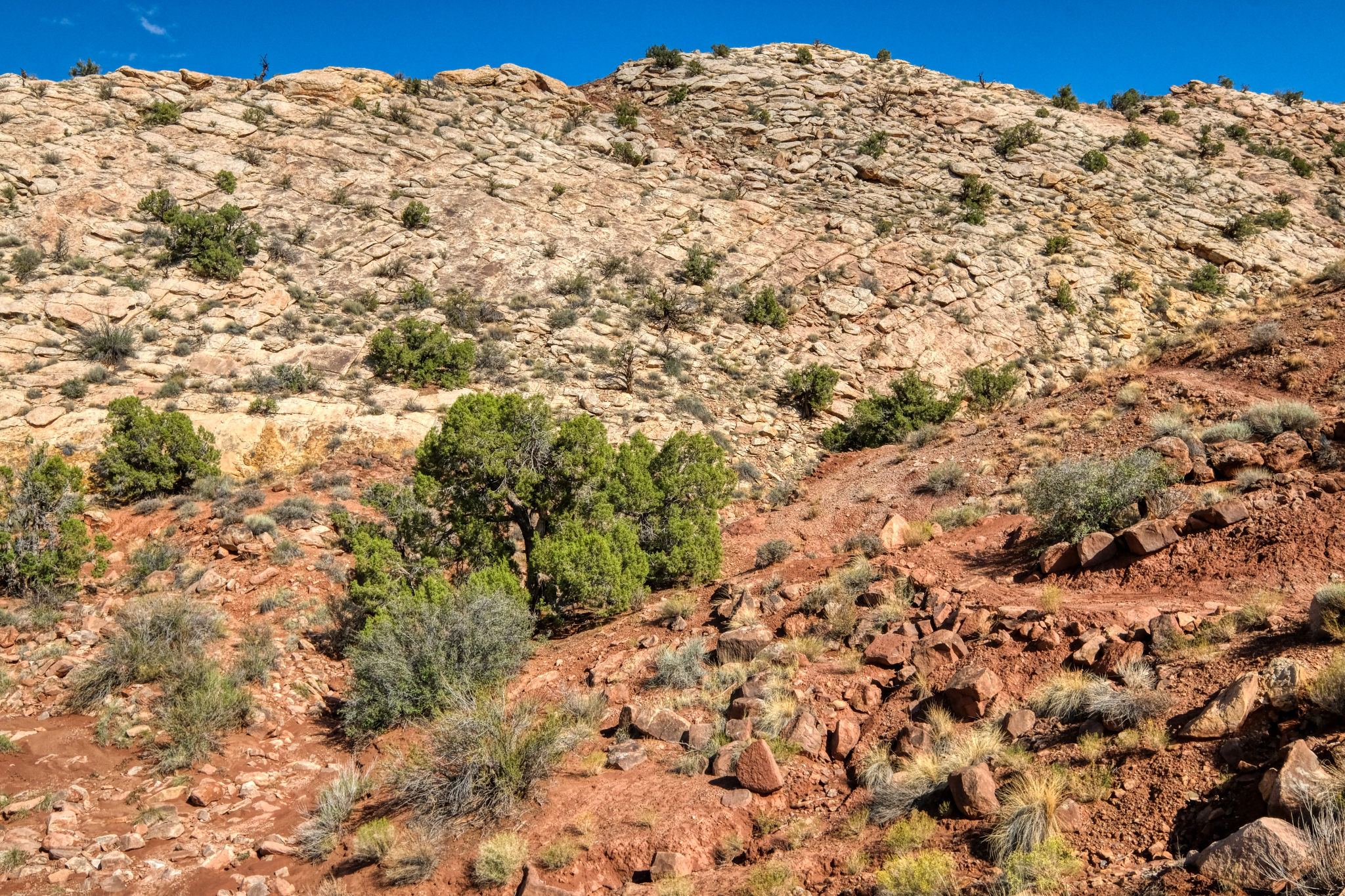
 There were only occasionally patches of large plant life . . .
 I rode my bike on up the very long steep uphill trail . . . noticing more "cactus" type plants the higher I went.
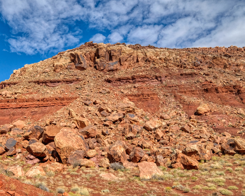 More and more geological changes.
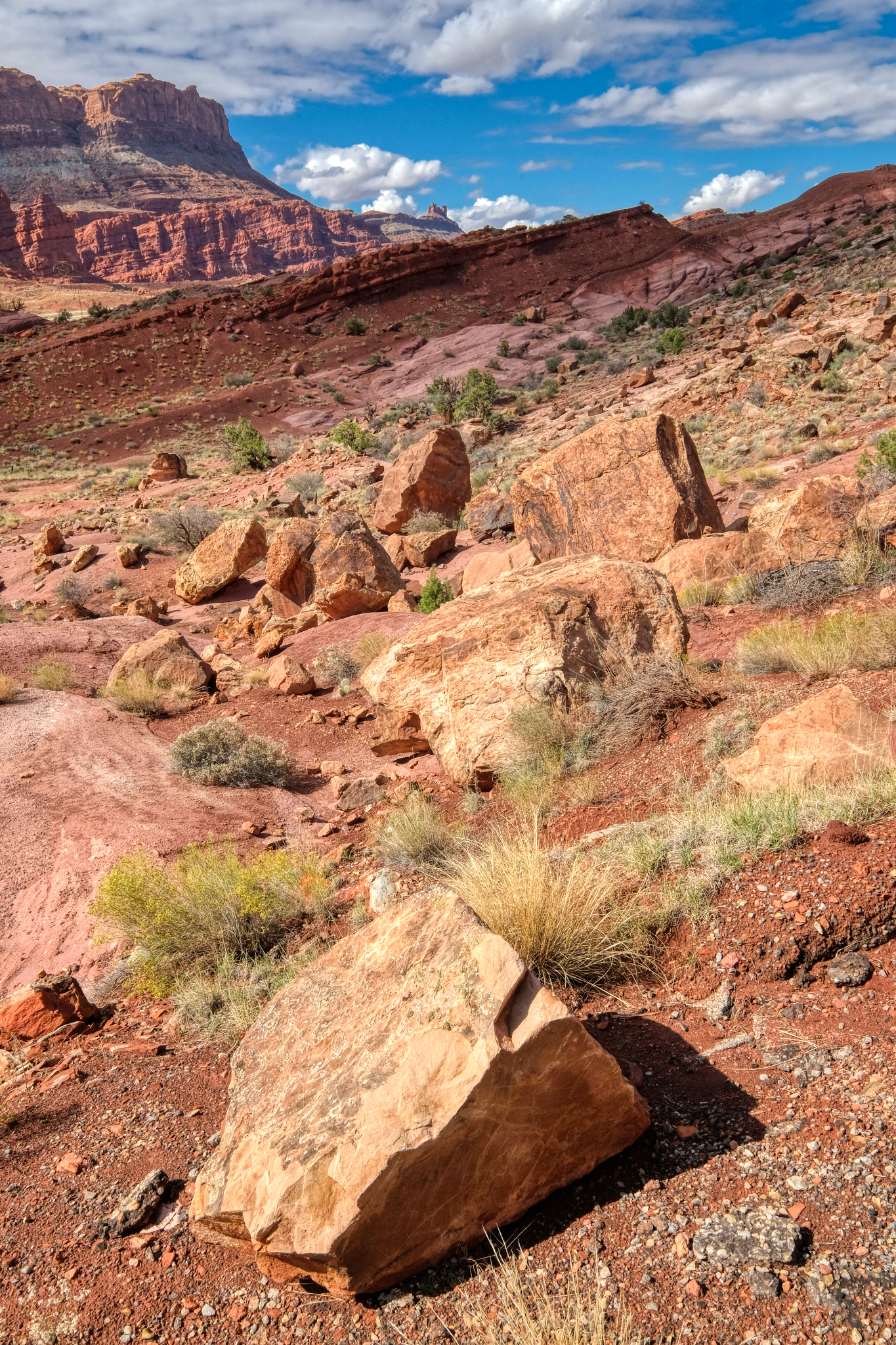 Rocky desert portrait.
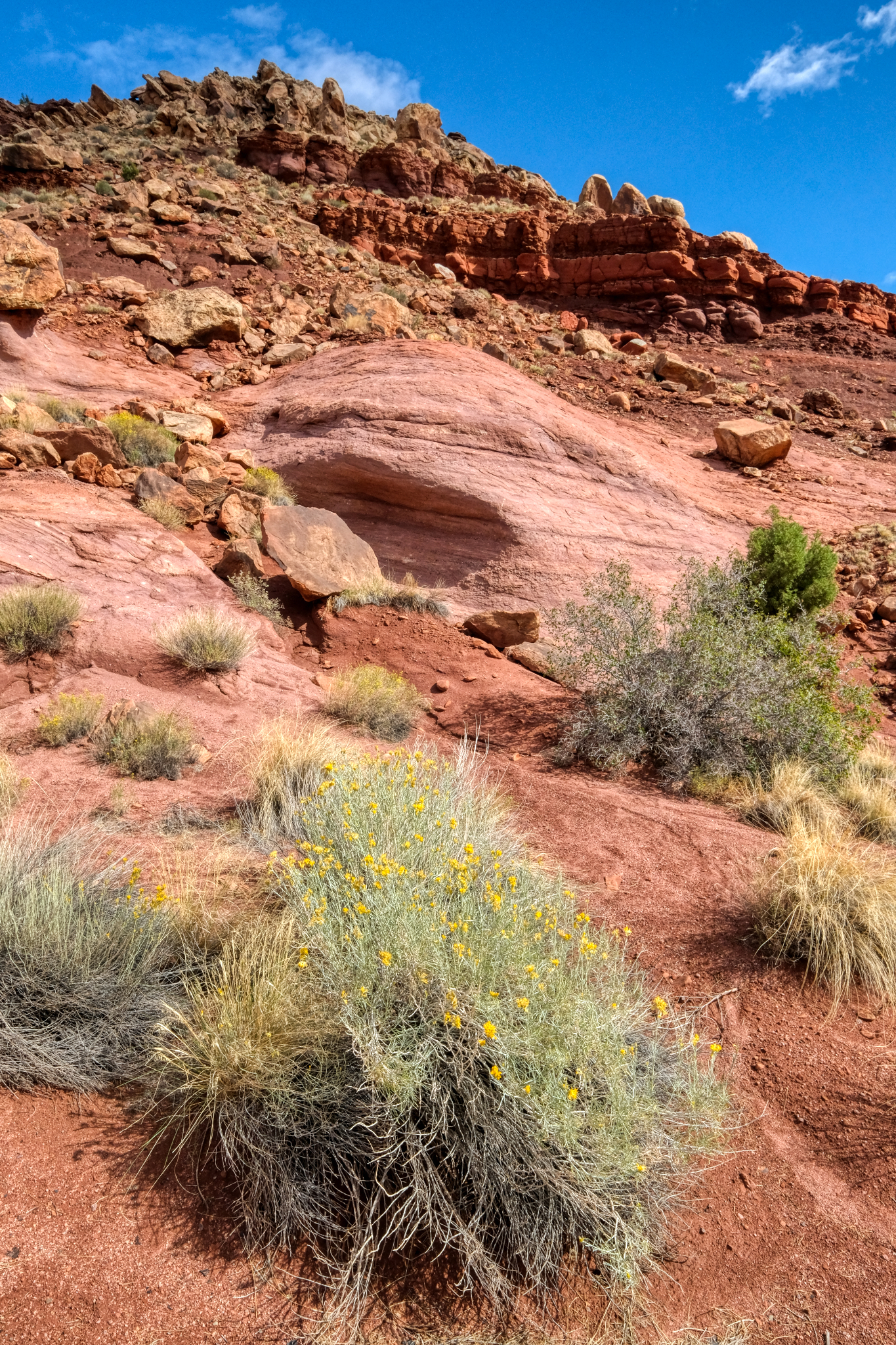 Rocky desert flora portrait.
 After riding uphill all day I was getting ready to turn back in the late afternoon . . . after I climbed this last steep hill.
 My last steep climb.
 At last I reach my 'this is far enough for the day' point . . . and it was beautiful. I consoled myself with the knowledge that it would be all downhill to my RV camp site in Moab.
 I felt that it must get pretty windy and dusty up here . . . and turned around right here . . .
 And downhill I went . . . and saw the very first bike rider all day . . . a woman from South Africa. She stopped and we asked each other where we were from. I said Bangkok, Thailand . . . and she laughed. On we rode, she uphill, and I coasting back to my camper.
 The bike trail ran next to Highway 191 for a short while on my way back.
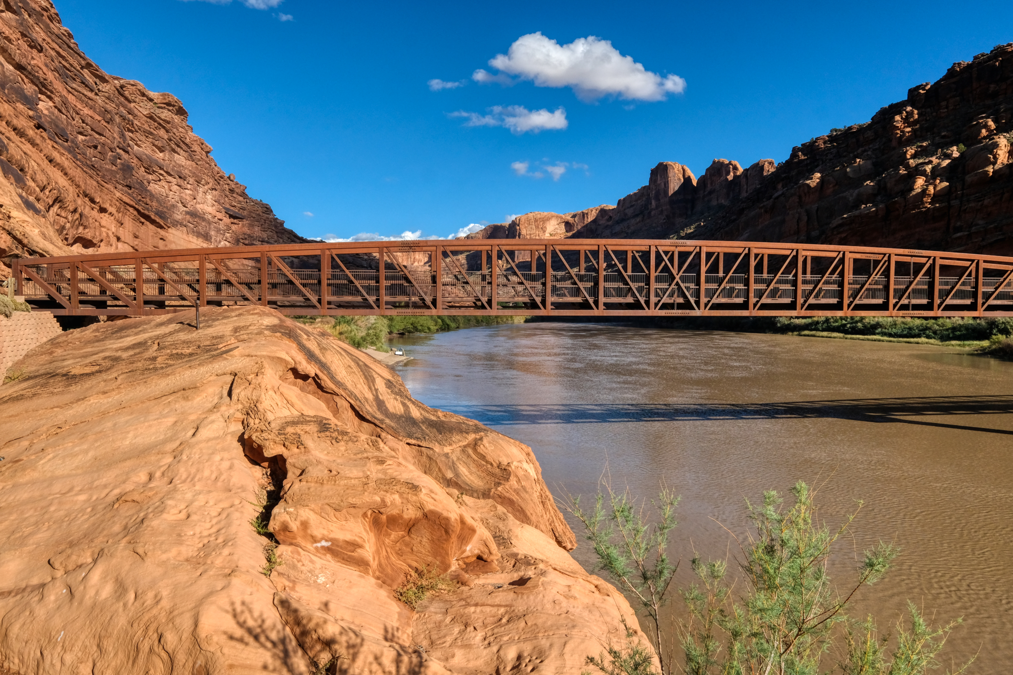 And back across the Colorado River bike bridge . . .
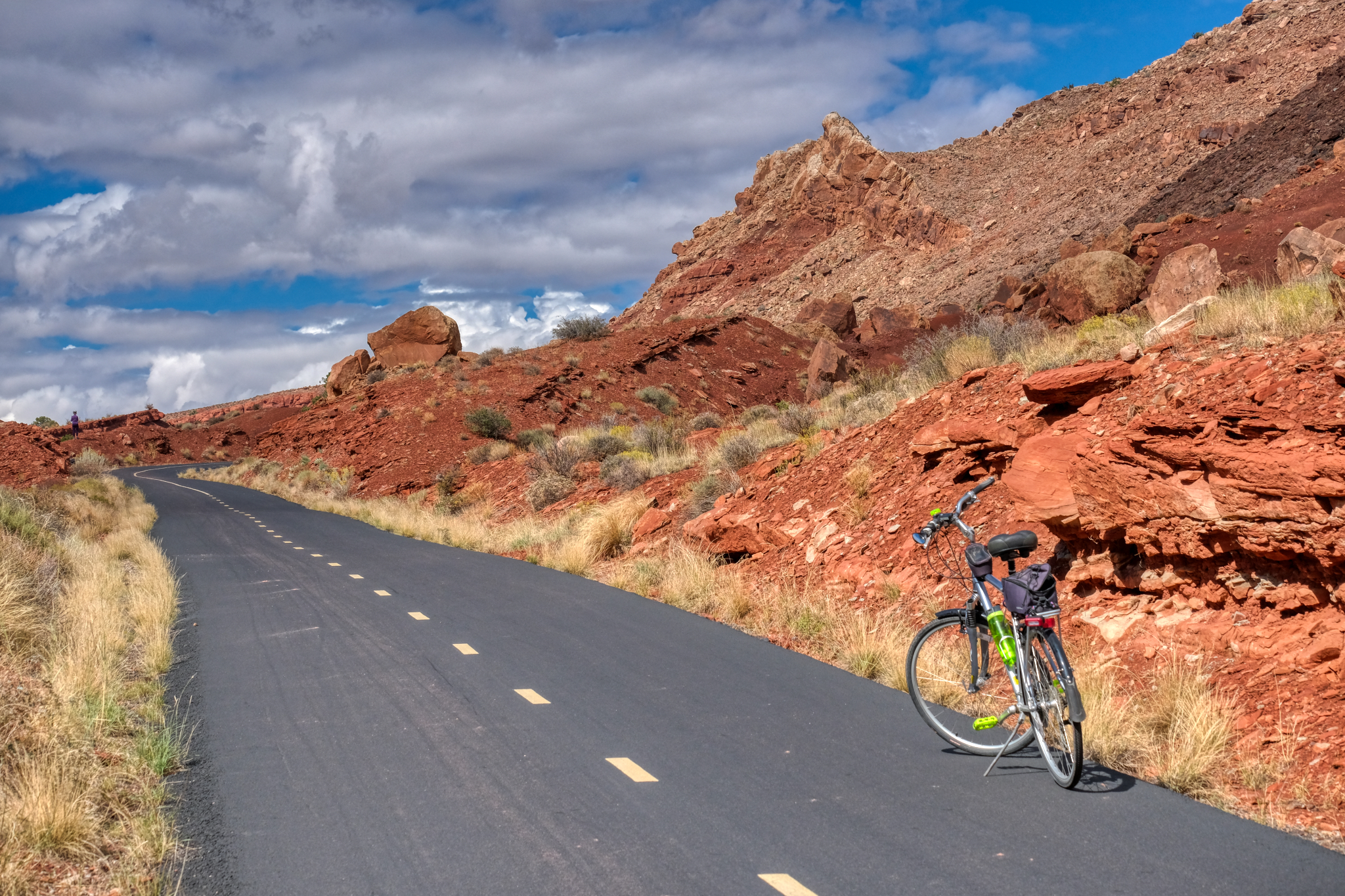
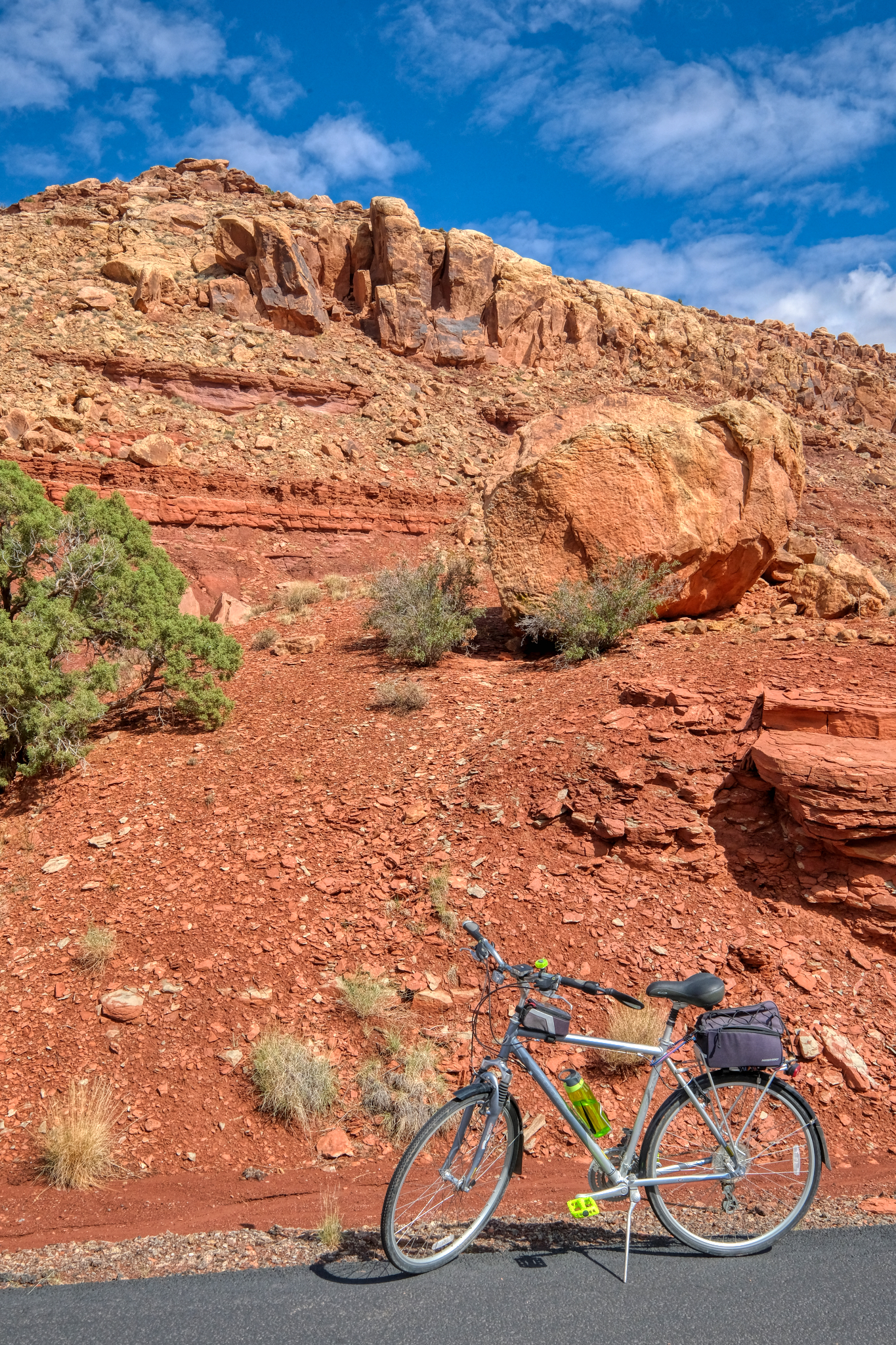
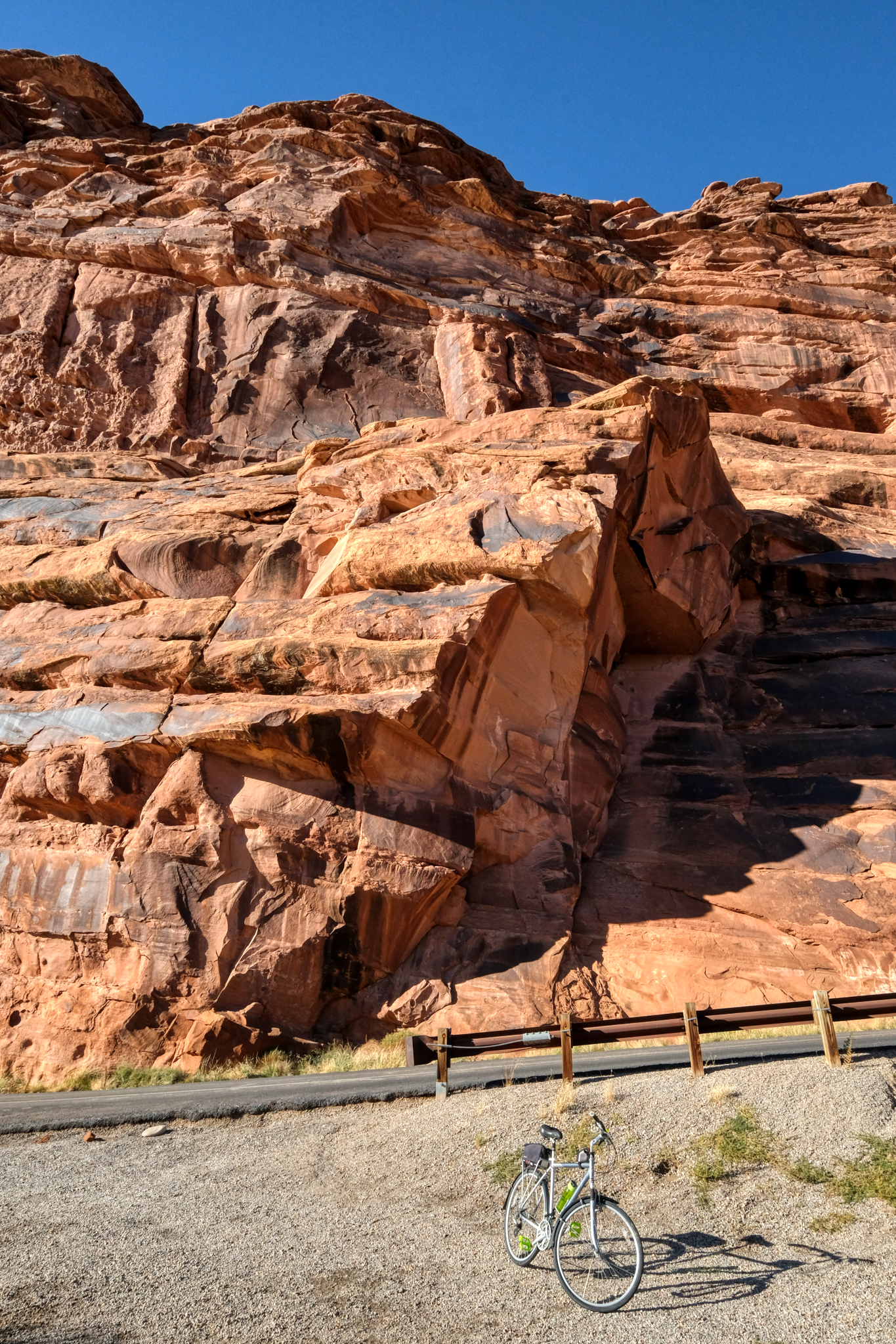 My last stop for a photo of my bike and a stone cliff . . . not far from my Slick Rock RV Campground (very nice place with very nice people working there). The next morning I would wake before dawn . . . and before coffee . . . for the long drive over the Rocky Mountains to my next destination: visiting an old high school friend in Colorado Springs, Colorado.
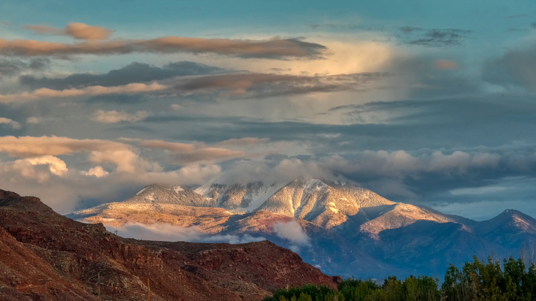 I headed out of Moab on my birthday on highway I-70 heading east to Colorado . . . this was the last view of Utah . . . snow on the mountains . . . little did I know that I would drive across the high Rocky Mountain passes during the very first snow storm of the season . . . but that is another story.