My most current blog entry:
Entries in Ghost Town (4)
USA Road Trip: Black Rock Desert Camping - Nevada
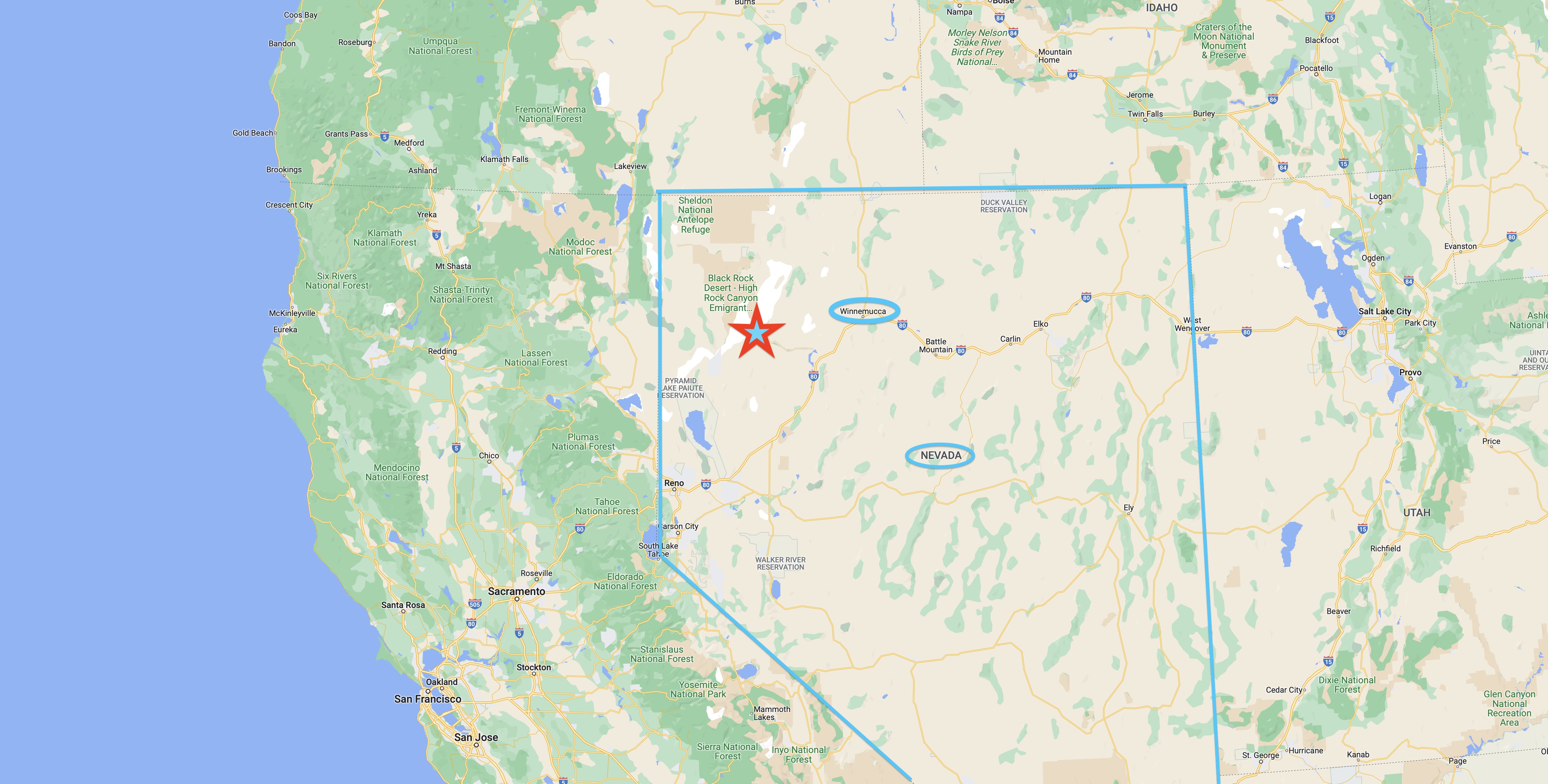 My big USA road trip took me on the small roads from Oregon south across the Nevada border and into the town of Winnemucca, where I washed clothes, showered, and cleaned out my camper at an RV park next to a casino.
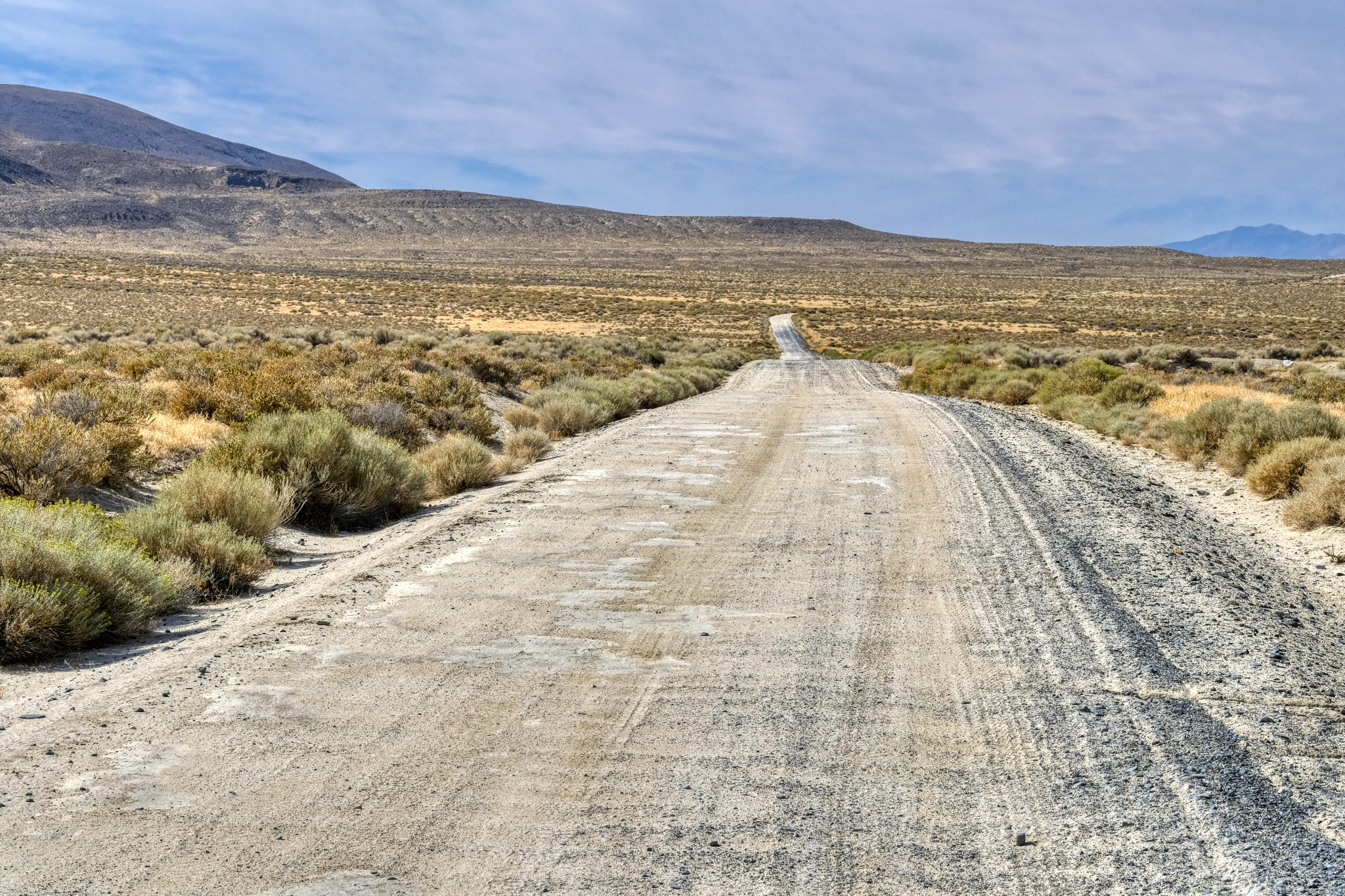
 Heading out on gravel and sand Nevada Highway 49 out of Winnemucca across dried lake beds and desolate desert landscapes. My kind of place.
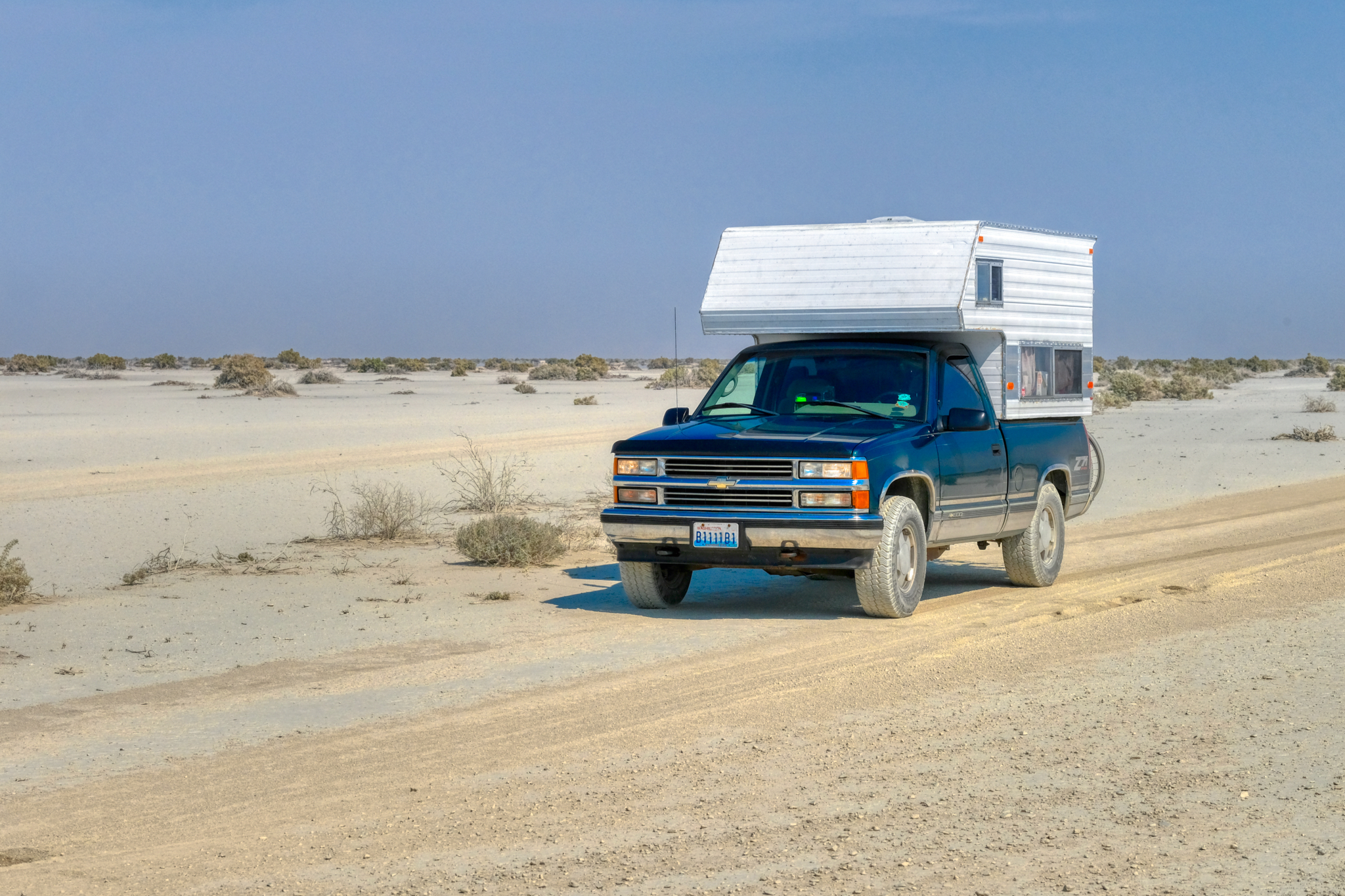
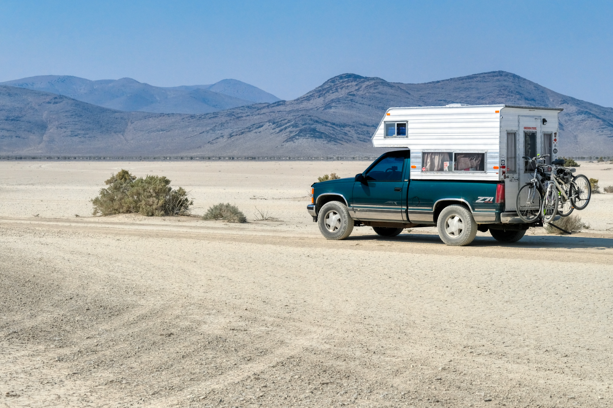 Ready for anything that comes my way in my brother's trusty 4X4 Chevy camper (now sold).
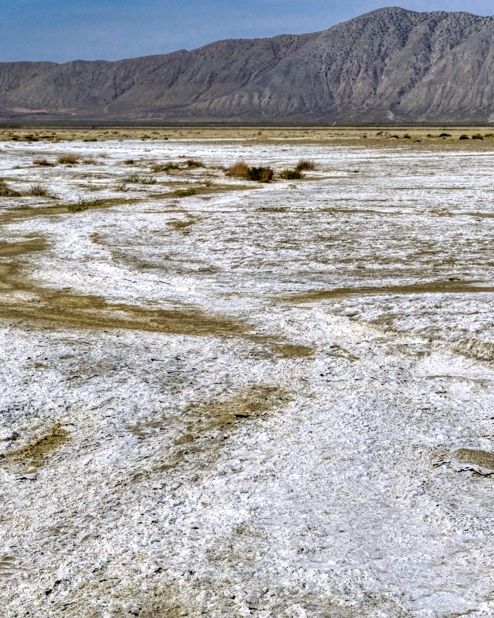
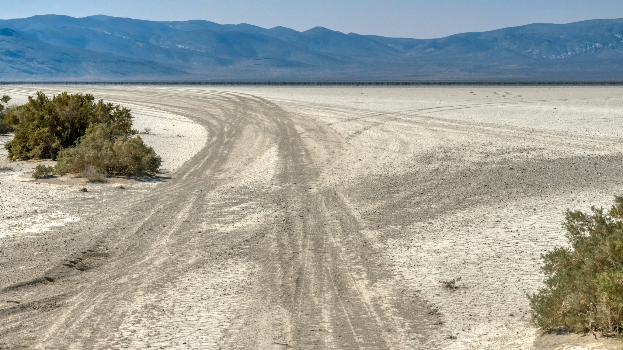 Nevada Highway 49 swerves across several alkaloid flats on the way out to the Black Rock Desert.
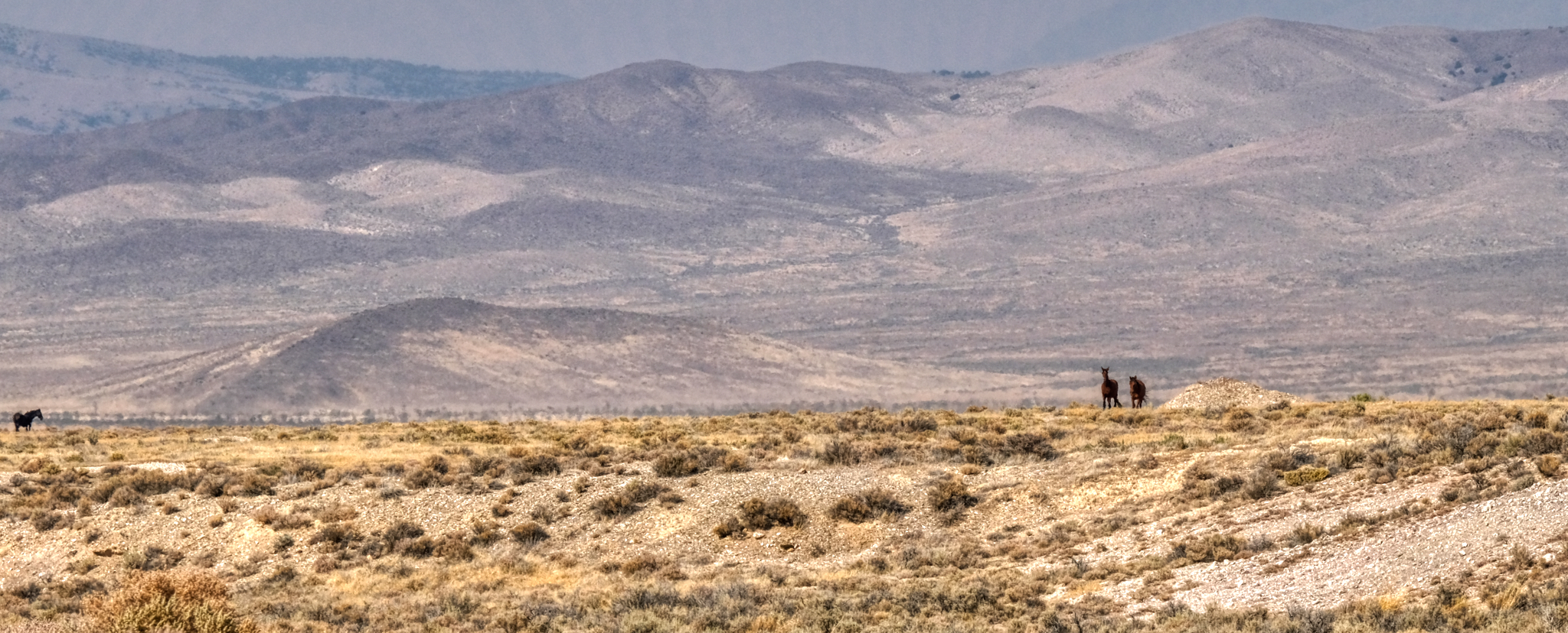 Wild country . . . with wild horses still running free.
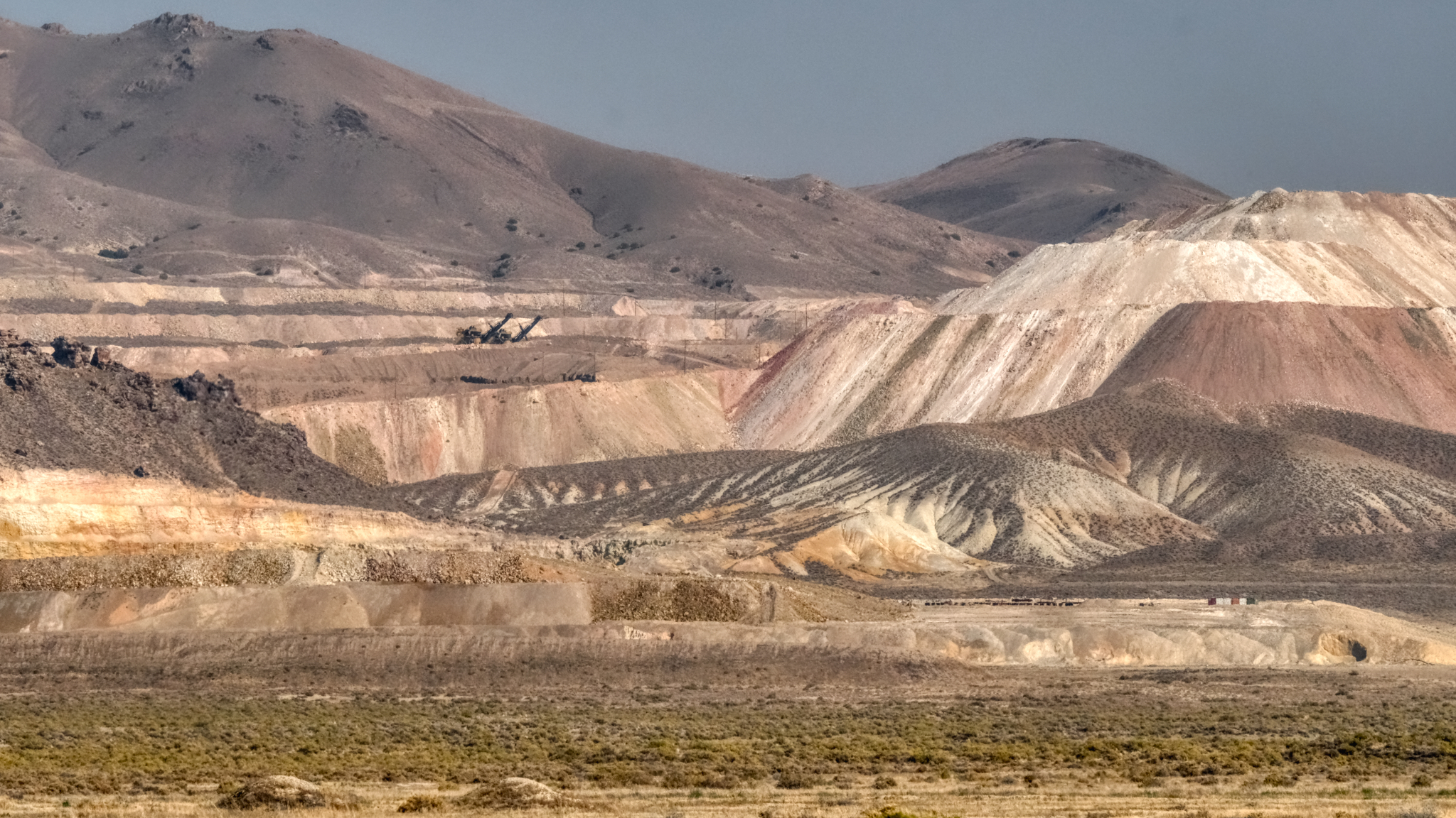 The Allied Nevada Hycroft Gold Mine is along Nevada Highway 49 . . . a very large mining operation.
 The gold mine moved a lot of dirt around . . . they stripped the face off of quite a few hills to be able to see the color of the rock and sand beneath. Huge scars.
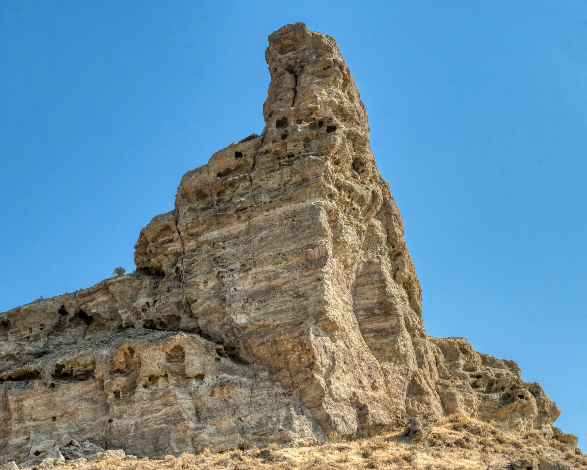
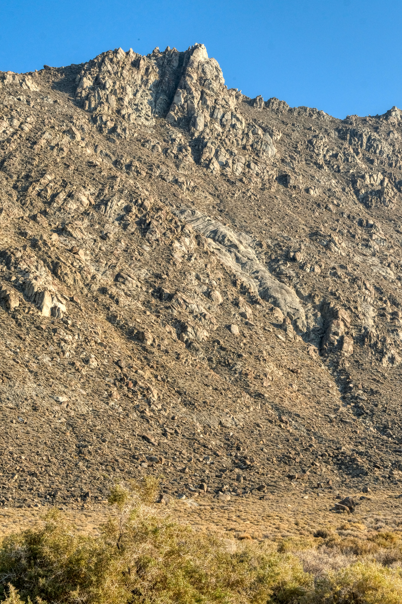
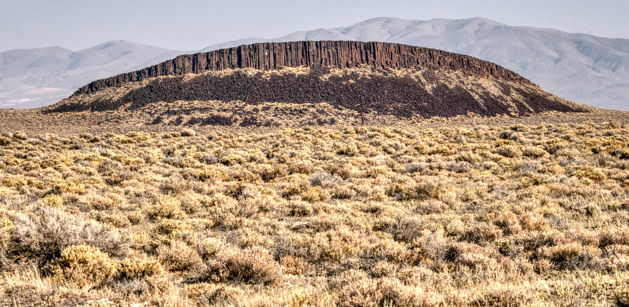 Highway 49 passes through some truly amazing desert. This volcanic spine was marvelous . . .
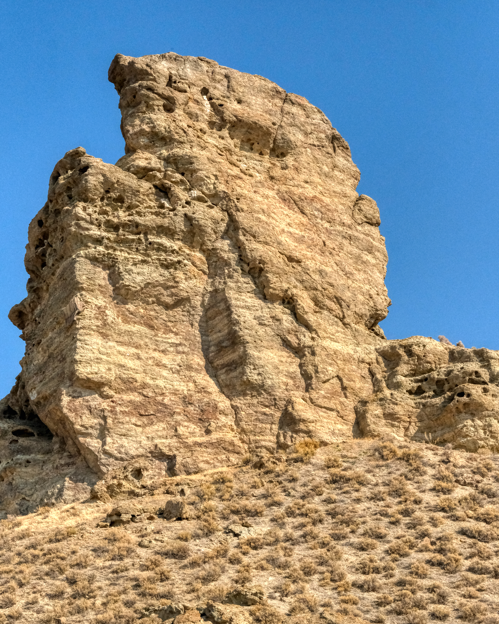
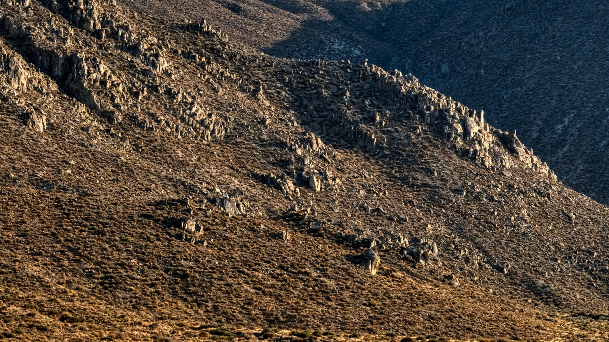
 Here and there along the road were rock outcroppings in fantastic shapes. Unfortunately, the sky was still full of smoke from the many wildfires out West that summer . . . making photography very difficult.
 The desert.
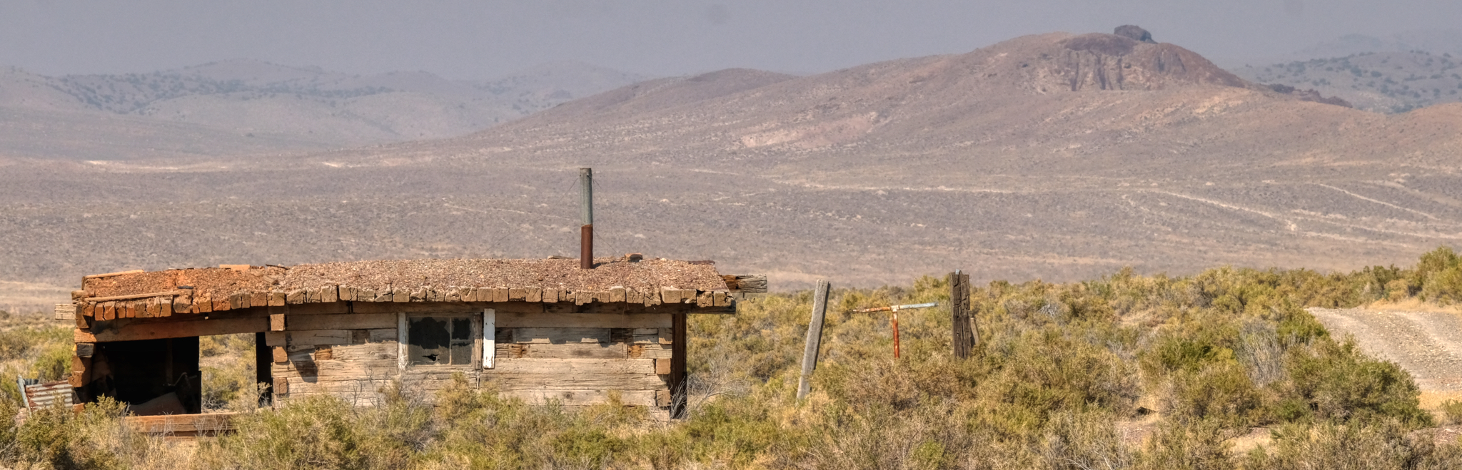 Driving on these sand and gravel desert roads means you are always on the lookout for bumps and ditches . . . and occasionally scanning the horizon for something interesting . . . like an abandoned homestead. I spotted this one off in the distance and drove out to in on a two track trail. I always respect "Private Property" and "Keep Out" signs . . . but this place had no such signage. I went in.
 What was life like living out in this remote place?
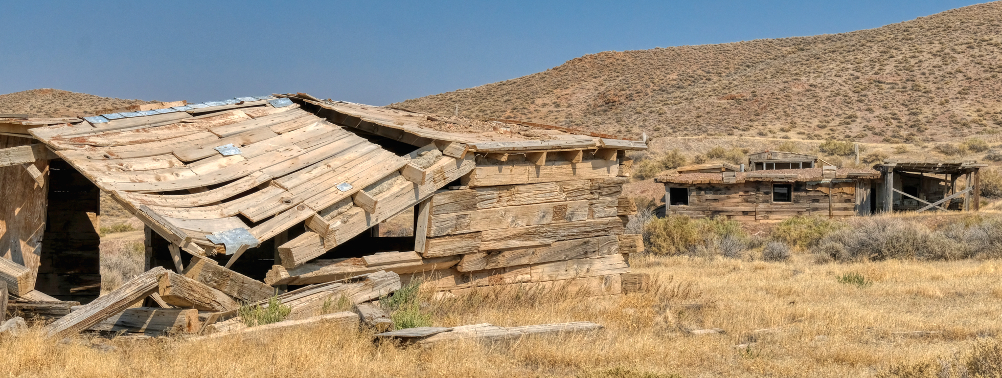 These old abandoned desert homesteads offer great photo opportunities.
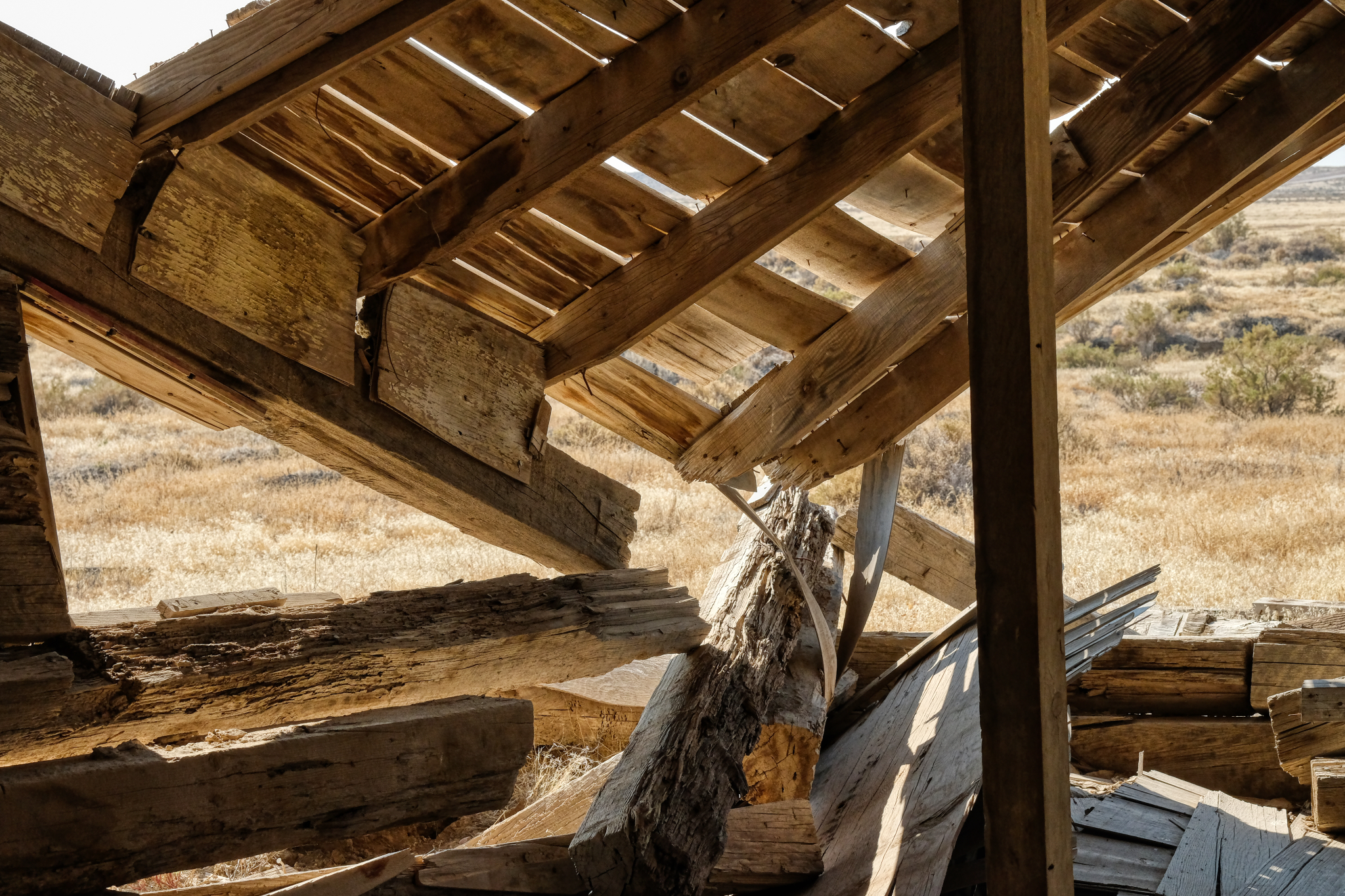
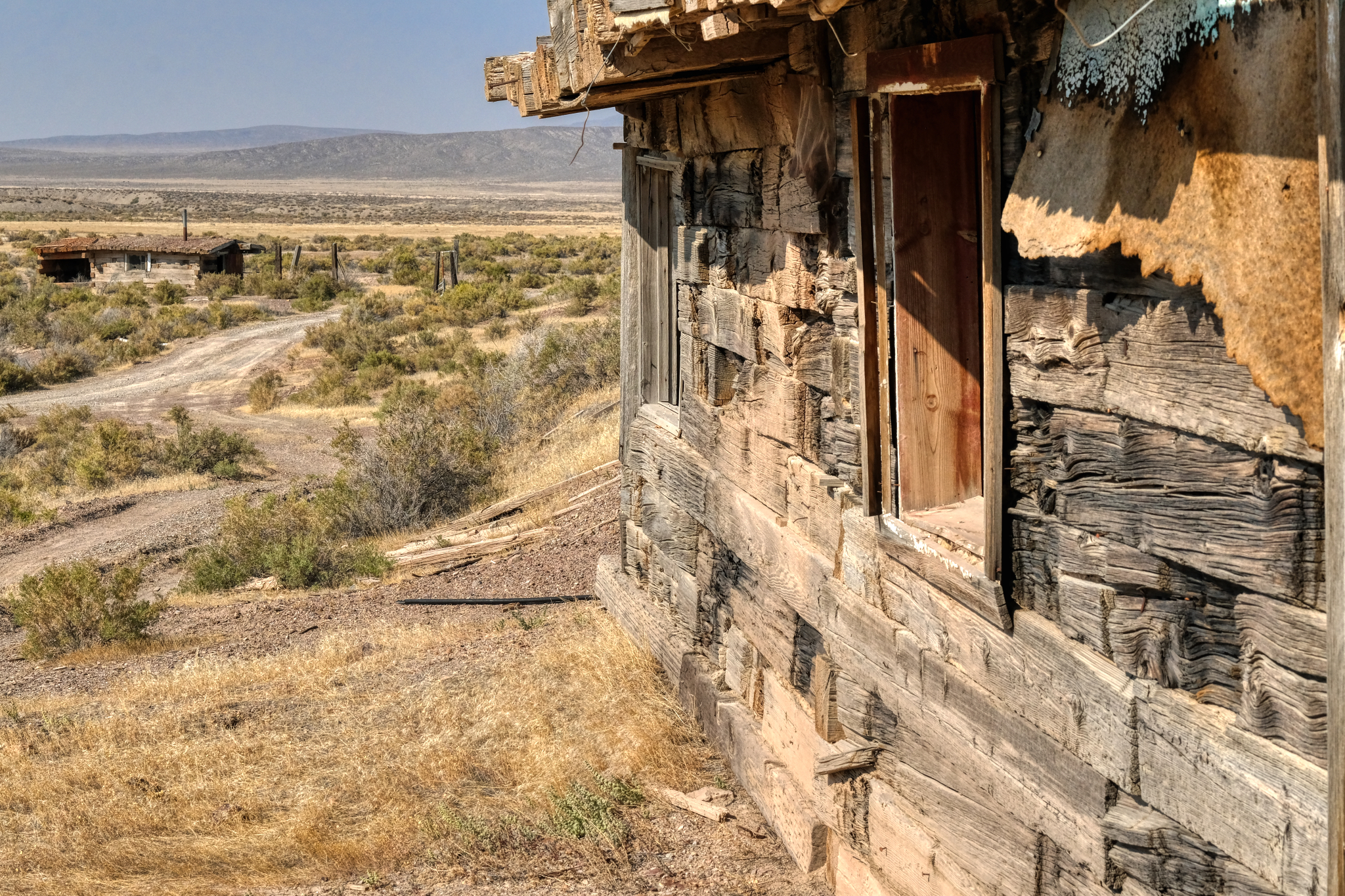
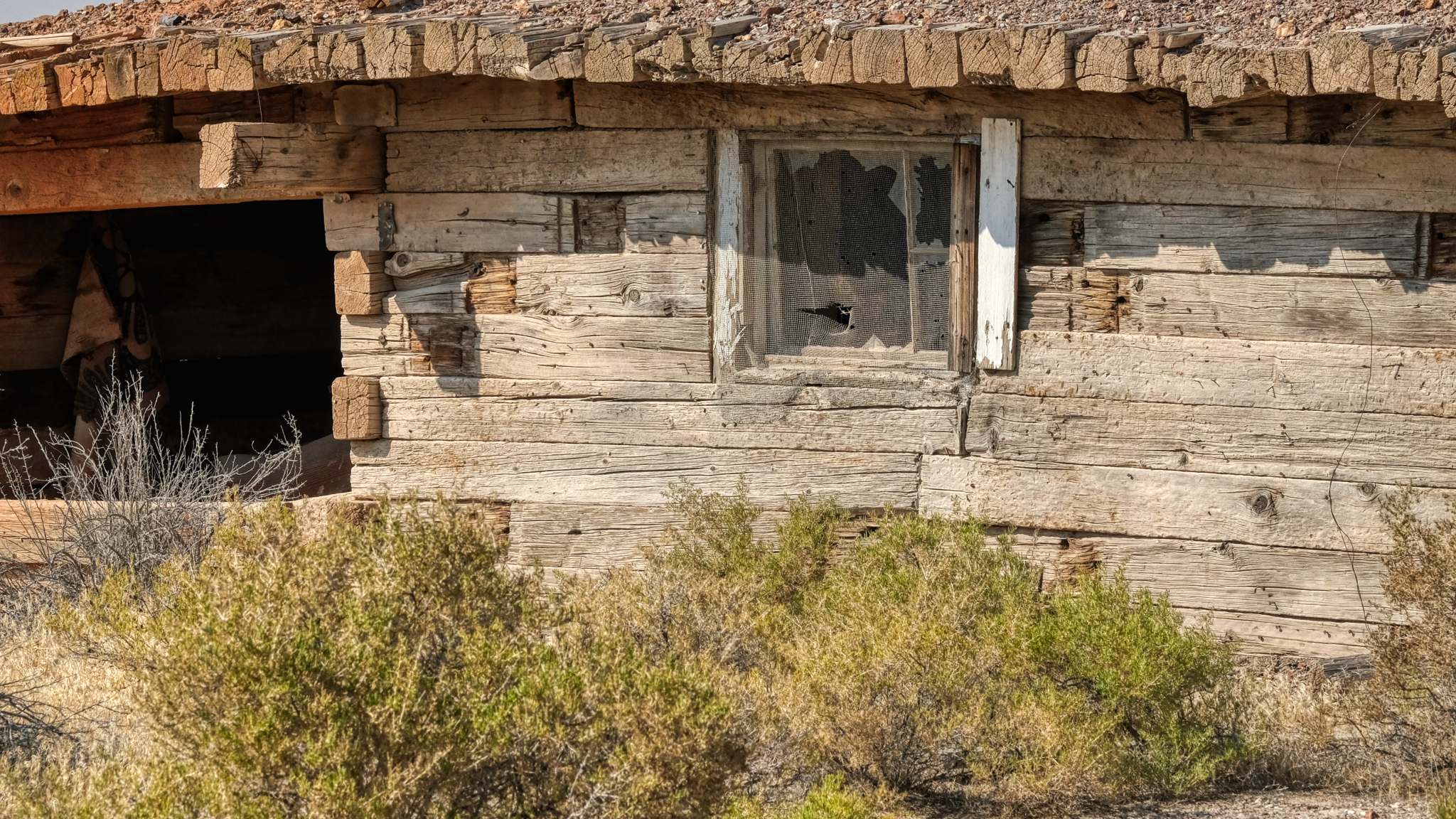
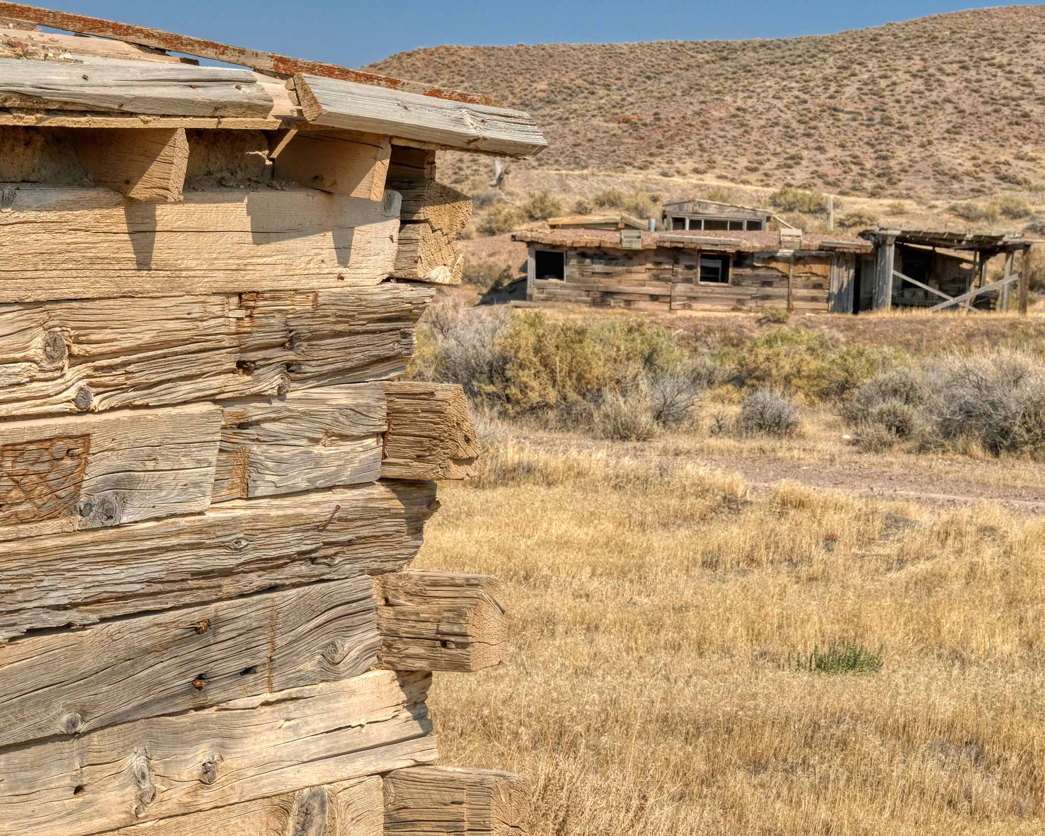 They used some very large wooden beams to construct these buildings. Looks like something salvaged out of old mines.
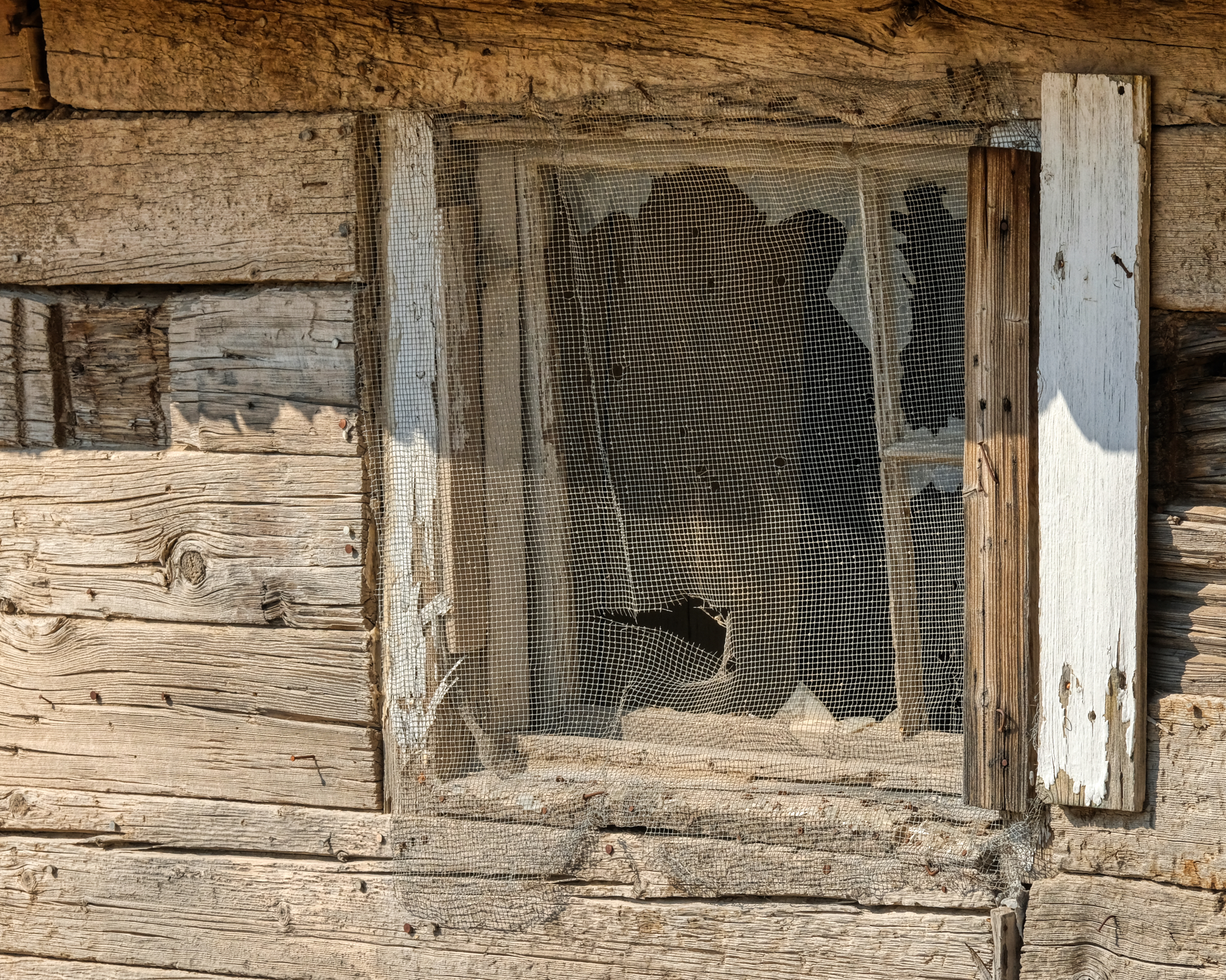
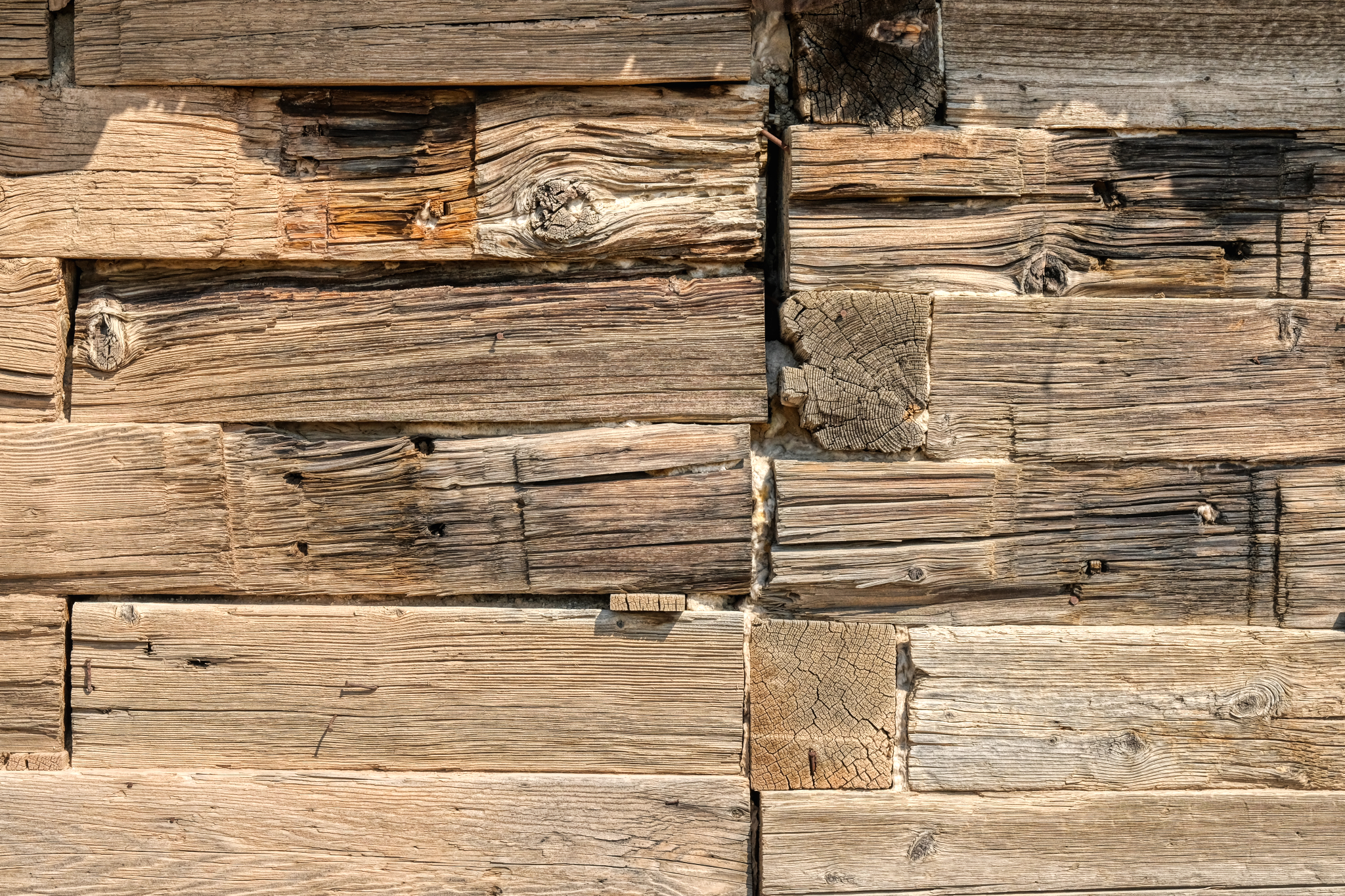
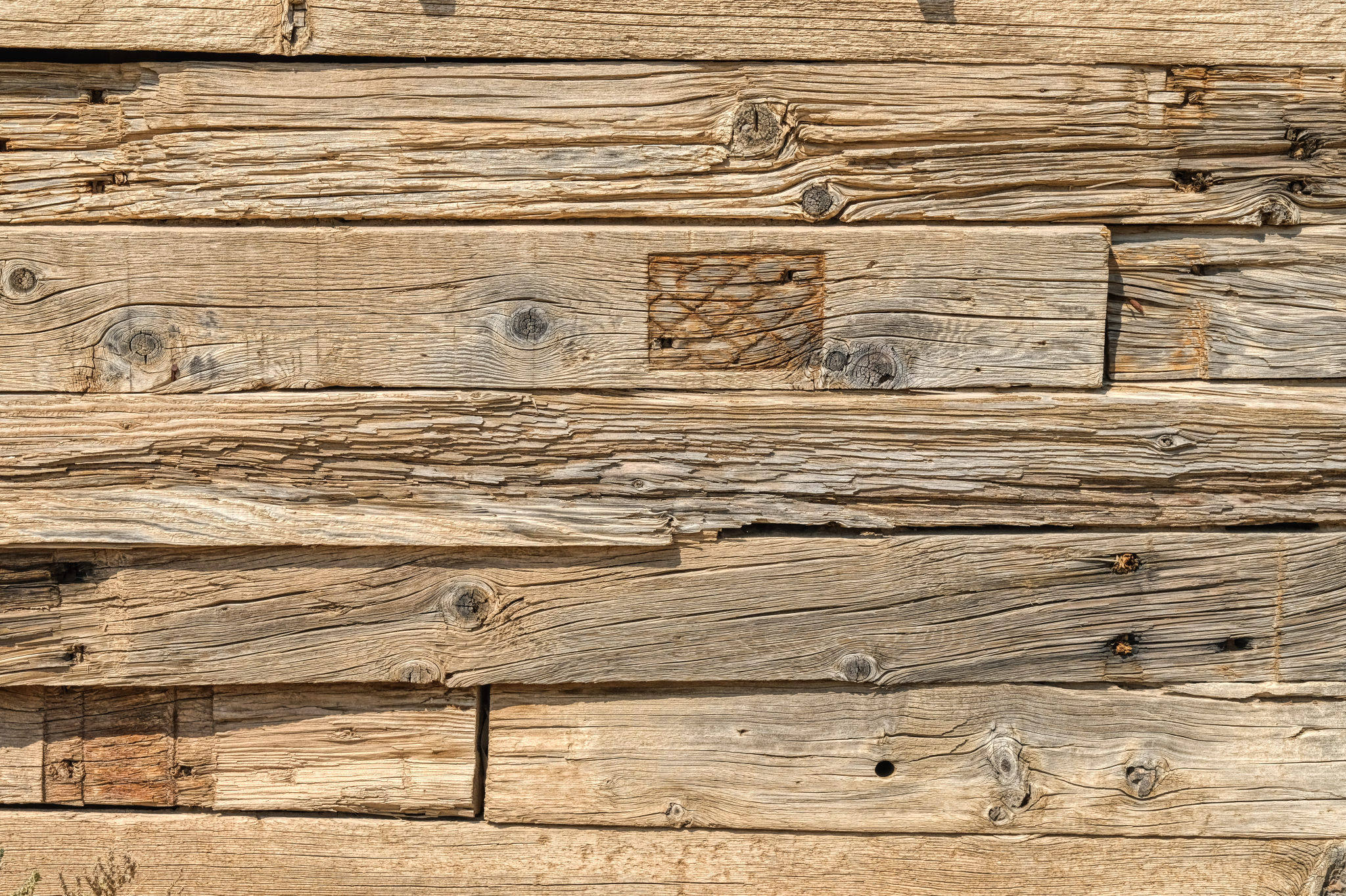 The textures! WOW! One of my favorite photographic subjects: weathered wood.
 I spent quite a long time exploring this visually interesting place.
 Stunning arrangements everywhere . . . just waiting for printing and framing.
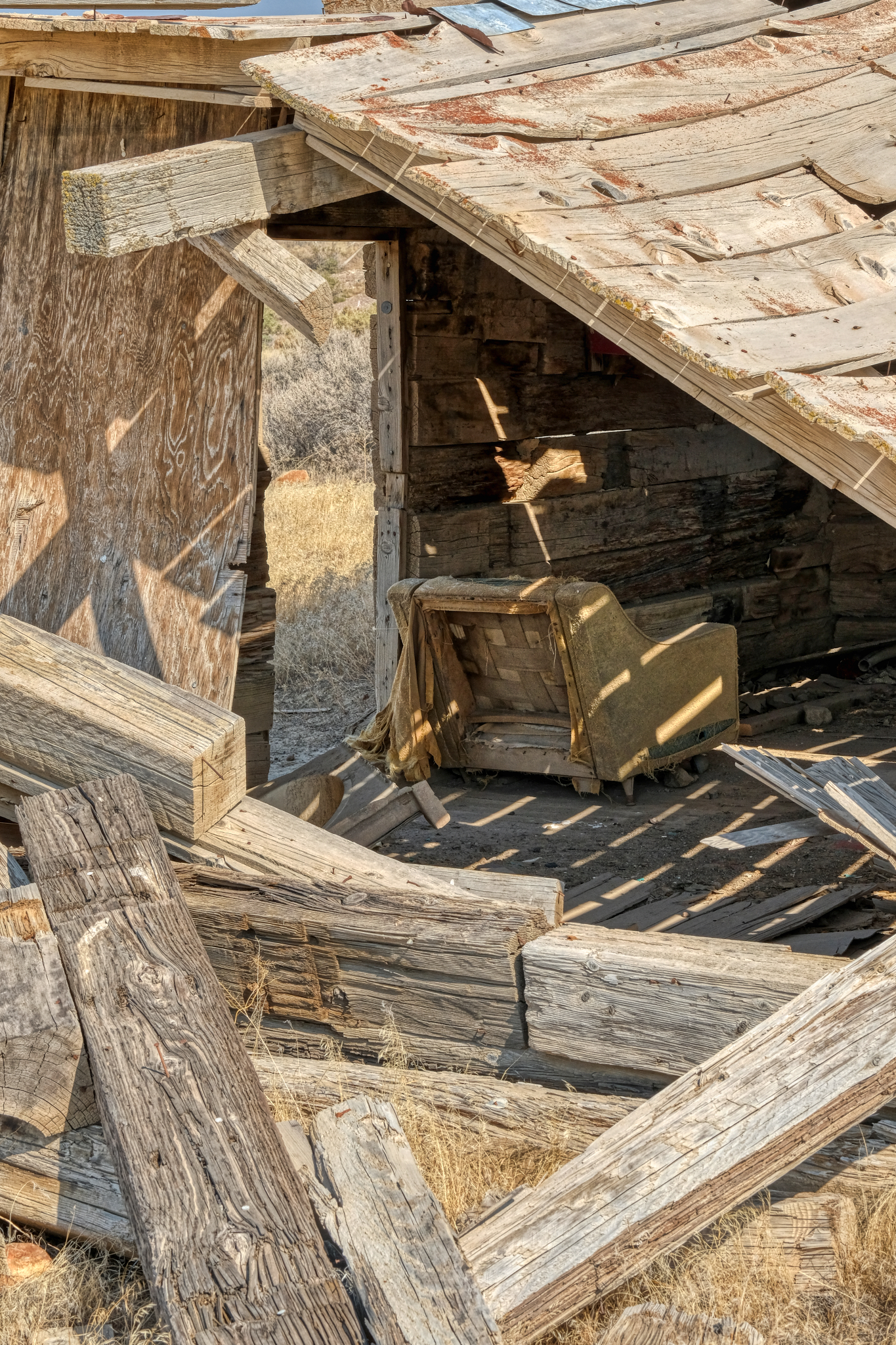
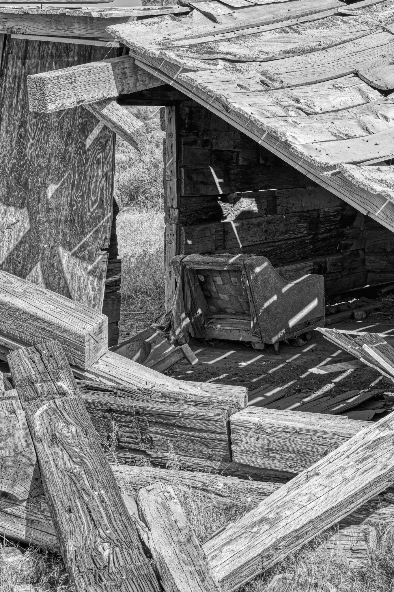
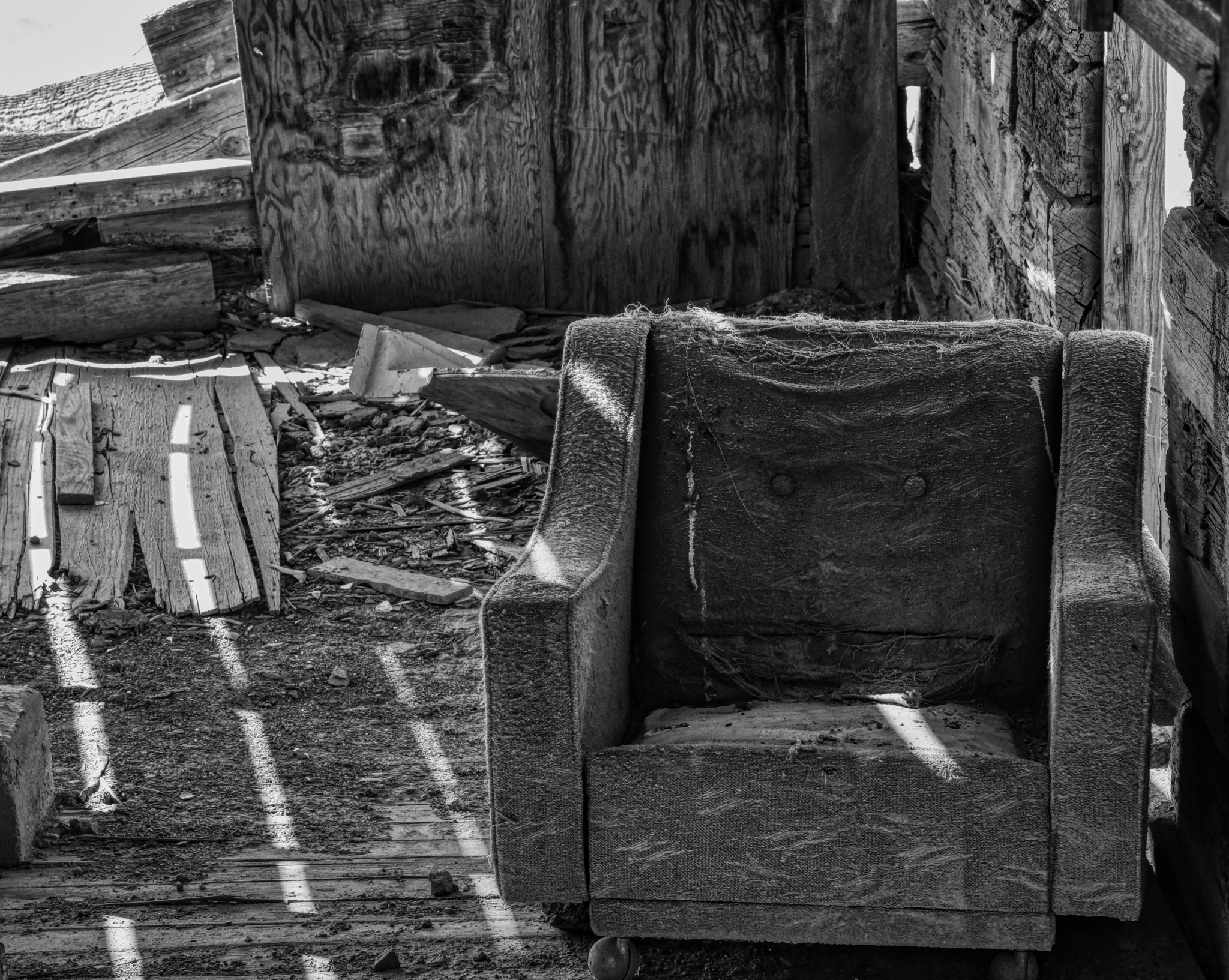
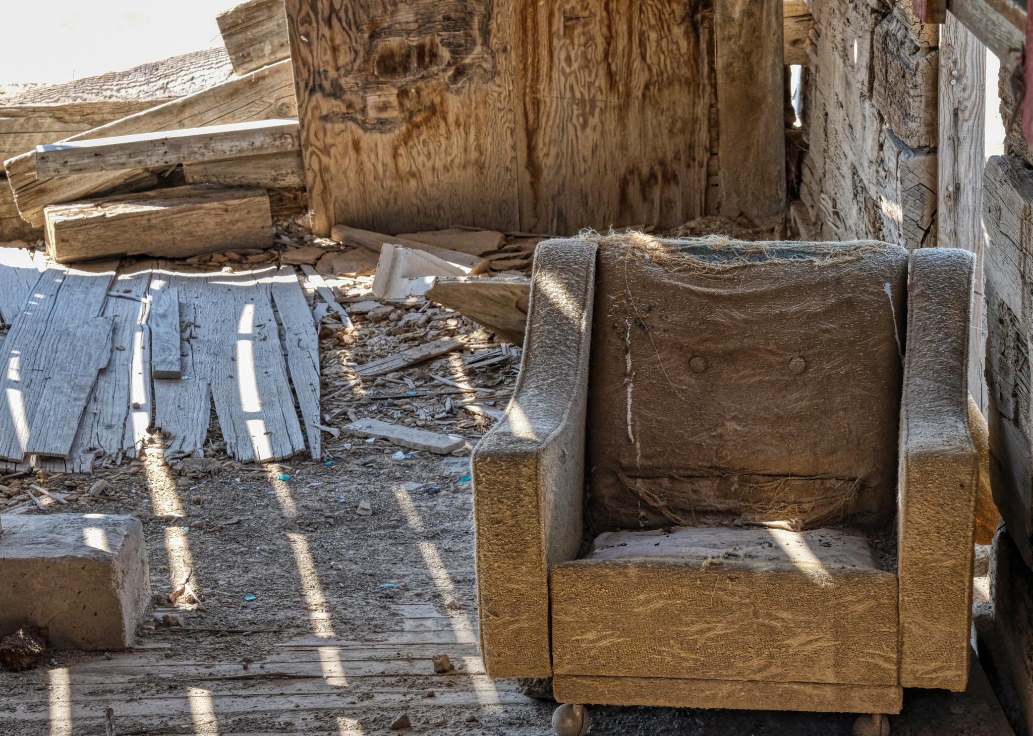 I guess they decided NOT to bring the good chair along with them when they left.
 Lovely light, shadow, and shape.
 There were several houses on this site. I imagined that there must have been a place name . . . a "town" name at one time, but I could find no mention of this site on any online maps I could find.
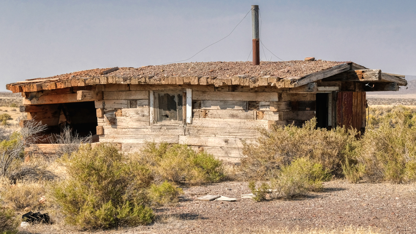
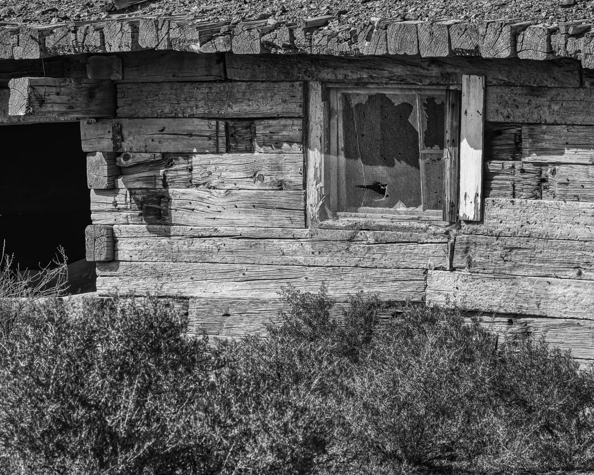
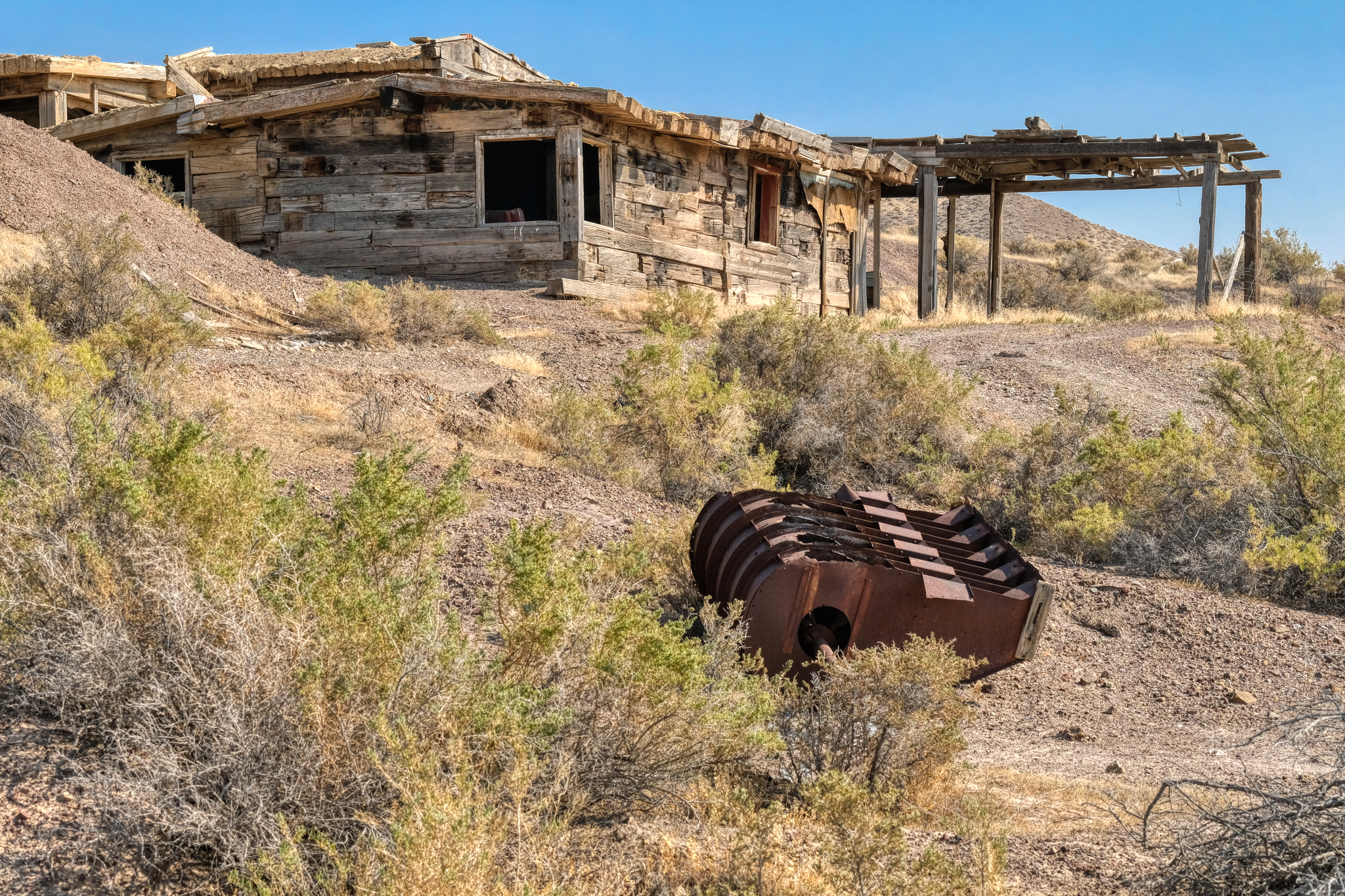 This house was larger than the rest of the cabins. There was a mine opening on the hill above.
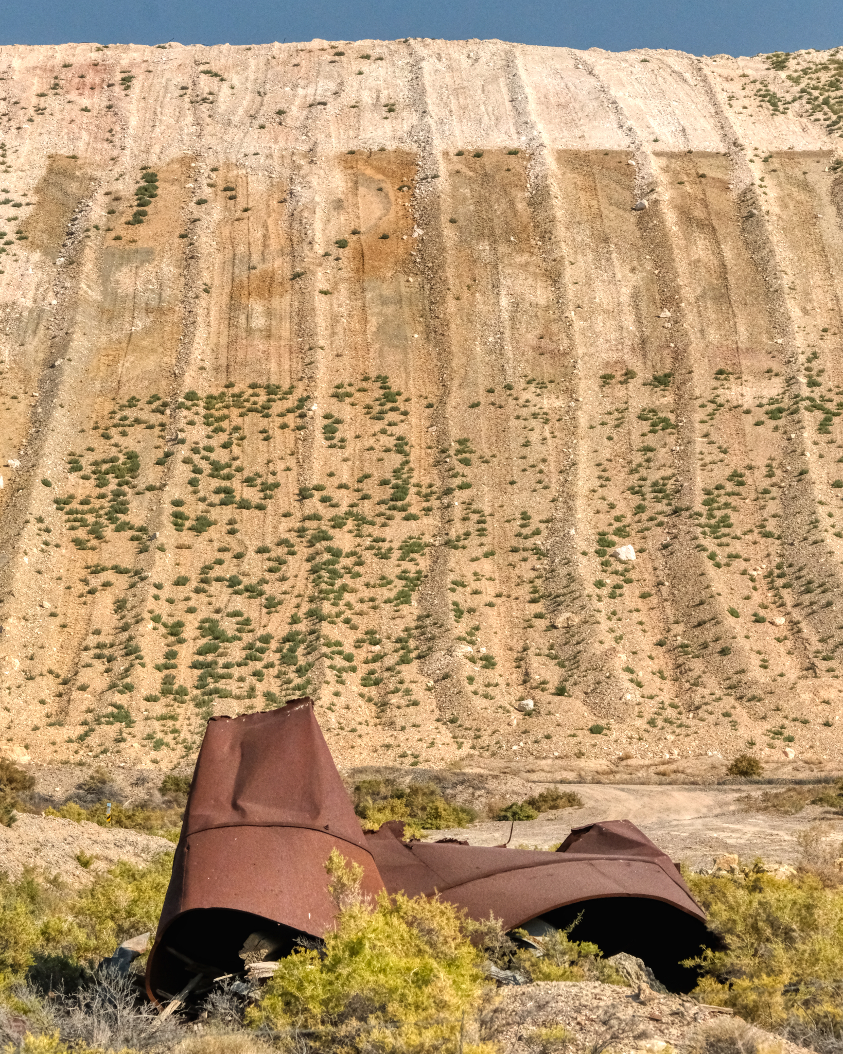
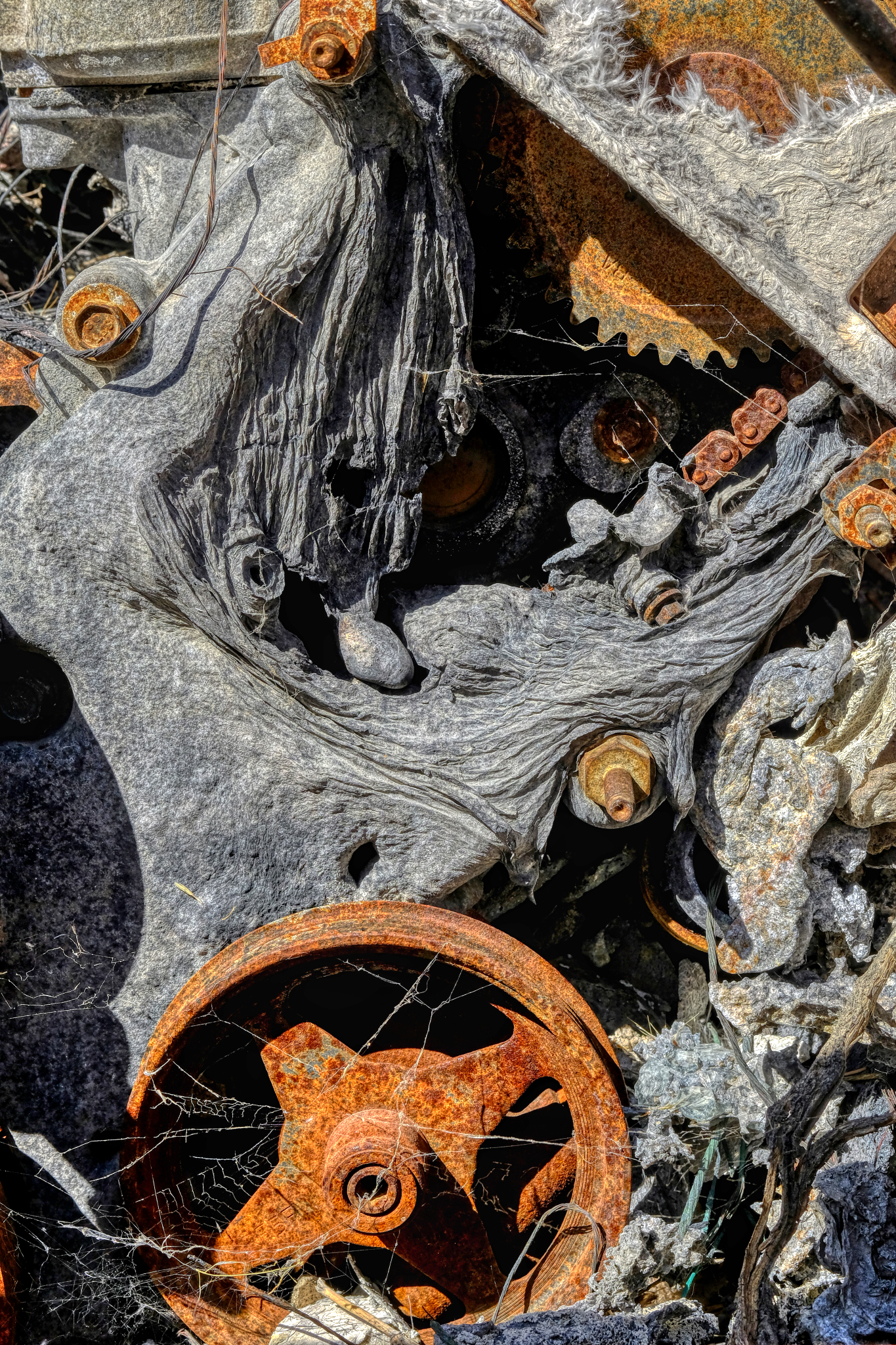
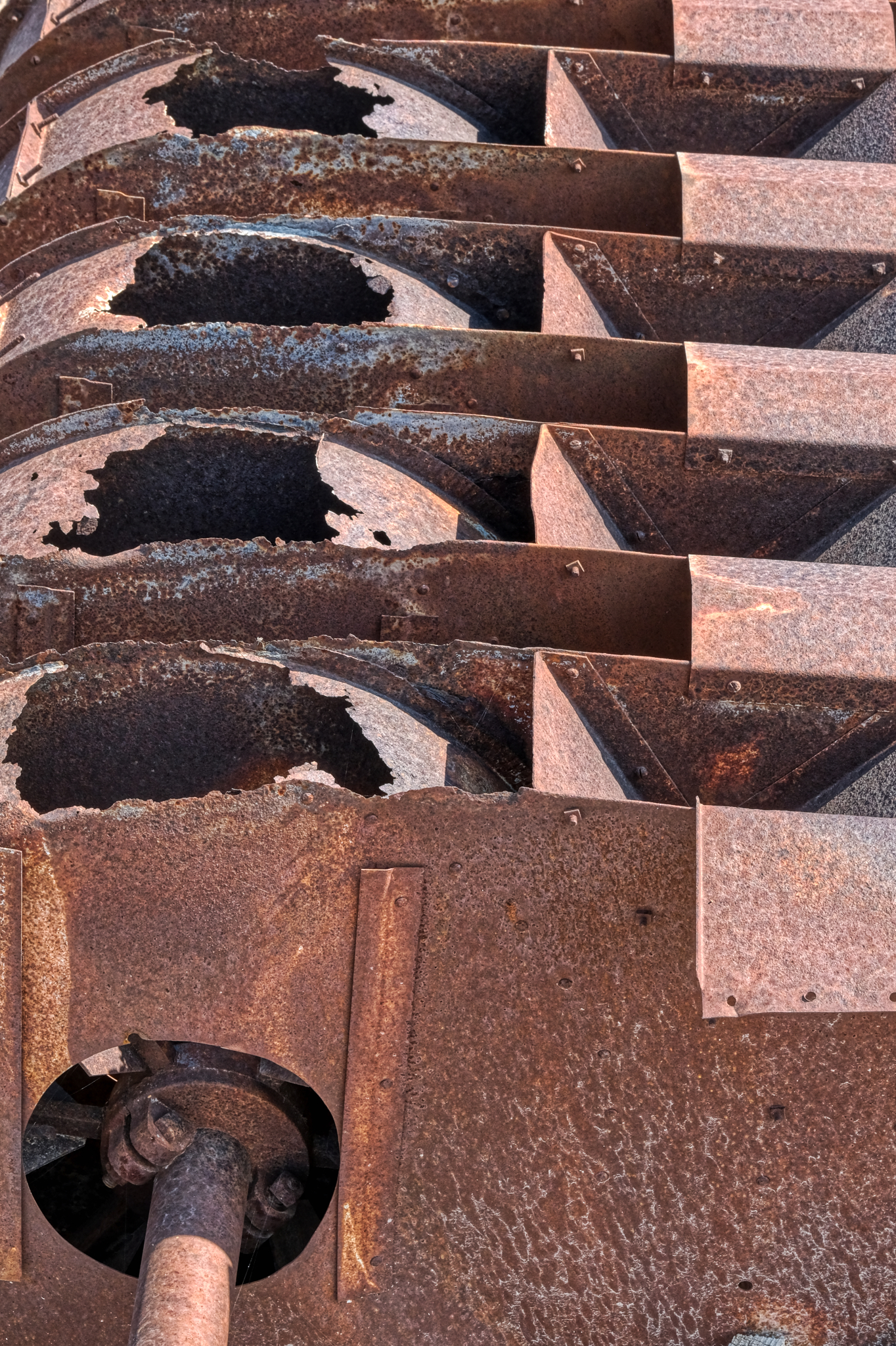 A piece of rusting mining machinery. I do not know what this could have been used for . . . sorting and separating something, I suppose.
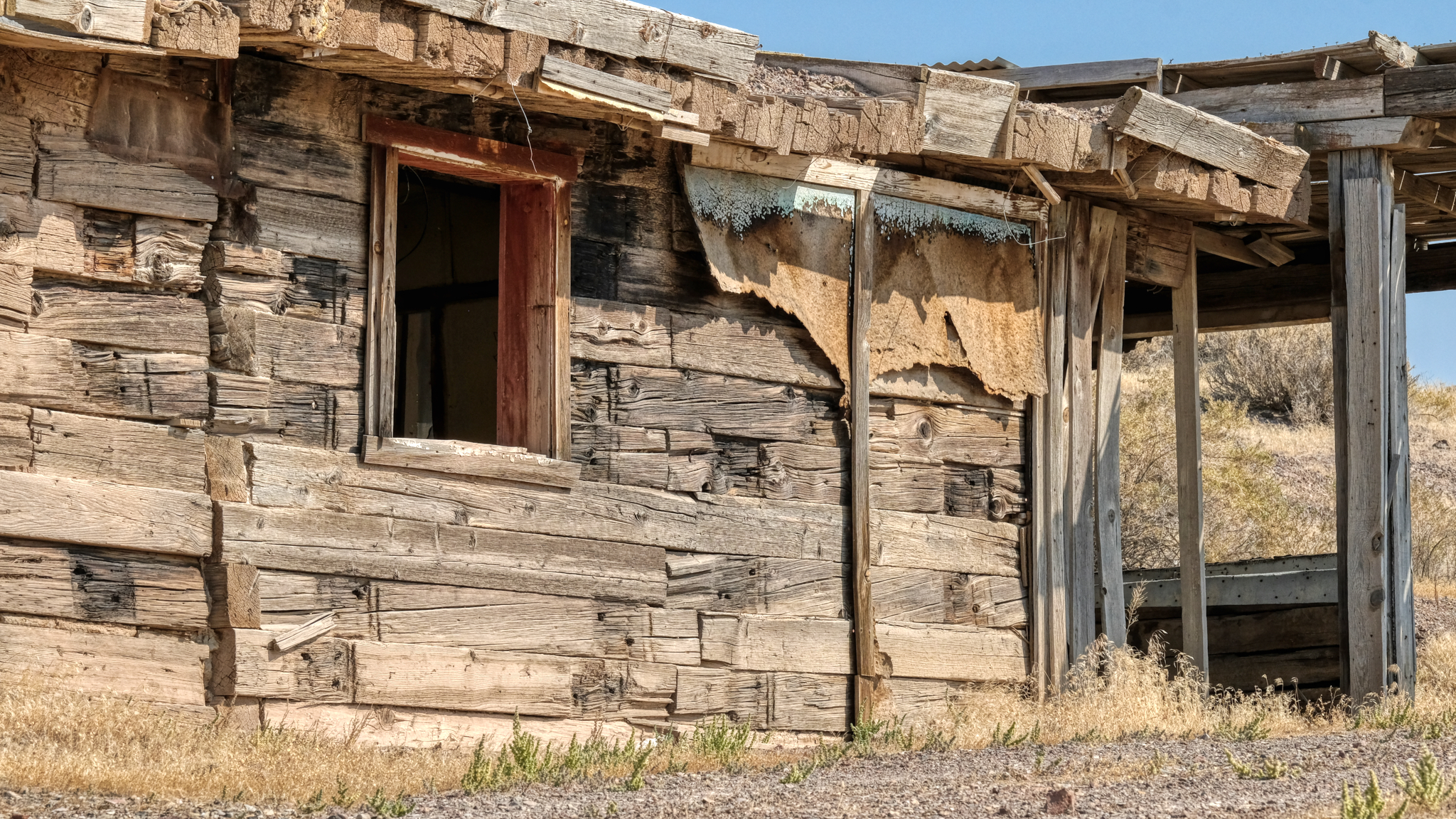 The 'Big House' . . . looks like it had fibreboard and tarpaper covering at one time.
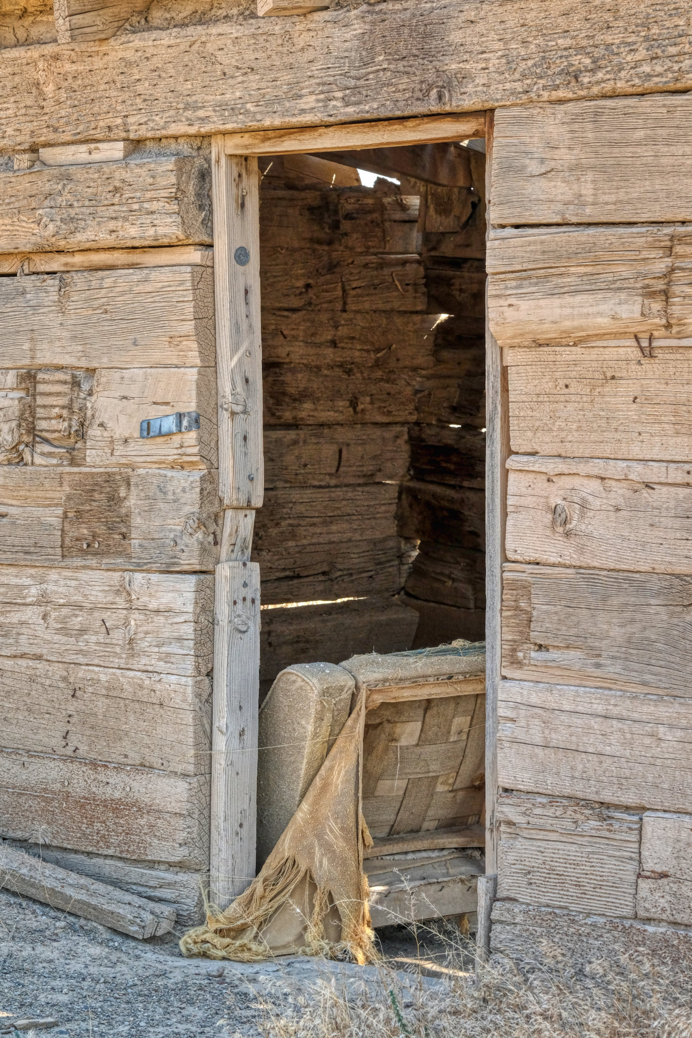
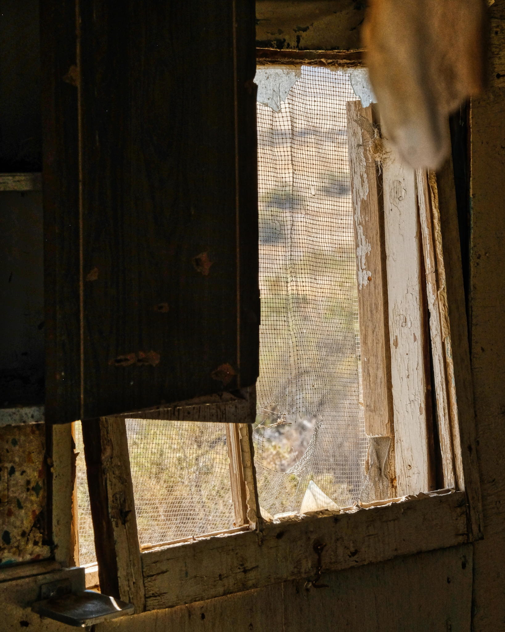
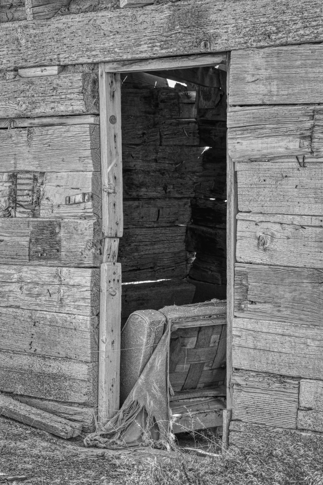
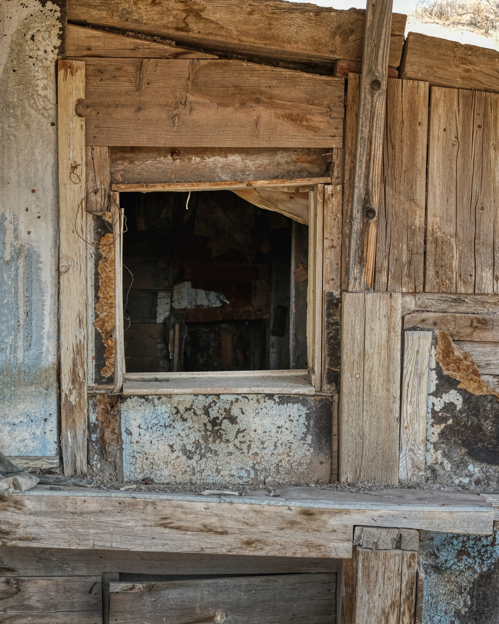 I poked my nose into the Big House . . . .
 . . . and the view from the inside of the 'main house'. It was a mess . . . perhaps whoever had lived here left in a hurry . . . .
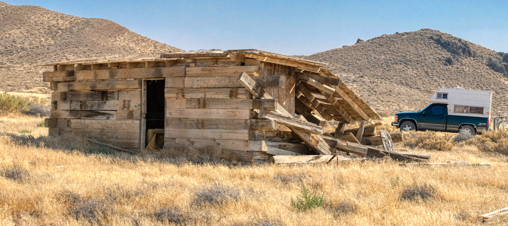
 I walked down the hill to another abandoned old wood cabin.
 Another house made of these very large wooden timber beams.
 Fantastic old, dry timbers . . . the textures and patterns!
 A picture tells a story . . .
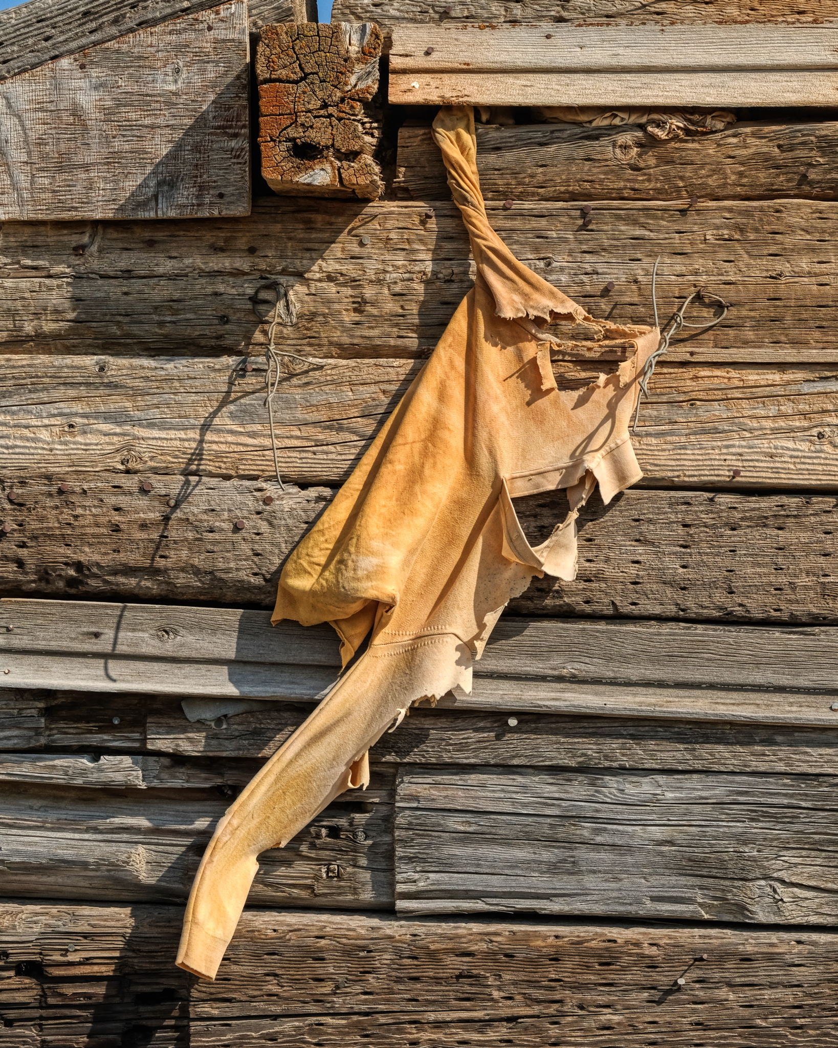 I had apparently stumbled upon the site of the National Sweatshirt Testing Facility (NSTF).
 A perfect 'screen saver' photo . . .
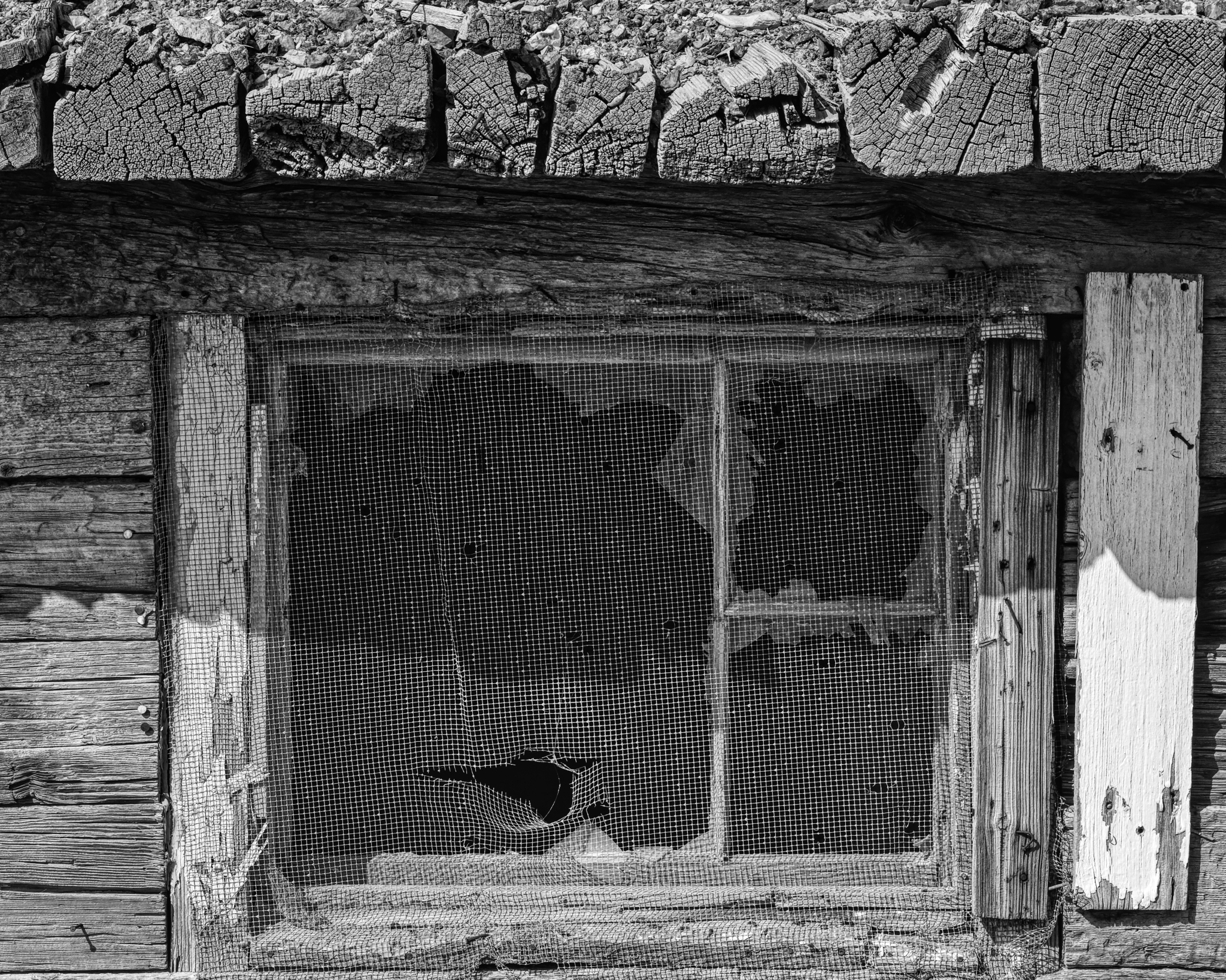
 All I could think was that the flying insects around here must have been pretty big.
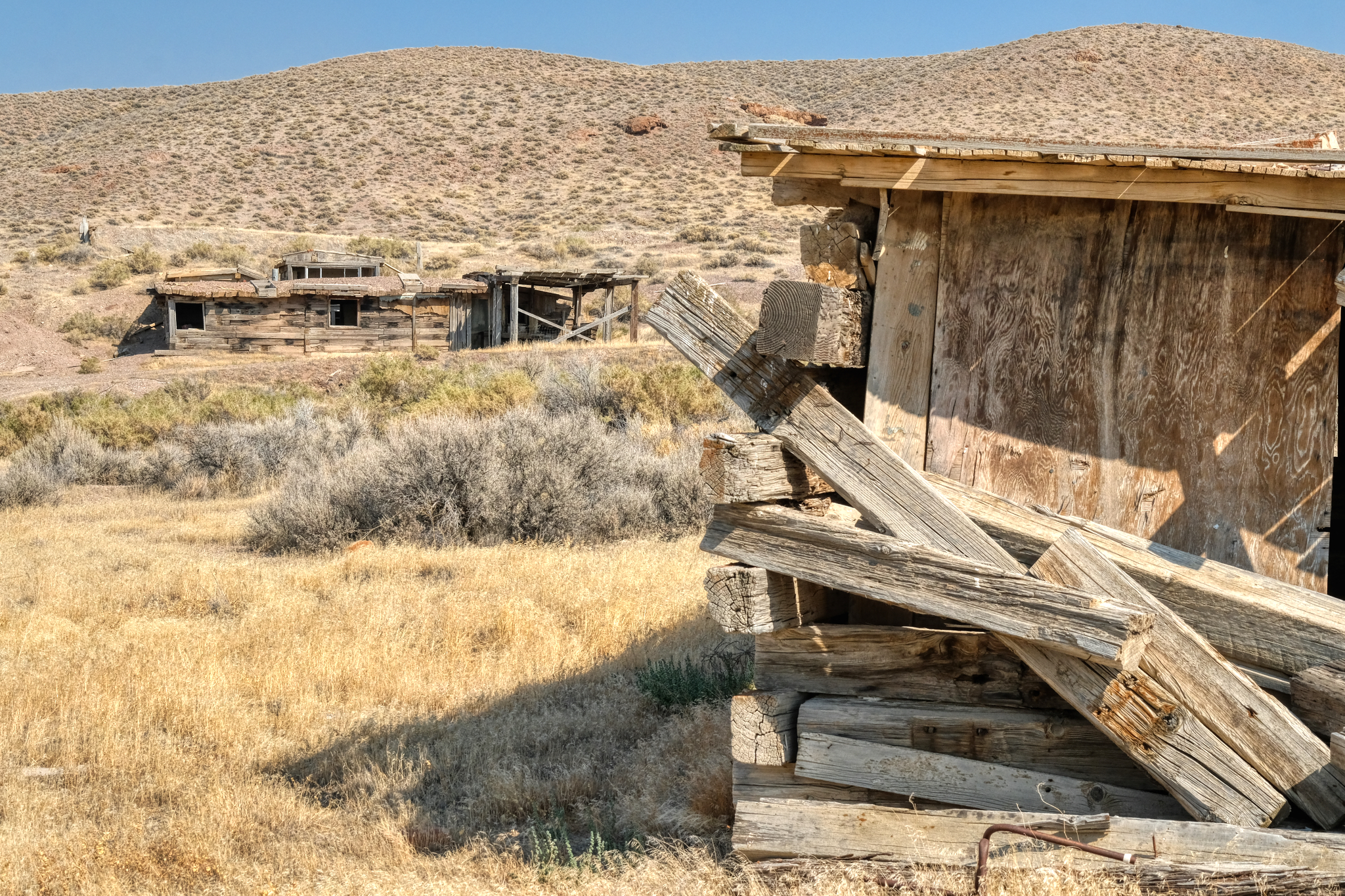
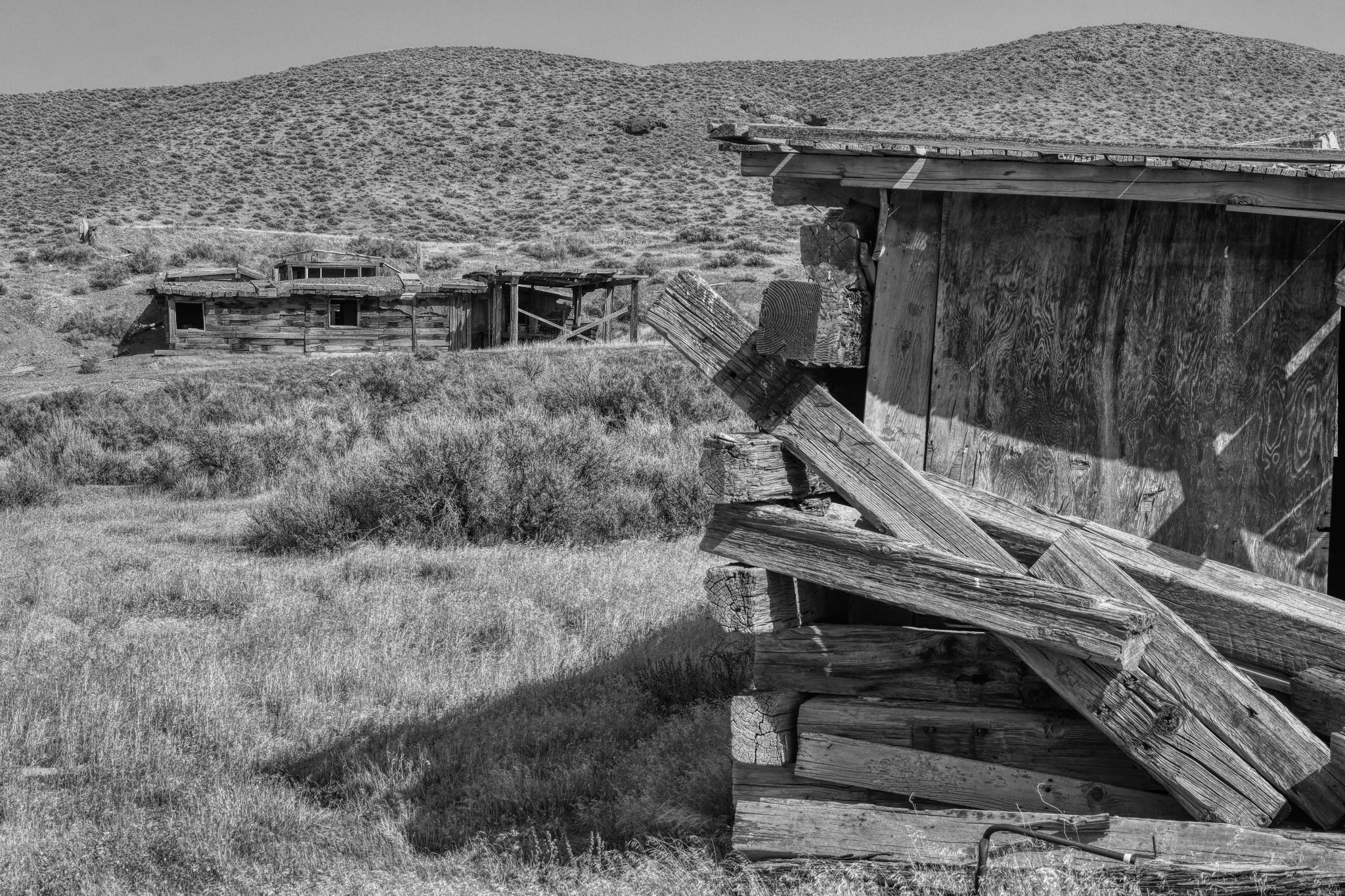
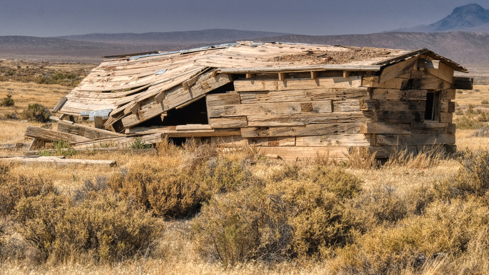 Yet another abandoned miners house from a bygone era . . . not all that long ago . . . .
 It was early September when I was in northwest Nevada . . . and there is always some fauna that thrives at every time of the year on the desert.
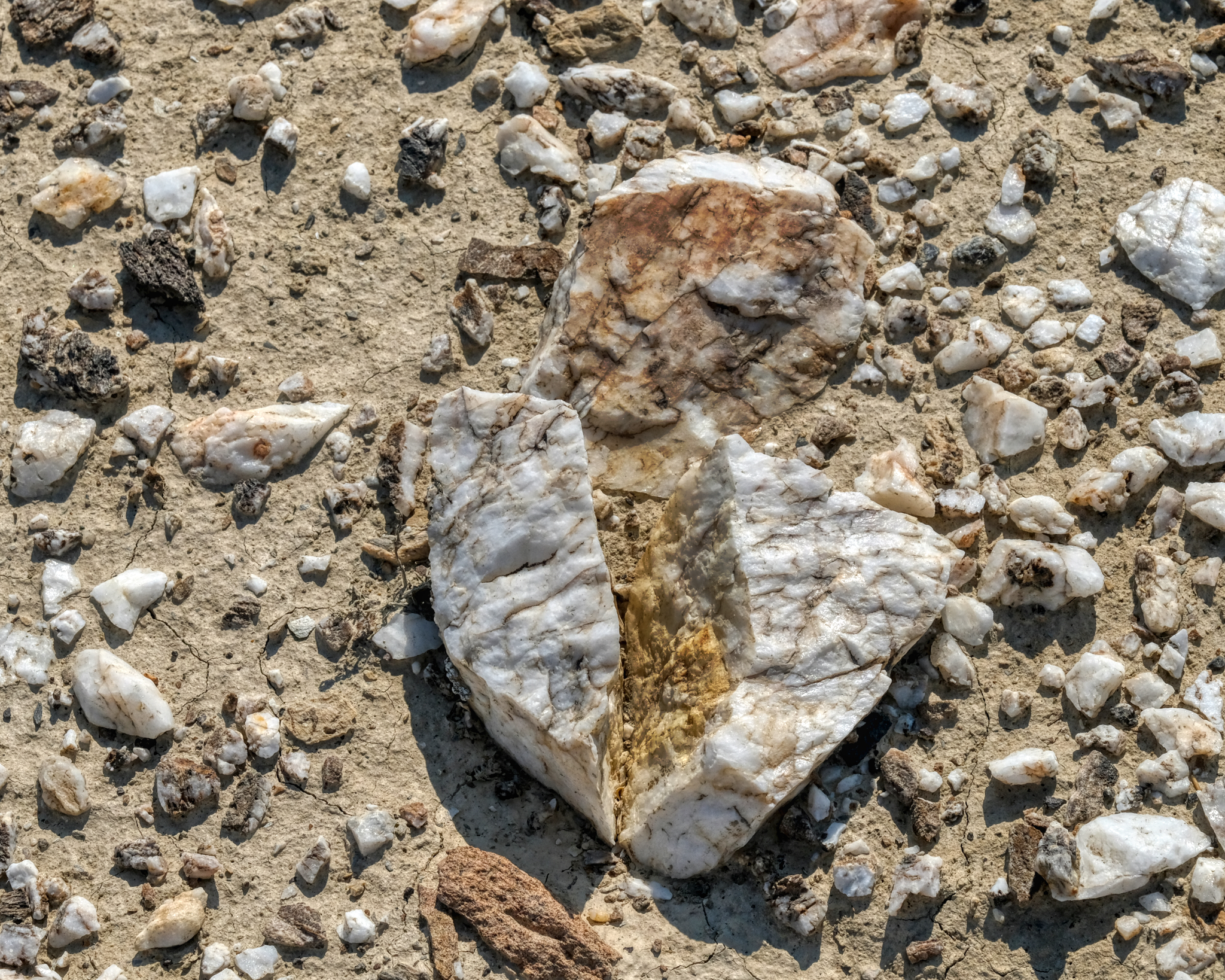 The desert floor around the old mining community was littered with this white quartz . . . I wonder what they were mining for here? I left the abandoned miner houses and drove back out on Highway 49 . . . to look for a place to set up camp.
 This is what I was looking for: a track that led up and away from the road and into the wild desert. I drove about a mile up this track before I decided that this isn't what I wanted . . . and I do not know why. But I was tempted.
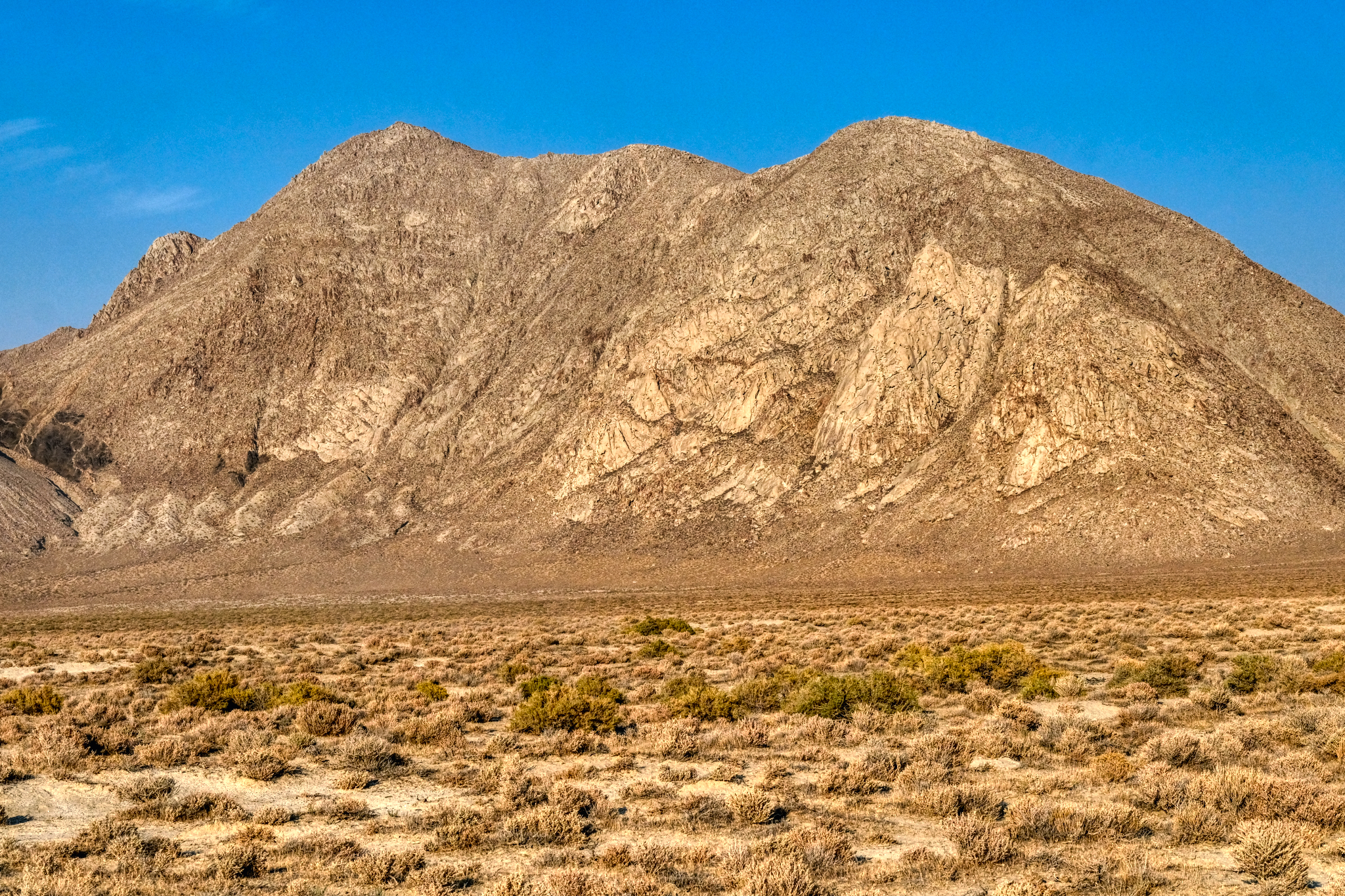
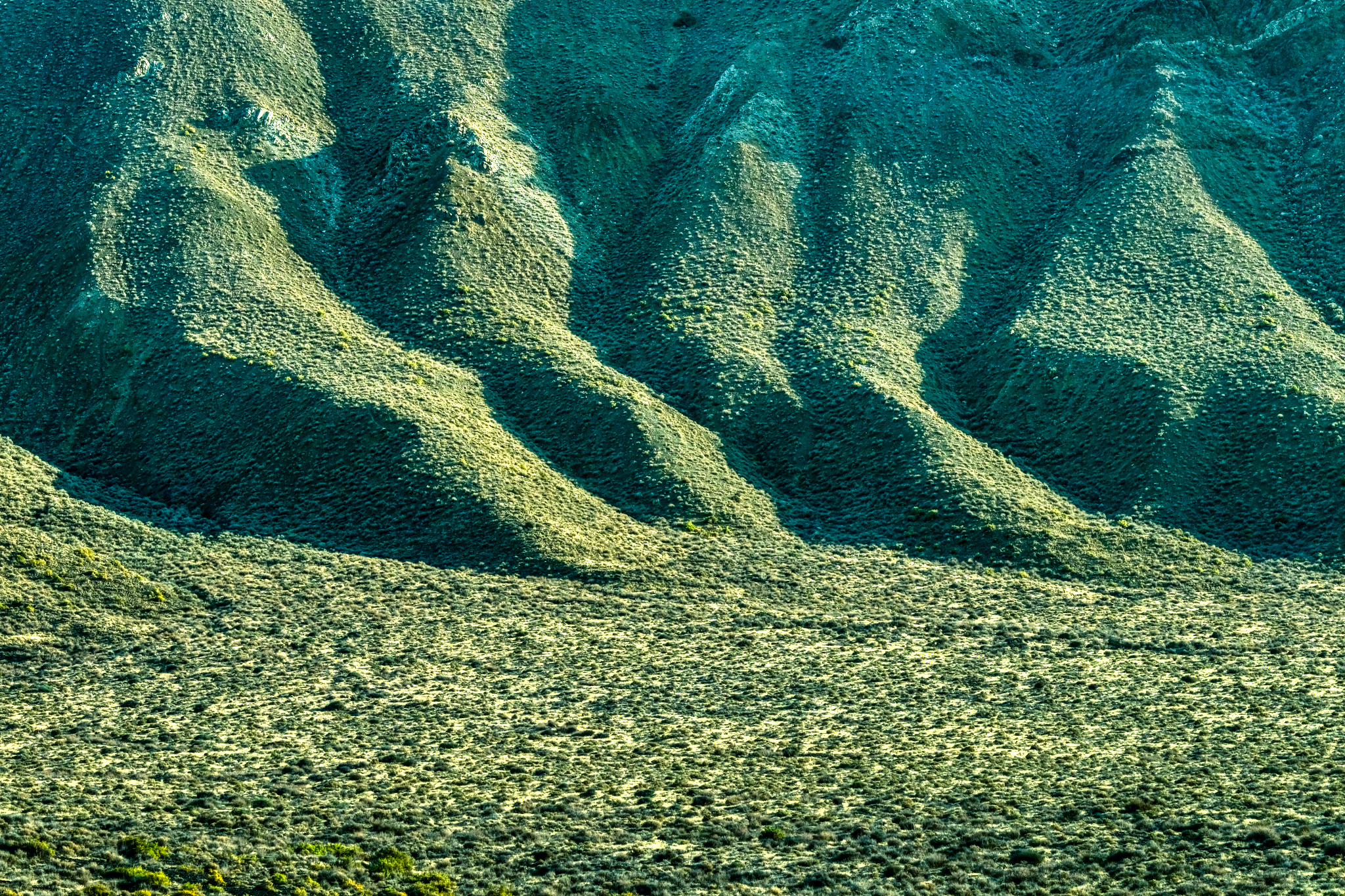
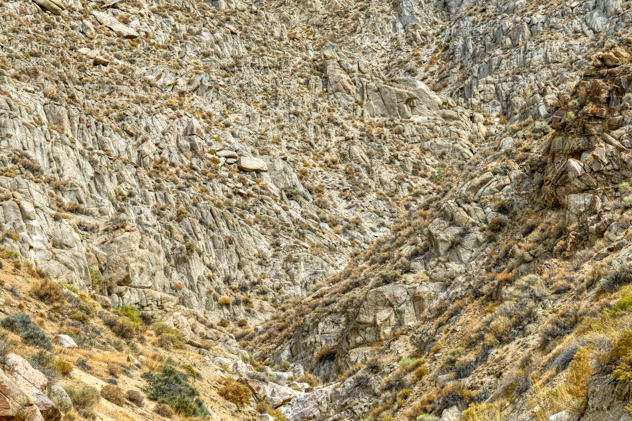
 The view to my left as I drove toward the Black Rock Desert was always a sharp escarpment, with ever-changing geology and brush covering.
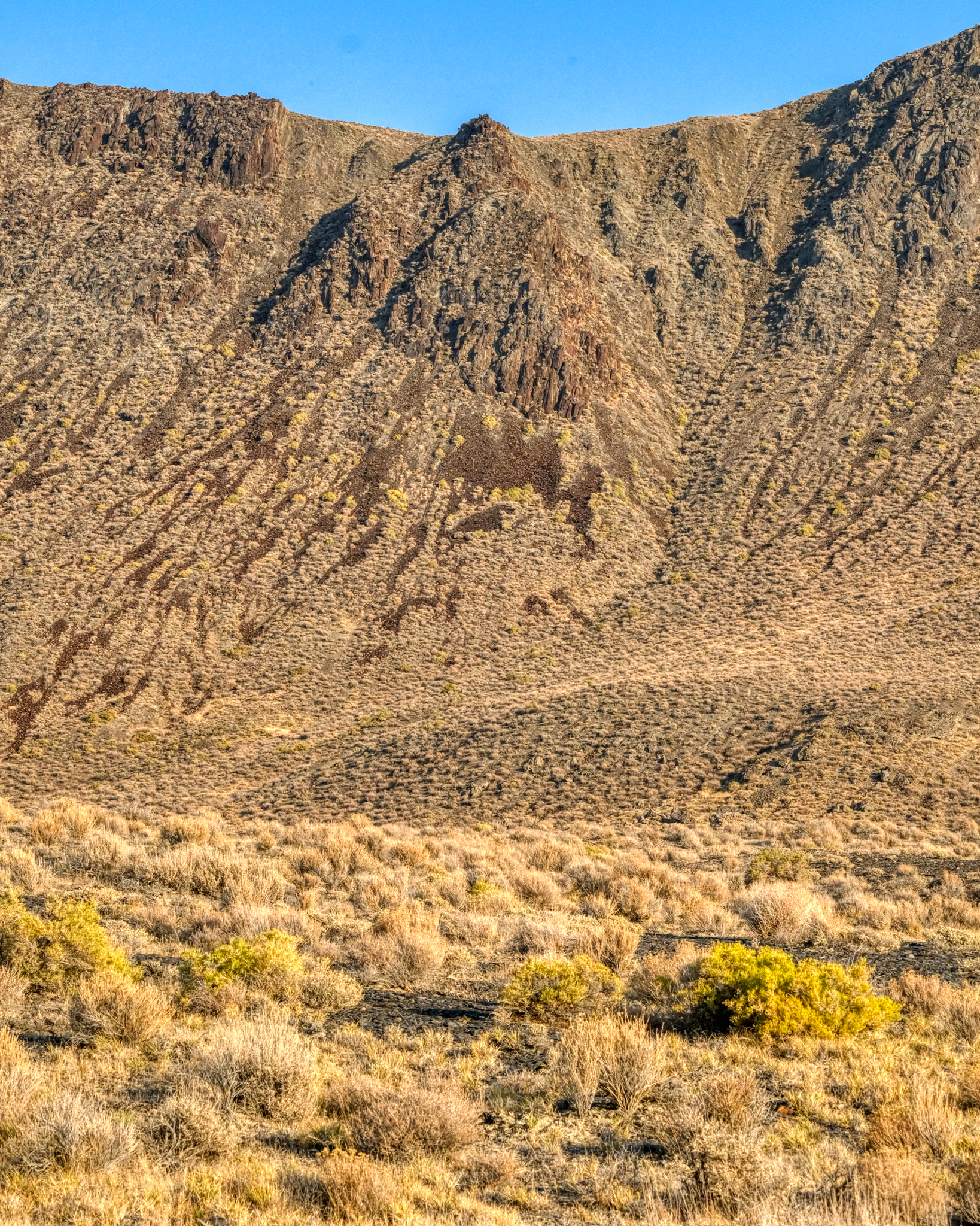
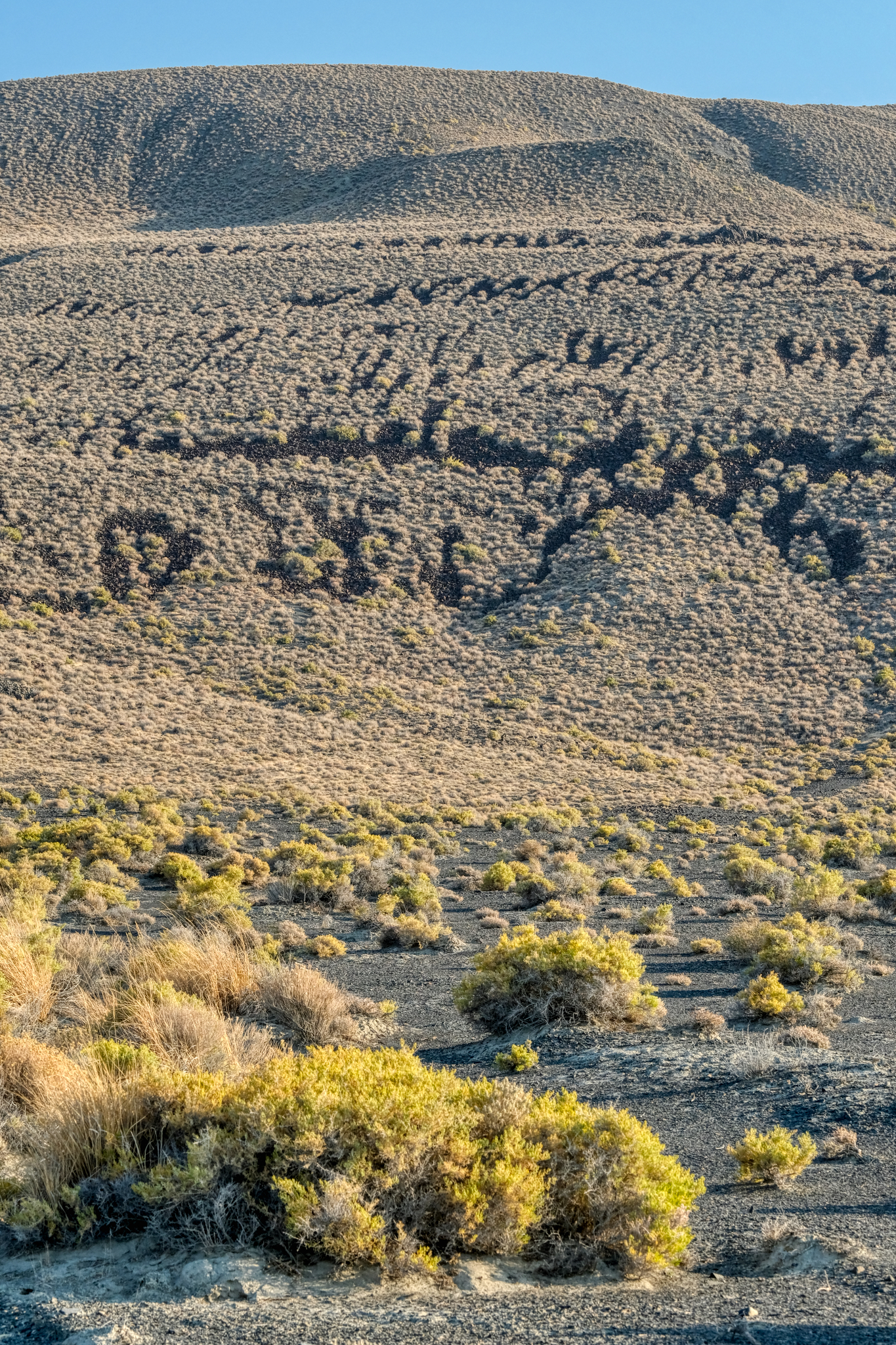 I stopped here in wonderment! There seemed to be giant petroglyphs on this volcanic hillside. What language was this? Of course, I knew it was just bald spots on an old lava flow . . .
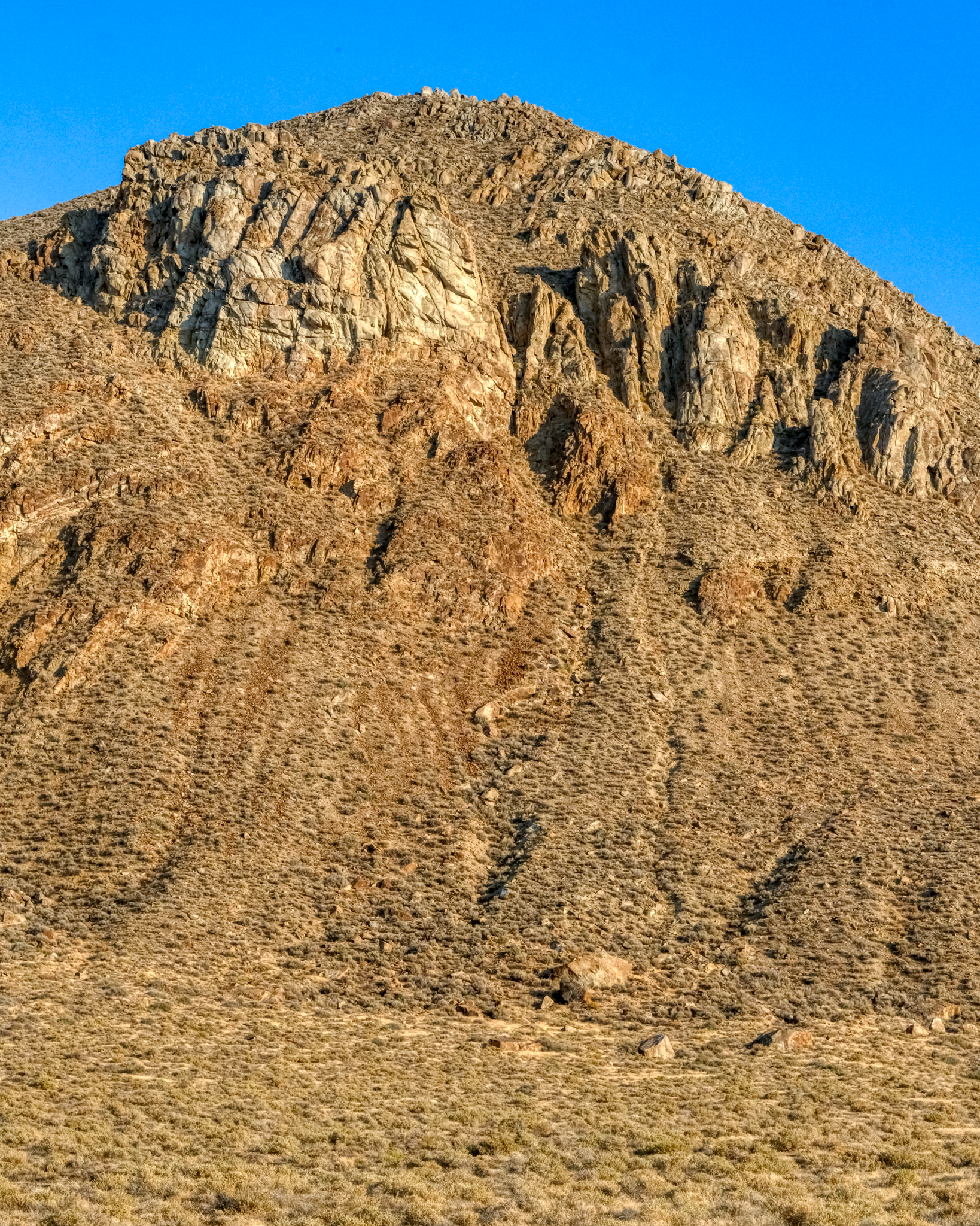 Such an amazing desert mountain landscape . . . but look closely . . .
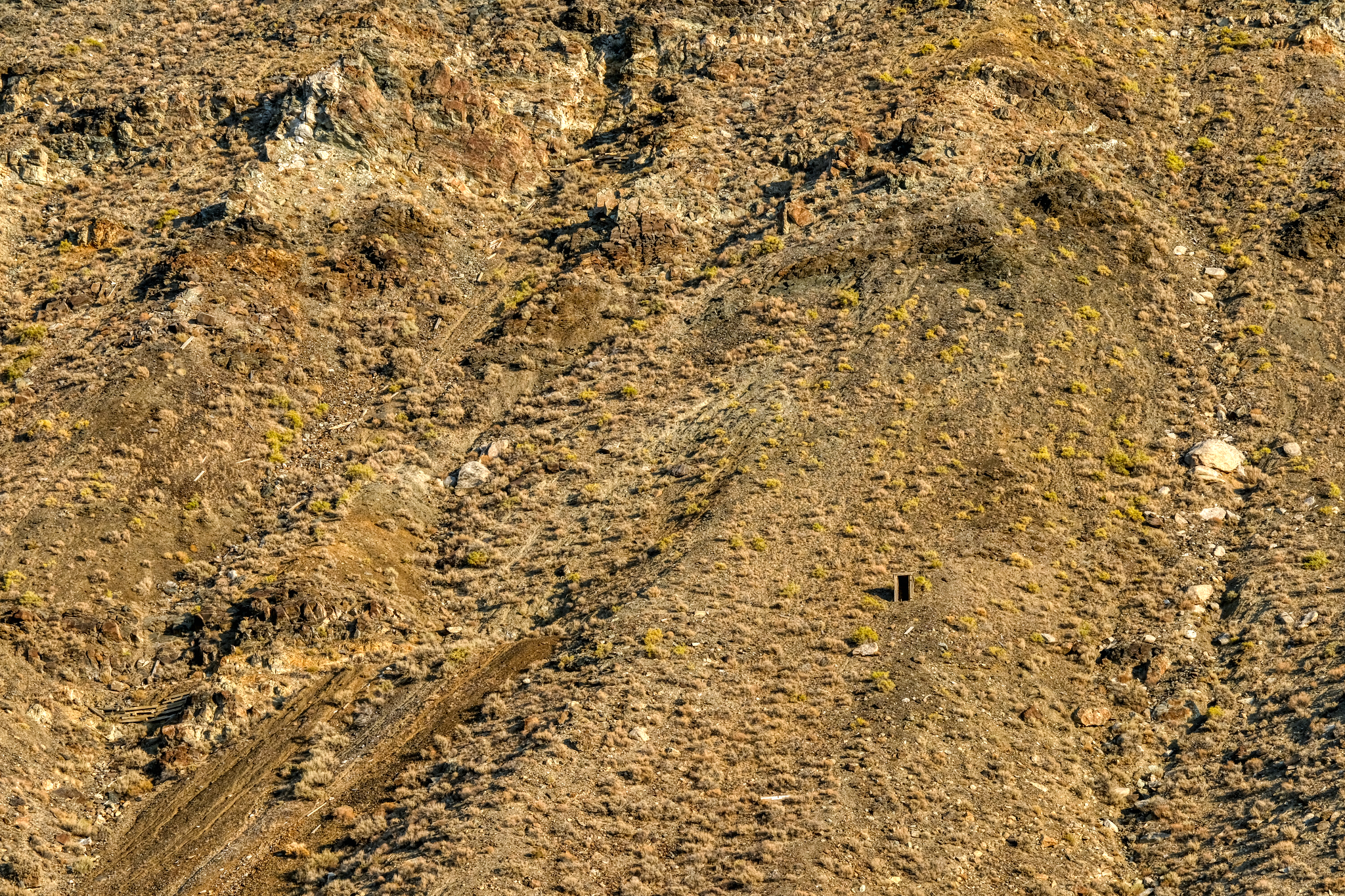 . . . but look closer . . . and you see the remnants of an old mine entrance way up on the mountainside. Astounding!
 I drove for an hour alongside this rocky ridge . . . always scanning for something interesting . . .
 I stopped and contemplated climbing up to this "dry waterfall ' . . . but it was much further away and much taller than I thought.
 The shadows were getting longer and I felt the need to find my camping spot . . .
 Long shadows on the desert hills.
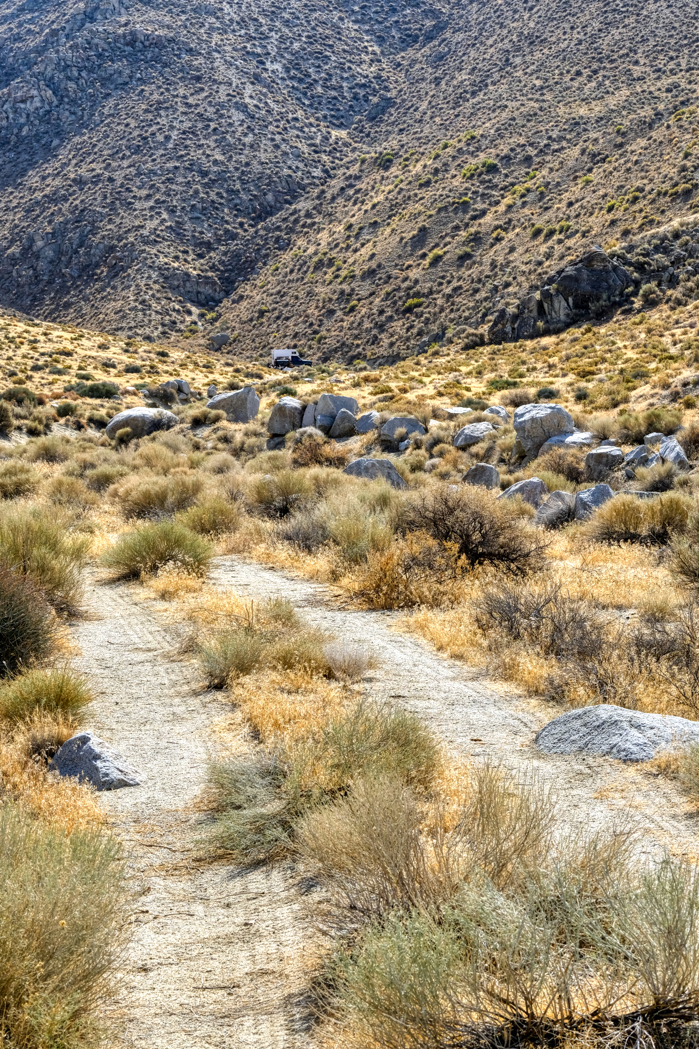
 In the five days I spent out of Winnemucca on the desert roads, I saw only two other cars . . . I caught up with this truck . . . but turned off before I got too close.
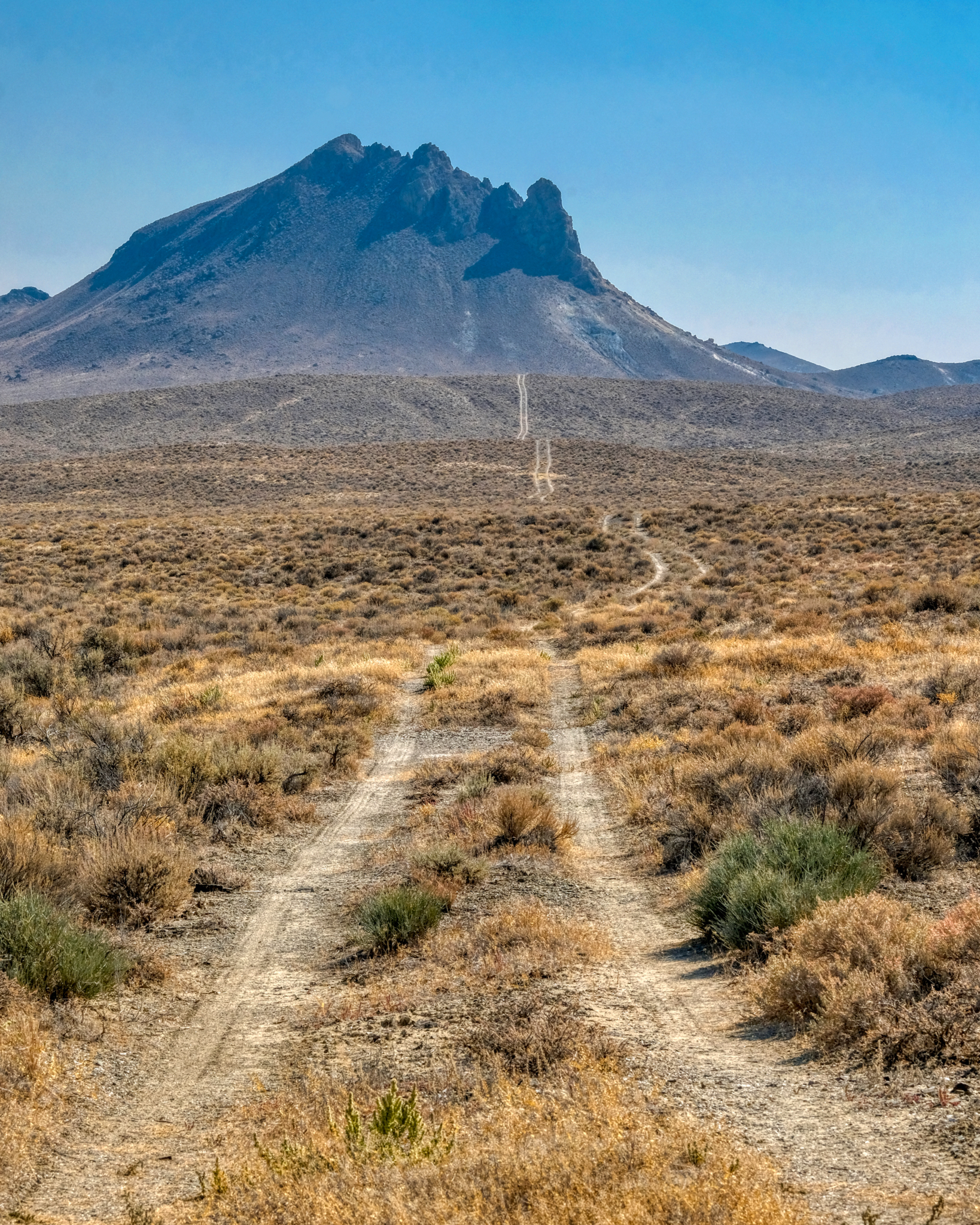
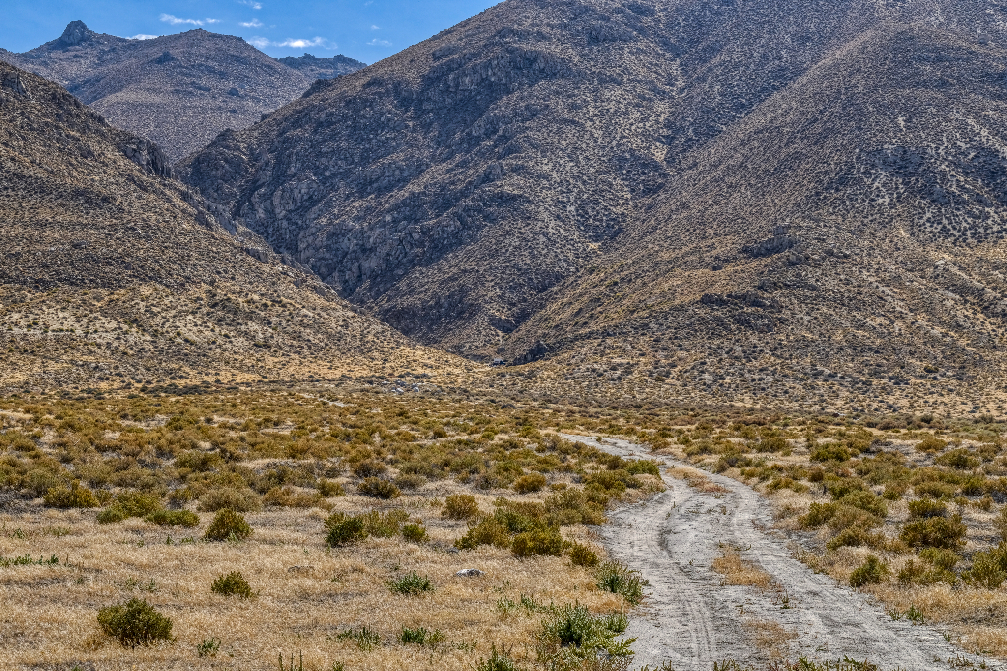 I eventually spotted this little track heading up into a gap in the rocky hills and thought it might be an interesting place to park my camper . . .
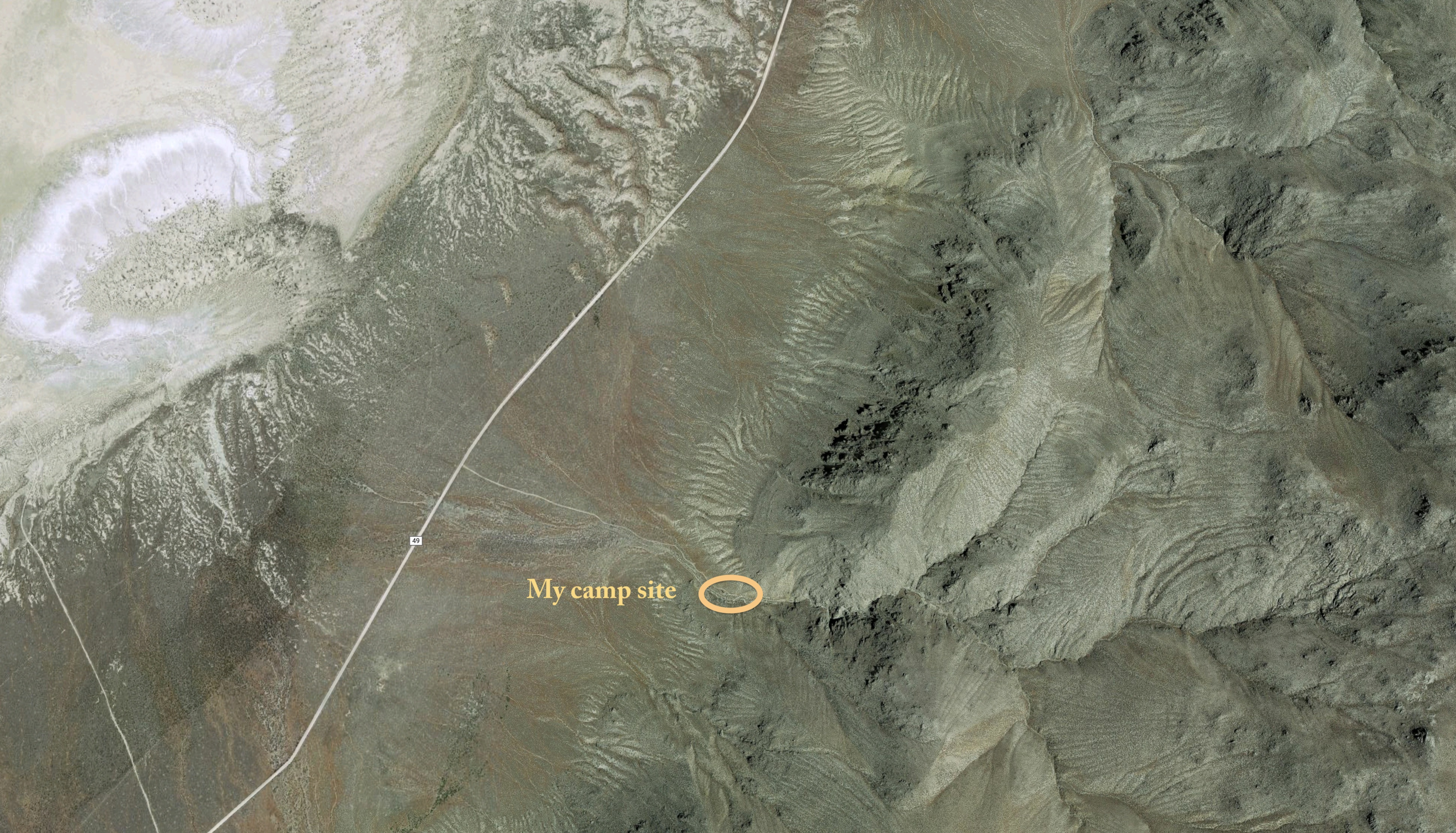 GoogleMaps photo of my campsite . . . . a dream location for me!
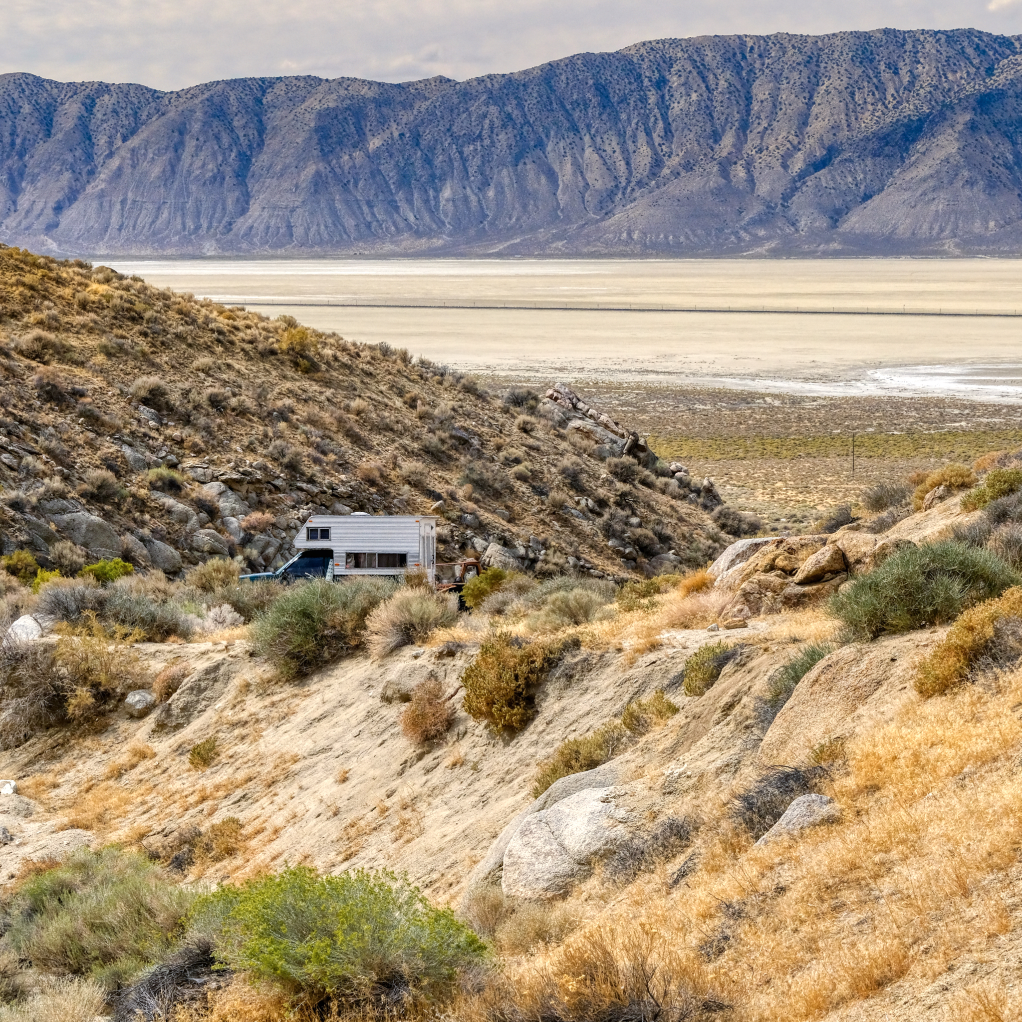 I drove up the sandy track and found a flat place to park . . . . the next morning I took this photo of the fine place I found . . . with a grand view of the Black Rock Desert.
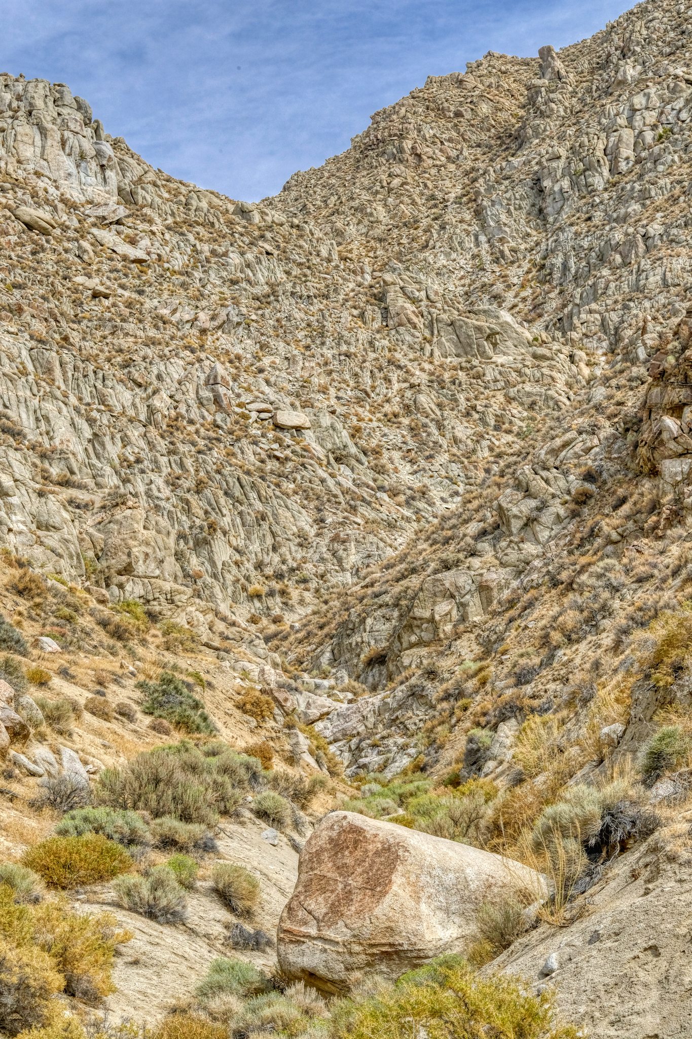
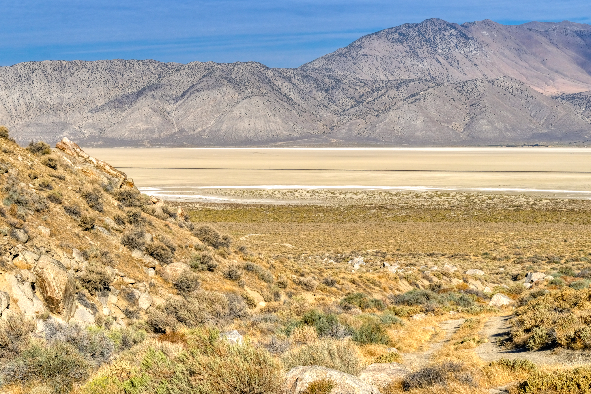
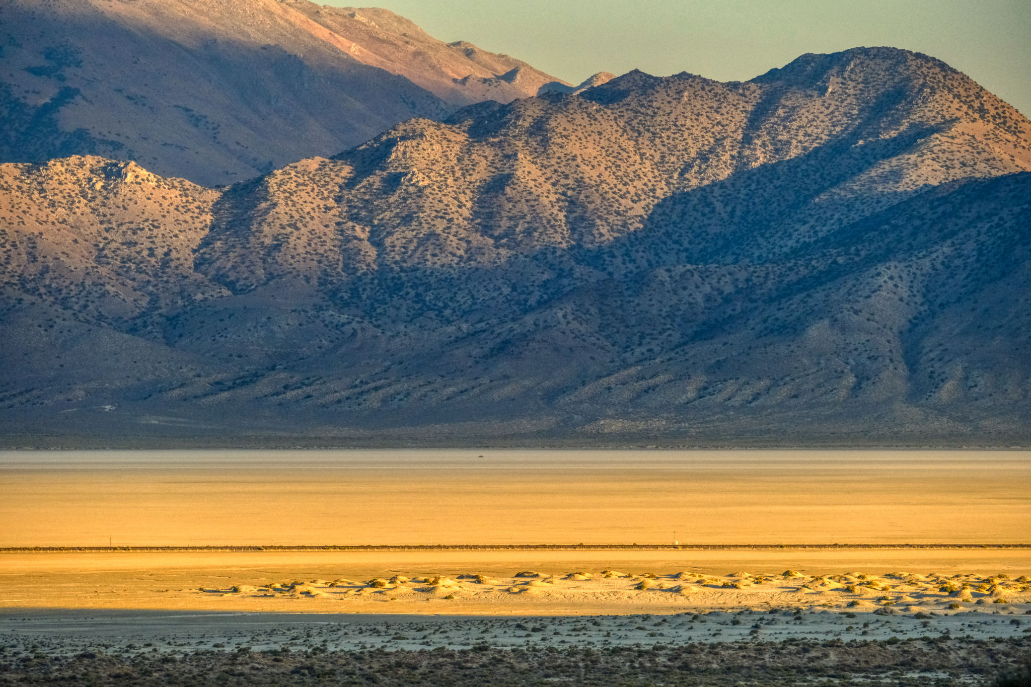
Looking away from the Black Rock Desert I had this view . . .
 My incredible desert canyon view . . . I wasn't sure which way to point my chair . . . the dry lake or the rocky canyon!!!
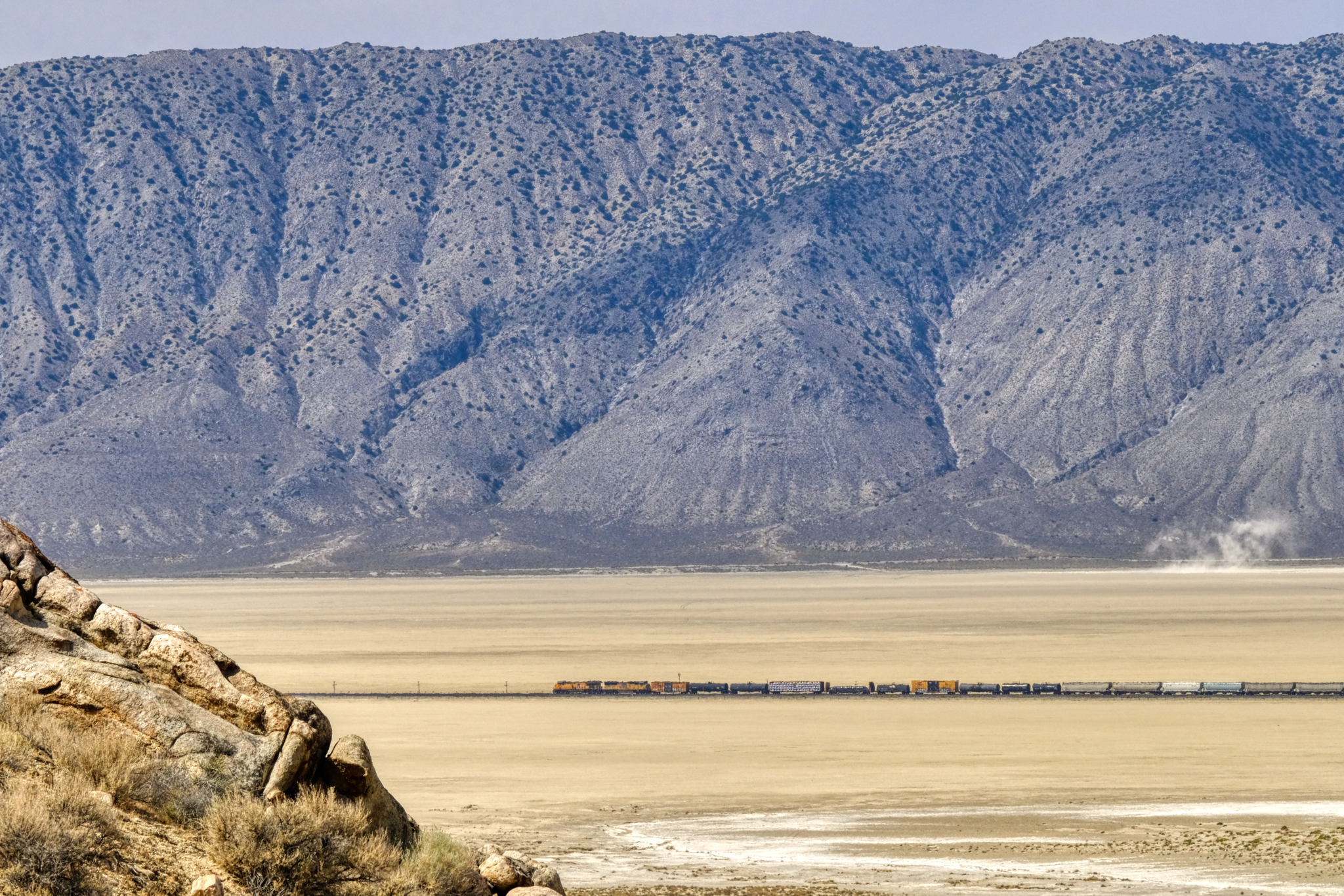 My view of the dry lake included an active train line . . . a couple times a day long freight trains would slowly pass below.
 My morning Grand View . . . I think I will go for a walk.
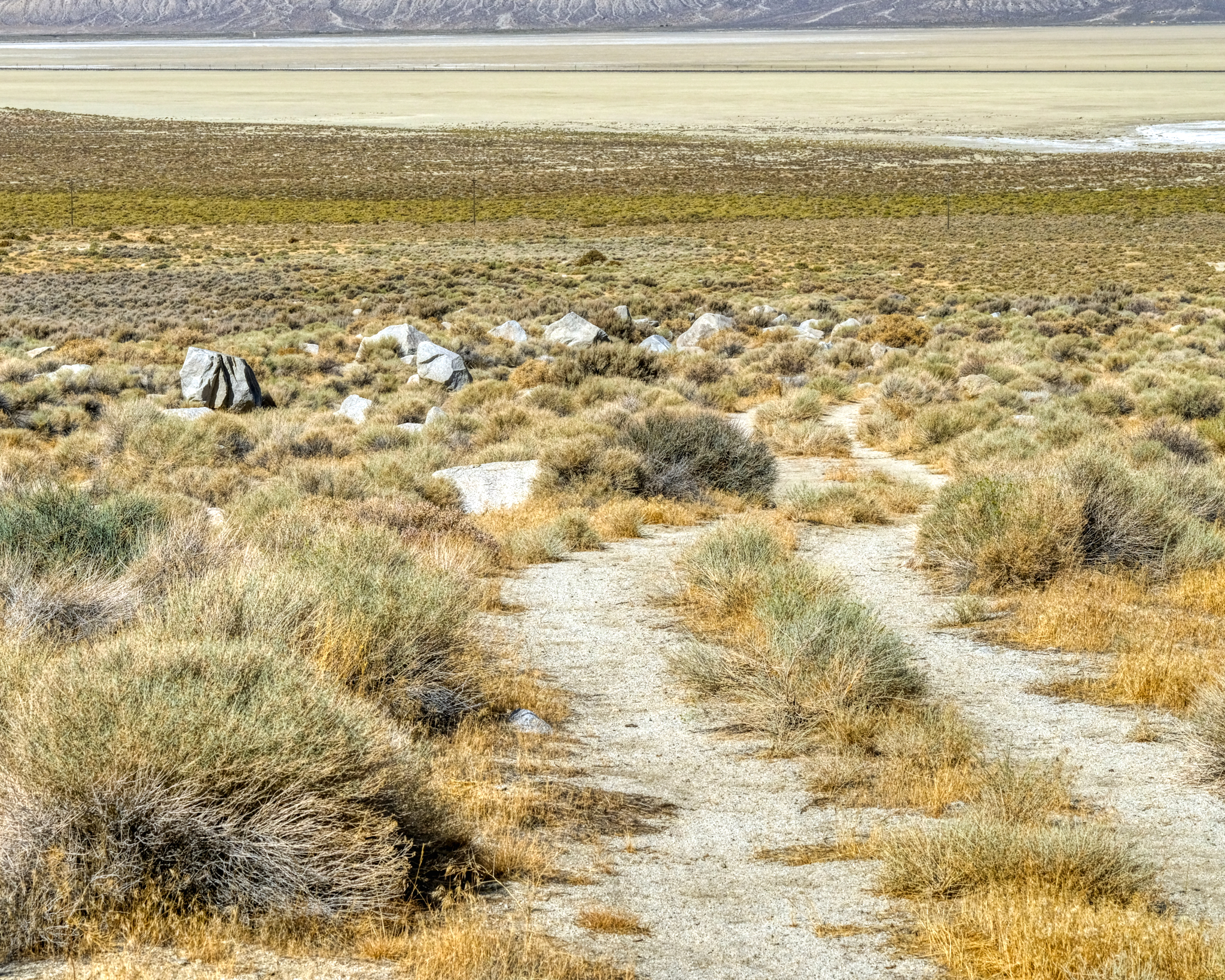
 One morning I decided to walk down the sandy track and out onto the dry lake bed . . . for exercise . . . and curiosity.
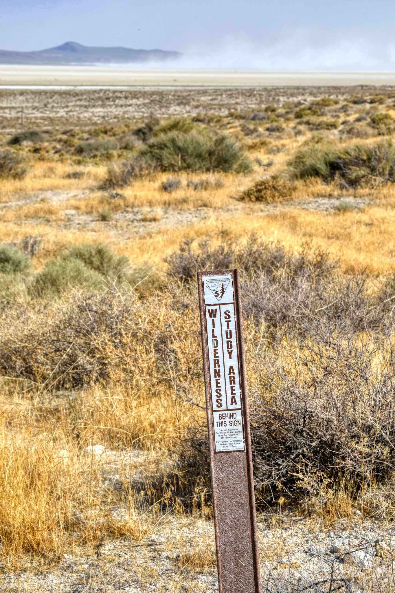 I was happy to see this sign . . . glad the area was being protected.
 At some point after I set up my camp, probably while I was staring at the mountainside, somebody rode a horse across my tire tracks on the sandy track. An interesting walk indeed!
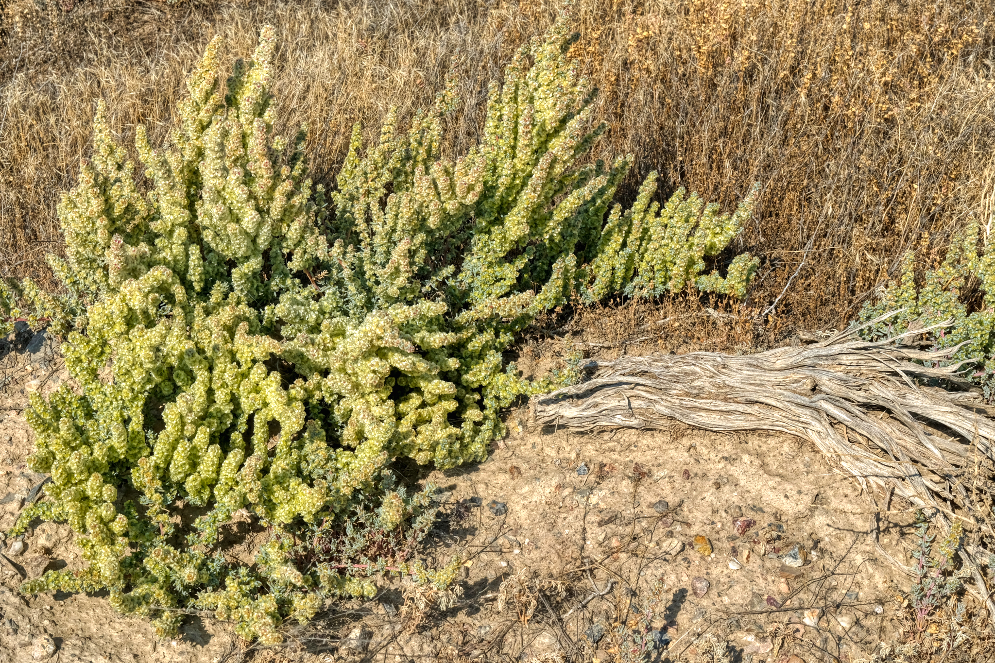
 The marvelous morning light made for great photography of the desert flora.
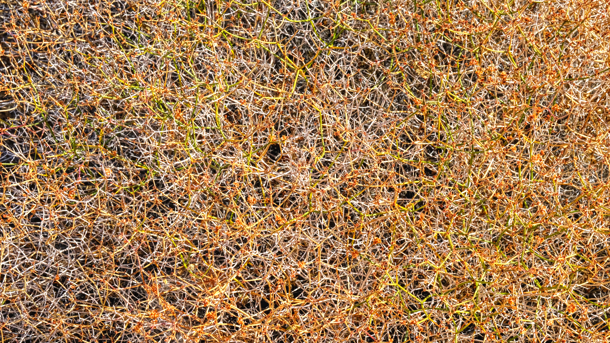
 These "desert reeds" was a complexity of beauty.
 Wonderful complex patterns out here in "the middle of nowhere" . . .
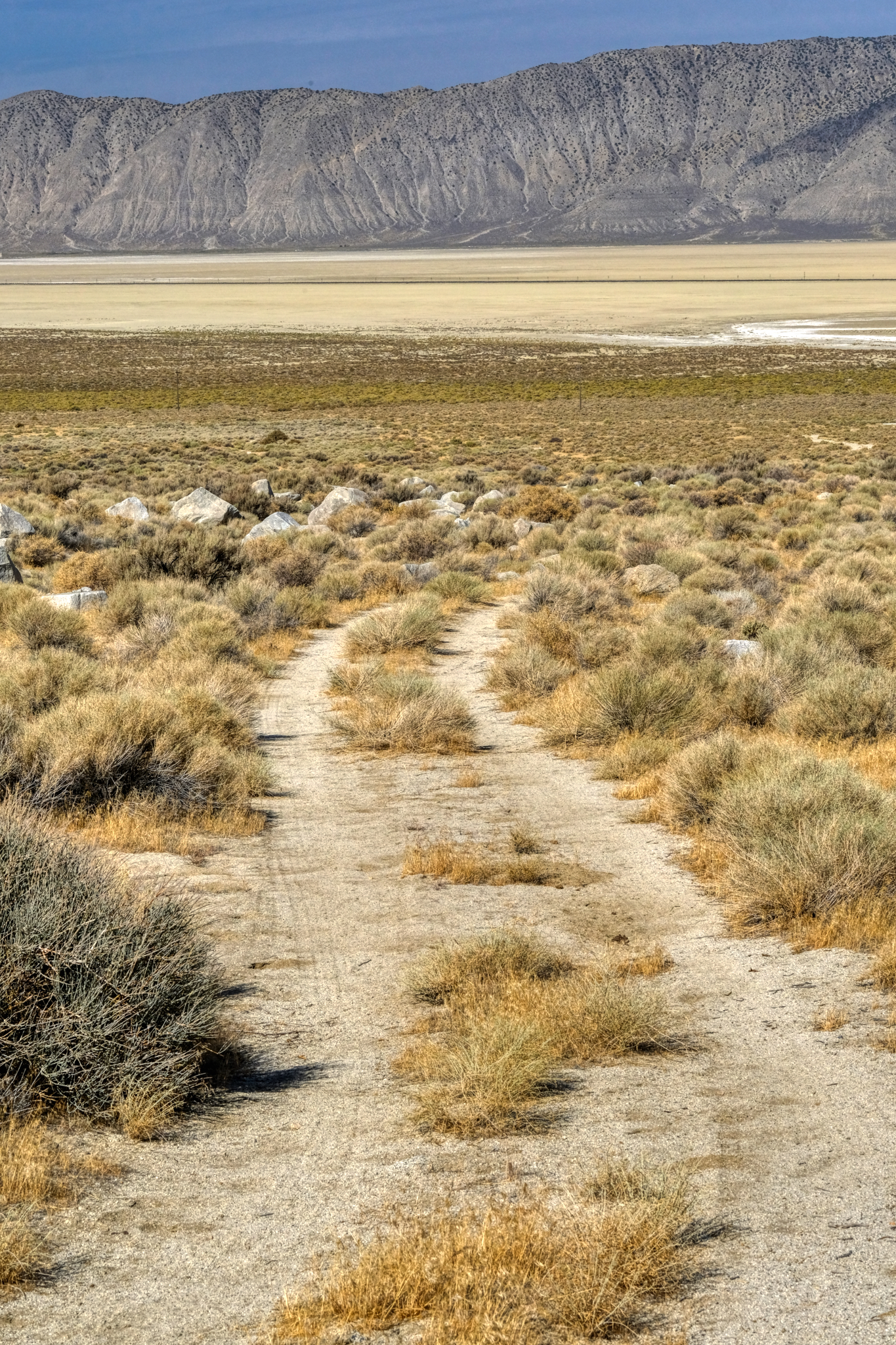
 Looking back up the track to my camper in the canyon.
 Walking further, I crossed Nevada State Highway 49 as I approached the wide dry lake bed.
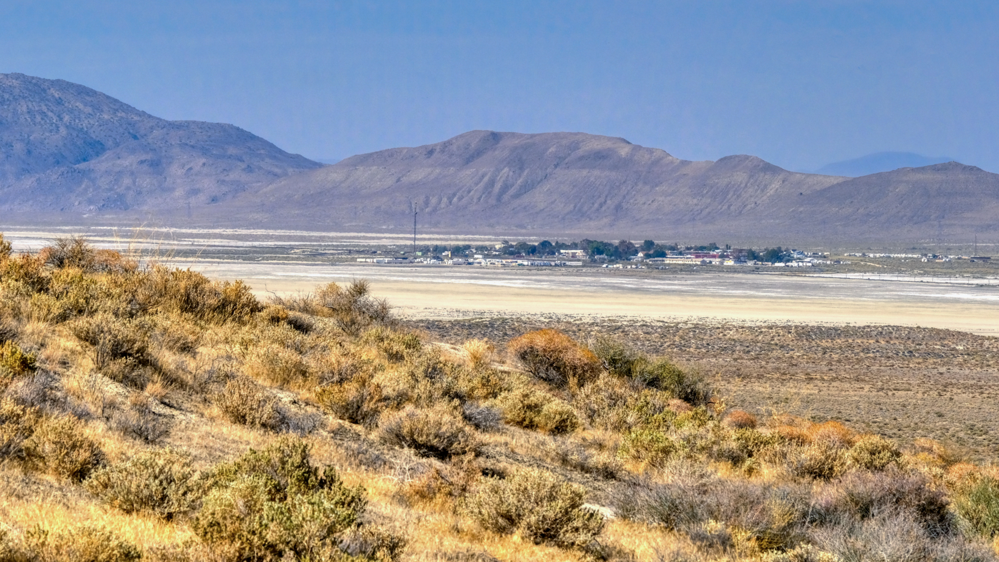
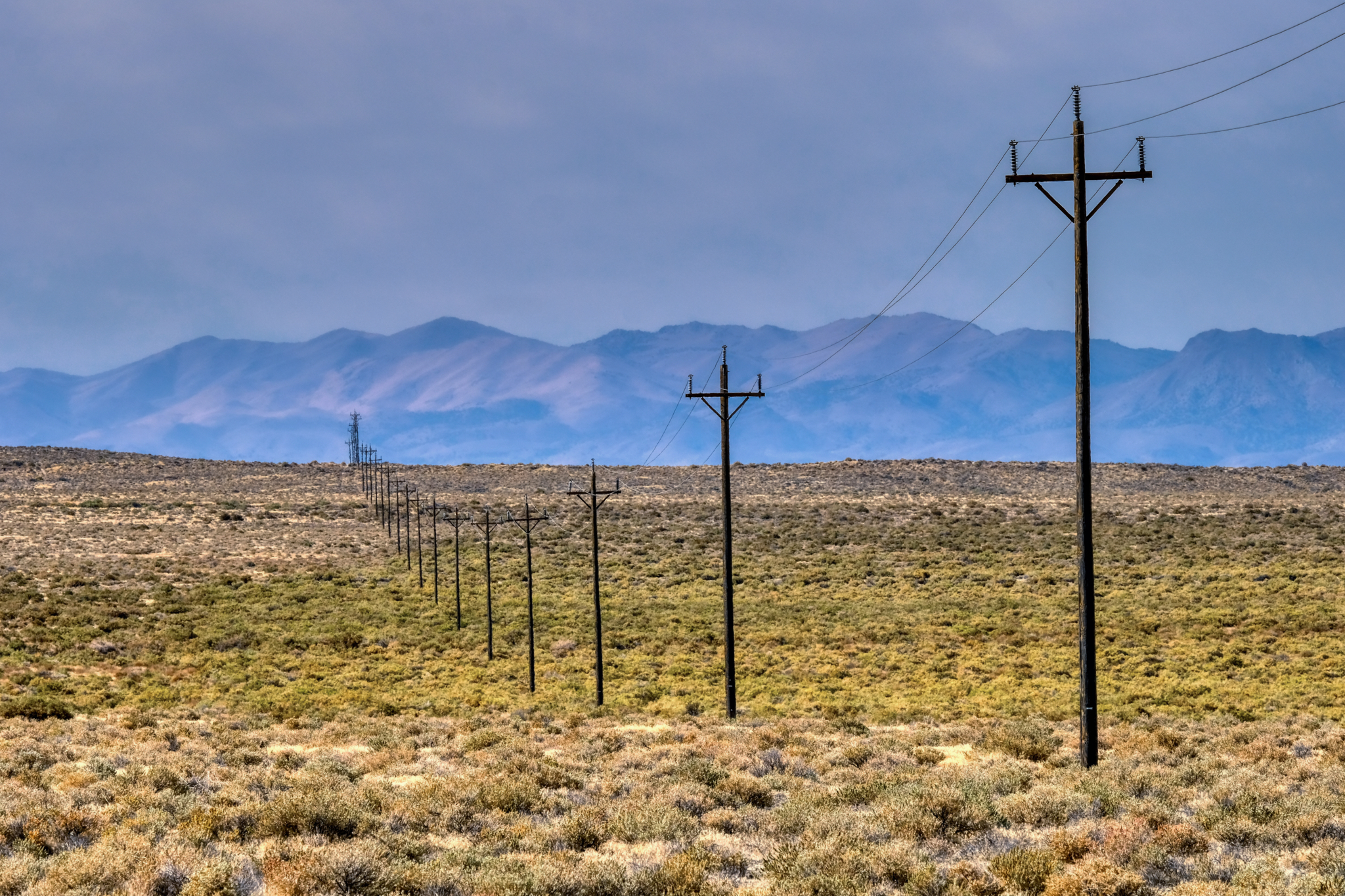 A short stretch of scrub brush with phone poles leading to the little town of Gerlach, Nevada (pop. 107).
 . . . and at last I stepped out onto the amazing surface of the Black Rock Desert.
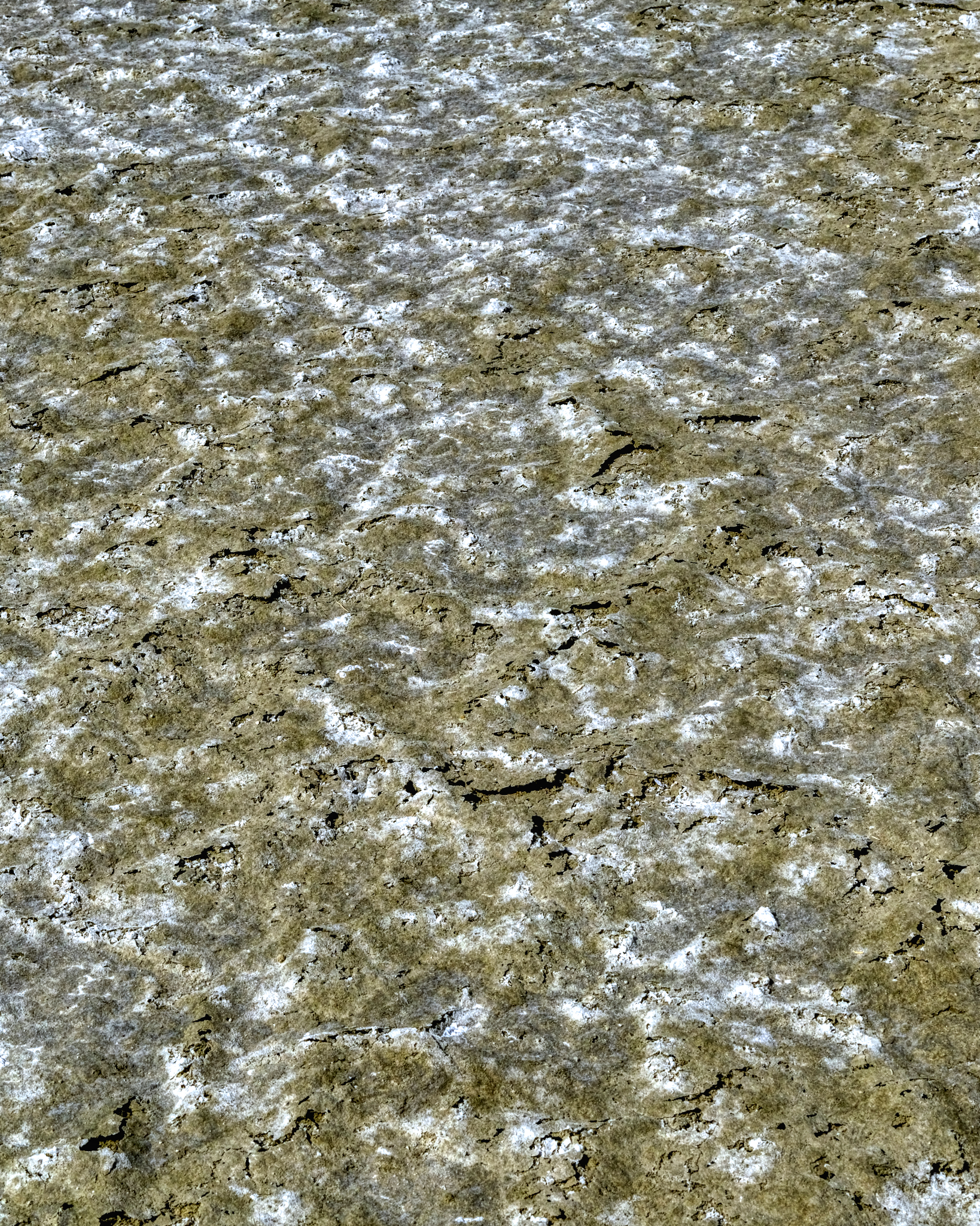
 I love these desert/dry lake bed textures as photographic subjects. I was not disappointed here!
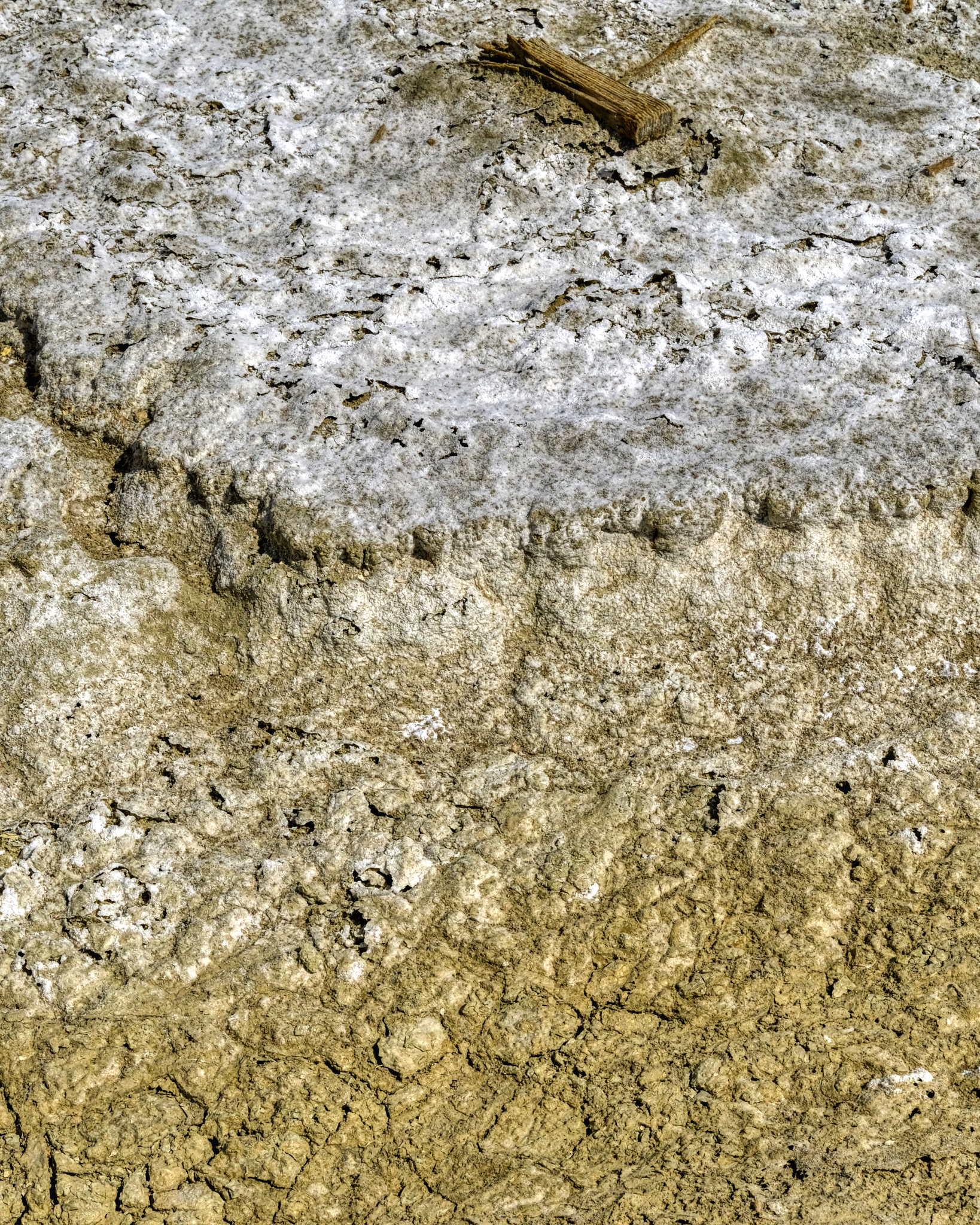
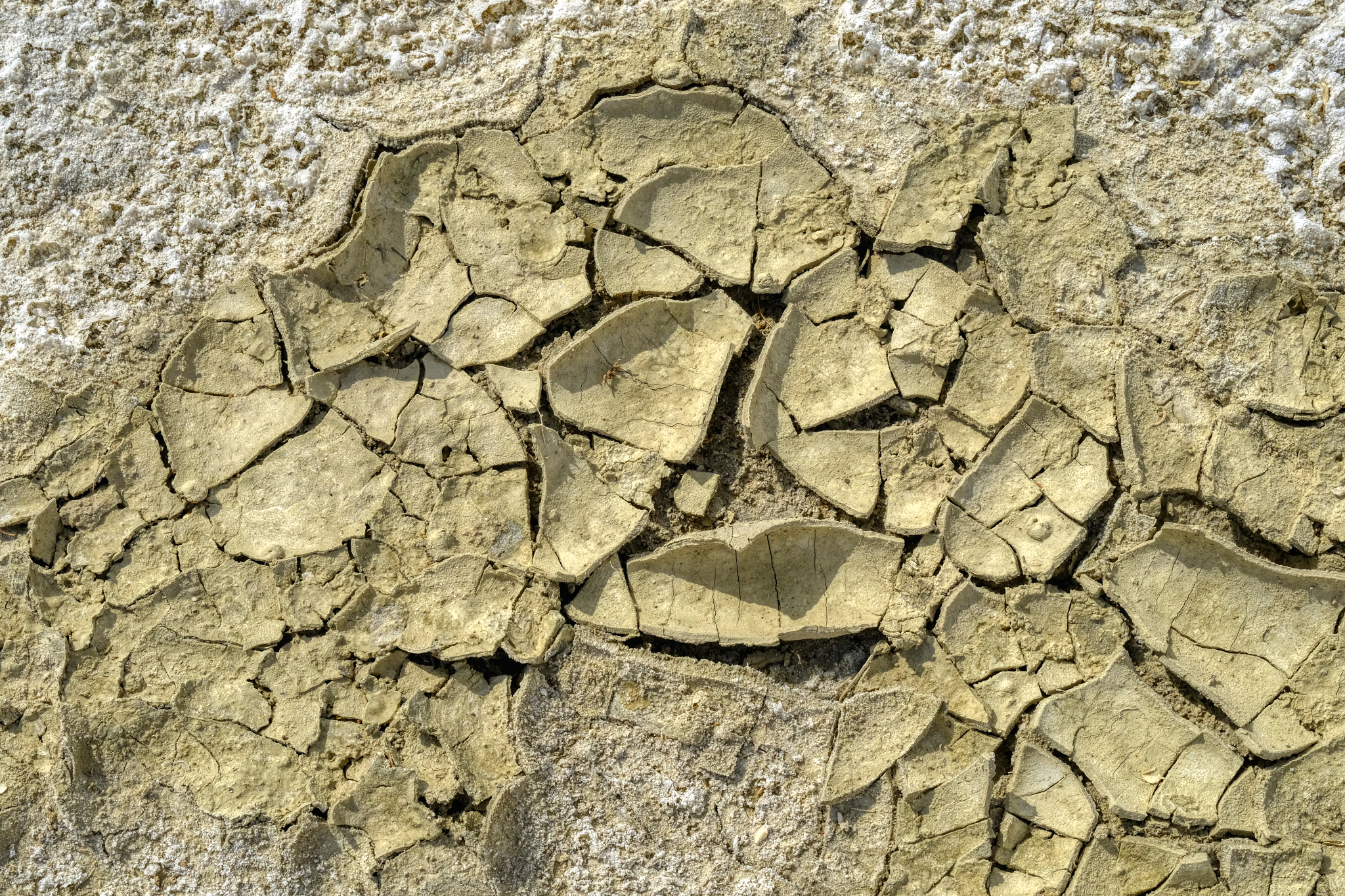
 Such delicately thin wafers of minerals spread out underfoot . . . I tried to avoid stepping on them.
 Salt or alkaline crusting . . . I do not know . . . I did not taste it.
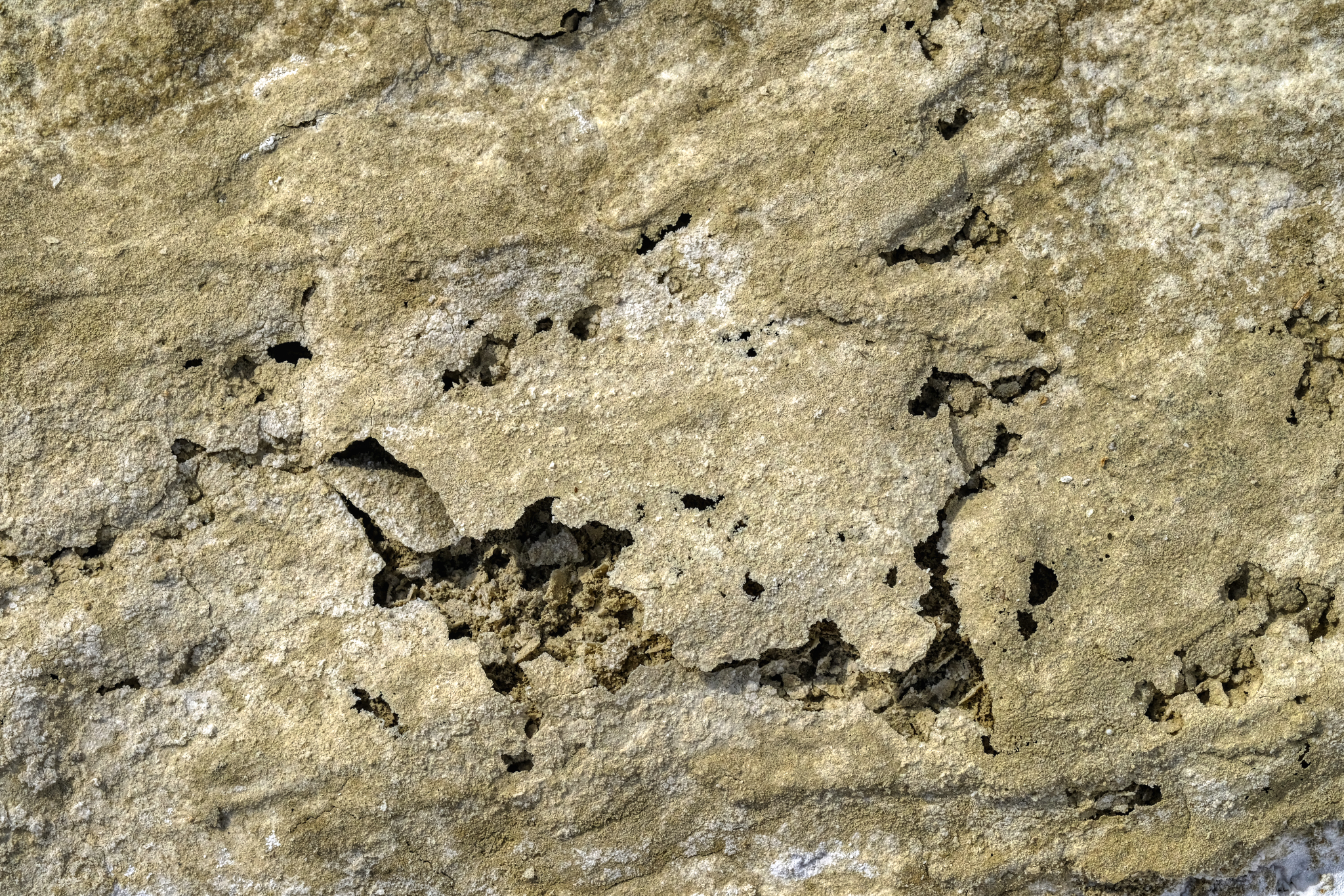
 Water had pooled here in the not too distant past.
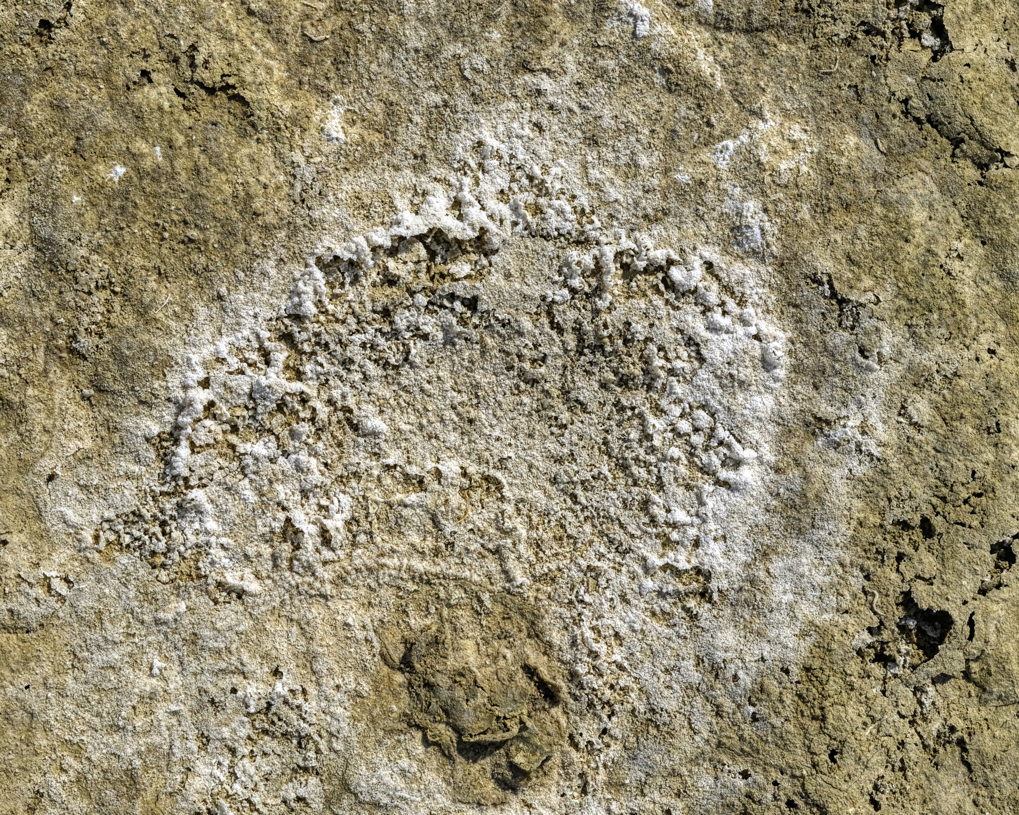
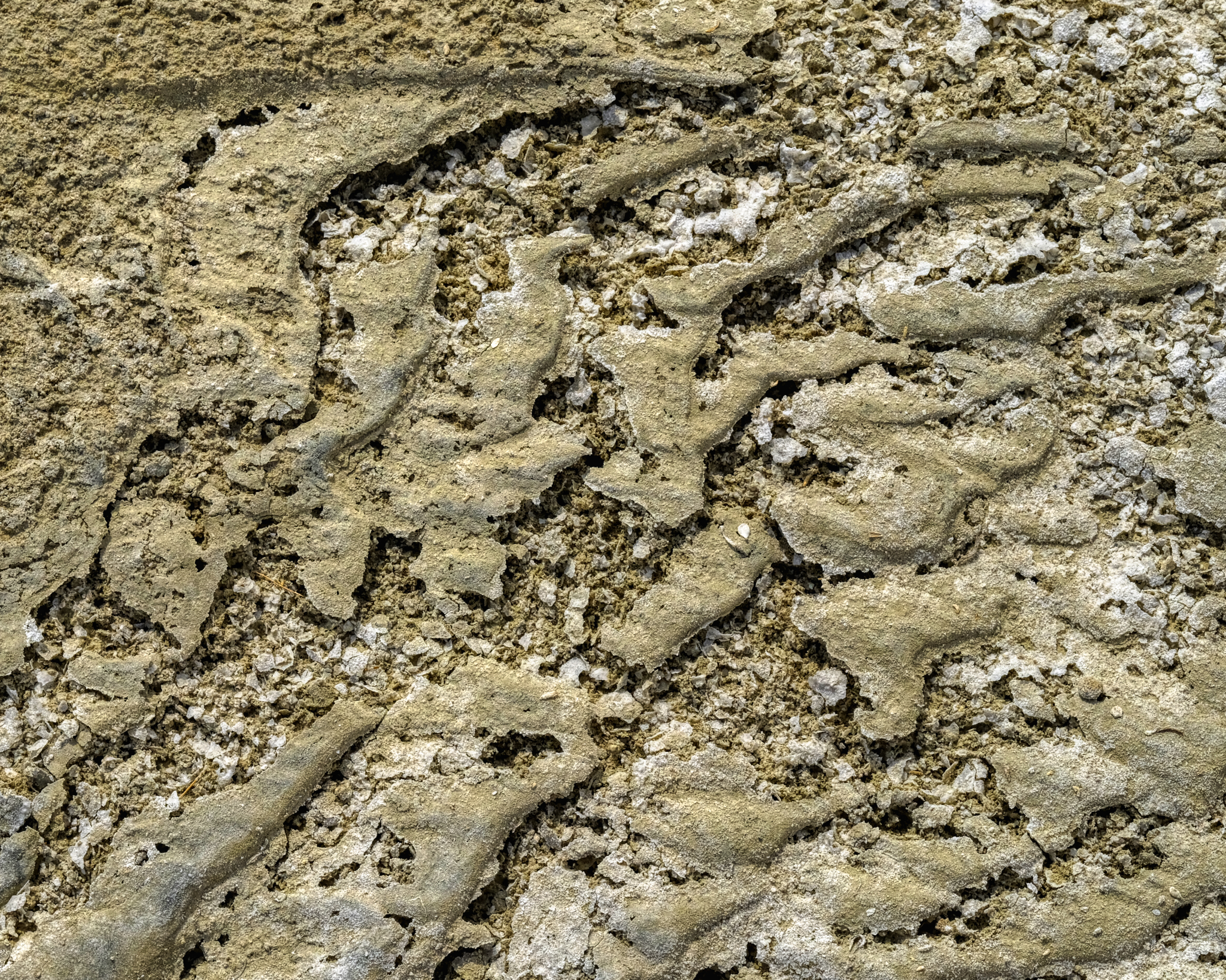 Much of this vast surface had this texture . . astonishing beauty!
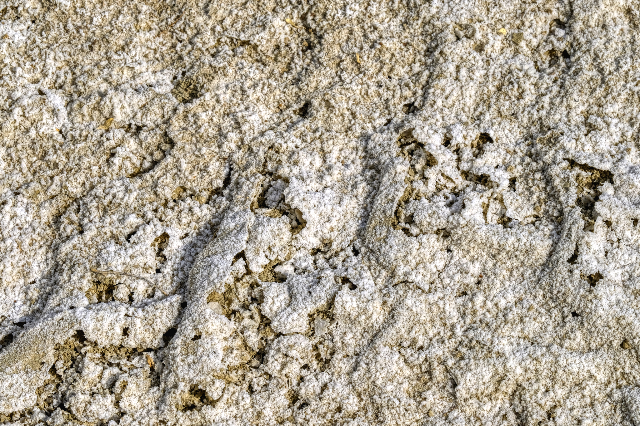
 Thin mineral wafers . . .
 I crunched around on these amazing surfaces for quite awhile before turning back to my camper.
 I walked back to my camper by way of this little canyon . . .
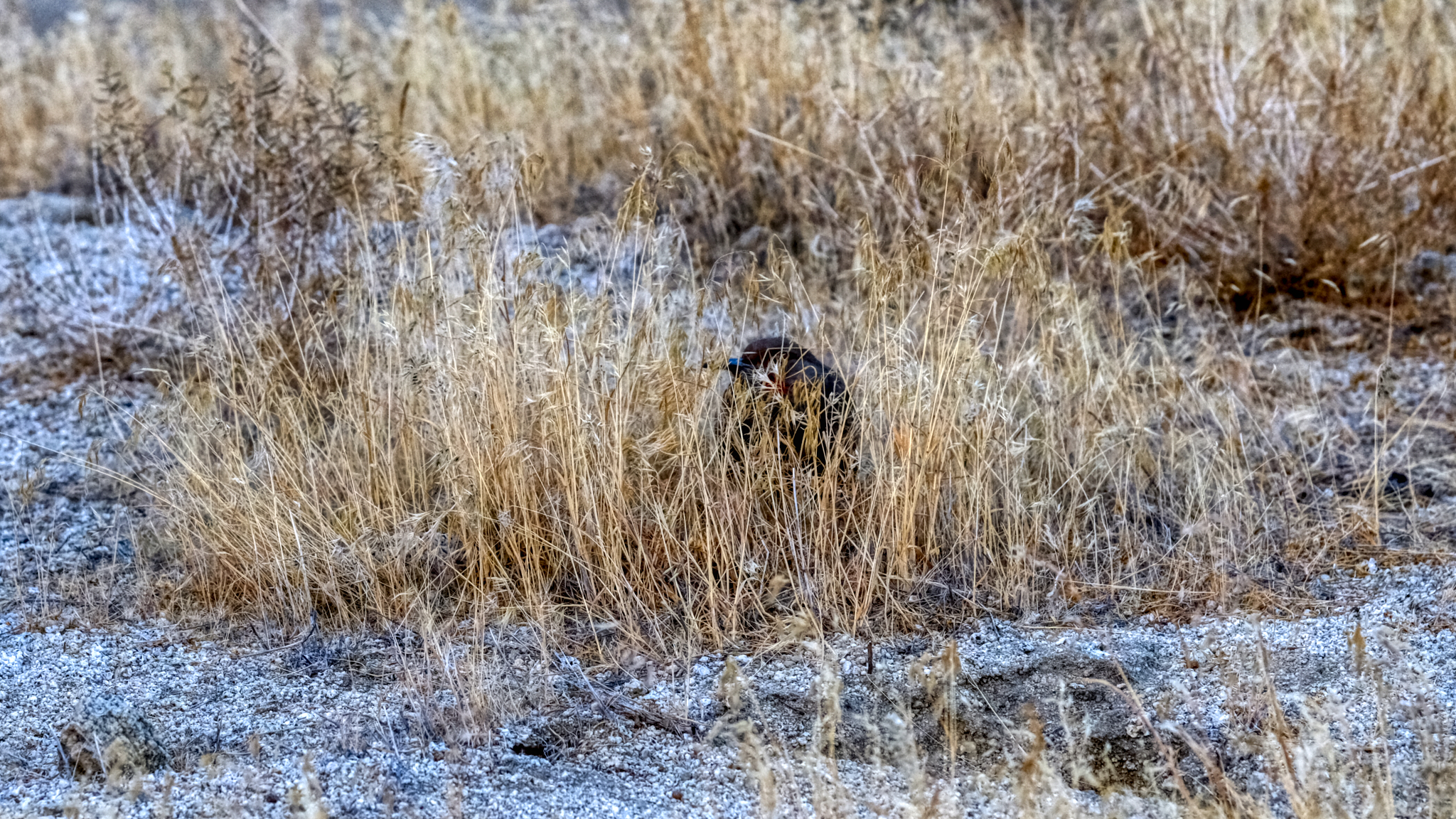 . . . the only wildlife I saw during my five days in the Black Rock Desert . . . one lone bird. There weren't even any insects.
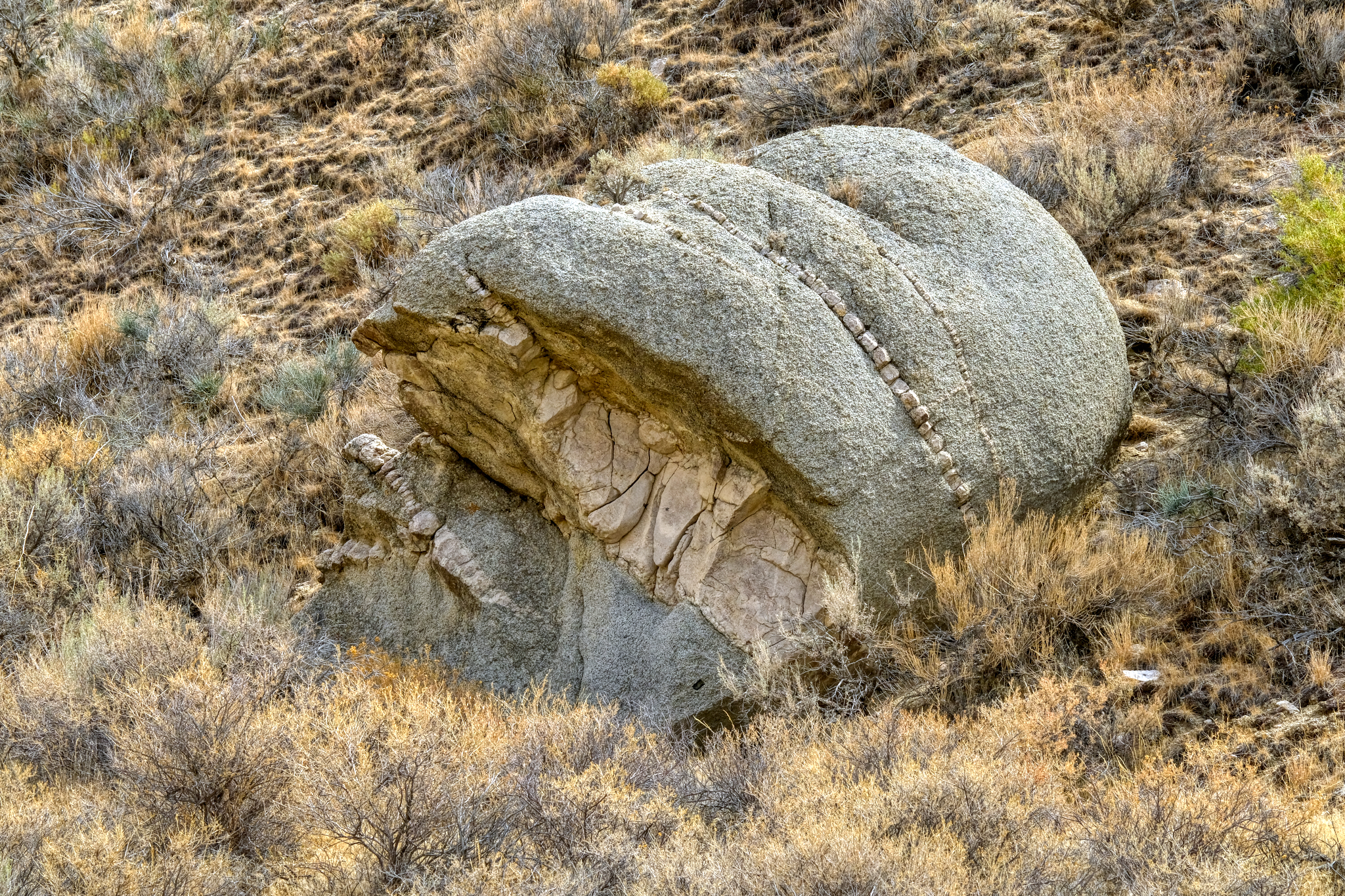 What I did have in the place of wildlife was geology . . . lots of fascinating geology.
 Back at my campsite, settled into my camp chair, I sat enjoying the rest of the day . . . reading, snacking, drinking lots of water . . . and, yes, checking my iPhone for messages . . . as there was very good (4 bars) Internet way out there!
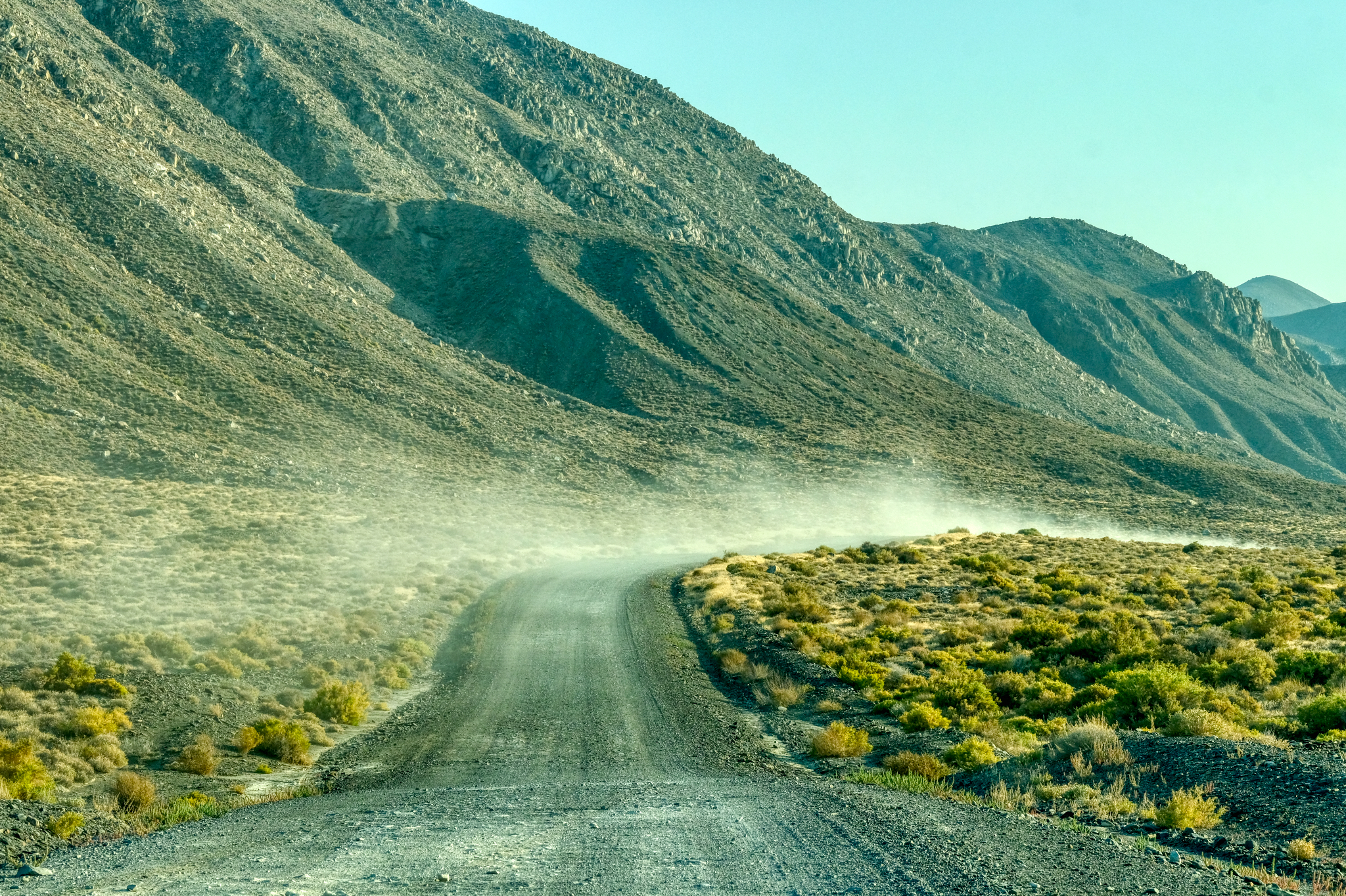
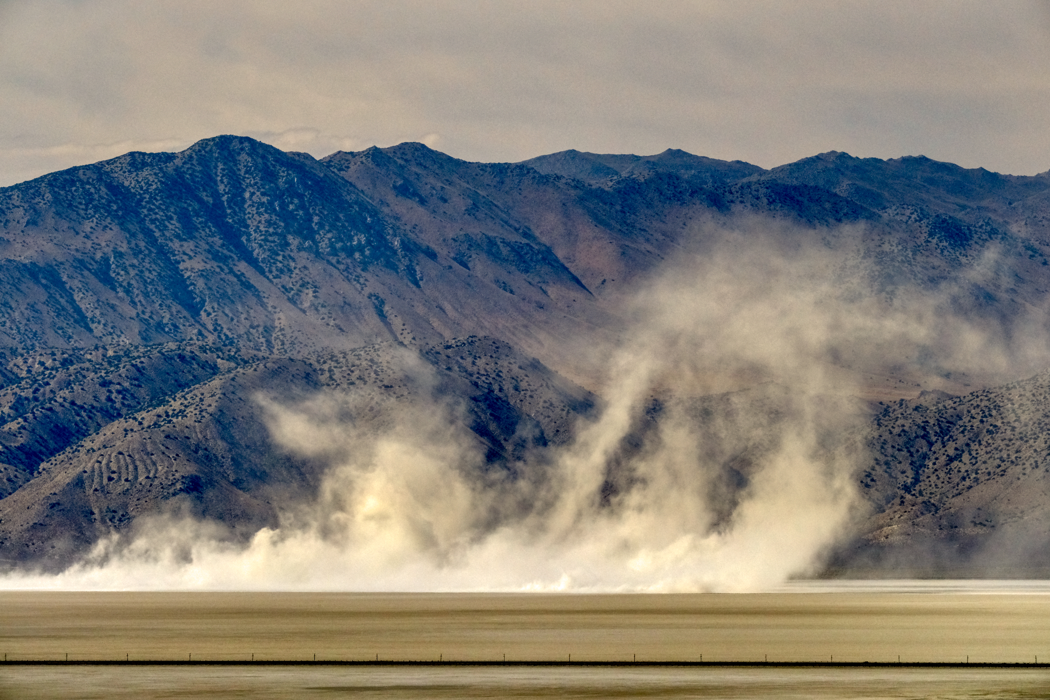 A nice dust storm blew up mid afternoon . . .
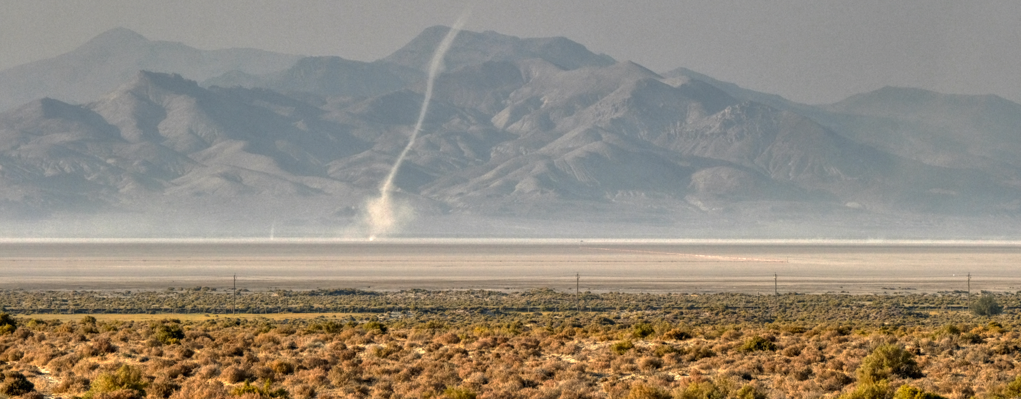 . . . and then a wonderful 'dust devil' blew across the dry lake bed. (Excuse the quality of this photo - a lot of dust in the air at this time).
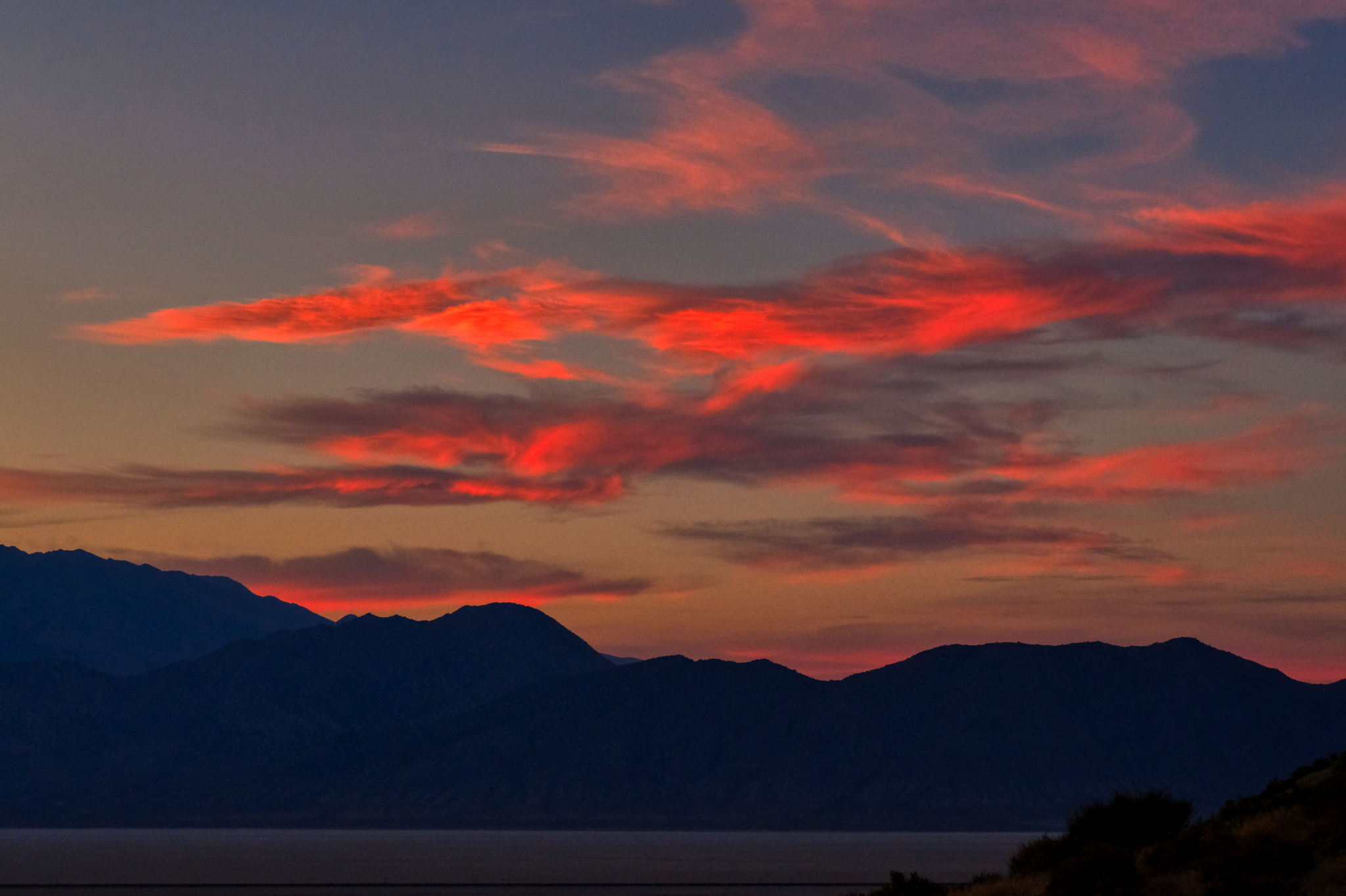
 The sunsets were magnificent!
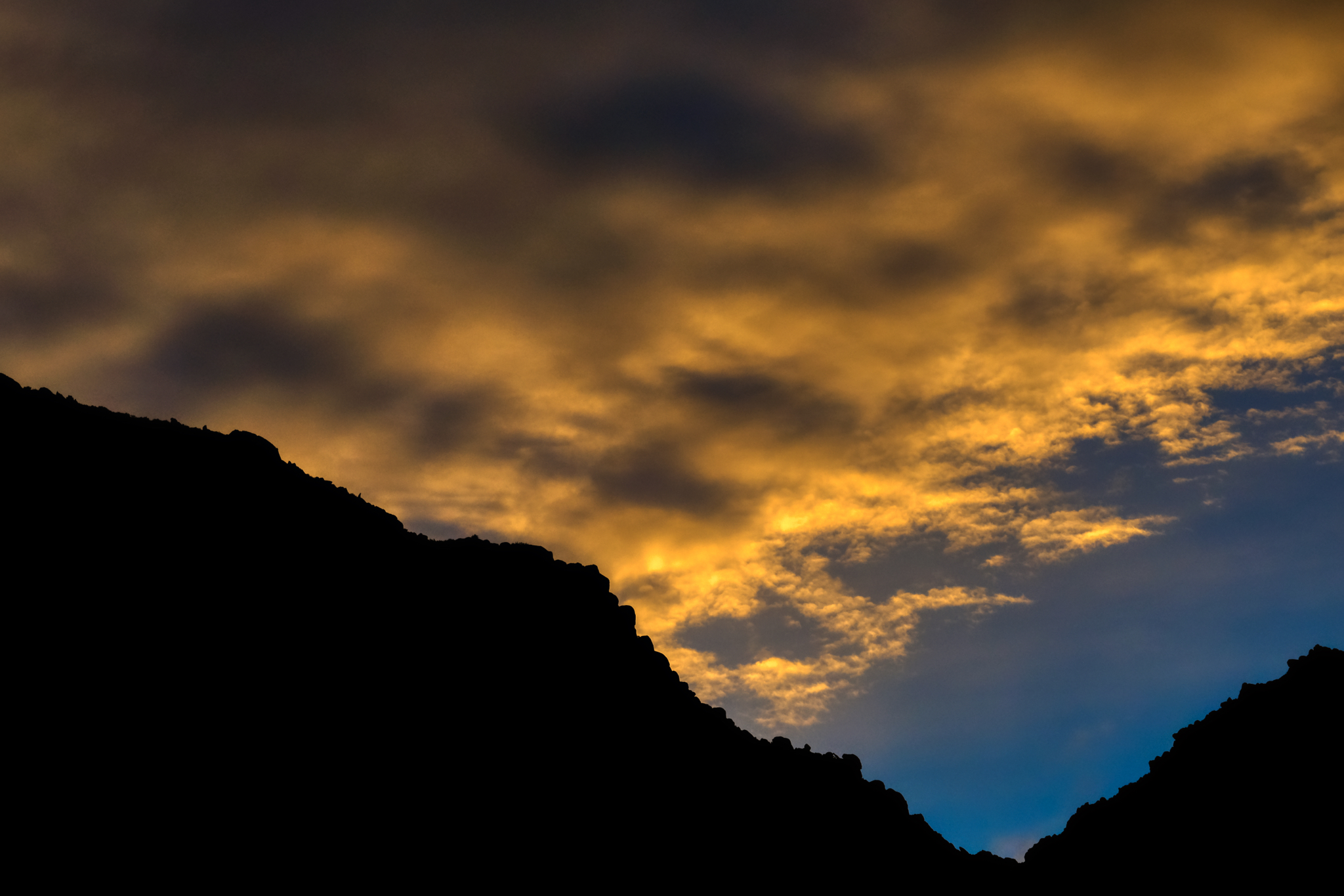 The colors!!!
 "You are in the forest, but you are on the desert."
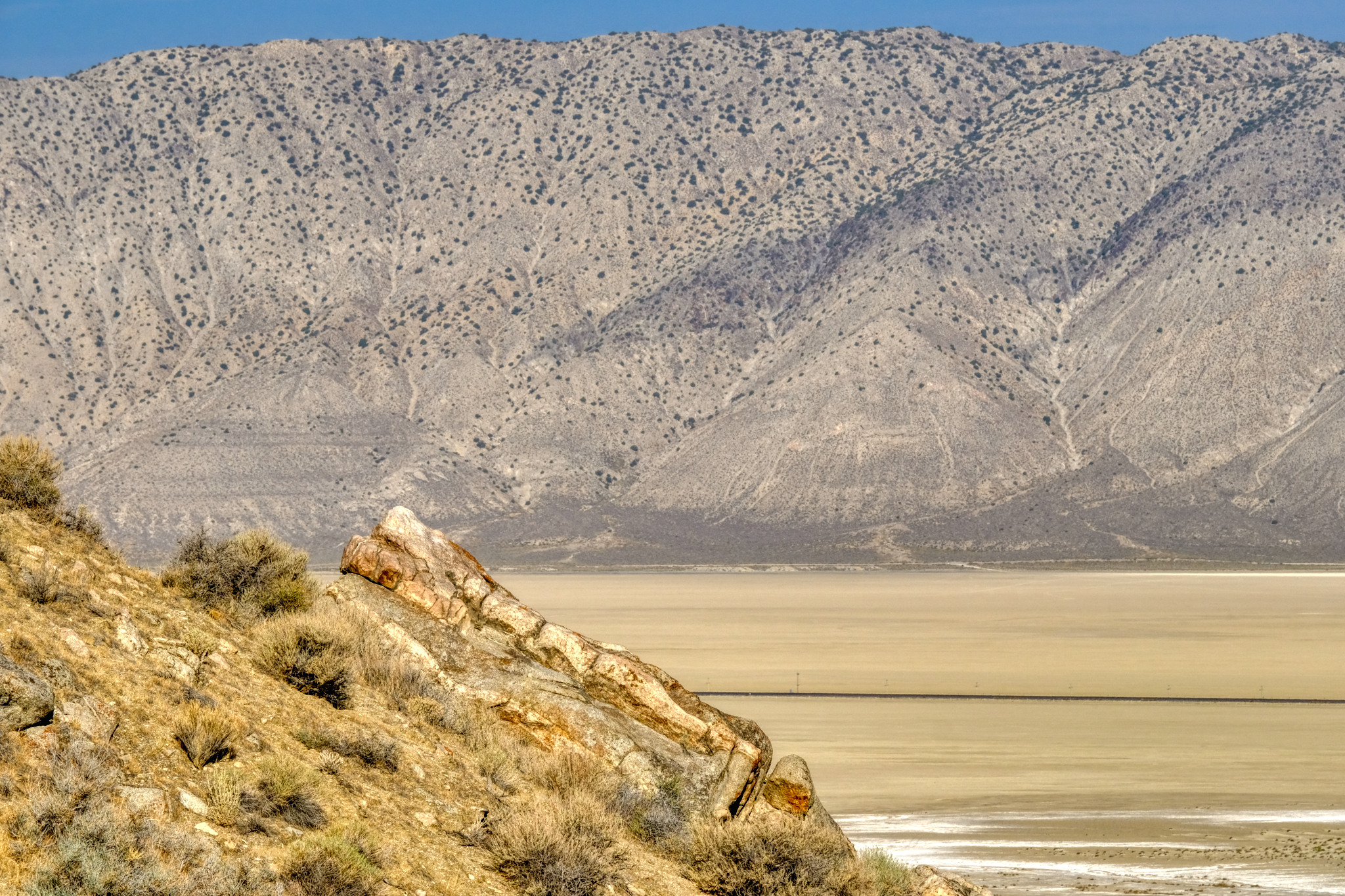
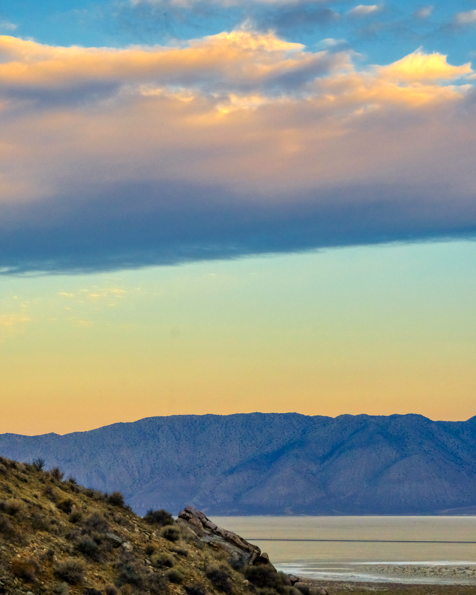
 A morning view out over the dry lake bed of the Black Rock Desert.
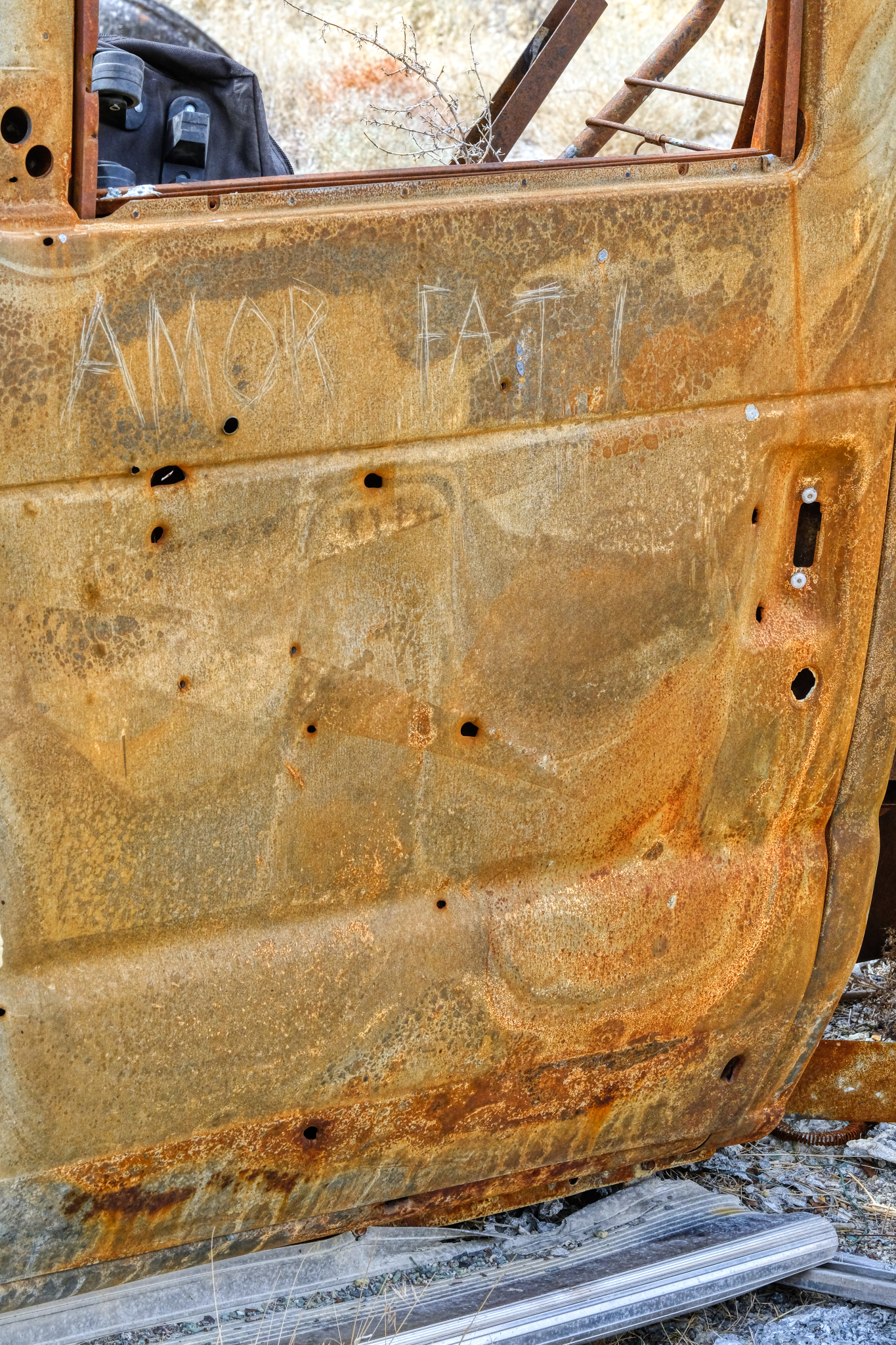 As I discovered, my 'lucky' campsite had not been so lucky for a former visitor to the spot. There was the charred remains of a burned out motorhome not far away. I left this message for future visitors, "Amor Fati."
 I diagnosed the motorhome's problem as an 'overheating problem in the engine.'
 After five days my camper batteries had gone down, so I folded up my sun shade and loaded the table, chairs, porta-potty, and BBQ back into the camper and headed back down the hill. I had had a wonderful and relaxed time just sitting, reading, thinking, wandering around the desert, and enjoying the view. Perfect.
 And then back out on Nevada Highway 49 into Gerlach (pop. 107) . . . and civilization! I stopped in at the only cafe and had a 'real' breakfast and good coffee. I also stopped in at the Burning Man Main Office to find a harried woman dealing with major complaints of some of the attendees . . . the Burning Man event was just two weeks before . . . I intervened and counseled peace and understanding. People calmed down. My work was done. I stopped at the little store and bought a large bag of Cheetos and a couple of Coke Zeros for the drive back to Winnemucca.
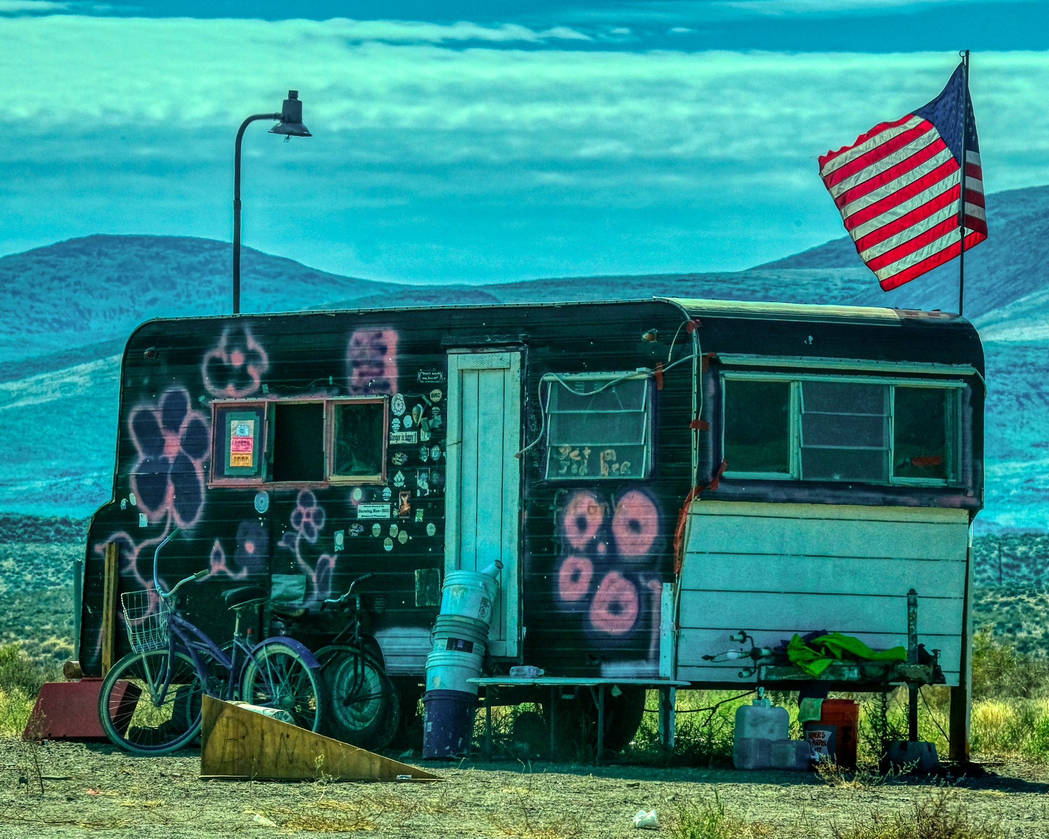 From Gerlach I headed south on Nevada Highway 447 toward Interstate 80 and then back to Winnemucca. But I could not resist stopping and getting this photo of REAL AMERICAN FREEDOM! "Turn on, tune in, and drop out" anyone?
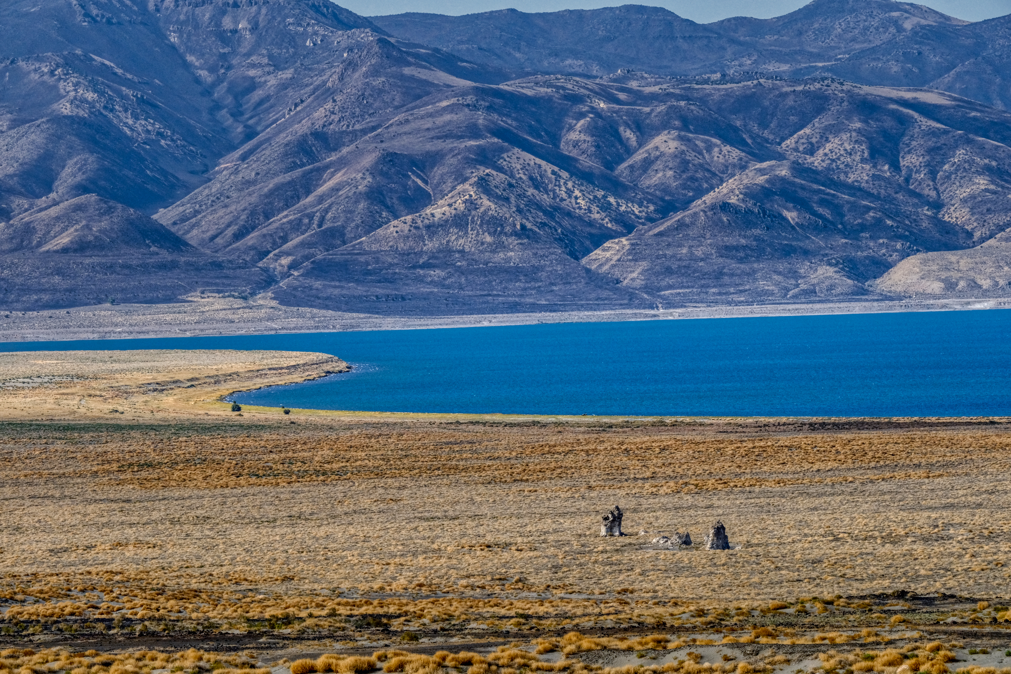 Ancient Pyramid Lake and the town of Nixon was my last stop before I entered I-80. A shower, washing machine, and NFL games in the casino lounge were waiting for me.
 A great trip!
 Dr. Jeff Harper
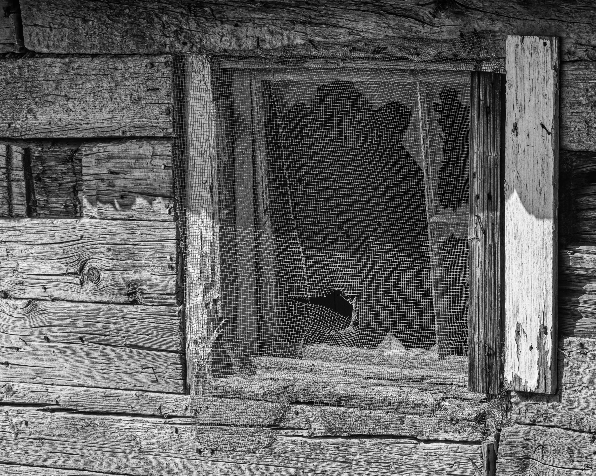
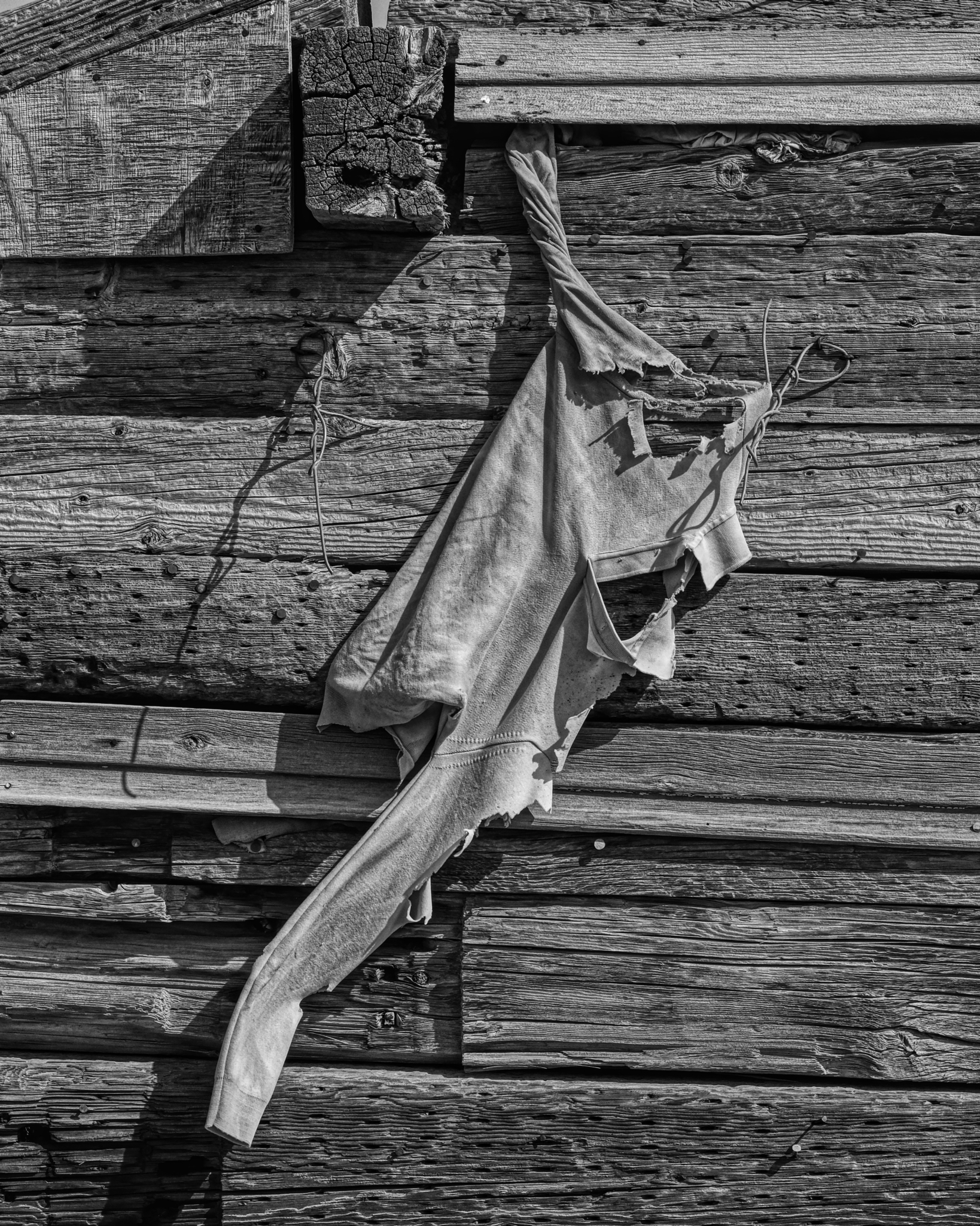
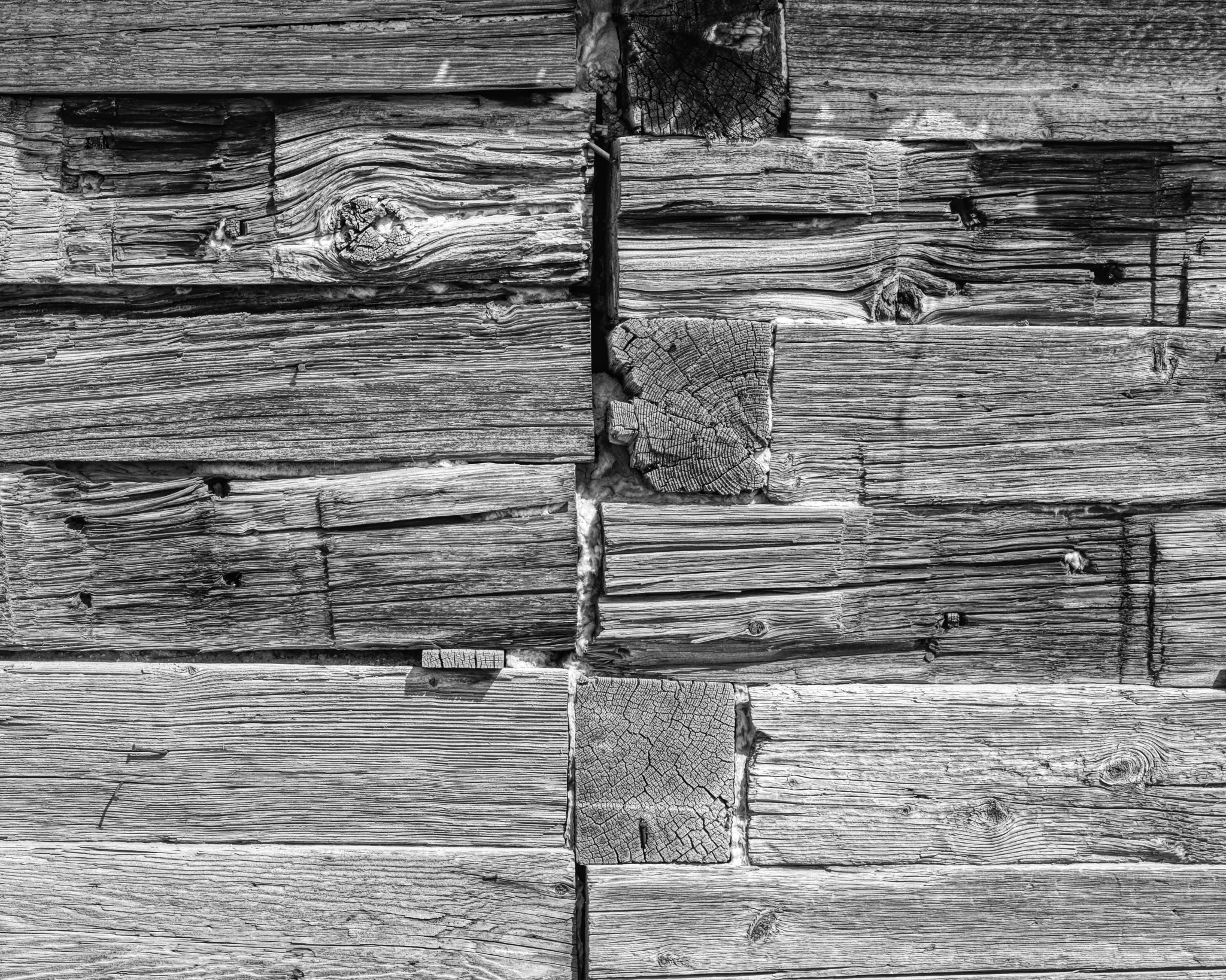
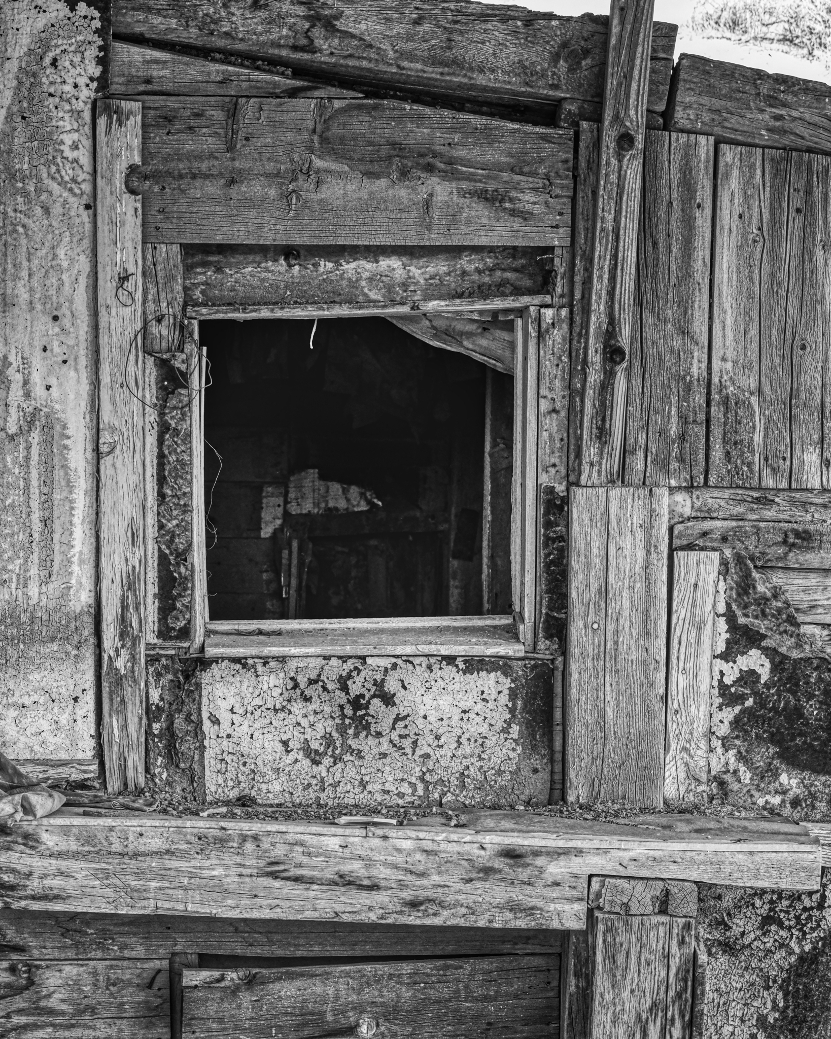
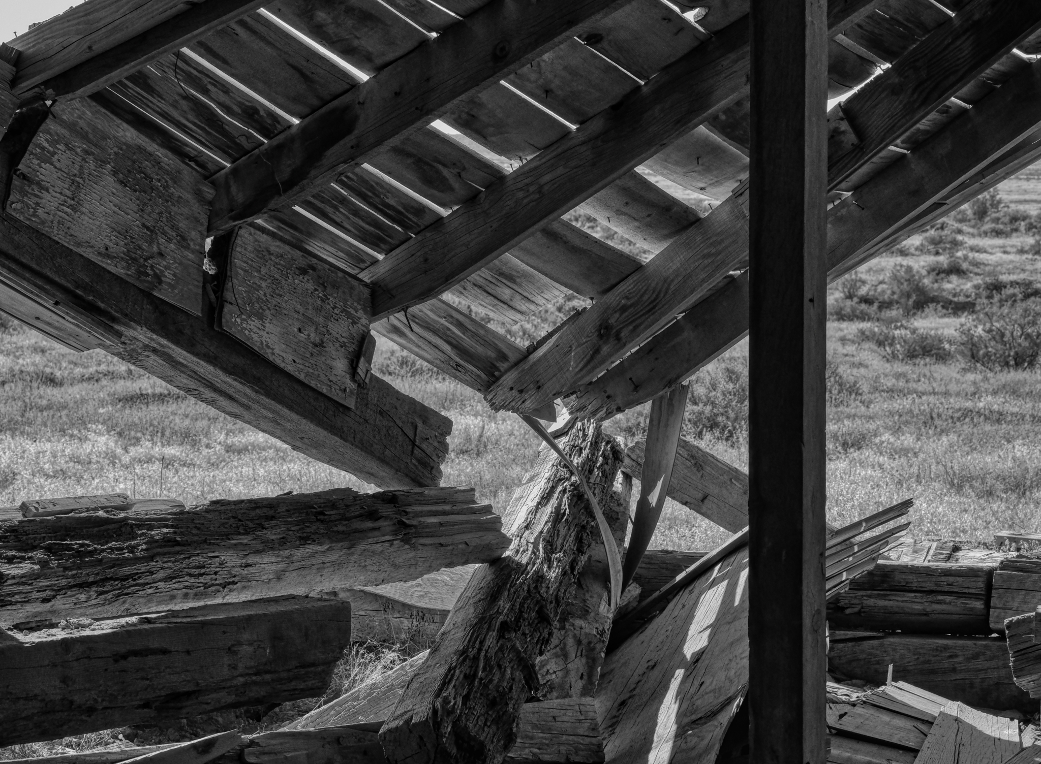
Some of the photos of the abandoned miners' 'town' demanded black and white post-processing . . . here they are without comment:
Road Trip USA: Bodie Ghost Town, California
In June of 2018, as a part of my bigger year-long road trip, my wife and I took a trip from Oregon to the Grand Canyon. Along the way we stopped at whatever seemed interesting along the way. In east-central California, off of US Highway 395, is the old ghost town of Bodie, now a popular and much visited National Monument. It is one of the largest and most complete ghost towns in the USA (Jerome, Arizona is another).
 We arrived a the broad site of Bodie in a light drizzle under threatening skies.
 Our first view of Bodie was of scattered shacks and abandoned mine tailings.
 And after parking and walking into the cluster of old weathered buildings, the layout of a town started to appear.
 Bodie became a town in 1876 when a productive vein of gold was discovered there.
 Even though it was mid June, the elevation of 8379 feet (2554 m) combined with the wind and mist, made the surfaces wet, revealing the colors and textures perfectly.

Bodie had a population of 7000 before the gold was all mined . . . and was connected to the world by a small gauge rail line.
 At it's height, Bodie had two churches, a Wells Fargo Bank, a myriad of shops and services, as well as its own hydroelectric generating station 13 miles away.
 There were 2000 buildings in Bodie at one time. There are nowhere near that many left today . . . but it is still an impressive sight to see.
 I am a fan of old doors and windows . . . especially weathered old doors and windows. I was in photographers' heaven in Bodie.
 Several of the old general stores still had period merchandise in them. I am not sure if the items inside were left behind or carefully placed there years ago by over-eager National Parks staff, but the interiors are a marvel.
 A photo of a general store interior, taken through the window since visitors could not go in. Fascinating.
 Bodie sees nearly 200,000 tourists yearly. The day we were there, we saw two large tour busses and four smaller vans full of tourists from France. They loved the place too. The building with the open door is the tourist information center, gift shop, and historical display.
 The museum had this wonderful horse drawn hearse, as well as many other finds from the site.
 A lovely collection of amber bottles in the museum.
 A number of the buildings used some kind of metal siding . . . as well as metal shingles on the roofs.
 I was fascinated by this metal siding.
 The small metal sheets were used all around Bodie. This house used metal for the roof, as a siding, and for various patching.
 Upon closer inspection, I came to the conclusion that the metal strips were, in fact, opened up 'tin cans' . . . which were made from iron and steel in those days. Because of the altitude and cold weather (303 nights a year with below freezing temperature), and deep snow (average 10 feet or more of snow per year) in the winter meant they must have had to import a lot of food . . . which at that time was packed into cans. You can see the can ridges on some of the large metal strips.
 A kind of early recycling. In addition, these walls are visually very interesting in their own right.
 One more . . . just for the artistic effect.
 1881 was the highest production from the Bodie mines: $3.1 million US dollars. The total value of all the gold pulled from the ground here was $34 million US dollars . . . a lot of money at that time!
 There is still a lot of mechanical debris left over from the age of industrial mining.
 It is interesting to try and imagine where these parts went and what their purposes might have been.
 Your guess is as good as mine . . . .
 There were many mine head rigs and tanks across the area.
 Although the rail line was torn up, trucks continued to supply the town with food, supplies, and machinery.
 There were some very nice old homes here. Although it was designated a ghost town as early as 1915, there were still a few hardy souls who lived in Bodie up into the 1950s.
 This view back in the day would have had many more houses in it.
 One house had an open door . . . so I went in for a look.
 Fantastic!
 Although tens of thousands of visitors come to Bodie every year, it still feels like a discovery to find these old abandoned rooms.
 I cannot tell if the furniture is original, but those layers of linoleum sure are!
 Again, some of these old homes were lived in up to the 1950s, so I am not sure if this is one of those houses or it it dates to the end of mining around 1916.
 "The last breakfast" table still set. At least they didn't have to do the dishes on that last day . . .
 Wonderful patina of age.
 The old wood stove would have been the center of life in this very cold place.
 Looks like a cozy room . . . at one time.
 I spent a long time in this old house . . . soaking up the silent beauty . . . and reflecting on the human lives that were lived out here . . . and my own life.
 Such beautiful visual compositions laying around everywhere. Another photographers' paradise!
 The longer we stayed, the darker the sky became . . . we started to move back to the camper at about this point. There was much more to see in Bodie, but the rain would drive us out.
 This steel out-house looks like it has tipped over in the past . . . I wonder how this happened?
 Darker and darker . . .
 My fellow tourists were heading to cover from the approaching rain.
 This shop-front must have been beautiful back in the day.
 This intreguing and tilting little building was beautiful from the front and side (next photo).
 Such wonderfully defined textures and colors . . . highlighted by the fine mist that has settled on them.
 Sweet little place . . .
 Fine, honest door (and self-portrait!).
 Time to go.
 The sage brush has reclaimed most of the streets and paths.
 I would like to come back here . . . perhaps when there is some snow on the ground . . . and better light.
 Commemorative plaques.
 And so, we drove off from Bodie.
 One last look at the scattered shacks and sheds among the sage.
 We drove back out the 20 miles to US Highway 395 and headed south toward Mono Lake.
 We pulled over on US 395 at this amazing viewpoint high above Mono Lake.
Road Trip USA: Benton Hot Springs, California . . . Almost A Ghost Town
 On my drive from the Bonneville Salt Flats in Utah back to my friend's house in the High Eastern Sierras, I took a 'short cut' down some very small, and often unpaved, roads. One of the joys of this type of travel is the discovery of amazingly photogenic little wide spots in the road. One such gem was Benton Hot Springs, just off of US Highway 6, just across the state line . . . on California State Road 120.
 The Benton Hot Springs Hotel is the pride of the nearly dead town. The hotel (now closed) was founded as a general store and Wells Fargo Station in 1868.
 This lovely, and poetical plaque was placed on the old hotel in 1968.
 A nice place to lean a chair and pop open an ice cold Nehi on a hot summer day.
 The old hotel/store still had its old gas pump outside.
 A lazy place lost in the dust of time.
 But what caught my eye in the first place as I drove along State Highway 120 were the old abandoned cars just beyond the hotel.
 Although these cars were not necessarily abandoned where they sat (they had obviously been towed to their present locations for photographic effect, one suspects), they made for a wonderful atmosphere of age and neglect . . . my favorite subject!
 When I crisscrossed the USA with my family in the '50s and '60s, these kinds of scenes were common. Now, not so much.
 I spotted a few very interesting cars here, like the 1934-1937 Chrysler Airflow (middle) - the first production car that attempted aerodynamic streamlining to increase economy.
 I had fun being an "art photographer" with all the shapes and patterns around me.
 These scenes lend themselves to black and white photography, so I have added a number of B&W photos to the end of this blog entry.
 There weren't very many buildings in Benton Hot Springs, but this one had nice arched windows.
 A chopped up old VW bus.
 There was a nice old farmhouse across the road from the hotel.
 Very pretty little place . . . and only 30 miles to Bishop, California . . . the nearest mall.
 Although very fascinating to look at, it is a shame to see these old farm implements rusting away in the harsh weather. The average low temperature in January is 16(f) and the average high temperature in July is 92(f).
 An antique tractor.
 Another antique tractor.
 People who live out in the deserted parts seem to like to drag old stuff out of the hills and old mines and display it around their houses as yard decor. In Benton Hot Springs someone had gathered many old wagons and wagon wheels just outside of town. These should be preserved too.
 There was a hillside covered with these old wagons from the horse and buggy days.
 Benton Hot Springs sits in a green valley below Boundary Peak.
 I walked out of town and up a hill to get a view of Benton Hot Springs.
 "If these walls could talk." Indeed.
 As I travel the world I often ask myself, could I live here, in this place? I mean actually live here . . . to actually move to the place and make a life there. I am capable and free enough to live wherever in the world I want. I can say YES, I could live here. I may look into it more closely.
 I left Benton Hot Springs behind and headed into the rocky landscape along California State Highway 120 toward Swall Meadows.
Dr. Jeff Harper
BONUS: Black & white photos of Benton Hot Springs, California!


Road Trip USA: Cherry Creek, Nevada
 After a wonderful four days at the World of Speed event at the Bonneville Salt Flats in Utah, I headed off on US Highway 93 (via Alt 93) to the Eastern Sierras in California. I was in no hurry . . . and planned to stay at a campground somewhere along the way.
 I came across this road leading up to some hills with a sign that said "Cherry Creek Museum 8 Miles" that looked interesting to me. Why not? Maybe it is an old photogenic mining town.
 Yep, sure enough: Cherry Creek was an old mining town that had seen its glory days in the 1880-1890s. Just what I had hoped!
 The blooming sage and the old weathered houses made for perfect compositions.
 Some of the shacks seemed much older than others . . . perhaps dating to the beginning of the last century.
 Much repairing and patching was done before these old houses were abandoned.
 The old and the new(er).
 In 1882, Cherry Creek was estimated to have had a population of 7800, but by the census of 1890, it had fallen to just 350. In 2007 the population was 93 (61 male and 32 female). I did not see a single solitary person during my one hour walk-about.
 Corrugation and dilapidation . . . my favorite photographic subjects.
 There were some lovely photos to be had.
 Although I didn't see any of the 93 inhabitants, I did see a nice rustic garden.
 Patching, propping, and repairing right up to the end.
 I saw several of these houses in the region that seemed to be made of large timbers like railroad ties.
 The 'townsite' was literally littered with old antique trailers . . .
 . . . and old motor homes. These residents may live out "in the middle of nowhere" . . . but they are by no means remote: there is fiber optic cable!!!
 A very cool juxtaposition of old and new . . . .
 At some point in the recent past there was commerce here . . . this old store was for sale.
 The Cherry Creek Museum was the old school house. It was closed, but a map on the door told you which trailer door to knock on to get a tour.
 "One of the oldest standing one room schools in Nevada. Built in 1872."
 There was this wonderful commemorative plaque attached to the old school.
 Oh the memories these children made! At it's peak there were 66 students. Where are all those 'children' now?
 Outhouses.
 A strong wall and a steel gate to protect what is not there from what is no longer there . . . .
 And so I left Cherry Creek, Nevada and headed up the 8 miles of road back to US 93.
 Further up the highway . . . more wonder: corrugation and dilapidation.
 Cherry Creek is in the northeast corner of Nevada.Dr. Jeff Harper
 Some of the photos seem to lend themselves to black & white . . . and perhaps printning.